Trip Report Roundup: Solstice brings warmer weather, wildflowers and wildlife
No matter where hikers were heading after the summer solstice, they saw higher temperatures, flowers blooming and wildlife abound. Over the last couple of weeks, we at WTA — and the greater hiking community — have enjoyed reading all about your adventures in trip reports as summer officially starts.
No matter where hikers headed after the summer solstice, they saw higher temperatures, blooming flowers and wildlife abounding. And they went all over the state! How lucky are we to have so much to explore in all of Washington's nooks and crannies?
Over the last couple of weeks, we at WTA — and the greater hiking community — have enjoyed reading all about your adventures as summer officially starts.
Already a trip reporter? Today, we're celebrating you! You are making a huge difference to other hikers, helping them know what to expect if they're planning to hike the trail you just visited.
Haven't submitted a trip report yet? We'd love to have you join the ranks of the hikers below, who shared their hikes in trip reports — to the benefit of fellow hikers statewide.
Marcus Trail
Location: Eastern Washington > Okanogan Highlands/Kettle River Range

Photo by Vanny.
"This is one of the most beautiful flower-filled hikes I’ve been on."
Vanny braved a somewhat overgrown trail to find many colorful wildflowers on their quiet hike along the Marcus Trail. They also saw a bear on the way, though the bear did not really seem to notice them back.
Kamiak Butte
Location: Eastern Washington > Palouse and Blue Mountains

Photo by Wildflower.
"From the first viewpoint to the summit, the views and wildflowers were amazing. Descending on the north-facing side of the butte was a completely different experience."
Wildflower (an appropriate screen name given how many blooms they saw on this hike!) got a nice mix of forest hiking and great views of the rolling hills from up high at the top of Kamiak Butte.
Silver Shadow Loop
Location: Southwest Washington > Vancouver area

Photo by Penstemon.
"Swainson's thrush were trilling almost the entire hike, and what I believe to be great horned owls were alternating their whoop-whoop-whoops to each other across a clearcut from their respective stands of older trees."
There was no lack of flora and fauna to enjoy on Penstemon’s hike on the Silver Shadow Loop. Not only could they identify several of the different wildflowers that had popped up after past clearcutting activity in the area, but they also got nice views of Mount St. Helens and Mount Rainier.
Grassy Knoll and Big Huckleberry Mountain
Location: Southwest Washington > Columbia River Gorge - WA

Photo by Sonnyrae.
"Overall a nice overnight, great way to have spent the solstice. This is a nice option if you need to start your hike in a little later in the day."
Sonnyrae took to the Grassy Knoll trail, and rang in the summer solstice by spending the night at the top of the Big Huckleberry Mountain. They settled into camp with beautiful sunset colors and a great view of Mount Hood.
Sleeping Beauty Peak
Location: South Cascades > Mount Adams area
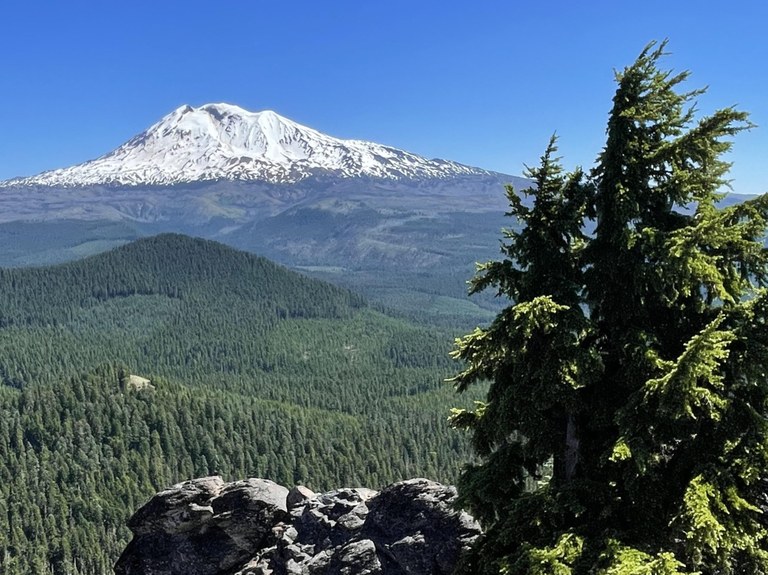
Photo by KASMITH07.
"Wow this hike really has it all. The views are some of the best of any hike I’ve done in Washington."
KASMITH07 gave their hike to Sleeping Beauty Peak a 5-star review, after climbing to the top and getting views of four huge volcanoes. Plus, they got to share the view with a mountain goat!
Angel Falls Loop
Location: South Cascades > White Pass/Cowlitz River Valley

Photo by SeanoftheWild.
"The falls kept getting better. Covel Creek Falls you can walk under! Facing the falls, the right side is the best view. Then you wind up to Angel Falls and it feels so lush up there."
SeanoftheWild had a great time wandering through the forest to the waterfalls on the Angel Falls Loop. They recommend hikers download or print a map beforehand to avoid getting turned around in the trail network.
Muddy Meadows/Foggy Flat
Location: South Cascades > Mount Adams area

Photo by Zachary1992.
"First time on this hike on my favorite Washington stratovolcano!"
Zachary1992 had to contend with some snow and many mosquitoes on their hike at Muddy Meadows/Foggy Flat, but they were able to get up close and personal to the majestic Mount Adams.
Heather Lake
Location: North Cascades > Mountain Loop Highway
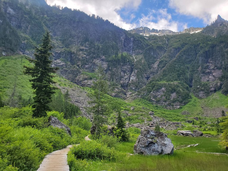
Photo by bethanyyyy.
"Despite being so rocky that my feet are still tender a day later, the trail simply feels...lovely. And the lake, of course — what a jaw-dropping place to eat lunch!"
bethanyyyy shared a very helpful "berry report" from their Heather Lake hike: There are plenty of salmonberries to enjoy at the lake, and you can expect some ripe thimbleberries along the trail soon!
Riser Lake Loop
Location: North Cascades > Methow/Sawtooth

Photo by AndreaAndrea.
"Highly recommend going at sunrise for beautiful light on the hills, cool temperatures and fewer bugs."
AndreaAndrea only made it about a mile into the Riser Lake Loop before heading back due to the tall brushy grass and potential tick risk, but before they left, they were able to see some beautiful early morning colors and shadows.
Paddy-Go-Easy Pass
Location: Snoqualmie region > Salmon La Sac/Teanaway

Photo by dakotamangus.
"Paddy goes hard! This trail is truly beautiful and totally overlooked."
dakotamangus got in quite the calf workout hiking up to Paddy-Go-Easy Pass. Along the way, they saw plenty of wildflowers and super clear views of Mount Daniel, even with quite a few clouds in the sky.
Mirror and Cottonwood Lakes
Location: Snoqualmie region > Snoqualmie Pass

Photo by Pete R.
"Overall, this is a short hike that will get your heart rate up just enough, and with plenty to see along the way and at the end."
Pete R got clear skies on their hike to Mirror and Cottonwood Lakes. They hiked a little further past Mirror Lake to check out the waterfall there, where they also got some nice mountain views through the trees.
Gold Creek - Devil’s Slide
Location: Central Washington > Yakima
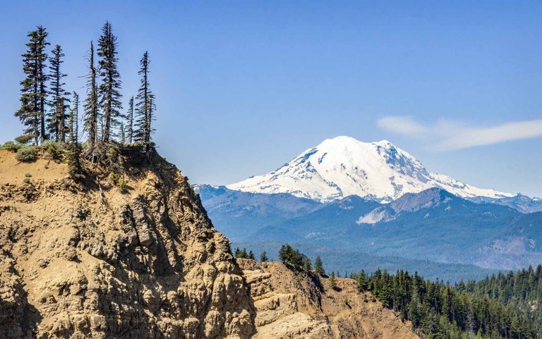
Photo by mytho-man.
"There were wildflowers every step of the way. The most predominant were larkspur, lupine and groundsel along with quite a few blue forget-me-nots."
mytho-man and friends trekked up the Gold Creek Trail to Devil’s Slide, a grand vista above the Milk Creek Valley. They had most of the hike to themselves — maybe not so surprising for a Monday — only having to share the trail with a few chipmunks.
Tieton River Nature Trail
Location: Central Washington > Yakima

Photo by robgirl.
"Tieton River is stunning. It's so dang beautiful."
robgirl and their best friend ended their trip to Yakima with a hike on the Tieton River Nature Trail. It was a hot bluebird day with unrelenting sun and they were a little nervous about rattlesnakes in the brush, but they still had a good hike.
Millersylvania State Park
Location: Olympic Peninsula > Olympia
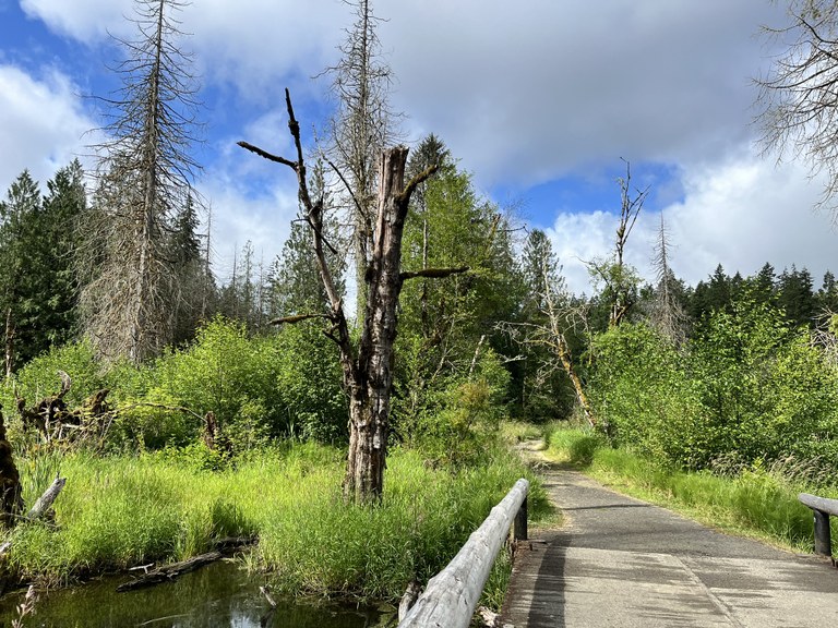
Photo by StellarRae.
"Beautiful trail, lots of options to take, maps placed throughout so you know where you are."
StellarRae found some respite from the sun under the tree canopy, as well as some lakeside time, during their day at Millersylvania State Park. They also saw many rabbits throughout their quiet hike.
Marmot Pass
Location: Olympic Peninsula > Hood Canal
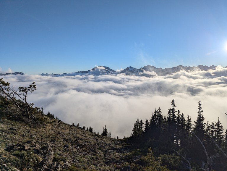
Photo by kinira.
"Views up on the ridge were gorgeous. Clouds/fog were coming and going but moving enough to allow us to see the surrounding peaks."
kinira ran into a WTA work party only a couple of miles into their hike, but continued hiking a few more miles to Marmot Pass, where they set up camp for the night. Though it was cloudy, peeking mountain peaks still dotted the horizon, and the clouds cleared up by morning.
Cape Alava
Location: Olympic Peninsula > Pacific Coast
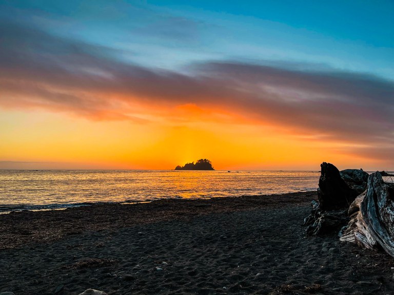
Photo by rutcat.
"No matter how many trips I take to Cape Alava — and there have been more than a few — I never get sick of it. I see something new every time."
rutcat set up camp at Cape Alava for one night. Among the many highlights included seeing hunting harbor seals, sunbathing sea lions, floating otters, grazing deer and a beautiful sunset.
Crystal Peak and Crystal Lakes
Location: Mount Rainier area > NE - Sunrise/White River

Photo by buzzworm.
"This trail was amazingly smooth, both to the peak and lakes. It's hard to find an easier trail to walk to a mountaintop."
buzzworm got two for the price of one, hitting up both Crystal Peak and Crystal Lakes on the 4th of July holiday (three, if you count both lakes). They pushed past Upper Crystal Lake to do a very short stint on the PCT as well, reaching Sourdough Gap before deciding to turn around.
Grand Park via Lake Eleanor
Location: Mount Rainier area > NE - Sunrise/White River

Photo by zieiuk.
"On this sunny and hot day, we had a great time hiking to Grand Park from Lake Eleanor trailhead. The mountain and meadows were just so beautiful."
zieiuk attracted many mosquitoes on their hike (although their friends fared better!), but it was worth it for the beautiful views they got on their way to the meadows of Grand Park.
Clayton Beach
Location: Puget Sound and Islands > Bellingham area
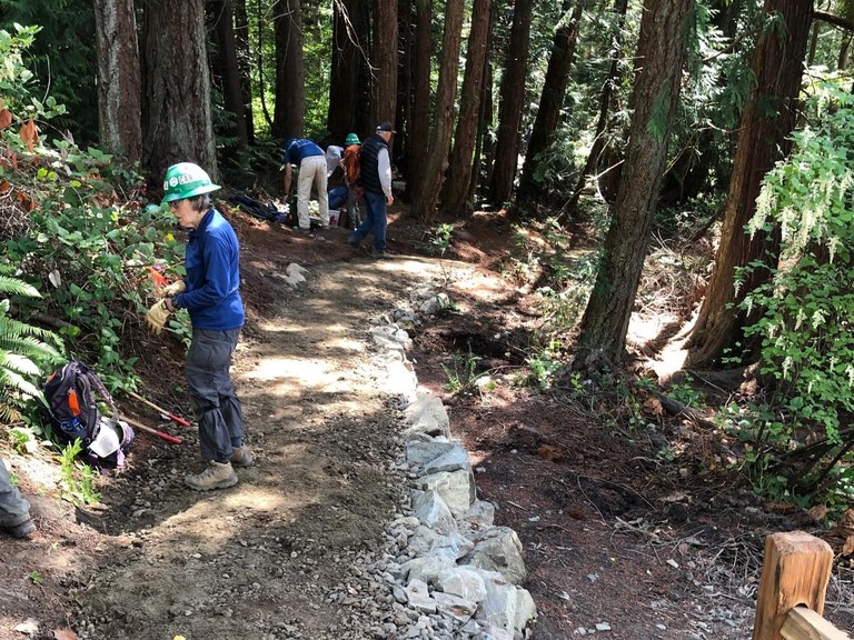
Photo by DryNwetDiver.
"I plan to bring my friends and show off the good work all the volunteers have done over the last 5 months improving this trail. ENJOY."
DryNwetDiver spent a day on a WTA work party working on the trail to Clayton Beach, putting in some finishing touches. Go check it out for yourself (and then write up your own trip report)!
Meadowdale Beach Park - Lund's Gulch
Location: Puget Sound and Islands > Seattle-Tacoma area

Photo by Smashingley.
"The new path under the railroad is really wonderful, if you haven’t been in a while like us — and having the sand-mat path and foot washes were great after spending a lot of time on the beach."
Smashingley went to Lund's Gulch at Meadowdale Beach Park during low tide, where they got to see the effects of estuary restoration efforts, as well as some very nice clean portable toilets (and who doesn't love a nice facility?).
Whether you take a short jaunt through an urban forest, spend a full week in the backcountry or do anything in between, we want to hear all about your adventure! File a trip report and help other hikers know what to expect during their next hike.


Comments