10 trails to view glaciers
Glaciers are beautiful and fascinating rivers of ice. They've shaped some of Washington's most stunning landscapes — from the carving of the Missoula Floods to the U-shaped valleys of Mt. Baker-Snoqualmie National Forest and beyond. They also play a critical role in our ecosystem by replenishing water supplies and supporting habitat for plants and animals. But they’re shrinking at an alarming rate.
Washington is home to many of the glaciers in the contiguous United States. Some are found in national forests, but many of those glaciers are on the high peaks of Mount Rainier, North Cascades and Olympic national parks. Washington’s National Park Fund (WNPF), a philanthropic partner of those parks, funds scientific research and monitoring on the changing environment in the parks, including melting glaciers.
Can’t see a glacier in person? Check out the Terminus project
The Olympic National Park’s Terminus project is one of the projects that WNPF has funded. Scientists estimate that the park’s glaciers will disappear by 2070. The Terminus project aims to to spark a conversation about the changing environment and actions that we can take as individuals. Forty-three artists were each assigned a glacier in the park. They created paintings, wood carvings, poems and more to commemorate the glaciers. Twenty-five of the original pieces are on display at Seattle’s Klondike Gold Rush National Historical Park until March 31, 2026.
Tips for viewing glaciers
- Check the weather. Alpine weather can be unpredictable and unforgiving. And besides safety, you’ll want clear skies to see glaciers from afar!
- Dress appropriately. Glacier areas are synonymous with eroded hillsides, rushing water and cool temperatures. Stay prepared.
- Bring binoculars. Whether you’re viewing from afar or near a glacier, a good pair of binoculars will enhance your experience.
- Bring your pass and get a permit. Trails in this feature are found across public lands — know which parking/entry pass or overnight permit you need for each.
Check out the Hiking Guide for each trail and review trip reports to learn the latest trail and road conditions to decide which hike is right for you. And don’t forget to save trails to your My Backpack account to plan for later!
Olympic National Park
Blue Glacier via Hoh River Trail
Location: Pacific Coast
Length: 37 miles, roundtrip
Elevation gain: 3,700
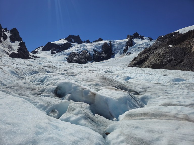
Up close view of Blue Glacier. Photo by sarahgpt
Hikers hoping to glimpse Blue Glacier should be prepared for a 17.5 mile trip one-way, but the effort is worth it! Enjoy old-growth rain forests, traverse adventurous ladder-assisted washes and toil up your option of two separate moraine-oriented views to experience this Olympic National Park icon.
Bonus: Get a backcountry permit to make this trip a lot more fun! Hoh River Road and visitor center are busy, and this trip is burly as a day hike.
> Plan your trip to see Blue Glacier using WTA's Hiking Guide
Deception Glacier via Royal Basin
Location: Hood Canal
Length: 16 miles, roundtrip
Elevation gain: 5,700 feet
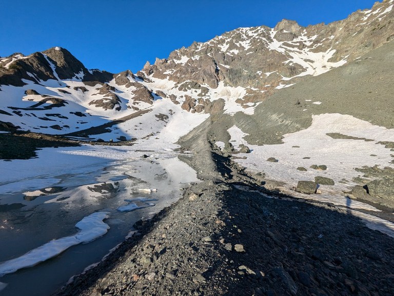
The Glacial moraine leading to Mount Deception. Photo by Pribbs
Making your way up to Royal Basin is a showcase of everything that Olympic National Park has to offer: Forested stream crossings, wildflower meadows, whistling marmots and glacial tarns. This area has it all. As you arrive at Upper Royal Basin, you’re welcomed with the grand view of Deception Glacier. This is your opportunity to see a glacier that is on its way out — where it continues to hold some ice and snow, but no longer at its fullest potential.
Bonus: You’ll need a backcountry permit if you want to camp overnight in Royal Basin. View the Terminus piece about Deception Glacier.
> Plan your trip to Royal Basin using WTA's Hiking Guide
Panoramic Glacier via Hurricane Hill
Location: Northern Coast
Length: 3.2 miles, roundtrip
Elevation gain: 650 feet
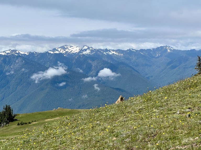
Panoramic views of glaciers from afar. Photo by ZhuckYu
A visit to Hurricane Hill offers panoramic views of the surrounding landscape, including multiple glaciers from afar. You can even enjoy multiple glaciers from the drive-up picnic area. Glimpse the Hoh and Blue glaciers on the slopes of Mount Olympus, Carrie Glacier on Mount Carrie and Mount Fairchild, or White Glacier on Mount Tom.
Bonus: Check the forecast and bring a pair of binoculars. Views in Washington are top tier, but only if weather cooperates! In the summer months, rangers sometimes bring spotting scopes to Hurricane Ridge viewpoints to spot wildlife and glaciers from afar.
> Plan your trip to Hurricane Hill using WTA's Hiking Guide
Mount Rainier National Park
A note about roads near Mount Rainier: As of August 2025, the White River Bridge on State Route 410 between Enumclaw and Buckley is closed. Hikers should use detours using State Routes 164, 18, 167 and other sections of SR 410.
Learn about other road closures, including an interruption on SR 123 from Stevens Canyon Road to Panther Creek from Sept. 2-30, here.
Emmons Glacier via Emmons Moraine
Location: White River
Length: 3 miles, roundtrip
Elevation gain: 700 feet
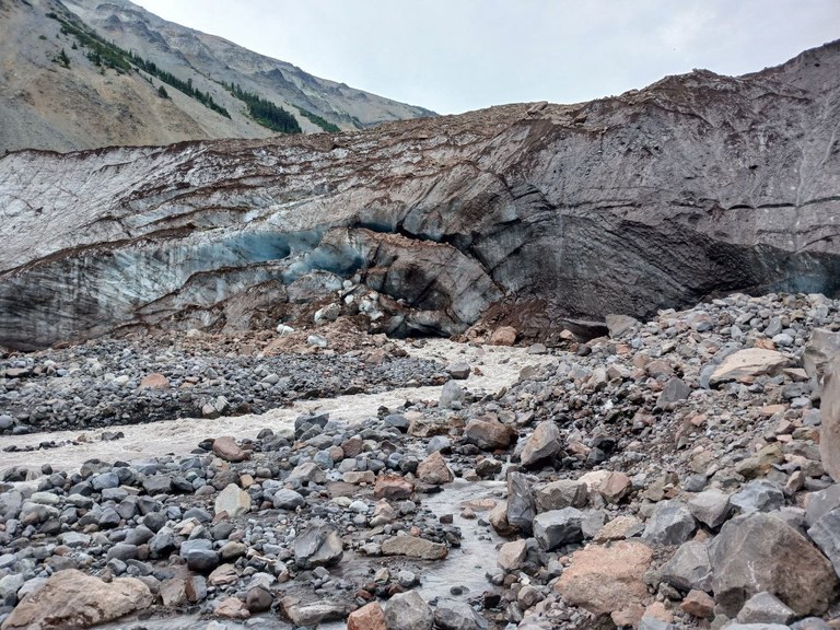
The end of Emmons Glacier. Photo by ayhiker
Hikers visiting White River can see the massive Emmons Glacier with a relatively short hike along the river valley. Savor the journey — it’s only about a mile and a half to the viewpoint from White River campground. The trail is a walk through time, taking travelers through moraine fields and eroded washes left in the wake of this body of ice’s massive shifts over the centuries. It’s also the largest glacier by area in the lower 48!
> Plan your trip to see Emmons Glacier using WTA's Hiking Guide
Winthrop Glacier via Burroughs
Location: Sunrise
Length: 9 miles, roundtrip
Elevation gain: 2,500 feet

Hikers can see more than one glacier from this trail. Photo by G. Thomas Bancroft
View the second largest glacier on Mount Rainier while hiking the scenic Burroughs Mountain trail. You can extend or shorten your trip by turning around at any of the three burroughs, depending on your energy levels. Being above treeline means expansive views of the mountain. If you make it to Third Burroughs, you’ll be granted a front row seat of the Winthrop Glacier.
Note: Through the end of September, 2025, weekend visitors need a timed entry reservation to enter the Sunrise corridor, in addition to the national park entrance fee. For more information, visit Mount Rainier National Park’s timed entry page.
Bonus: You can also view the Emmons Glacier via the Burroughs Mountain trail.
> Plan your trip to see Winthrop Glacier using WTA's Hiking Guide
North Cascades National Park
Neve Glacier and Boston Glacier via Ruby Mountain
Location: North Cascades Highway
Length: 17 miles, roundtrip
Elevation gain: 6,300 feet
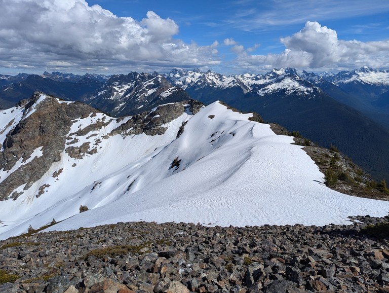
This climb isn't to be underestimated, but the views are spectacular. Photo by neek
The North Cascades is known for its more than 300 glaciers, making it the most glaciated area in the United States outside of Alaska. Adventurous hikers can view two glaciers in one hike from the panoramic views at Ruby Mountain. But keep in mind, this trail is strenuous and is closer to a scramble than a casual stroll on a well-maintained trail.
> Plan your trip to Ruby Mountain using WTA's Hiking Guide
Sahale Glacier via Cascade Pass and Sahale Arm
Location: North Cascades Highway
Length: 12 miles, roundtrip
Elevation gain: 4,000 feet

Cascade Pass and Sahale Arm is one of Washington's most iconic hikes. Just be prepared with a plan B — it's also one of Washington's most popular! Photo by karan s
Cascade Pass and Sahale Arm is one of Washington’s most famous hikes. It blends awesome views of North Cascades National Park’s jagged peaks with alpine wildlife like marmots, mountain goats and bears. Better yet: it brings you directly to the foot of the shimmering Sahale Glacier. From afar, hikers can also see Quien Sabe Glacier and several named peaks.
This hike is also one of Washington’s most popular. A list of glacier-viewing hikes in Washington would be incomplete without a mention of Cascade Pass and Sahale Arm, but please be conscious of how you visit this area. Camping at Sahale Glacier Camp requires a backcountry permit. Absolutely have a backup hike in mind, and expect limited parking and a rough road, especially in the fall.
Bonus: This trail is at risk of succumbing to the effects of recreational impact and high foot traffic. Consider visiting this area during the middle of the week and park thoughtfully (or down the road and take a bike to the trailhead).
> Plan your trip to see Sahale Glacier using WTA's Hiking Guide
Terror Glacier via Sterling Munro Boardwalk
Location: North Cascades Highway
Length: 0.1 miles, roundtrip
Elevation gain: minimal
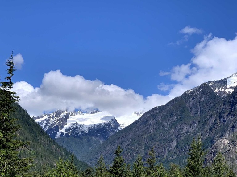
Hikers don't need to gain a ton of elevation to enjoy the view of a glacier from the Sterling Munro boardwalk. Photo by vikr
No brutal climb or rugged incline needed to spot Terror Glacier from Sterling Monroe boardwalk — simply traverse the 330 foot boardwalk and enjoy dramatic views of the Picket Mountains.
Bonus: This hike is wheelchair-friendly. Don’t forget your binoculars at home.
> Plan your trip to Sterling Munro using WTA's Hiking Guide
Mt. Baker-Snoqualmie National Forest
Easton Glacier via Railroad Grade
Location: Mount Baker Area
Length: 7 miles, roundtrip
Elevation gain: 2,000 feet
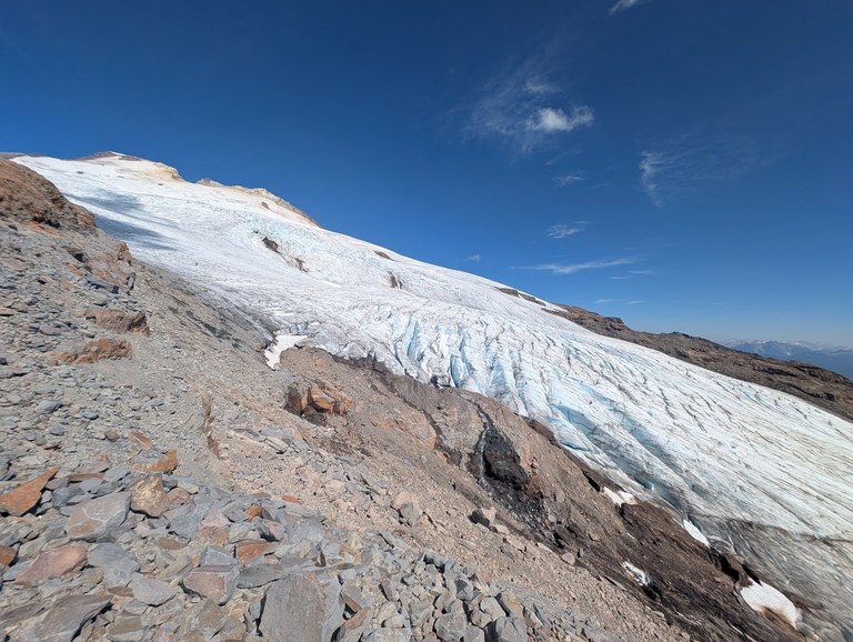
Hikers can enjoy glacier views from Railroad Grade without climbing to the top of Glacier Peak. Photo by SavvyExploring
Tons of users hike along the Railroad Grade trail every spring and summer on their way to summit Mount Baker or to visit Park Butte. Keep on the trail to get spectacular views of Easton Glacier from the end of a glacial moraine. Easton Glacier is one of the most famous glaciers on one of Northwest Washington’s most famous peaks and is named after Charles F. Easton, who worked hard to record the history of this incredible mountain.
> Plan your trip to see Easton Glacier using WTA's Hiking Guide
Extinct Glaciers
Missoula Floods via Sun Lakes-Dry Falls State Park - Deep Lake
Location: Central Washington > Grand Coulee
Length: 15 miles of trail
Elevation gain: Varies
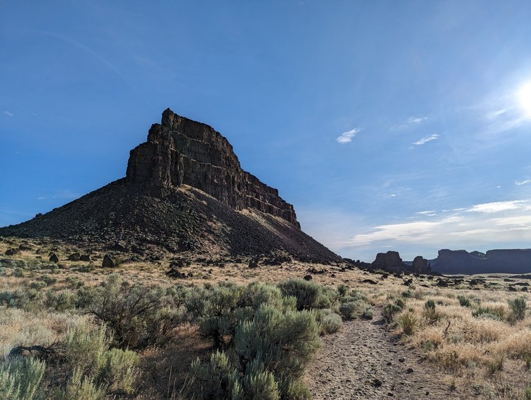 Sun Lakes and much of Washington's scablands were created by extinct glaciers, even if they aren't around anymore. Photo by Brian Ferris
The extinct glaciers that shaped Washington’s landscape during Earth’s last glacial period — some 18,000 - 15,000 years ago — are gone but not forgotten. These giant glaciers created lakes and massive waterfalls that shaped much of Eastern and Central Washington’s scablands region. Nowhere is the impact of these glaciers more obvious than at Sun Lakes - Dry Falls State Park.
Bonus: Visit this region in fall or spring for optimal temperatures. And don’t forget to visit the Dry Falls Visitor Center to check out their exhibit on the Ice Age Floods!
> Plan your trip to Dry Falls State Park using WTA's Hiking Guide

