Fall Backpacking Trips on Trails WTA Worked On
Whether they're disappearing under brush, obscured by hundreds of logs, or washed or eroding away, many trails across the state are at risk of being lost to time. At Washington Trails Association, we work tirelessly each year to help bring them back.
WTA mobilizes crews across the state to put disappearing trails back on the map as part of our Lost Trails Found campaign, one of four campaigns that work together to create a healthy trail system in Washington.
To bring these trails back from the brink, volunteers and staff head out on multi-day backcountry response teams (BCRTs), volunteer vacations, and day work parties.
Backcountry crews work from April to October, so fall is an exciting time of year for hikers because by autumn, most trails on our radar have seen some amount of recent maintenance. So, before the snow flies, get out to one of these destinations. Take advantage of the cooler temperatures to tackle a steep trail, or enjoy the fall colors from a new vantage point.
When you're back, make sure to write a trip report! We want to hear all about your hike — from the state of the trail to fall colors to any challenges you encounter. Conditions can change rapidly in the backcountry, so if you run into barriers like fallen logs or overgrown stretches of trail, definitely include that info in your trip report. It's helpful for WTA and for fellow hikers alike.
Mount Rainier Area
BUmping Lake
Region: Chinook Pass - Highway 410
Length: 9.0 miles, roundtrip
Elevation Gain: 300 feet
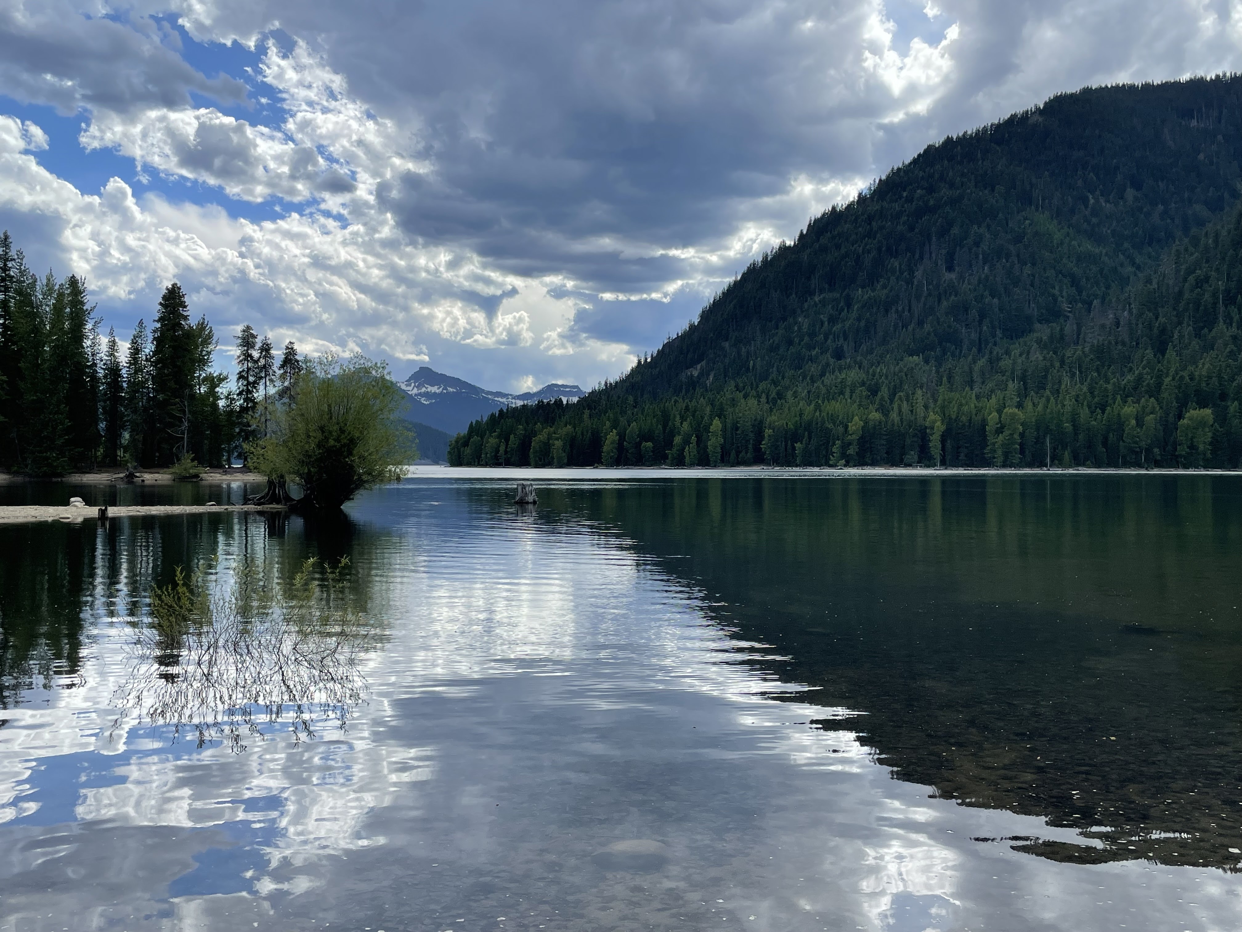
The view from the crews campsite. Photo by Joan Nelson
This gorgeous, large lake east of the Cascade Crest near Mount Rainier is a wonderful backpacking trip, especially in the fall. In 2024, crews cleared nearly 4 miles of trail, removing 44 logs, clearing 4 drains, and repairing 50 feet of damaged trail in the process. Visit Bumping Lake to check out their work and the stunning fall colors.
> Plan your hike to Bumping Lake using WTA's Hiking Guide.
Maggie Creek
Region: Chinook Pass - Highway 410
Length: 11.0 miles, roundtrip
Elevation Gain: 2,920 feet
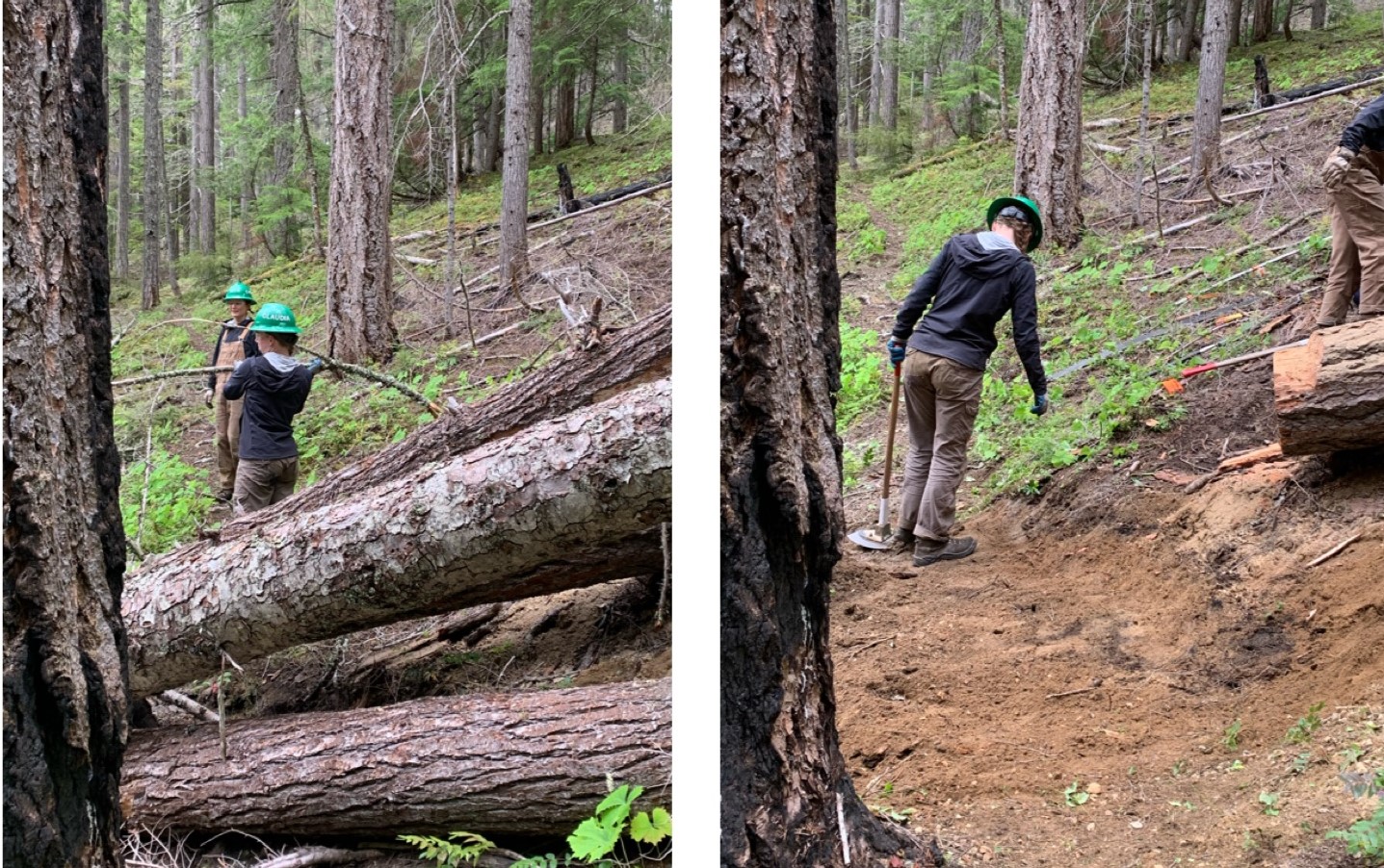
Logout projects (like the one pictured above) typically also require a fair amount of work after removing the log to re-establish damaged tread. Photo courtesy WTA's Lost Trails Found pro crew.
Maggie Creek is a relatively unknown trail. But thanks to the efforts of our Lost Trails Found crew, this trail and the nearby, more popular Greenwater Lakes Trail are clear of 148 logs and have 100 feet of newly re-established trail.
> Plan your hike to Maggie Creek using WTA's Hiking Guide.
Bear Gap / Fog City
Region: Chinook Pass - Highway 410
Length: 2.0 miles, roundtrip / 2.4 miles, roundtrip
Elevation Gain: 1,030 feet / 1,055 feet
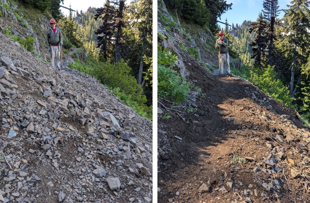
One of several sections of tread that were improved thanks to volunteer efforts at Bear Gap/Fog City. Photo by Lisa Black.
Crews at Bear Gap/Fog City addressed years of deferred maintenance in just three days. They cleared two logs from the trail and removed encroaching foliage from 2.45 miles, but some of the toughest work was in the 2,315 feet of rebenching they completed (pictured above) and the 98 drains they cleared!
With these two trails addressed, hikers can now enjoy a 6 mile loop hike in the Snoquera area. But be prepared for steep trails (WTA crews can only do so much in just a few days)! This is probably more of a day hike, but it's possible to put together a backpacking trip with other trails in the area.
> Plan your hike to Bear Gap or Fog City using WTA's Hiking Guide.
Southwest Washington
Bluff Mountain
Region: Lewis River region
Length: 12.0 miles, roundtrip
Elevation Gain: 890 feet
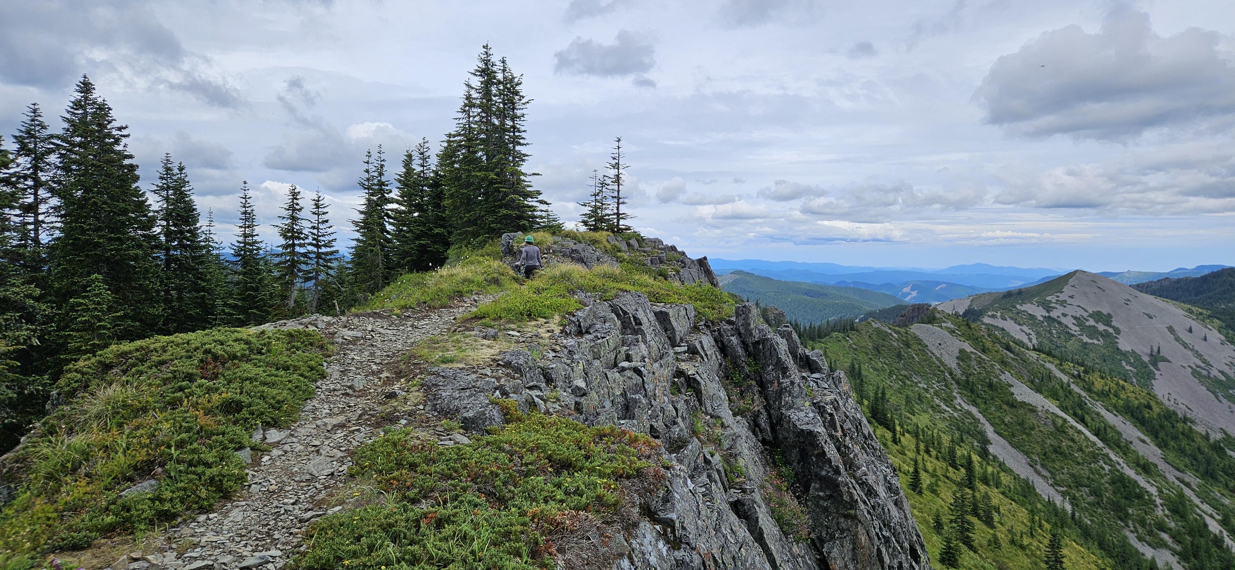
A volunteer on the Bluff Mountain trail, cleared by volunteers in 2024. Photo by James Alexander.
This peak in the Silver Star area offers a beautiful summit but is in constant need of maintenance. A BCRT here removed overgrown foliage along more than 5 miles of the trail and removed several trees and other hazards, making it easier for hikers to follow the route all the way to that gorgeous view.
> Plan your hike to Bluff Mountain using WTA's Hiking Guide.
Augspurger Mountain
Region: Columbia River Gorge - WA
Length: 15.5 miles, roundtrip
Elevation Gain: 4,400 feet
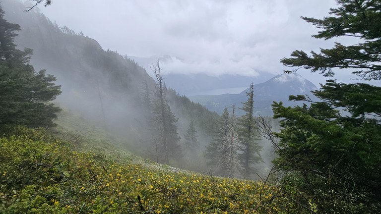
Dog Mountain visible through the clouds on Augspurger Mountain. Photo by James Alexander.
Another not-quite backpacking trip, Augspurger Mountain makes for a great alternate to Dog Mountain. Or, you can loop it with the Dog Mountain trail, thanks to nearly 2.5 miles of brush removal from WTA crews, as well as 823 feet of trail stabilized. The Gorge is overlooked in the fall — head there and let us know how it is!
> Plan your hike to Augspurger Mountain using WTA's Hiking Guide
South Cascades
Angry Mountain
Region: Goat Rocks
Length: 16.8 miles, roundtrip
Elevation Gain: 3,409 feet

Working on the notorious Angry Mountain trail. Photo by trip reporter OrcaDan.
The crew at Angry Mountain was tasked with tackling 165 trees over the course of just 4 days. While they didn't get to every single one, they handled 4.5 miles of the 6 mile trail, addressing maintenance issues nearly four years old. You can still use Angry Mountain as access to a multi-mile backpacking trip in the Goat Rocks wilderness.
> Plan your hike to Angry Mountain using WTA's Hiking Guide.
Ghost Lake
Region: Mount St. Helens
Length: 5.2 miles, roundtrip
Elevation Gain: 640 feet
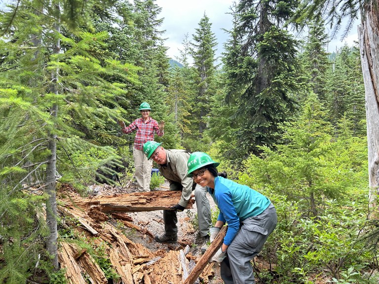
An energetic crew of volunteers worked during a Jamboree partnership weekend with Mount St. Helens Institute to restore 7 miles of the Boundary Trail, Independence Ridge, Independence Pass, Ghost Lake and Harmony trails. All of them are worth a visit. Ghost Lake, tucked away off the Boundary Trail, had been in bad shape for years until the work during the Jamboree addressed almost every foot of that route. Go give it a look!
> Plan your visit to Ghost Lake using WTA's Hiking Guide.
Clear Fork
Region: Goat Rocks
Length: 9.6 miles, roundtrip
Elevation Gain: 1,200 feet

A saw crew stands proudly in front of one of the gnarlier trees they removed during this trip. Photo by Gary Zink.
A perennial favorite, Clear Fork always has logs to remove, and remove them our crews did! This area is famous for big trees, and the crew had their work cut out for them. Thanks in part to longtime partner Back Country Horsemen of Washington, this crew opened up this shaded, quiet trail on the northwest edge of the Goat Rocks. Now hikers can enjoy this gateway to the backside of the Goat Rocks.
> Plan your hike to the Clear Fork Trail using WTA's Hiking Guide.
Lost Lake
Region: Goat Rocks
Length: 16.2 miles, roundtrip
Elevation Gain: 2,400 feet
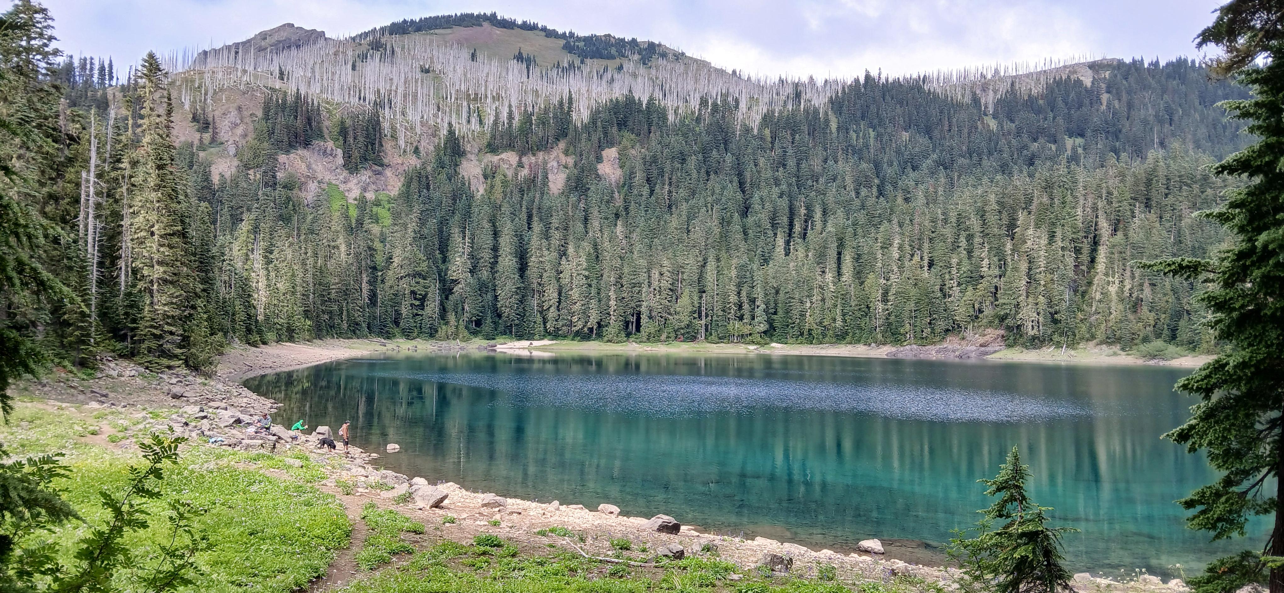
Quiet Lost Lake is just above Packwood Lake, and thanks to 2024 maintenance, more accessible than ever. Photo by Gary Zink.
Lost Lake is less-visited than nearby Packwood Lake, but it's no less lovely. The crew here removed 31 trees, removed encroaching foliage along a half-mile of trail and repaired 78 feet of trail — all in just two days! With Lost Lake and Clear Fork cleared, hikers now have two options for accessing the backcountry in the northwest corner of the Goat Rocks.
> Plan your visit to Lost Lake using WTA's Hiking Guide.
Eastern Washington
Shedroof Divide - Thunder Creek
Region: Selkirk Range
Length: 13.4 miles, roundtrip
Elevation Gain: 3,095 feet
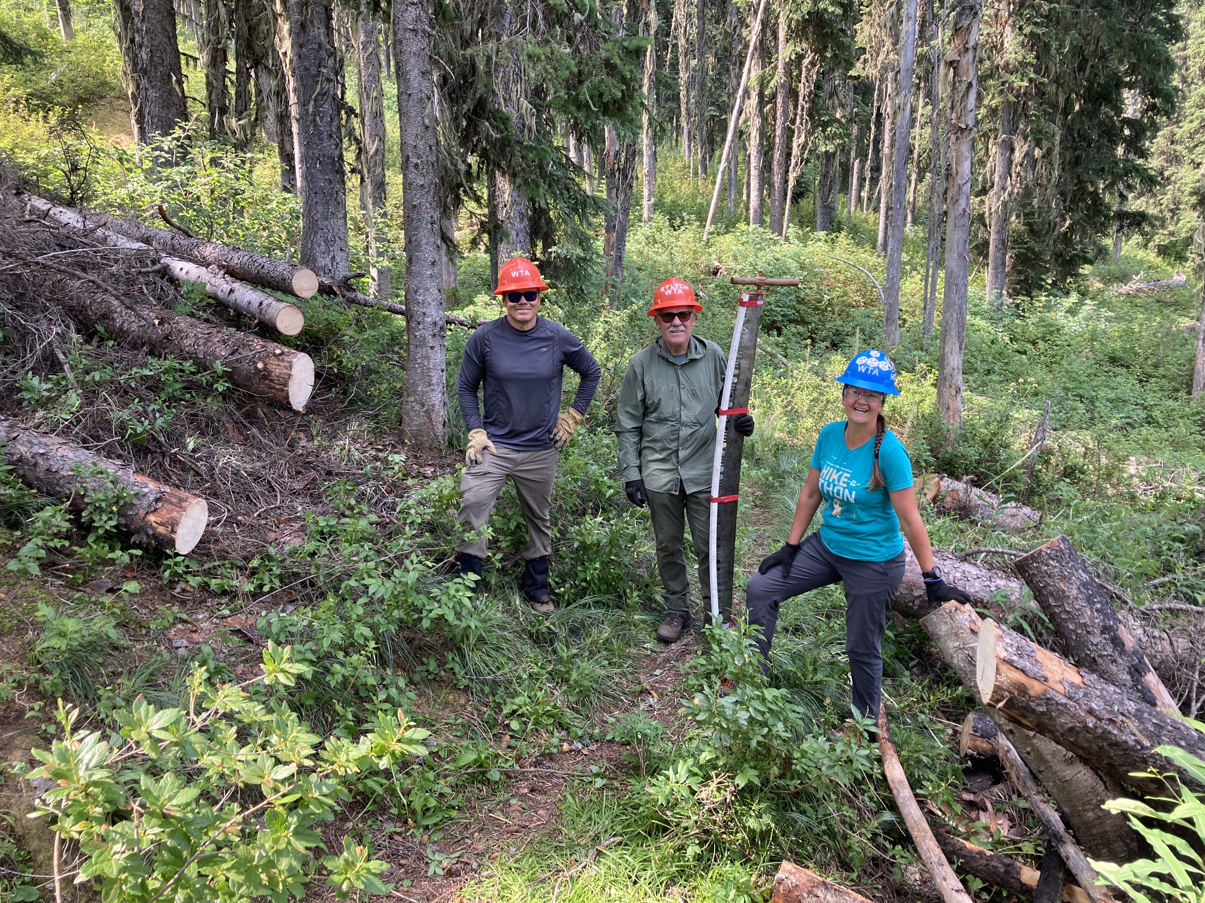
Just some of the many logs removed on this short but strenuous BCRT on the Shedroof Divide. Photo by Holly Weiler.
It's not often a crew finishes logging out the entire length of the trail they're working on, but that's exactly what this small but mighty crew of four did! Give this signature backpacking loop in the Salmo-Priest wilderness a visit and see what you think.
> Plan your visit to the Shedroof Divide and Thunder Creek using WTA's Hiking Guide.
Columbia Mountain
Region: Okanogan Highlands/Kettle River Range
Length: 5.4 miles, roundtrip
Elevation Gain: 3,348 feet
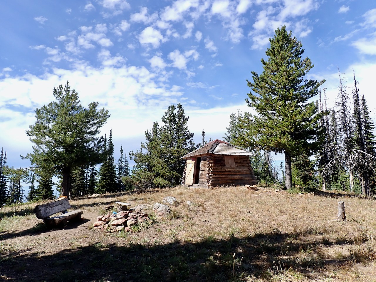
The cabin at the top of Columbia Mountain is a great place for both day hikers and backpackers alike. Photo by DaphneF.
Here's an unique one. Earlier in 2024, we led a winter BCRT, camping and brushing the trail corridor for two days. Working on top of the snow load allowed us to get at high-up branches we wouldn't have otherwise been able to address. This summer, trip reporter (and former WTA executive director) Karen Daubert reported that the section we brushed in February had a few blowdowns, but was otherwise a nice hike!
> Plan your visit to Columbia Mountain using WTA's Hiking Guide.
North Cascades
Little BEaver/Perry Creek
Region: North Cascades Highway - Highway 20
Length: 35.0 miles, roundtrip
Elevation Gain: 6,213 feet

The Big Beaver Trail (above) is much more accessible now thanks to efforts by WTA on the little Beaver Trail. Photo by trip reporter gurple.
A tough BCRT crew tackled some truly miserable brush to reopen this trail that connects to a lovely route in the North Cascades near Ross Lake. Hikers noticed their work and noted the improvements in trip reports after the crew came through. Why not go see it for yourself?
> Plan your trip to Little Beaver Creek using WTA's Hiking Guide.
Scatter Creek
Region: Methow/Sawtooth
Length: 9.2 miles, roundtrip
Elevation Gain: 3,850 feet
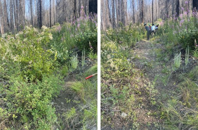
Before the youth crew came through and while they were working. Photo by Annalise Pree.
A youth volunteer vacation removed logs, re-established 1,500 feet of trail, and removed encroaching vegetation from 0.6 miles of intensely overgrown corridor (above), all in the blistering heat of a burn scar. Crew leader Annalise Pree said, "The conditions were nothing short of character-building!"
Depending on the weather, the hike might be character-building too, but it's a beautiful area and as the temps cool off, it might be the perfect weekend backpacking trip.
> Plan your hike to Scatter Creek using WTA's Hiking Guide.
Central Cascades
Lake Michael
Region: Salmon La Sac/Teanaway
Length: 17.2 miles, roundtrip
Elevation Gain: 4,190 feet
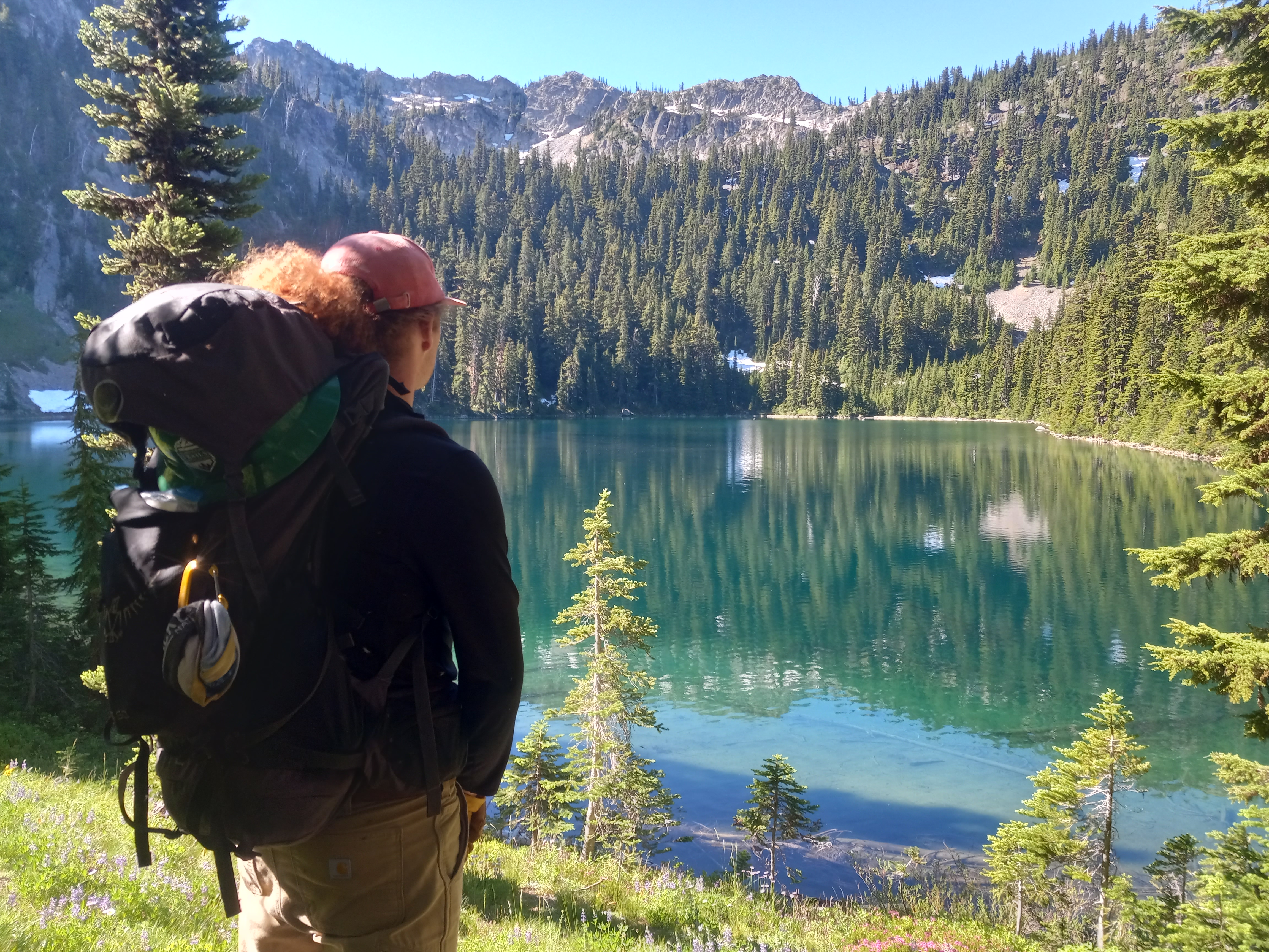
A crew member takes a moment to admire quiet Michael Lake on the trip that cleared the trail. Photo by Melissa Davis.
This infrequently-visited lake is now more accessible thanks to a crew who cleared 5 logs, repaired 300 feet of trail and removed overgrown vegetation from more than 2 miles of trail! They also improved some drains and two creek crossings, all in just 2 days.
> Plan your visit to Lake Michael using WTA's Hiking Guide.
Paddy-Go-easy Pass
Region: Salmon La Sac/Teanaway
Length: 6.0 miles, roundtrip
Elevation Gain: 2,560 feet
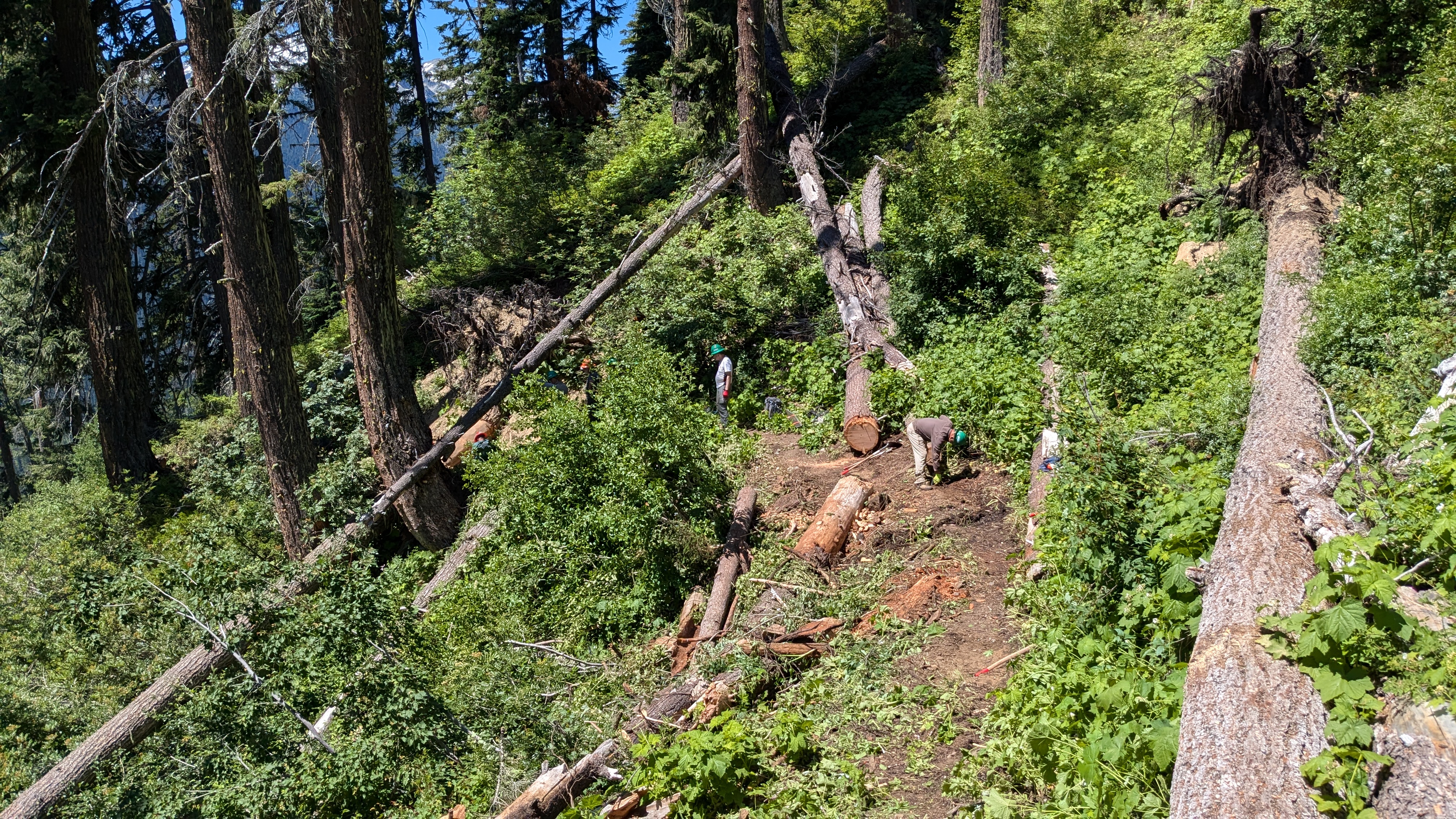
The crew at Paddy-Go-Easy did incredible work in challenging conditions. Photo by Caleb Pilcher
Paddy-Go-Easy is a popular route for backpacking trips, thru-hikes and as an access point for various climbing areas. This year's crews tackled tricky cuts in steep terrain to clear the way for hikers to enjoy the full length of the trail once again.
> Plan your hike to Paddy-Go-Easy Pass using WTA's Hiking Guide.
Mount David
Region: Stevens Pass - East
Length: 14.0 miles, roundtrip
Elevation Gain: 5,800 feet
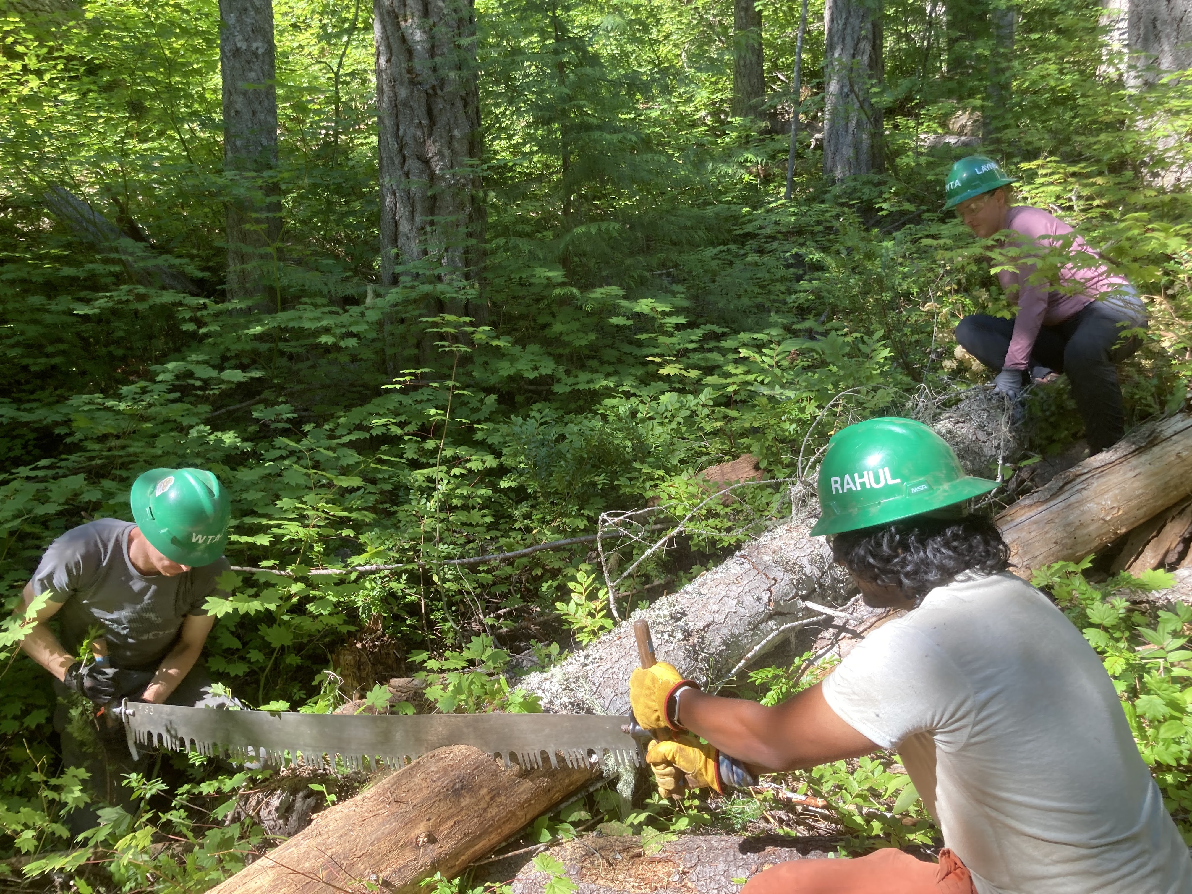
Log removal was the primary goal of the BCRT to Mount David. Photo by Perry Sproed.
A hardy crew removed 30 logs from this beautiful trail, making it easier for day hikers, backpackers and climbers to enjoy the views from this signature location east of the Cascades.
> Plan your hike to Mount David using WTA's Hiking Guide.
Entiat River To Cow Creek
Region: Entiat Mountains/Lake Chelan
Length: 11.25 miles, roundtrip
Elevation Gain: 3,500 feet
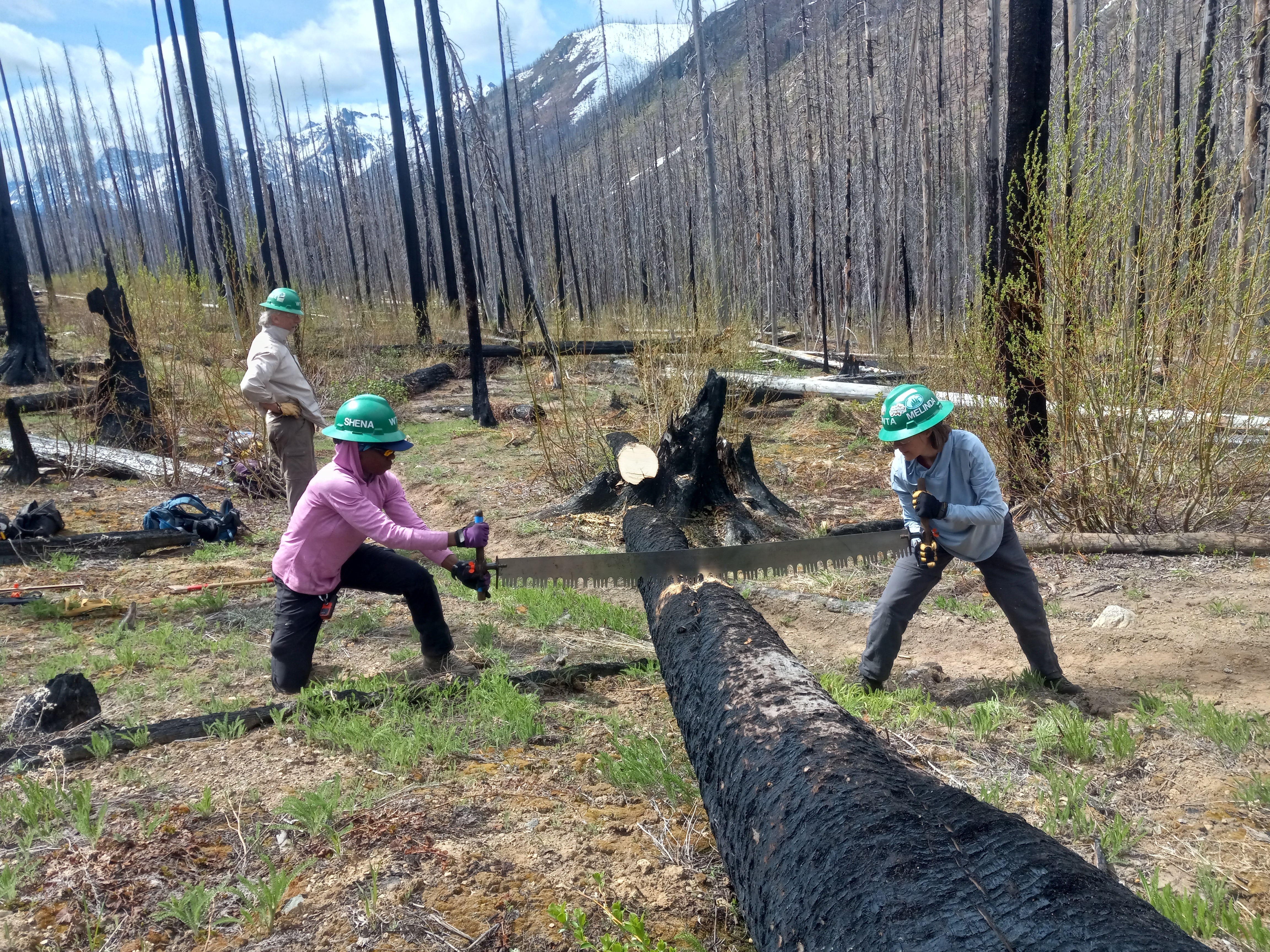
One of the hundreds of logs two crews removed from trails in the Entiat area. Photo by Melissa Davis.
The Entiat River is a longtime WTA favorite, with crews working there for years to restore access. Several trails branch off the main artery of the river trail, including Cow Creek. In 2024, crews cleared more than 14 miles of trail, removed 256 logs and repaired 1,200 feet of tread. That's incredible work, and it's all done in time for you to enjoy it this year.
> Plan your visit to Cow Creek using WTA's Hiking Guide.
Olympic Peninsula
Graves Creek
Region: Pacific Coast
Length: 7.4 miles, roundtrip
Elevation Gain: 1,500 feet
 This nice footbridge is about the newest thing you'll encounter on the Graves Creek Trail. Photo by Theodore Spoon.
Graves Creek is a trail in need of a lot of log and overgrown foliage removal. The crew reopened a section of the trail that hadn't had maintenance in years, removing logs and brush and prepping larger logs for a crew that would follow. It's a woodland ramble, but that doesn't mean it's easy.
> Plan your hike to Graves Creek using WTA's Hiking Guide.
Elk Lake
Region: Hood Canal
Length: 4.9 miles, roundtrip
Elevation Gain: 400 feet
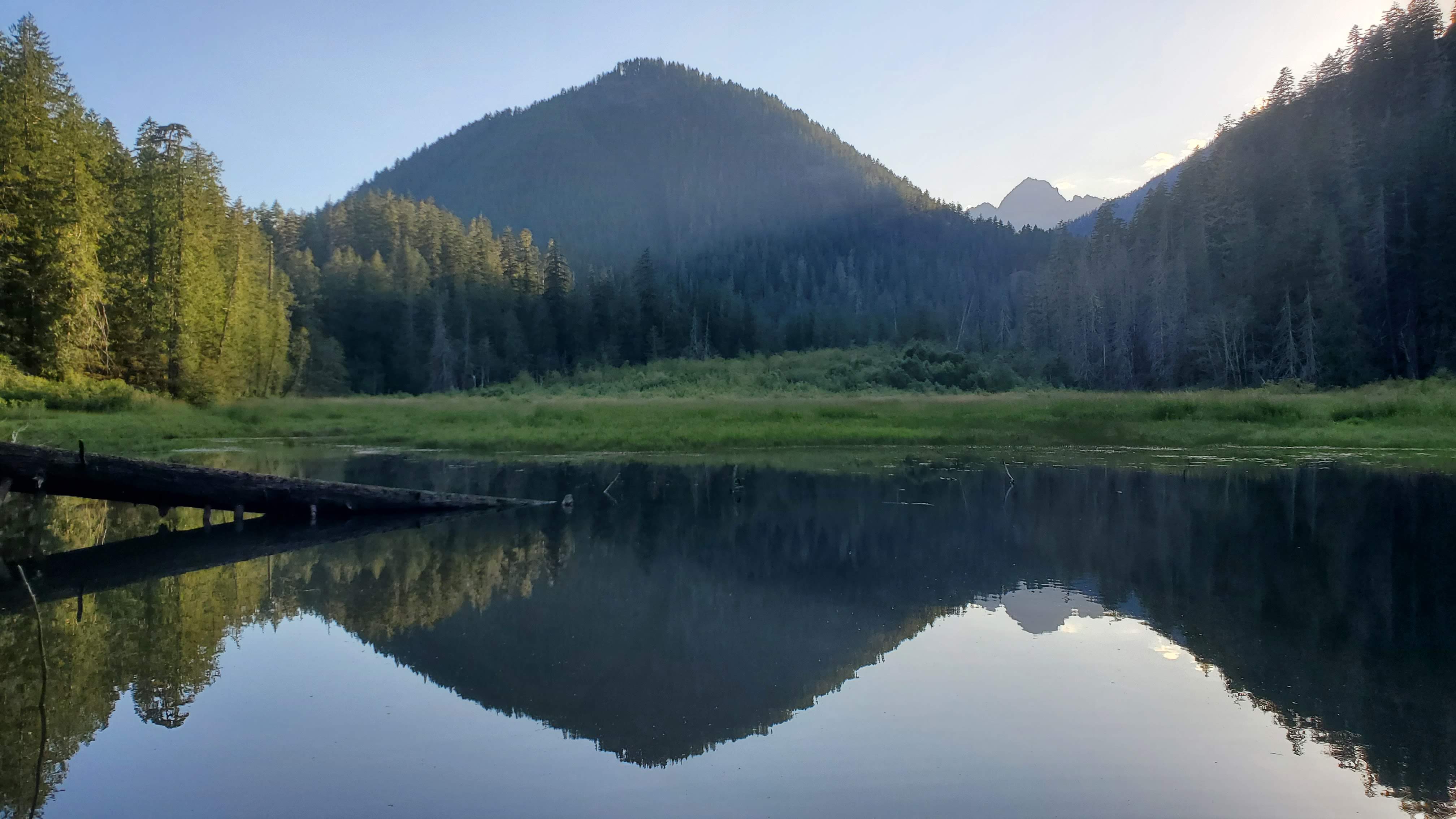 Elk Lake is a beautiful, quiet destination, with recently-cleared trail! Photo by Emme Leadbetter
The trail to this gorgeous lake is much improved after work from a BCRT earlier in 2024. They brushed and re-established much of the trail. Brushing means you'll have fewer leaves and branches in your way, and the newly rebenched trail is sturdier and easier to hike. Say thanks to the crew if you visit!

