Trails for everyone, forever

Home Go Hiking Hiking Guide Maggie Creek

Maggie Creek

Mount Rainier Area > Chinook Pass - Hwy 410
47.0842, -121.4039 Map & Directions
Length
11.0 miles, roundtrip
Elevation Gain
2,920 feet
Highest Point
4,930 feet
Calculated Difficulty About Calculated Difficulty
Hard
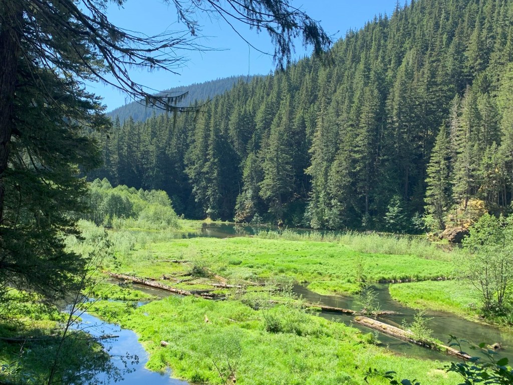
Views from the trail. Photo by Jackie Marusiak. Full-size image

Parking Pass/Entry Fee

Northwest Forest Pass
Saved to My Backpack

Explore the Norse Peak Wilderness on this trail, which connects the Pacific Crest Trail near the Mike Urich Cabin with the Greenwater Lakes trail. Continue reading

Rating
3.20 out of 5

(5 votes) Log in to rate

Hiking Maggie Creek

The trail climbs out of the trailhead then levels out soon after for about 0.7 mile. Here, you'll hit the PCT. If you turn left, you'll soon be at the Mike Urich Cabin at Government Meadow. Instead, turn right to follow the PCT for a short 0.2 mile before reaching the junction with the Maggie Creek trail.

Turn right here to hop on the Maggie Creek trail, which crosses the trail's namesake creek in 1.5 miles. The trail continues for another 3.2 miles, where it meets up with the Greenwater Lakes trail

The trail can also be accessed in the other direction starting on the Greenwater Lakes trail — the junction with the Maggie Creek trail is about 5.2 miles in from the Greenwater Lakes trailhead (a little over a mile before you reach Echo Lake). 

WTA worked here in 2024!

Hike Description Written by
Multiple authors contributed to this report, WTA Community

Maggie Creek

Map & Directions

Trailhead
Co-ordinates: 47.0842, -121.4039 Open in Google Maps

Before You Go

See weather forecast

Parking Pass/Entry Fee

Northwest Forest Pass

WTA Pro Tip: Save a copy of our directions before you leave! App-based driving directions aren't always accurate and data connections may be unreliable as you drive to the trailhead.

Getting There

Eastern Trailhead

From Enumclaw, take Highway 410 east. Continue for about 17 miles, driving through Greenwater, then turn left onto FR 70. In 10.2 miles, take the right at the fork to stay on FR 70. In 3.6 miles, stay to the right at the junction to stay on FR 70. The trailhead will be at the end of the road in 6.6 miles. 

WEstern trailhead (Greenwater lakes)

Take I-5 south to SR 18 at Exit 142A. Follow Highway 18 into Auburn and take the SR 164 exit. Head left on SR 164 through Enumclaw to SR 410. Turn left onto SR 410 and drive about 20 miles through the town of Greenwater, past the fire station to FR 70 on the left. Follow FR 70 a little over nine miles to FR 7033. Take a right and follow the road to the trailhead. Northwest Forest Pass required. There is an outhouse at the trailhead.

More Hike Details

Trailhead

Mount Rainier Area > Chinook Pass - Hwy 410

Maggie Creek (#1186)

Mt. Baker-Snoqualmie National Forest, Snoqualmie Ranger District

You can improve or add to this guidebook entry!

Maggie Creek

7 Trip Reports

Hiked here recently?

Submit a trip report!
 
Loading trip reports...
Trip Reports