Hike the State 2024: 12 trails picked for you by WTA staff
Get excited for your next adventure with four WTA staffers as they reveal three of their favorite hikes from around the state. No matter your preferred type of trail, there's something here for everyone, as well as some great resources (and even food suggestions) to help you plan your next hike.
If you try any of these hikes, we'd love to hear about it in a trip report. If you can't make it out on trail right now, save them to your My Backpack account for later. By saving hikes to your backpack and writing trip reports, our hike recommender tool can help you find even more personalized hike suggestions.
If you find these WTA resources helpful, consider becoming a member and supporting our work. Thank you for investing in the future of trails.
Loren's Picks
 Loren Drummond (she/her)
Role at WTA: Senior digital strategy manager
About Loren: Loren has dedicated her career at WTA and other nonprofits to using digital communications for creating change. She's backpacked (and rebuilt) sections of the Colorado Trail, and she's put in miles on the Appalachian and Pacific Crest Trails, too. At WTA, she loves connecting with and supporting an incredible community of volunteers, hikers and would-be hikers with Washington's wild places. She has a particular fondness for desert camping, alpine basins and marmots.
Escure Ranch — Towell Falls
Region: Central Washington - Potholes
Length: 6.4 - 20 miles
Elevation Gain: 530 feet
Permit required: None
Dog-Friendly: Yes
Photo by Jeff Clark
Poke around this former sheep ranch about 45 minutes south of Sprague or spend a full weekend appreciating the beauty of the Channeled Scablands. Towell Falls makes a lovely destination for an out-and-back picnic, or explore the full the trail network and be blown away by the unexpected geology. What first seems like relatively similar landscapes transforms into tiny pockets of buttes, mesas and outcroppings of columnar basalt.
Rock Creek provides a hub for wildlife activity, as well as pockets of trees and bushes that transform over the seasons. There’s a small, first-come, first-served campground here near the ranch buildings.
If you are feeling particularly ambitious, the trails here connect to the Columbia Plateau Rail Trail, so technically, you could work a visit here on a bike trip from Spokane. Be sure to write a trip report about that if you do it!
WTA Pro Tip: Late spring or early summer is an ideal time to visit, before the heat makes a lack of shade a problem. Dress to avoid picking up ticks or visit in winter when it’s too cold for them.
> Plan your hike to Escure Ranch using WTA’s Hiking Guide
Quartz Creek
Region: Central Cascades — Stevens Pass - West
Length: 8.4 miles
Elevation Gain: 1,500 feet
Permit required: Northwest Forest Pass
Dog-Friendly: Yes
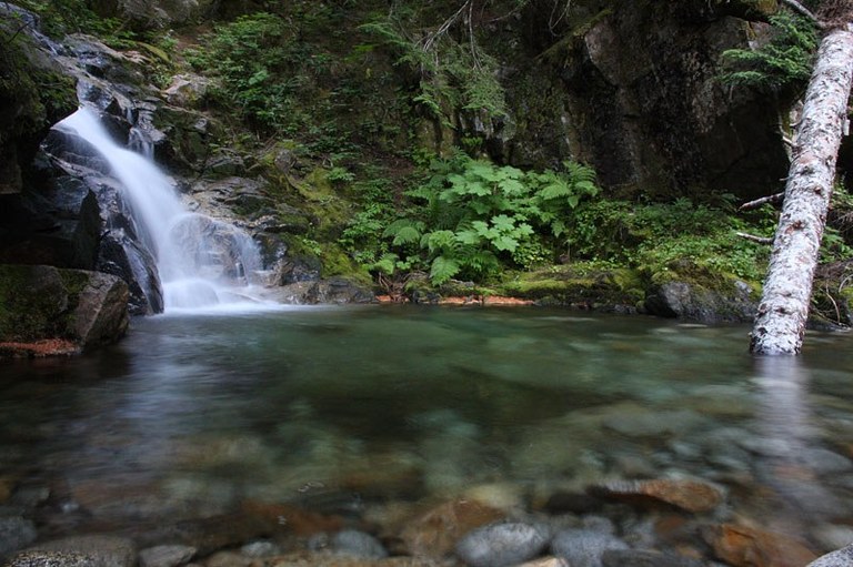
Photo by D. Baxter
This trailhead, just past popular Blanca Lake, has three trails leading out of it, splitting foot traffic and creating some pretty interesting loop options. Climb alongside the creek on the Quartz Creek Trail, and one bigger stream crossing that a charming trailside waterfall plunge pool that makes an excellent turn-around spot for a shorter hike. Otherwise, climb up toward the low pass — Curry Gap and meadows that really recommend themselves for lunch (if the bugs aren’t bad). It’s a quiet, lovely day hike with a few peek-a-boo views.
Quartz Creek can also be worked into a much bigger trip that climbs up the Bald Eagle Trail to one of the more stunning sections of the Pacific Crest Trail. From there, you’ve got basecamp, key exchange or loop options in all directions. Before you go, check snow conditions on our Hike Finder Map to see how well the higher elevations are melted out
WTA Pro Tip: Depending on the last time it saw maintenance, this trail can be brushy. While that also can put some berries in easy reach, you should go prepared to get your legs dew-damp and pay attention to any overgrown patches of nettles earlier in the season.
> Plan your hike to Quartz Creek using WTA's Hiking Guide
Twin Sisters Lakes
Region: Mount Rainier Area — Chinook Pass - Hwy 410
Length: 4.4 miles, roundtrip
Elevation Gain: 900 feet
Permit required: Northwest Forest Pass + wilderness permit self-issued at trailhead
Dog-Friendly: Yes
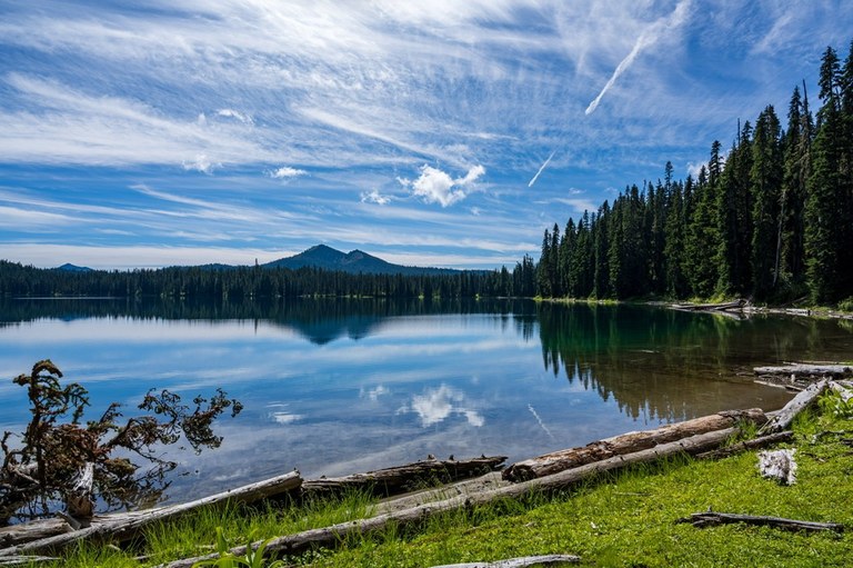
Photo by terradactyl
Twin Sisters Lakes are a popular family backpacking destination, and for good reason. A relatively gentle 2-mile climb puts them in reach for a day hike or backpacking trip. The lakes are big enough to poke around and enjoy all day long; and there are plenty of established campsites. A few spots even grant you views of Rainier on a clear day. If you have the extra time, detour over to the large and otherworldly Blankenship Meadows on your way there or back.
Twin Sisters Lakes makes a great destination for a 4.4-mile day hike or short overnight. But it also makes a stellar launching spot for some big basecamp adventures or much more ambitious backpacking trips, including catching the Pacific Crest Trail (PCT) down to White Pass if you can sort out a ride or a key exchange. Basecamp explorations can take you to the top of Tumac Mountain (a former lookout) or for a swim in Pear Lake.
WTA Pro Tip: It's usually best to wait until fall because the mosquitos can be brutal here. But in a dry year, it becomes hikeable much sooner. It’s dog-friendly, but go prepared to share the trail with horses, and in fall, hunters as well. This is well-known elk country.
> Plan your hike to Twin Sisters Lakes using WTA’s Hiking Guide
Tiffany's Picks
 Tiffany Chou (she/her)
Role at WTA: Communications Coordinator
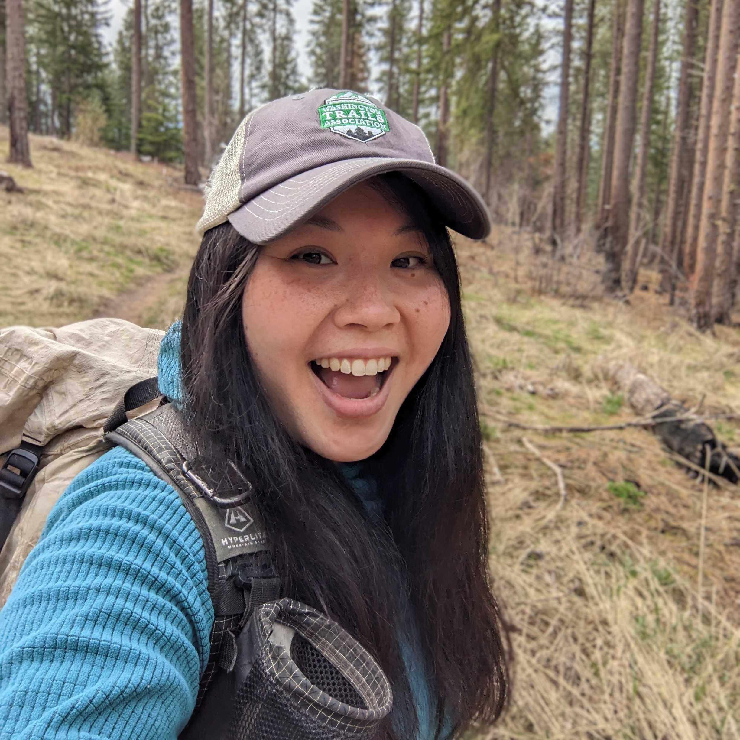
About Tiffany: Tiffany joined WTA after completing our Emerging Leaders Program in the spring of 2022. She was a famous name here at WTA already though, having won the coveted Most-Miles-Hiked by a long-distance hiker in WTA's annual Hike-a-Thon while she was a Southbound PCT thru-hiker in 2019. Now she's got tons more miles under her feet as the communications coordinator at WTA.
Skagit River Loop Trail
Region: North Cascades — North Cascades Highway - Highway 20
Length: 1.8 miles, roundtrip
Elevation Gain: 118 feet
Permit required: None
Dog-Friendly: Yes
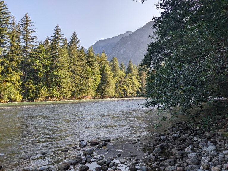
Photo by Tiffany Chou
If you’re camping at the Newhalem Creek Campground or want to take a short hike along the Skagit River in the North Cascades, this trail is a great family-friendly option for hikers of all experience levels. It's a serene loop going west from the campground away from the campsites, which can be quite lively on a warm summer day. I prefer going counterclockwise because of the beautiful views you get of the mountains in the second half of the loop. That said, it’s a lovely forest walk in either direction.
When you’re ready to start your hike, head to the back side of the visitors center. If you turn left, it’s only a few hundred feet to the Sterling Miller Overlook, where you can enjoy views of the peaks nearby.
Turn right on the trail from the visitor’s center to start on the connector trail. In just a quarter mile, you’ll hit a four-way junction. From here, you can turn right to hit up the To Know a Tree loop. Instead, take a left to take the Skagit River Loop clockwise, or head straight to take the loop counterclockwise.
This junction is the easternmost point of the loop. Going counterclockwise, you’ll soon be walking alongside the Skagit River on the north side of the loop, where a couple of spots offer you the opportunity to hop down from the trail to the rocky shoreline. Along the way, you’ll walk past a couple of boards with information about the Skagit River and the forest surrounding you. Definitely take the time to head down to the shore — it’s a perfect place to dip your toes or take a lunch break while listening to the white noise of the river.
Continuing to the west side of the loop, make sure to look up to catch a view of the mountains in the distance through the trees. There are a few small log benches along your hike, the perfect quiet spots for a short sit or wildlife watching.
You can extend your hike by tacking on the aforementioned To Know a Tree trail, connected to the east side of the loop. This short interpretive loop has informational boards to help you “know the trees” in this area. It's less remote-feeling, as it goes around one of the campground loops, but it is a great little loop nonetheless, especially if you have little ones who want to learn more about the forest.
WTA Pro Tip: Newhalem Creek Campground is a car campground with many operational facilities during its open season (generally May through September), including full-plumbing bathrooms, picnic shelters and even potable water spigots available. Several phone carriers can get reception here as well. Be sure to stop in the visitors center if it’s open to learn more about the national park. They have a relief map of the park, as well as exhibits on the park’s history.
> Plan your hike to Skagit River Loop Trail using WTA’s Hiking Guide
Basalt Peak via Basalt Pass
Region: Central Cascades — Stevens Pass - East
Length: 5.2 miles, roundtrip
Elevation Gain: 2,200 feet
Permit required: None
Dog-Friendly:

Photo by Tiffany Chou
Looking for a calf-burner? A hike through the woods? New growth — like colorful fireweed — in a burn zone? 360-degree views? Boy howdy, have I got the hike for you!
The first mile of this hike is the Basalt Pass trail, a fun(?) 1,000-plus-foot climb. The middle of the trail is relatively flat, so expect the first and last sections of this hike to be practically vertical at times. Mercifully, this part of your hike is entirely in the forest, so you won’t have to contend with the unrelenting sun on a clear summer day (the ideal type of day for this hike if you want those views at the end).
You’ll know you’ve reached the pass when the trail widens at a shaded flat spot. It’s the perfect place to take a breather and cool off after that brutal climb. Unfortunately, there are no views here, but fret not — the views are coming soon.
From here, you've got options. You can turn right to head up to Garland Peak (which has trails connecting to many other beautiful places like Larch Lakes, Ice Lakes and the Entiat River), head straight to take the Rock Tie Trail to the Rock Creek trail, making for a great backpacking trip — or take a left onto the Basalt Ridge trail to Basalt Peak. The Basalt Ridge trail is your route.
The trail from here is, fortunately, a much more reasonable grade than the first half… although that might not be clear at the start, since it still starts relatively steep.
Just beyond Basalt Pass, the trail is shaded by a tree canopy. Not to worry though! Although your views may be obscured by the trees that flank the trail, you’ll be able to peek at some mountains on both sides of you when the trees thin out every so often along the ridge. And then the ridgeline opens up entirely, and you can see why there aren’t any trees to cover you here — it’s a huge burn area. It's exposed from here all the way to the peak (though you can enjoy the blankets of fireweed at your feet). At the summit, you’ll get sweeping views. They're an appropriate payoff for tough hiking.
WTA Pro Tip: Even though the first half of the hike is shaded, you’ll want sun protection for the very exposed last bit of the hike on a sunny day — especially if you plan to spend some time at the summit.
> Plan your hike to Basalt Peak via Basalt Pass using WTA’s Hiking Guide
Chelan Butte
Region: Central Cascades — Entiat Mountains/Lake Chelan
Length: 7.46 miles, roundtrip
Elevation Gain: 2,500 feet
Permit required: None
Dog-Friendly: Yes
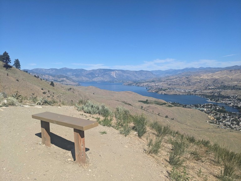
Photo by Tiffany Chou
On this hike, you'll get your heart rate going under intense UV rays and a whole lot of dust in your nose/shoes/socks, so pack your trekking poles, sunscreen, buff, an extra pair of socks and lots of water! But for braving the elements, you’ll be rewarded with a rainbow of wildflowers (think balsamroot, desert-parsley, phlox, lupine and so much more), incredible views of the town of Chelan, and perhaps best of all, the massive lake that the town shares its name with.
From the parking lot, cross the street and walk along a wide “trail” (a dirt road, really) for about a quarter mile before coming to a sign pointing you in the direction of a much narrower trail.
As you climb higher and higher, the views of Lake Chelan become more expansive, with mountains in the distance. In the springtime, wildflowers dot the grass around you. Along the way to the first viewpoint — Elephant Head — you’ll encounter a couple of well-placed benches to take a load off as you take on the relentless, exposed climb.
You’ll see another bench if you take the short, very steep side trail to Elephant Head before continuing to the top of Chelan Butte. It’s a worthwhile detour, as it provides panoramic views of the surrounding area, including your first view of Columbia River. All in all, Elephant Head makes for a great day hike in and of itself.
That said, if your destination is the butte, head back down to where you turned off to get to Elephant Head and continue along the trail. From here, the trail gets even steeper, so you may want to mentally prepare yourself at Elephant Head before starting up again. Expect even broader, uninterrupted views of the lake and North Cascades on the second half of your hike.
Some might consider the top of the butte a little less impressive than the rest of the hike as it’s covered by communication towers, some of which obstruct the 360-degree views you’d otherwise get. That said, you can pat yourself on the back for taking on this relatively brutal hike and making it all the way to the top, and (luckily) you already caught many of the best views on your way to this point.
WTA Pro Tip: This trailhead is also the start of a fun short and mild trail that takes hikers “through the planets,” with informational signs on each planet. Head to the southeast of the parking lot — the trail starts past the trailhead map bulletin.
> Plan your hike to Chelan Butte using WTA’s Hiking Guide
Joe's Picks
 Joseph Gonzalez (he/him)
Role at WTA: Digital Content Coordinator
About Joe: Joe grew up in the San Francisco Bay Area. He has been enchanted by the Pacific Northwest ever since thru-hiking across it along the Pacific Crest Trail in 2016. His passion for empowering hikers launched a career in guiding backcountry trips and developing adventure travel itineraries in iconic regions of the US. These opportunities have allowed him to thru-hike the Appalachian Trail, Continental Divide Trail, and more. He is excited about promoting equity and trail awareness in his current role as Digital Content Coordinator. When he’s not thru-hiking, you can find him foraging, paddling, or lost in a good story.
Bogachiel River
Region: Olympic Peninsula - Pacific Coast
Length: 12 miles, roundtrip
Elevation Gain: 400 feet
Permit required: Northwest Forest Pass
Dogs: No

Photo by Joseph Gonzalez
Olympic National Park has a bunch of really fun river walks. The Hoh river and Enchanted Valley are great areas many people have already checked off their life list. While the Bogachiel River is similar to these, this trail feels significantly more rugged, remote and quiet. It’s a much tougher hike with fewer people, but it’s very rewarding.
I first visited the Bogachiel in May of 2019, hoping to get my first backpacking trip of the season in. That was before I knew it was part of the Pacific Northwest Trail — a roughly 1,200 mile trail that stretches from Chief Mountain at Glacier National Park to Cape Alava in Olympic National Park. So I revisited it in 2023, this time connecting it as part of a larger loop. The loop we had planned would take us through the Bogachiel, along the High Divide, then out of the park via the Hoh River. We knew the back half of the trek would be spent sharing trail and views with other hikers, so we relished the time we spent in solitude along the more challenging sections of the Bogachiel — tackling the hard part first!
The road getting into the Bogachiel River trailhead is rough and a bit slow before reaching the USFS trailhead. That’s right, this trail starts on USFS land before crossing the national park border. Budget your time for the drive accordingly!
WTA Pro Tip: You need a Northwest Forest Pass to park at this trailhead (not a national park pass). But if you're an enthusiastic explorer of Washington's lands, you may want to consider getting an America the Beautiful Pass, which grants you access to both national forests and parks. Learn more about passes and permits and determine which one will work best for your hiking style.
> Plan your hike to Bogachiel River using WTA’s Hiking Guide
Lake Hills Greenbelt
Region: Puget Sound and Islands — Seattle/Tacoma area
Length: 2.3 miles, roundtrip
Elevation Gain: minimal
Permit required: No
Dog-Friendly: Yes

Photo by Joseph Gonzalez
Have you ever done an urban hike and been surprised at how “wilderness-y” it felt, even though you were in a metro area? The Lake Hills Greenbelt and the greater Lake to Lake Trail in Bellevue is basically that. Hit after hit. I originally moved to Bellevue in January of 2020. When COVID hit, I canceled my gym membership and began running. Little did I know I had accidentally moved to the heart of this rich urban trail network.
Explore this greenbelt if you love birding or want a nice, continuous stretch of trail to run or ride your bike. It’s also great for an accessible stroll or picnic.
Wildlife lovers: bring your binoculars and camera! I’ve seen so much fun wildlife on this trail like osprey, pileated woodpeckers and barred owls. Some trip reports from this area even report sightings of otters and weasels.
WTA Pro Tip: Don’t forget to explore Larsen Lake Blueberry Farm in the summer, or to visit Kelsey Creek farm to check out the farm animals on weekends.
> Plan your hike to Lake Hills Greenbelt using WTA’s Hiking Guide
Timberline Trail
Region: Southwest Washington — Columbia River Gorge - OR
Length: 38.5 miles
Elevation Gain: 12,338 feet
Permit required: Yes, self-issued at trailhead
Dog-Friendly: Yes

Photo by Joseph Gonzalez
I first visited Mount Hood and the Timberline Trail in 2016 on my northbound thru hike of the Pacific Crest Trail (PCT). I remember it like it was yesterday — Oregon and California in my rearview, with the final test ahead of me before reaching Canada: the great state of Washington. The lodge was bustling. The beer was delicious. And I was in sheer awe of the majesty of the Pacific Northwest.
Since then, I’ve revisited twice to thru-hike the Timberline Trail. Once in 2020, and again in 2023. Both times were clockwise starting from Timberline Lodge. Permits are USFS self-issue at the trailhead. Both trips were one night, two days long. Both were tons of fun.
The trail itself boasts incredible scenes like Ramona Falls (seriously, waterfalls around every corner) and views of Mount St. Helens, Rainier and Adams, Mount Jefferson and even the Three Sisters. Did I mention wildflowers galore and brilliant meadows? But, this trail is not without its challenges: it’s a flat-out hard hike. Expect many blowdowns, prepare to ford across fast-running glacial streams, and look out for eroding cliff sides and dead standing trees at camp. Also, be prepared to share the trail with others, especially around popular features, trailheads and water sources.
The southwest quadrant is the PCT, so keep an eye out for thru-hikers in late summer. The northwestern quadrant has lots of burn scars and blowdowns, but stunning wildflowers and campsites. The northeast quadrant turns to a dry, moon-like hike at higher elevation, so expect at least a few patches of snow. The southeast quadrant is a rollercoaster of deeply eroded river valleys, brimming full with waterfalls and flowers.
> Plan your hike to Timberline Trail using WTA’s Hiking Guide
James' Picks
 James Alexander (he/him)
Role at WTA: Southwest Crew Leader
About James: James is from the island of Luzon, Philippines, and was raised in a small country town in Texas. James started volunteering with WTA in the fall of 2020 shortly after retiring from the United States Army with 25 years of active duty service. Though he had no prior experience doing trail maintenance, he learned quickly and now leads dozens of work parties a year. James credits the volunteers for originally teaching him the "way of the grubber."
Burley Mountain
Region: South Cascades — White Pass/Cowlitz River Valley
Mileage: 14 miles, roundtrip
Elevation Gain: 4,078 feet
Permit required: Northwest Forest Pass
Dog-Friendly: Yes

Photo by James Alexander
One of my first mountain hikes and fire lookouts in Washington back in 2018, and now I keep returning to it.
Start your journey at the Covel Creek trail network and choose from several paths, such as the Covel Creek Falls Trail that features three waterfalls if you take a short detour on the Angel Falls Loop.
Walking up Burley Mountain Trail, you'll pass through a second-growth forest with old-growth stumps that were burned out in the early 1900s. Don’t stop once you hit Forest Service road 7605. You only have 3 more miles on the service road to reach the summit of Burley Mountain and one of the few remaining fire lookouts in the Gifford-Pinchot National Forest.
Once at the summit, take a break, indulge in a snack or two, and bask in the stunning view of Mt Rainier and Mt Adams. Trust me when I tell you, hiking to the summit is better than driving. The final miles in a vehicle will have your heart racing, eyes wide, and perhaps saying 'This isn't right!' as I did last year when I drove up.
WTA Pro Tip: Follow the WTA driving directions. I highly discourage using the NF-25 to NF-76 route. Your vehicle and back will thank you. Once you make it back down, you might be hungry like I usually am after hiking here. Try out Big Bottom in Randle, or venture into Packwood for some good eats at the Blue Spruce.
> Plan your hike to Burley Mountain using WTA’s Hiking Guide
Vanson Peak
Region: South Cascades — White Pass/Cowlitz River Valley
Mileage: 11 - 18 miles roundtrip
Elevation Gain: 3,001 - 2,805 feet
Permit required: Northwest Forest Pass
Dog-Friendly: Yes
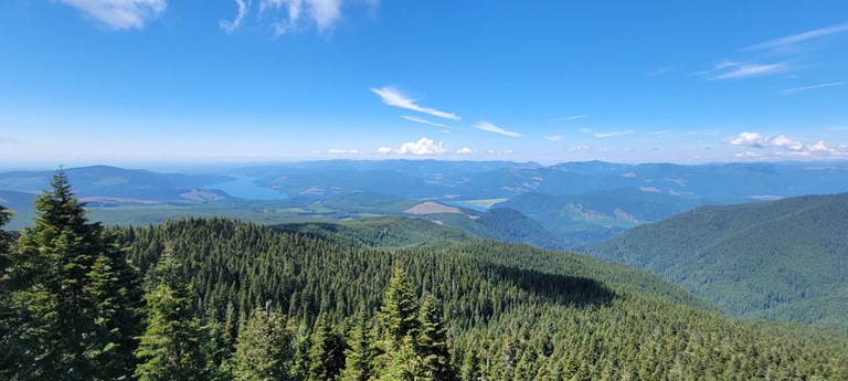
Photo by James Alexander
I scouted the Goat Creek Trail with a volunteer in June 2022, leading to my first visit to the peak via the Vanson Peak Trail.
Breathtaking views await at the summit, but the hike up is just as amazing, and there are several route options. You can opt for the Vanson Ridge Trail via the Green River Trail, which passes through a striking old-growth forest of Douglas firs, hemlocks, and western red cedars. On the way up, take a detour to Vanson Lake.
My favorite route though, is from the Goat Creek Trail, with old growth but also features picturesque cascading falls and a memorable section where you walk under the Cathedral Falls.
I would consider this a great beginners overnight camping excursion.
WTA Pro Tip: Between April and June the falls will be flowing. It’s fairly remote, so leaving a trip itinerary with someone would be a good idea. Normally I’m hungry after this hike, and if burgers and shakes are your thing, I recommend Huff and Puff, just outside of Randle.
> Plan your hike to Vanson Peak using WTA’s Hiking Guide
Steigerwald Lake National Wildlife Refuge
Region: Southwest Washington — Vancouver area
Mileage: 6.8 miles, roundtrip
Elevation Gain: 55 feet
Permit required: Discover Pass
Dog-Friendly: Yes (on Refuge River Trail only)

Photo by James Alexander
A short and easy hike perfect for visitors to the Portland-Vancouver area, suitable for all ages and experience levels.
I first walked through Steigerwald in 2017, on the Lewis and Clark Discovery Trail. Later, in April 2023, I led a WTA work party to brush and lay crushed gravel on the Wildlife Art Trail. In between, the trail was closed for major reconstruction, but now there are many miles to explore, and the Art Trail is especially charming.
Bird enthusiasts, rejoice! You'll find both local and migrating birds flourishing in this marshland paradise.
WTA Pro Tip: The majority of the trail is exposed, so during the summer, sunscreen would be highly recommended. During the spring you’ll enjoy the migrating water fowls. If you like beer, head over to Grains of Wrath. They have darn good food too.
> Plan your hike to Steigerwald Lake National Wildlife Refuge using WTA’s Hiking Guide
Your Questions, Answered
There were so many great questions during the presentation we didn't have time to answer all of them. Here are a few we heard from several folks, along with our answers and resources:
How do I work up from shorter to longer hikes?
Of course how you do this largely depends on where you're starting from and what you're aiming to achieve. In general, you should consider mileage and elevation gain. How much can you currently do, and how much would you like to be able to do? At the core of this is conditioning: that means improving your cardio health, your strength, and your endurance. Here are our recommendations for getting into your peak condition (because everyone's is different). And if you want some ideas for hikes to condition on, we've got those too.
How can I find accessible trails for wheelchairs?
Start by using the wheelchair-friendly filter on WTA's Hiking Guide, under the "accessibility" header in the lefthand column. Each hike marked wheelchair-friendly also includes info about the accessibility of the area. A wheelchair-friendly designation also means the trail is likely a good one for strollers or mobility limitations. We do also have a starter feature, if you want to see a selection of barrier-free trails across Washington.
What would you recommend to someone just starting out backpacking, or backpacking with kids?
If you're just getting used to carrying backpacking weight (or adjusting to carrying everything you need to backpack with kids) a great place to find a trail to practice on is our is our Backpacking Trips for Kids feature. You can also always use the filters on the hiking guide to find exactly what will work for you and your family.
How do I know what pass or permit is needed for a particular trail?
Each hiking guide entry indicates what pass is needed to park at the trailhead, or if necessary, to camp in the area. You'll find it just above the photo for the hike, next to the heading "Parking Pass/Entry Fee". These passes and permits are determined by who manages the land you will be hiking on. To understand more about what is needed for different trails, WTA's Passes and Permits page explains the ins and outs of permits, including seasonal changes, costs, and why permits exist.
What should I know about encountering wildlife on my adventures?
It is very common to have concerns about running into animals, large and small, while out hiking. Please keep in mind that a lot of behaviors that help keep humans safe are also important because they keep wildlife safe and protected, like staying on trail, not approaching or feeding wildlife (no matter how cute or friendly they are) and properly storing food, including packing out the waste from all the food you pack in, including pistacho shells, banana or orange peels, sunflower seeds, etc.
For more specific tips on hiking with various wildlife, check out the following guides to build up your knowledge:
- How to Hike in Bear Country
- How to Hike Safely in Cougar Country
- How to Hike in Tick Country
- How to Hike in Rattlesnake Country

