Trails for everyone, forever

Home Go Hiking Hiking Guide Quick Link

Quick Link

Issaquah Alps > Tiger Mountain
47.4807, -121.9350 Map & Directions
Length
0.5 miles, one-way
Elevation Gain
163 feet
Highest Point
2,657 feet
Calculated Difficulty About Calculated Difficulty
Easy
Misty weather on Tiger Mountain. Photo by George and Sally. Full-size image
  • Dogs allowed on leash
  • Fall foliage

Parking Pass/Entry Fee

Discover Pass
Saved to My Backpack

The Quick Link Trail is a short segment in the middle of the East Tiger trail system. Combine this trail with others to form any number of loop hikes, including a trip to the east tiger summit. Continue reading

Rating
0.00 out of 5

(0 votes) Log in to rate

Hiking Quick Link

The Quick Link Trail is a short segment in the middle of the east tiger trail system. Tiger Mountain is a dynamic forest owned and managed by the Washington State Department of Natural Resources (DNR). As a working forest it creates revenue for the state as well as providing recreation opportunities for hikers, mountain bikers, and horseback riders.

The quickest way to reach the Quick Link Trail starts at the Tiger Summit trailhead. Take the Connector Trail, cross 4000 Road and continue onto the Northwest Timber Trail. At the first junction, bear left onto the Master Link Trail and head uphill to 5500 Road — this is where the Quick Link Trail begins, roughly 3 miles with 1,000 feet elevation gain from the trailhead.

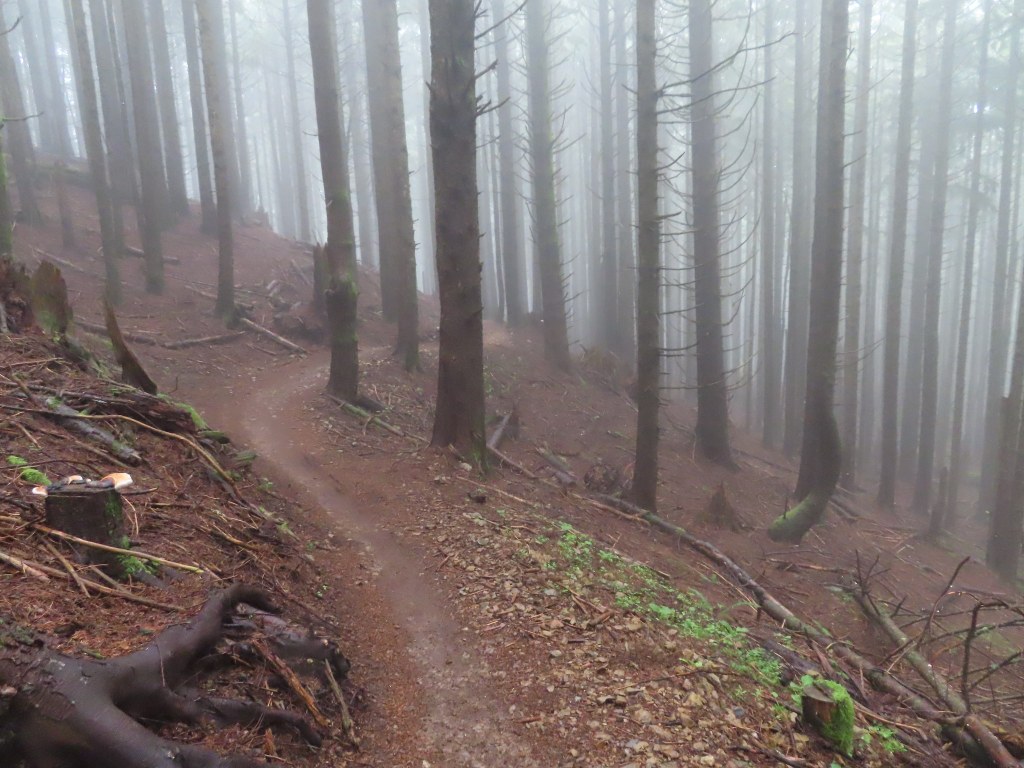
Over its 0.5 mile course, this trail gently contours a slope before ending at another intersection with access road 5500. For mountain bike riders, they are only allowed to travel in the uphill direction on this trail, whereas hikers can move in both directions. Many other trails in this network are directional in the same way. This trail can be combined with others to form any number of loop hikes, including a trip to the east tiger summit and beyond.

Toilet Information

  • Toilet at trailhead

More information about toilets

Quick Link

Map & Directions

Trailhead
Co-ordinates: 47.4807, -121.9350 Open in Google Maps

Before You Go

See weather forecast

Parking Pass/Entry Fee

Discover Pass

WTA Pro Tip: Save a copy of our directions before you leave! App-based driving directions aren't always accurate and data connections may be unreliable as you drive to the trailhead.

Getting There

From I-90, take exit 25 and head south on highway 18. After 4.2 miles, turn into the wide pullout on the right. From here follow signs down a gravel road for 0.3 miles to the Tiger Summit Trailhead.

More Hike Details

Trailhead

Issaquah Alps > Tiger Mountain

Washington State Department of Natural Resources

Guidebooks & Maps

DNR: Tiger Mountain Forest map

You can improve or add to this guidebook entry!

Quick Link

3 Trip Reports

Hiked here recently?

Submit a trip report!
 
Loading trip reports...
Trip Reports