
The Middle Tiger Trail begins on West Side Road, heads northeast, climbs near the Middle Tiger summit and descends to Main Tiger Mountain Road — 1.7 miles in total, with a 0.1-mile spur to the summit itself.
As the name suggests, Middle Tiger Mountain sits at the center of the Tiger Mountain Range, making it approachable from all four directions. At 2,607 ft, it stands lower than East Tiger and West Tigers 1 and 2, but higher than West Tiger 3 and both the north and south summits of South Tiger — squarely in the middle in more ways than one.
The description and statistics given on this entry are for an approach from the east/Tiger Summit trailhead.
Approaches by distance and elevation gain
- North — from High Point trailhead: 5.5 miles one way, 2,300 feet gain
- South — from TMT South trailhead: 4.9 miles one way, 2,300 feet gain
- West — from SE Tiger Mountain Road: 2.6 miles one way, 1,700 feet gain (no official trailhead; limited parking)
- East — from Tiger Summit trailhead: 3.5 miles one way, 1,600 feet gain
East Approach from Tiger Summit Trailhead
Start on the Iverson Railroad Trail from the north end of the Tiger Summit Trailhead parking lot. At the 0.3-mile mark, the trail splits — the left branch is shorter but steeper, the right longer and more gradual — before the two rejoin just ahead of a sturdy bridge.
At 1.5 miles, bear right at the junction onto the Side Hustle Trail, leaving the Iverson Trail behind. About 0.3 mile along, cross a creek on a sturdy bridge, then turn left onto the TMT Connector Trail. The Connector crosses a logging road, passes the site of a fatal train crash on February 23, 1925, and meets the TMT (Tiger Mountain Trail).
At the TMT, bear right, cross another logging road, and continue to the junction with the Middle Tiger Trail. Bear right again, cross the road once more, and begin the earnest climb. After 0.3 mile, a short spur trail on the left leads to the Middle Tiger summit.
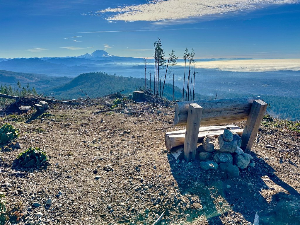
The 2024 clearcut has transformed the summit completely. A three-person bench faces Mount Rainier, and on a clear day, the views stretch all the way to the mountain, with the Seattle and Bellevue skylines spread out beyond Squak Mountain.
From the summit, you can return the way you came or descend via Main Tiger Mountain Road to complete a loop.

 Trailhead