 Washington Trails
Association
Trails for everyone, forever
A new project will use WTA's trip reports to help the Department of Health determine where people are encountering ticks in Washington. | By Anna Roth
Last year, UW Master of Public Health student Alex Eisen approached WTA with a request. Could she utilize our trip report data to evaluate human-tick encounters in Washington over time?
The text of WTA’s trip reports, so full of useful information for hikers, also harbors data points for tick presence across Washington since 1993 (when our website launched). Evaluating information like this could help epidemiologists better understand where in the state people may be most likely to encounter ticks and the pathogens they can carry, and if there is an association between the presence of ticks and previous wildfire activities.
That has public health implications. As tick habitat changes, people previously less used to recreating in tick habitat may be unsure how to prevent tick bites and associated diseases if they encounter a tick on trail.

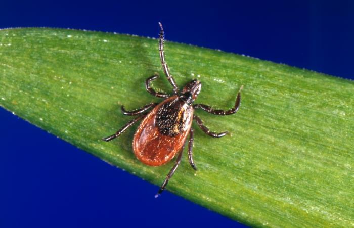
Ticks live in a variety of habitats in Washington state. A new study with UW and DOH using data from WTA helps evaluate where ticks have been spotted over time. Photo courtesy Washington Department of Health.
Alex, an aspiring epidemiologist, had realized this possibility and wanted to enhance a tool the Washington State Department of Health uses to track these changes as her final project toward earning her masters in global public health.
Since 2011, DOH has maintained a citizen-science program for tick identification. People who find ticks on themselves or their pets can submit them to DOH for identification. In 2024, this project was expanded to allow reporting tick encounters, even if someone didn’t keep the tick to submit. Data from this project is available on Washington Tracking Network (WTN), the Department of Health’s page documenting tick encounters.

The WTN page on the Department of Health’s website will be updated annually with data about tick sightings in WTA’s trip reports. Courtesy Washington Department of Health.
“Previously (and currently), [DOH has] utilized tick reports & submissions from the general public to identify potential tick habitats and to get ideas on where to conduct field surveillance,” said Dr. Liz Dykstra, public health entomologist with the Washington State Department of Health.
With Alex’s proposal, WTA’s trip report information supplements the individually-submitted reports DOH fields from the public, giving DOH more data to evaluate tick presence. This in turn helps DOH understand areas in Washington where targeted tick awareness campaigns may be useful and where to conduct field surveillance for ticks thanks to a 5-year grant awarded in 2024.
The funding is provided to perform ‘tick-drags’ in the field. Dragging for ticks involves pulling a 1-meter square white flannel cloth along the ground where ticks are suspected to be and checking it every few meters for ticks. Collection of these unfed ticks and testing them for pathogens helps DOH understand what tick species are established in an area, the type of habitat they prefer, and what disease-causing pathogens are present in those tick populations. This information can then help determine tick-borne disease risk for people (and their dogs!) who live, work and recreate in those areas.
This year, the focus is on Island and Kittitas counties. These two counties were selected due to a lack of information on western black-legged tick distribution in both locations. The western black-legged tick (Ixodes pacificus) is the one that can spread Lyme disease on the west coast, so understanding where this tick is likely to be found helps DOH target risk-awareness messaging. Data from tick encounters, such as those reported in WTA trips reports, can help select locations for field surveillance to ensure an efficient use of resources.

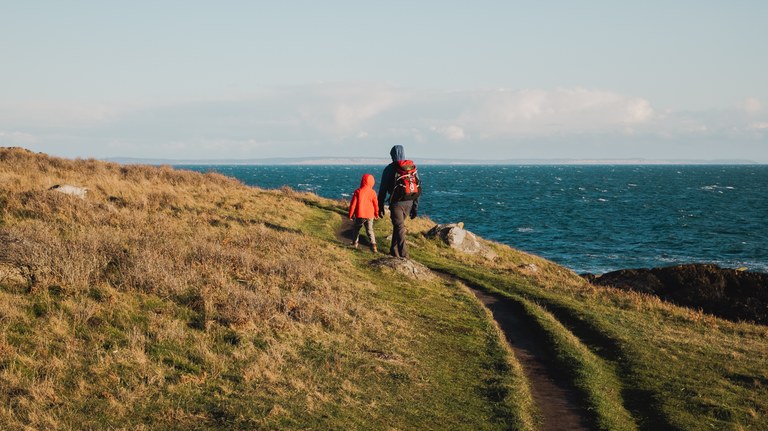
Hikers in Island County (pictured above) and Kittitas County can expect new data on tick species present in their counties. Photo by Erynn Allen.
It’s remarkable how much information can be gleaned from even a basic trip report. Indicating the road or trail conditions, whether or not there was snow present, and how bad the bugs are is a 5-second process and is often a good starting point for researchers.
What you write in your report can help, too. Including information like how full the parking lot was, how full the trail was, what you saw and how you felt about the hike can not only inform other hikers, they can help researchers understand a variety of details on trail, like visitation and hiker behavior.
WTA has shared anonymized trip report data for past research projects. We helped scientists at the UW track trail use based on trip reports, and another team evaluated trip reports for a specific part of Washington to assess where hikers experience wilderness characteristics on trail. We always anonymize the data we share with researchers, and collaborators must get permission to use the information in our trip reports and Hiking Guide.
We were thrilled at the idea that our trip report information could now be used to benefit public health, so after establishing an agreement about how the data would be used, we shared a batch of anonymized trip report data with Alex.
Alex wrote a code to search through trip report text and pull responses that mentioned the word tick or ticks. It was crucial to speed things along.
“This project would have been impossible without that code. It was the difference between needing to read all 250,000+ entries versus less than 1,000,” she said.
Once she’d isolated those trip reports, Alex did have to read through each one that had the word “tick” to verify it was truly reporting a tick sighting. Not all of them were. Trip reporters occasionally note that there were no ticks on trail, or use the word tick without referring to the insect (e.g., “we listened to the tick of our hiking poles as we walked along.”)
Manually sifting through the copy was time-consuming, but eventually Alex had data that included tick sightings and locations, and she was able to produce a data set illustrating where ticks had been reported across Washington over the years. She plugged that info into arcGIS to create a map showing the presence of ticks on Washington’s lands over time.
 The map that Alex produced for DOH with tick reports (green dots) compared to wildfire perimeters between 1998 and 2004. The more reports of ticks that hikers can provide in the future, the better and more robust data set this will be. Images courtesy Alex Eisen/Washington State Department of Health.
A surprising outcome of the report is the relatively low number of tick mentions in trip reports. WTA had more than 250,000 trip reports when we shared the data with Alex, and yet only 589 mentioned ticks. Washington doesn’t have as many ticks as other parts of the U.S., but less than 600 encounters since 1993 seemed like a low number. Of course, not everyone who encounters a tick writes a trip report.
Anna Roth, WTA's digital content manager, oversees WTA’s trip reports and Hiking Guide and is hopeful that the release of this map will encourage more trip reports when hikers encounter the little pests.
“I was surprised by how relatively few sightings were reported, especially considering how much time the dataset covered," she said. "I have friends in Yakima and Spokane who encounter ticks all the time, so I think it’s so normal for them that they likely never think to report one. I hope that with the news of his project, more people will report tick encounters, even if the ticks don’t attach. It’ll help improve this map and make for a much more robust dataset for the Department of Health.”

Even short walks like this one at the Eagle Creek Overlook in the Gorge are worth writing trip reports for, especially if you find a tick afterwards. Photo by Anna Roth
There are more reports for ticks in recent years. This is likely due to the increased number of trip reporters. In 1998, WTA had just two tick reports out of 1,217 total trip reports. In 2023, there were more than 17,600 reports and 45 of those documented a tick encounter.
Some trails didn’t even get their first report until a few years ago, because WTA has been expanding the Hiking Guide in the last 10 years. That doesn't mean hikers didn’t see ticks there in past years, there was just no hike on WTA for them to write a trip report. For example, the first instance of a tick report for Buck Point on our website was 2024, when Anna wrote the entry for the location and the first trip report for it to document a tick sighting.
Alex’s proposed project intended to investigate the potential association between wildfire activity and tick reports. The idea was that if there was a connection between the two, it might be easier to predict where ticks may appear in Washington state, and it may be evidence of an on-the-ground effect of climate change.
After filtering and analyzing the trip reports, Alex compared the tick locations with perimeters of past wildfires to see if tick habitat spread was related to areas burned by past wildfires.
She did not find evidence of an association between wildfire activity and tick sightings. But one study does not mean the question is answered.
“Even if there really is no association between wildfire activity and tick populations [which itself still needs to be studied], it could still mean that wildfires and tick populations are both downstream impacts of climate change," Alex said. "Therefore, even if wildfire activity does not directly impact tick population, climate change could be impacting BOTH wildfire activity and tick populations.”

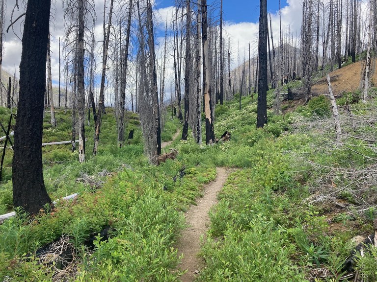
Burch Mountain burned in a fire in the Pasayten Wilderness several years ago. The undergrowth — prime tick habitat — is the first to come back. Photo by trip reporter Abam.
There is strong evidence that both wildfires and tick populations are impacted by climate change. As the climate warms and forest fires are more common, the first thing to grow back in a fire recovery area is grass and brush; perfect tick habitat. Changes in temperature and precipitation will impact the distribution and seasonality of ticks. These changes will also expand the geographic range of disease-carrying ticks, leading to increased risk of tick-borne disease.
Washington has four types of ticks that are known to bite and transmit diseases to people; three of these are hard (Ixodidae) ticks that you might encounter on trails.
The Western black-legged tick lives in forested, oak savannah or brushy areas across parts of western Washington and the eastern slopes of the Cascades, like the eastern section of the Columbia River Gorge Scenic Highway.
Western dog ticks prefer woodland areas, medium height grasses and shrubs between wetlands and woods, and sunny or open areas around woods, like the area around Wenatchee, Leavenworth and Lake Chelan or the Methow.
Similar-looking Rocky Mountain wood ticks are most common on the east side of Washington state — near Spokane, and prefer woodland areas, medium height grasses and shrubs between wetlands and woods, and sunny or open areas along the edge of woods. They also tend to be more commonly encountered at higher elevations than western dog ticks.

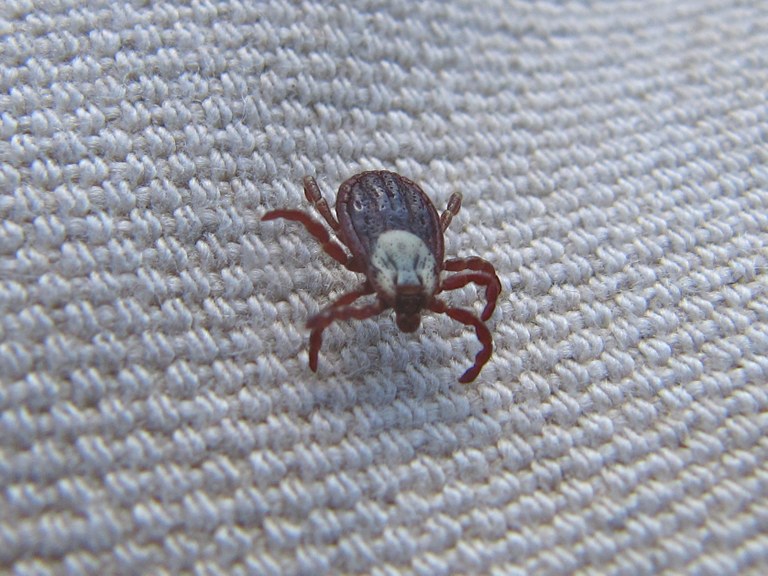
Wearing light-colored, tightly woven clothing can help you see and remove ticks before they attach while you’re on your hike. Photo by Hal Pelton.
It’s easy enough — based on the above facts — to project that ticks will have much more habitat available in the coming years. But the only way to know is by continuing to study direct reports from hikers or residents in addition to conducting studies in the field. So it’s especially important to document tick sightings from your hikes.
“This data is fueled by individuals within the hiking community," Ales said. "This kind of research is only possible if hikers take the time to submit a trip report to WTA or a tick encounter report to DOH — especially if they had a tick encounter on trail.”
Trip reports will continue to inform hikers of tick presence season by season, but they’ll also inform the Department of Health. Understanding how and where ticks are living and spreading can help DOH direct their tick awareness and prevention messaging, and inform where they’re looking for disease.
Moving forward, WTA will share our trip report data annually with DOH to give them a snapshot of the year prior. They’ll use the code Alex developed and combine the trip report data with data from the tick drags and the existing tick encounter and identification project to increase coverage across the state.
“Environmental conditions influence the distribution of ticks and the diseases they carry. These conditions are changing, and only by having a robust state-wide dataset with up-to-date data from multiple sources can we inform people when and where to expect ticks and tick-borne diseases. This is important because the best defense against tick-borne disease is knowing how to reduce your exposure to ticks,” said Dr. Hanna Oltean, senior epidemiologist for zoonotic and vector-borne disease at DOH.
Better data also means better, more targeted public messaging.
“DOH will use this data predominantly to help message tick awareness and to help us make evidence- based decisions on where to focus our tick surveillance efforts," Dr. Dykstra said. "By posting it on our WTN site, it will be available for the public to see.”
So what can you do? Write those trip reports and if you encounter a tick, be sure to include that information! Check yourself for ticks after hiking in tick habitat, and don’t forget to check for ticks on children, pets and gear. If you find a tick, send it to DOH for identification.