Trails for everyone, forever

Home Go Hiking Hiking Guide Buck Point

Buck Point

Southwest Washington > Columbia River Gorge - OR
45.6427, -121.9249 Map & Directions
Length
0.8 miles, roundtrip
Elevation Gain
452 feet
Highest Point
702 feet
Calculated Difficulty About Calculated Difficulty
Easy
View from Buck Point of Bonneville Dam and some burned trees from the 2017 Eagle Creek Fire. Photo by Anna Roth. Full-size image
Saved to My Backpack

A quiet, infrequently-visited trail in the Eagle Creek Campground. It hasn't seen maintenance in a while, so you may need to do some routefinding, but you'll likely be the only one there. Continue reading

  • Dogs allowed on leash
  • Established campsites
  • Good for kids
  • Mountain views
  • Rivers
  • Wildflowers/Meadows

Parking Pass/Entry Fee

Northwest Forest Pass
Rating
0.00 out of 5

(0 votes) Log in to rate

Hiking Buck Point

From the front parking area (cars should not park in the campground unless they're part of a party of campers with a reserved site) look for the Gorge 400 trailhead, just up the paved road to the left of the bathrooms. Alternately, you can walk up the paved road to the campground, but it's quite a bit longer (and arguably less scenic) than just taking the trail.

The Gorge trail leads around the edge of the Eagle Creek Rec area. It's lovely, shady and mostly flat or moderately graded, but it's a little loud - I-84 is right below you. Veer off Gorge 400 when you come by a campsite (try not to walk through an occupied one) and then walk the road up to campsites 5 and 6, set off up a moderate trail that's somewhat easy to follow, at first. 

The trail switchbacks up away from the campground, gaining elevation steadily. You hike through open forest with twinflower at your feet and mountain hemlock above, though many of the trees near you burned in the Eagle Creek Fire of 2017.

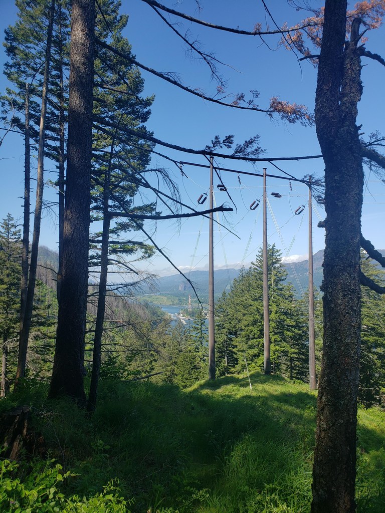
Eventually, you leave the forest for more open slopes; you're nearly to the top. A few BPA (Bonneville Power Administration) powerlines are your destination, along with a view of the Columbia River. But you do need to mount several very tall stairs - the trail here was likely a little more reasonably graded, but lack of use and erosion has rendered this section quite steep. Luckily, it's over soon, and you can enjoy a view of the Columbia River, Bonneville Dam, and the mouth of the Eagle Creek Gorge before heading back down.

Note: Some navigation applications indicate that the trail continues on past this point, but there is nothing more notable, nor a particularly better view than the open area you're in.

Toilet Information

  • Toilet at trailhead
  • Accessible toilet
  • Toilet has running water

More information about toilets

Hike Description Written by
Anna Roth, WTA Correspondent

Buck Point

Map & Directions

Trailhead
Co-ordinates: 45.6427, -121.9249 Open in Google Maps

Before You Go

See weather forecast

Parking Pass/Entry Fee

Northwest Forest Pass

WTA Pro Tip: Save a copy of our directions before you leave! App-based driving directions aren't always accurate and data connections may be unreliable as you drive to the trailhead.

Getting There

From Portland or Vancouver, drive east on I-84 to exit 41, just past the interstate tunnel (it's a good idea to get into the righthand lane BEFORE entering the tunnel). Drive to the end of the ramp, then take a right and park in the Eagle Creek Recreation Area, the first lot you get to. The Buck Point trail starts off of Gorge 400, between sites 5 and 6 in the campground. Please do not park in the campground unless you are a paying camper.

From Cascade Locks, drive west on Interstate 84 for about 3 miles to Bonneville Dam exit #40. Turn left at the stop sign, go under the interstate and then turn immediately left onto the eastbound freeway entrance. Travel east approximately 1 mile on Interstate 84 to exit #41 which is just past the interstate tunnel, so be in the right hand lane before you enter the tunnel. Take a right at the end of the off ramp and park in the first parking lot you come to. The Buck Point trail starts off of Gorge 400, between sites 5 and 6 in the campground. Please do not park in the campground unless you are a paying camper.

More Hike Details

Trailhead

Southwest Washington > Columbia River Gorge - OR

Buck Point (#439)

Columbia River Gorge National Scenic Area

You can improve or add to this guidebook entry!

Buck Point

1 Trip Report

Hiked here recently?

Submit a trip report!
 
Trip Reports