


21 Loop Hikes You Can Do in a Day
Loop hikes are so enticing because you get a full day of hiking without going over the same ground twice. In contrast to an out-and-back trail, a loop can access double the scenery in the same amount of time.
Maximize the variety of a trusty route by returning to hike it in a different direction. Views and landmarks will appear at different times than you're used to. It doesn't have to be a perfect circle either. Consider hikes of all shapes, like figure-eights, lollipops or even abstract polygons. Check out these 21 options to get started.
TIPS FOR SUMMER HIKing
- Want good views? In each hiking guide entry there is a link to the left of the Driving Directions that will show you the weather forecast for that specific area.
- Brush up on basics. Be prepared and carry the 10 essentials with you on every hike.
- Pack it in, pack it out. Practice Leave No Trace.
Mount Rainier


On the way to the Basin. Photo by Jeffr.
The Glacier Basin trail is great on its own—but why stop there? Hook up with the Burroughs Mountain trail to get the most out of your loop experience. Expansive views of Mount Rainier, up-close views of Emmons Glacier, lakes, and campsites are just a few features of this loop's varying landscape.

Reflection Lake. Photo by Ash99.
Eastern Washington

This loop provides a great tour of Mount Spokane State Park. It has a little bit of everything, taking visitors past some interesting and historic structures and on to wide open views. This journey fluctuates between strenuous climbs and calming places to rest. And if three peaks aren't enough for you, try the Eight Peaks Tour!

Lupine along the Sherman Peak trail. Photo by bb.
This stellar loop is home to more than 400 plants including the ever-present lupine and paintbrush and gives hikers photo-worthy views into Canada and the forests of Eastern Washington on a clear day. A fire blazed through this area in 1988 making for some interesting ecology, but also a lot of snags — keep an eye out for trees and be careful on a breezy day!
Grizzly Bear Ridge - Wenaha River - Slick Ear Loop

 Length
 Elevation Gain

Wenaha River. Photo by Froof-D-Poof.
From ridgelines to the river, this hike in a remote corner of the Wenaha-Tucannon Wilderness has it all. The remote upper Wenaha watershed is a natural haven for wildlife. Bring binoculars to scan the hillsides and ridge tops for black bear (both black or brown in color), cougar, deer, elk, moose and the Wenaha wolf pack (the largest pack in Washington and Oregon).

View through the trees to the valley below. WTA Archive.
This delightful loop offers a journey through the Okanogan Highlands. The forest here is full of old-growth trees that stand in the foreground of distant peaks. Wildflowers cover the hills in the spring and Larches provide a flash of color in the fall.
Central Washington


Badger Mountain view in the spring. Photo by Dustin Thomas.
This short hike packs fantastic views. To the south, look across to the crest of the Horse Heaven Hills. North and east, all the Tri-Cites spread out below, and with binoculars you can spot every landmark with minute accuracy. Beyond this, gaze into the Wallula Gap, halfway to Walla Walla and the Blue Mountains beyond. To the west, Candy Mountain and Red Mountain complete the string of the rattlesnake’s rattle, leading over to the much higher summit of Rattlesnake Mountain.

Bench overlooking the ranch. Photo by Henry.
Snow Mountain Ranch offers a variety of summer and winter walks on 9.2 miles of trails. Relics of the old cattle ranch still remind hikers of the past on this 1,800-acre property. History is just one of many attractions at Snow Mountain Ranch. Hike the riparian areas for a chance to glimpse great-horned owls, or focus your binoculars on the local pond for sightings of a variety of ducks.
South Cascades


Angel Falls. Photo by Mirek Kohout.
This short leg stretcher is a great hike for shade and well-maintained trails with views of waterfalls and rock faces. The Angel Falls Loop includes a stop by the nearby Covel Falls (or Curtain Falls) too and is sure to keep hikers of all ages entertained.

A sign along the Buck Creek Trail. Photo by Elementalll.
Get a taste of the south slopes of Mount Adams area when the snow is still in the high country on this eight-mile loop combining the Buck Creek Trail, Morrison Creek Trail, and Wicky Creek Trail. Start along the White Salmon River, then follow these three creeks through forests of ponderosa and aspen.

Photo by mrhamon.
Venture through dusty lahars, cool forest, and the high country on the shoulder of Mount St. Helens on this 12-mile loop. Do it in a day, or plan to camp along the way—this hike is both beautiful and a bit of a challenge; you’ll need a little scrambling experience to be comfortable hiking the whole thing.
Southwest Washington

Good signage along the trail. Photo by Anna Roth.
This loop takes hikers through a section of the Yacolt Burn State Forest. You will pass through forests in varying stages of growth, from seedlings to mature trees.

Photo by HaroldC3.
This long, looping hike offers a nice ramble in the backcountry of Catherine Creek. The views are excellent almost immediately, and will only improve for most of your hike. Throughout your hike, you'll get views from the Columbia River Gorge to the Lyle and Columbia Hills, and across the river to Rowena Plateau and the Tom McCall Nature Preserve in Oregon. Be warned — this trail does get hot in the dead of summer, so consider making it an early morning or late night outing.
Willapa National Wildlife Refuge - Porter Point Loop

-
Length
- 2.4 miles, roundtrip
-
Elevation Gain
- 371 feet

The Porter Point Loop is but one trail in Willapa National Wildlife Refuge. Photo by hikerjen.
Among the many trails in beautiful Willapa National Wildlife Refuge include the Porter Point Loop, a delightful loop where you'll find flocks of shorebirds and waterfowl (particularly in spring and fall), lovely views of the bay from Porter Point and the options to extend your hike to Porter Slough (or farther!).
Snoqualmie Area

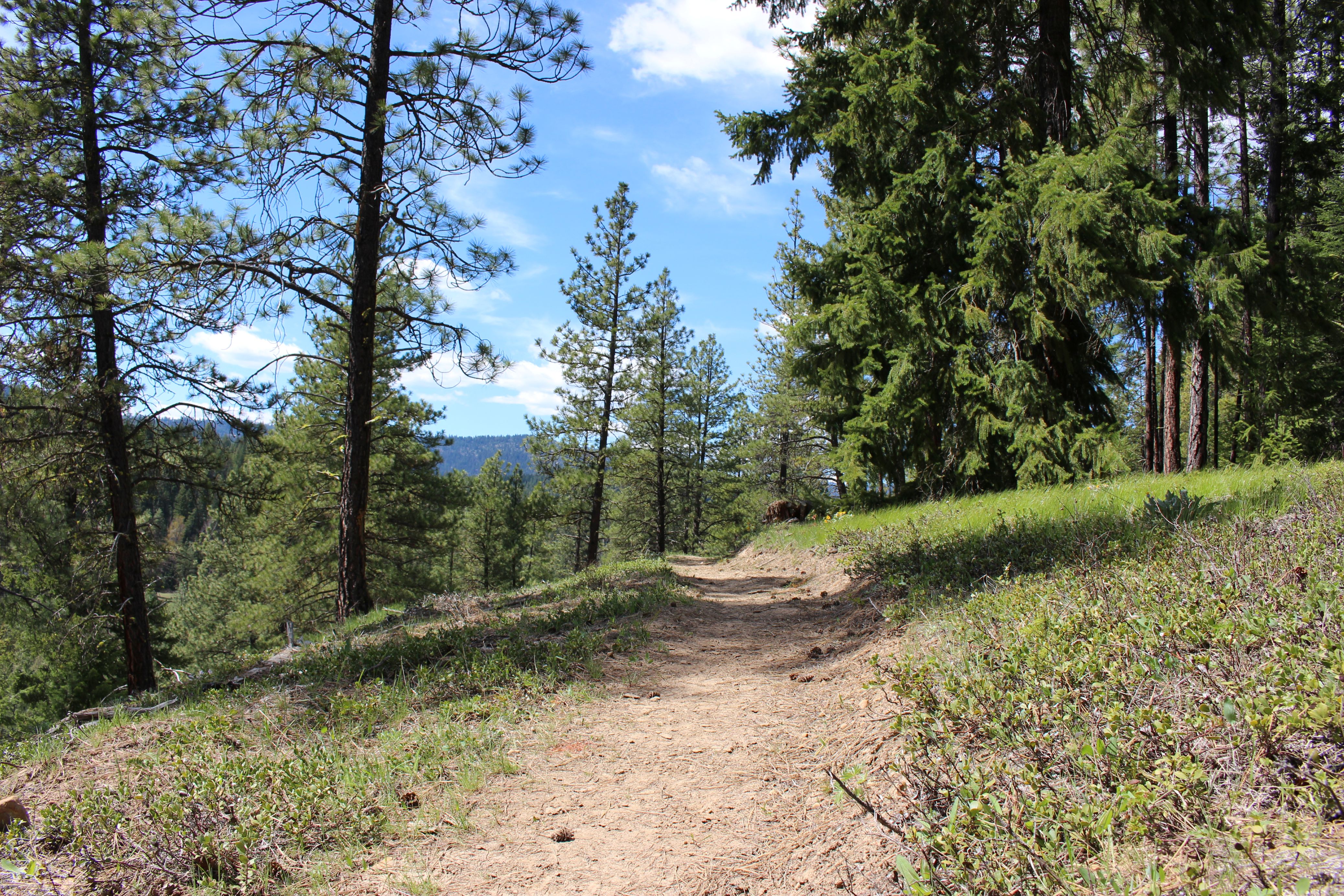 The Frog Pond Loop is lovely on a sunny day. Photo by Chloe Ferrone.
This 5.4-mile loop hike meanders its way through pine forest and brings trail users to a seasonal pond and large sandstone slab, offering striking views of the Teanaway Community Forest. The West Fork Teanaway trailhead opened in 2026 after years of 13 planning and collaborative work between WTA, Department of Natural Resources, the Washington Department of Fish and Wildlife and fellow nonprofits. Be among the first to add a trip report!

Colorful hillside along the trail. Photo by Suhleenah.
This loop takes you past two clear and calm lakes, up a steep, brushy trail to the beautifully manicured Pacific Crest Trail, then west under the blocky granite summit of Tinkham Peak and the shining pyramid of Silver Peak before dropping to Windy Pass.
North Cascades


The vast and wild Pasayten Wilderness is one of the best spots for seeking solitude in Washington. This can be an excellent place for wildflower viewing in the early season. In the autumn, the larches across the valley can be equally stunning. Robinson Pass is one of the shorter loop options available in the Pasayten, so if you're keen on longer trips and packing in miles, grab a map and start plotting your next visit to the north!

Scott Paul Trail. Photo by calixtomoon.
A loop hike to the base of Mount Baker or a rugged alternate route to Park Butte: take your pick. Along the way, soak in sweeping views of the North Cascades, gaze at Koma Kulshan’s glistening glaciers, munch on an inexhaustible supply of berries, and marvel at the old-growth western hemlock forest.
Olympic Peninsula

Lake Angeles Trail. Photo by bzimmer.
If you're feeling adventurous, this strenuous loop may be for you. Instead of hiking Heather Park as an out and back— continue to the Klahhane Ridge trail and eventually the Lake Angeles Trail, and complete a loop that ends right back where you started. You'll start with a climb to a high alpine parkland with gorgeous views, massive trees, and fluffy mosses along the way, and end with an up close and personal view of the enchanting glacier-sculpted landscape.
> Plan your trip to Lake Angeles using WTA's Hiking Guide
> Plan your trip to Heather Park using WTA's Hiking Guide
Port Gamble Forest - Forbidden Forest Trail Loop

-
Length
- 8.5 miles, roundtrip
-
Elevation Gain
- 350 feet

Forbidden Forest Trail. Photo by j. irwin.
This forest contains 60 miles of trail. This loop is a great way to get a sense of the trail network here without getting overwhelmed. Venture through Douglas fir forests and ravines full of ferns. There's also an option for a shorter loop if you prefer.

Footbridge over Willaby Creek. Photo by Eric Nagle.
Enter a world of lush green under a towering rainforest canopy of Sitka spruce and western hemlocks. This mossy loop meanders through a boardwalk bog, past crashing creeks and the shore of Lake Quinault, returning via the shorter interpretive loop. This interconnecting trail system provides options to lengthen or shorten your hike.