16 Hikes to Spot Miles the Marmot during Hike-a-Thon
Each August, WTA hosts our peer-to-peer fundraiser, Hike-a-Thon. It’s a ton of fun, connects you with other hikers and is a great way to give back to trails. Here to cheer you on all month is Hike-a-Thon mascot, Miles the Marmot. You’ll spot Miles online and in the weekly Hike-a-Thon emails sent to participants, but there are plenty of places across the state where you can see a real life Miles the Marmot and his wildlife friends. You might just hear him whistling in encouragement as you hike and raise funds for trails. 
TIPS FOR summer hiking and viewing wildlife on trail
- Keep cool on trail. Check the weather, carry adequate water and protect yourself from the sun.
- Before you go, check trail closures and the current air quality index. Our Hike Finder Map overlays are a great way to get started.
- Respect wildlife by following Leave No Trace principles.
- Observe wildlife from a distance. Do not follow or approach them.
- Never feed animals. Feeding wildlife damages their health, alters natural behaviors, and exposes them to predators and other dangers.
- Protect wildlife and your food. Store food, scented products and your trash securely.
- Learn more about sharing the trail with bears, cougars, snakes and mountain goats.
Moose LAke
Location: Olympic Peninsula > Northern Coast
Length: 8.2 miles roundtrip
Elevation Gain: 1,500 feet
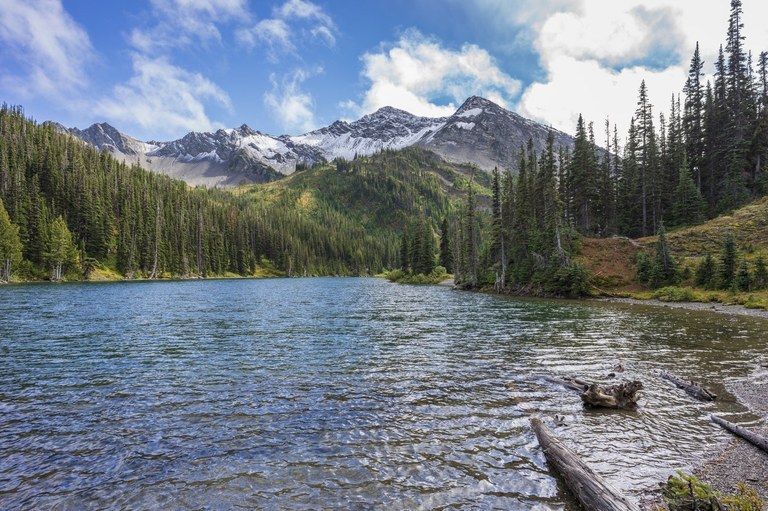
Take is the views at Moose Lake. Photo by spaceistheplace.
Grab stunning mountain views and hike through gorgeous alpine meadows on your way to Moose Lake. Most of the elevation gain is on the return for this hike so come prepared for a workout on the way back to the trailhead. Camping is possible here, but you’ll need reservations and a backcountry permit.
> Plan your visit to Moose Lake using WTA's Hiking Guide
Elk Mountain to Maiden Peak
Location: Olympic Peninsula > Pacific Coast
Length: 8.0 miles, roundtrip
Elevation Gain: 840 feet

Enjoy the mountains from Maiden Peak. Photo by ZhuckYu.
Keep an eye out for marmots, deer, chipmunks and ptarmigan as you take in the breathtaking views of Mount Olympus on this ridgeline hike to Maiden Peak.
> Plan your visit from Elk Mountain to Maiden Peak using WTA's Hiking Guide
Klahhane Ridge
Location: Olympic Peninsula > Northern Coast
Length: 5.0 miles, roundtrip
Elevation Gain: 1,700 feet

Experience expansive views from the Klahhane Ridge trail. Photo by Traversant.
Klahhane Ridge offers wildflowers, wildlife and incredible views of the Olympics. Come prepared with lots of water and sunscreen as the ridge provides little shade and be ready for sections of narrow trail with exposed cliffs and ledges.
> Plan your visit to Klahhane Ridge using WTA's Hiking Guide
SHOE LAke
Location: South Cascades > Goat Rocks
Length: 15.7 miles roundtrip
Elevation Gain: 2,500 feet

Spend the day exploring Shoe Lake in the Goat Rocks Wilderness. Photo by Anna Roth.
Adventure into the Goat Rocks with a long day hike to Shoe Lake. Keep in mind that there is no camping at this lake, but the views are worth the trip. Looking for a shorter hike in the same area? Check out our suggestion for Ginnette Lake below.
> Plan your visit to Shoe Lake using WTA's Hiking Guide
Ginnette Lake
Location: South Cascades > Goat Rocks
Length: 5.6 miles, roundtrip
Elevation Gain: 1,062 feet

Relax by Ginnette Lake on a sunny day. Photo by PJ Heusted.
Looking for a shorter hike with access to the Goat Rocks Wilderness? Check out the darling Ginnette Lake for a swim or some sunbathing. A perfect way to spend the afternoon before heading back to the trailhead.
> Plan your visit to Ginnette Lake using WTA's Hiking Guide
Takhlakh Lake and Takh Takh Meadow
Location: South Cascades > Mount Adam Area
Length: 3.0 miles, roundtrip
Elevation Gain: 500 feet
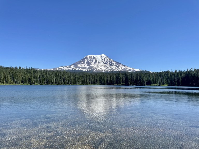
Take in the breathtaking mountains from Takhlakh Lake and Takh Takh Meadow. Photo by rupas.
Explore this beautiful trail that takes you to meadows and lava flows. This trail starts from the Takhlakh Lake Campground and offers views of both Mount Adams and Mount Rainier.
> Plan your visit to Takhlakh Lake and Takh Takh Meadow using WTA's Hiking Guide
Rock Mountain via Snowy Creek
Location: Central Cascades > Stevens Pass - East
Length: 9.0 miles, roundtrip
Elevation Gain: 3,600 feet
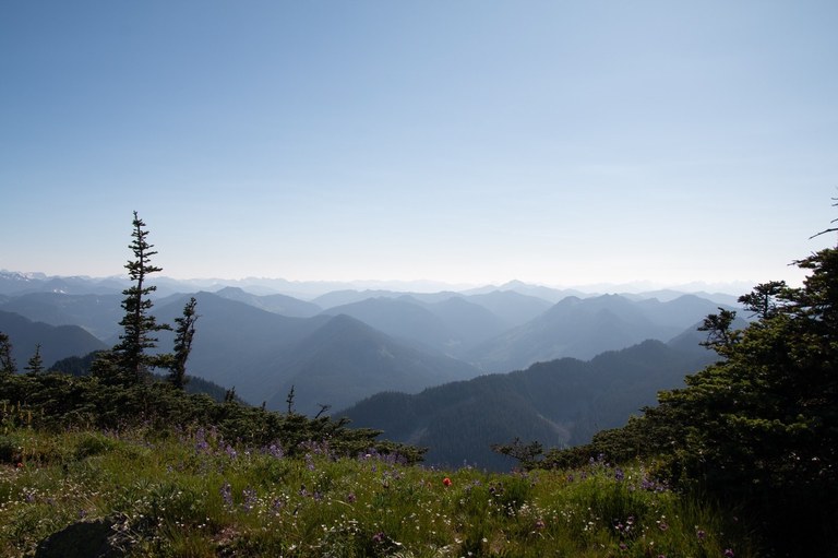
Enjoy wildflowers and mountain views from Rock Mountain via Snowy Creek. Photo by Aurora Ritter.
Hikers often access Rock Mountain via Rock Lake, but this alternative is shorter, less steep and more scenic. Keep an eye out for mountain goats on your way to the old lookout site and be ready for a brushy and exposed hike.
> Plan your visit to Rock Mountain via Snowy Creek using WTA's Hiking Guide
Silver Falls Interpretive Trail
Location: Central Cascades > Entiat Mountains
Length: 1.2 miles, roundtrip
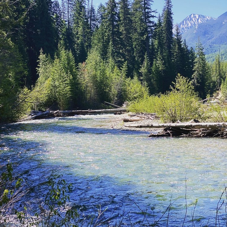
The Entitat River runs along the Silver Falls Interpretive Trail. Photo by WEvans.
Take a gentle stroll along the Entiat River. This makes for a great, relaxing option if staying at the Silver Falls Campground.
> Plan your visit to the Silver Falls Interpretive Trail using WTA's Hiking Guide
Albert Camp
Location: North Cascades > Pasayten
Length: 8.6 miles, roundtrip
Elevation Gain: 2,900 feet
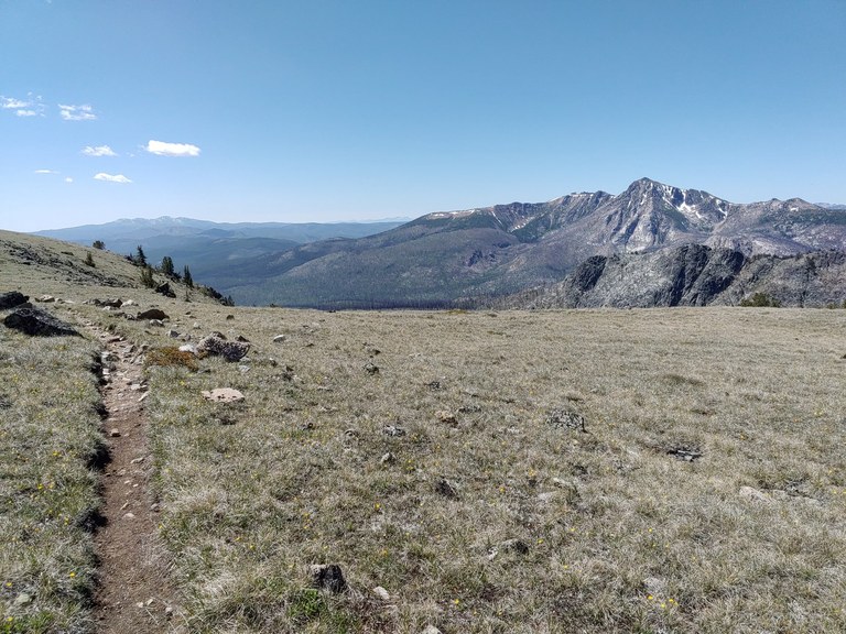
Enjoy never ending views from Albert Camp. Photo by melanib.
Keep an eye out for deer, marmots and even coyotes as you hike through the Loomis State Forest and Pasayten Wilderness. WTA’s volunteer trail crews recently worked here in July, clearing logs and cutting back vegetation.
> Plan your visit to Albert Camp using WTA's Hiking Guide
Sun Mountain Trails
Location: North Cascades > Methow/Sawtooth
Length: 68.4 miles of trails
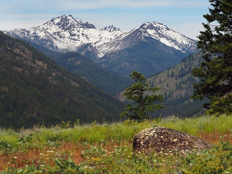
Visit the Sun Mountain Trails to experience wildflowers and mountain views. Photo by thebrink.
With endless opportunities to explore, grab a map and plan your perfect day on trail starting from the Sun Mountain lodge west of Winthrop. Just make sure to carry adequate water and sun protection as this area can be hot in the summer.
> Plan your visit to the Sun Mountain Trails using WTA's Hiking Guide
Howard Miller Steelhead Park — Wetland Wildlife Trail
Location: North Cascades > North Cascades Highway - Hwy 20
Length: 10 miles of trails
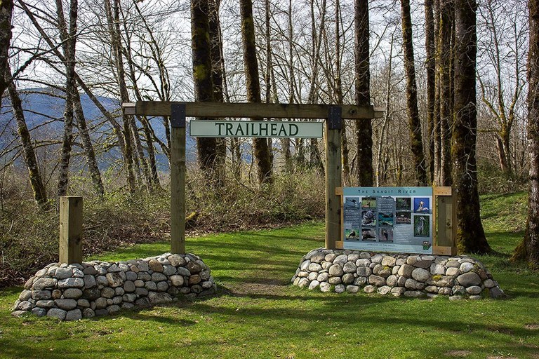
Learn about wildlife along the trails at Howard Miller Steelhead Park.
At this park, hikers can make their trips longer or shorter with a variety of trail options. This is a great place to not only see wildlife, but also learn about it with the informational boards along the way.
> Plan your visit to Howard Miller Steelhead Park — Wetland Wildlife Trail using WTA's Hiking Guide
RASAR State Park
Location: North Cascades > North Cascades Highway - Hwy 20
Length: 3.0 miles, roundtrip
Elevation Gain: 125 feet
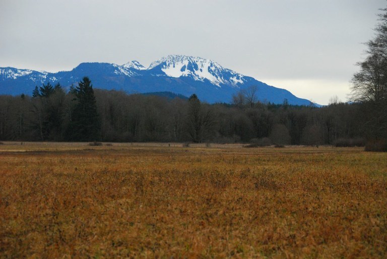
Explore Rasar State Park to take in views of Sauk Mountain. Photo by Bob and Barb.
Another park with multiple trails to choose from. We recommend exploring the Skagit Woods Trail, the Skagit River Trail and the Field Trail to make the mile loop. There’s also a wheelchair friendly trail here that’s one mile long and is marked on the map as Trail #8.
> Plan your visit to Rasar State Park using WTA's Hiking Guide
MANASTASH Lake
Location: Central Washington > Yakima
Length: 8.0 miles, roundtrip
Elevation Gain: 1,100 feet
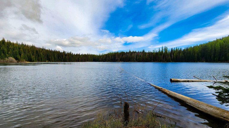
Enjoy the beauty of Manastash Lake. Photo by Kellbell.
Make it a day hike or plan for an overnight backpacking trip on this gorgeous hike to not one, but two alpine Lakes. You’ll reach both Lost and Manastash Lakes as you traverse the rolling basalt plateau of Manastash Ridge.
> Plan your visit to Manastash Lake using WTA's Hiking Guide
Clara and Marion Lakes
Location: Central Washington > Wenatchee
Length: 3.2 miles, roundtrip
Elevation Gain: 900 feet

A short hike will take you to the blue-green waters of Clara and Marion Lakes. Photo by kidz won't hike.
Enjoy this short trail full of chirping birds and Ponderosa pines. This hike leaves directly from the Mission Ridge Ski area’s parking lot and makes a great option for a family hike.
> Plan your visit to Clara and Marion Lakes using WTA's Hiking Guide
Bennington Lake
Location: Eastern Washington > Palouse and Blue Mountains
Length: 20.0 miles of trails
Elevation Gain: 0 feet
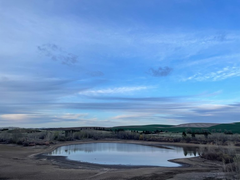
Outdoor activities abound at Bennington Lake. Photo by Rachel Wendling.
Escape from the summer heat in Walla Walla. Bennington Lake offers fishing, a variety of trails clocking different lengths and the Sun and Sage National Birding Trail, sure to keep bird enthusiasts entertained.
> Plan your visit to Bennington Lake using WTA's Hiking Guide
Turnbull National Wildlife Refuge
Location: Eastern Washington > Spokane Area
Length: 5.5 miles, roundtrip
Elevation Gain: 0 feet

Enjoy the views and keep an eye open for wildlife on the Turnbull National Wildlife Refuge. Photo by KristenSF.
Too hot to get out for a hike? The Turnbull National Wildlife Refuge offers a driving route where you can enjoy nature and wildlife with the A/C on or a breeze through the car window. Hikers can walk the main driving loop or explore one of the side trails.
> Plan your visit to Turnbull National Wildlife Refuge using WTA's Hiking Guide

