


Hike the State 2026: Four WTA staff share favorite fall hikes
Get excited for your next adventure with four WTA staffers as they reveal some of their favorite hikes from around the state. No matter your preferred type of trail, there's something here for everyone. Get ideas to help you plan an unforgettable autumn and sample some bigger trips you might want to spend the shoulder season planning for next year.
 A dusting of snow and golden larches can both be found in early October in the Sawtooth's Scatter Lake. Photo by WTA trip reporter rbs13.
If you try any of these hikes, we'd love to hear about it in a trip report. If you can't make it out on trail right now, save them to your My Backpack account for later and to take them with you on our free mobile app.
If you find these WTA resources helpful, consider becoming a member and supporting our work. Thank you for investing in the future of trails.
Tips for hiking safely in fall
- Five essential tips for hiking safely in fall
- Wear bright colors, keep dogs leashed and more tips for hiking safely in hunting season
- Help each other out and report fall colors, snow and ice conditions with a trip report!
Jenn's Hikes
Jenn Seva (she/her) - Donor Relations Officer
Jenn is part of WTA’s fundraising team. Before becoming a WTA employee, she volunteered as an outreach ambassador, trip reporter and trail maintainer for years. She delightedly added “staff” to that list of roles in 2024, professionally committing to building a community that gives back to trails and public lands. From the Philippines to Philadelphia and eventually to the Pacific Northwest, Jenn has had the privilege of working with and playing in the outdoors all over the world. With the company of her husband and dog, Jenn is often gardening, paddleboarding, hammocking (that’s a sport, right?), eating dark chocolate or — what else? — hiking.

 Length
 Elevation Gain
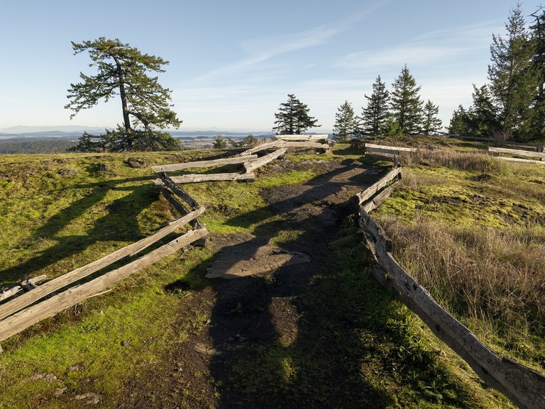
Summit view by WTA trip reporter ejain.
Mount Grant Preserve is a trail system on San Juan Island. The trails to the top offer the most elevation gain available on San Juan Island so you'll love this one if you're looking to get high up.

Photo of a sun-dappled Logan Lane by nwroth.
Within a residential neighborhood of south Everett, tucked between expansive public sport fields, an off-leash dog park and a golf course, a network of trails winds through towering trees, thriving native flora and a fragile yet precious wetland ecosystem.

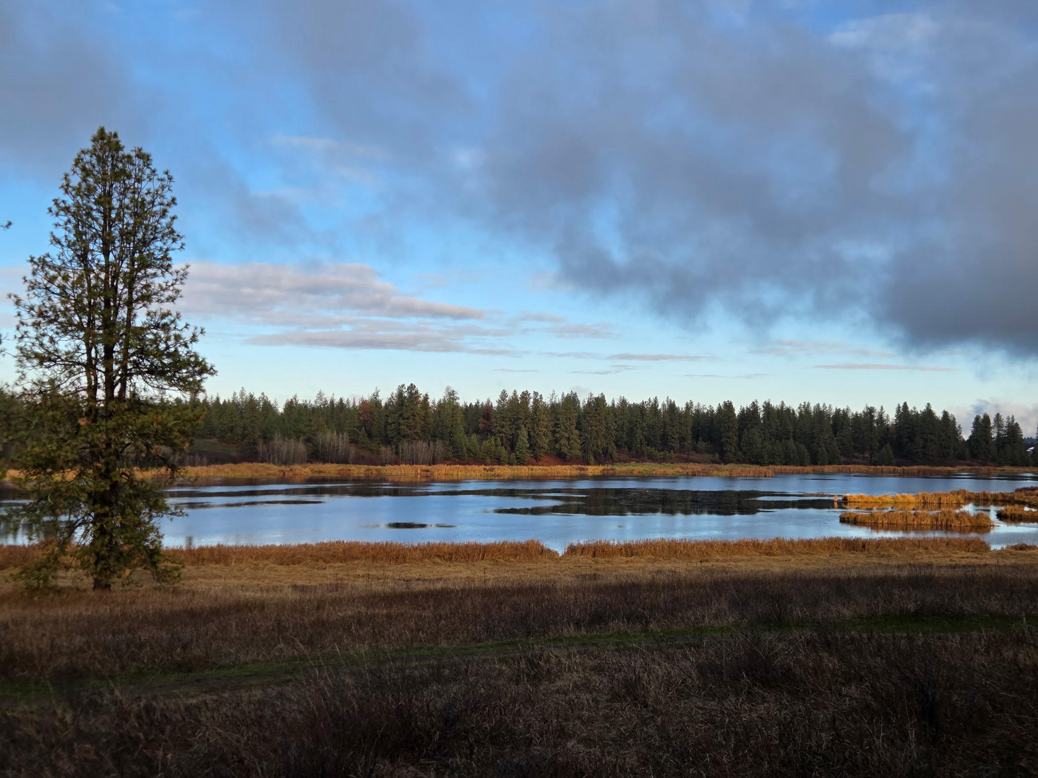 Autumn light creates drama on the ponds. Photo by WTA trip reporter Jesse W13.
The Slavin Pond Loop was restored from farmland as part of the Spokane County Conservation Futures program. This area is part of the winter migratory flyway for many birds, where hikers, bikers and dog-walkers are likely to spot ducks, geese and owls on their fall and winter forays.
Barbara's Hikes
Barbara Molina - South Puget Sound Trails Coordinator
Barbara has worked in outdoor restoration since 2022 and has worked in California, Vermont, Montana, and now Washington! She loves trails and loves creating a community that’s inclusive and fun. Barbara prioritizes connecting with the land as she works. She feels there is a rich history the land contains and that it provides opportunities for self-discovery, growth and healing. Before getting into the outdoor industry, Barbara was the founder of a skincare company, a dedicated laughter yoga instructor, and carried a strong creative spirit for writing and painting. Barbara is very thoughtful and loves having meaningful conversations with people.

 Photo by Bob Zimmerman.
The trail begins off of forest service road 7222 and travels through the 2017 wildfire burn scar. A few miles later you find yourself in a wooded area and the hike begins its steep ascent up into the alpine ecosystem. Along the way, you’ll also encounter an abundance of berries you can enjoy during the months of August and September. The steep ascent will subside only briefly because the final trek to the Noble Knob view point is another steep but short trek to some of the most awe inspiring views of the region. They are some truly enchanting and mystical views of the region.

Photo of Chambers Creek by WTA staff.
This trail is full of boardwalks and steps that allow you access to an ecosystem you wouldn’t normally get to hike in! The hike can be challenging in some sections because of some steep steps or sections of trail but otherwise is very approachable. You’ll walk alongside Chambers Creek surrounded by trees and skunk cabbage. The views are incredible and feel like you’re deep in the backcountry while being minutes away from a grocery store. This is currently only an out and back trail.
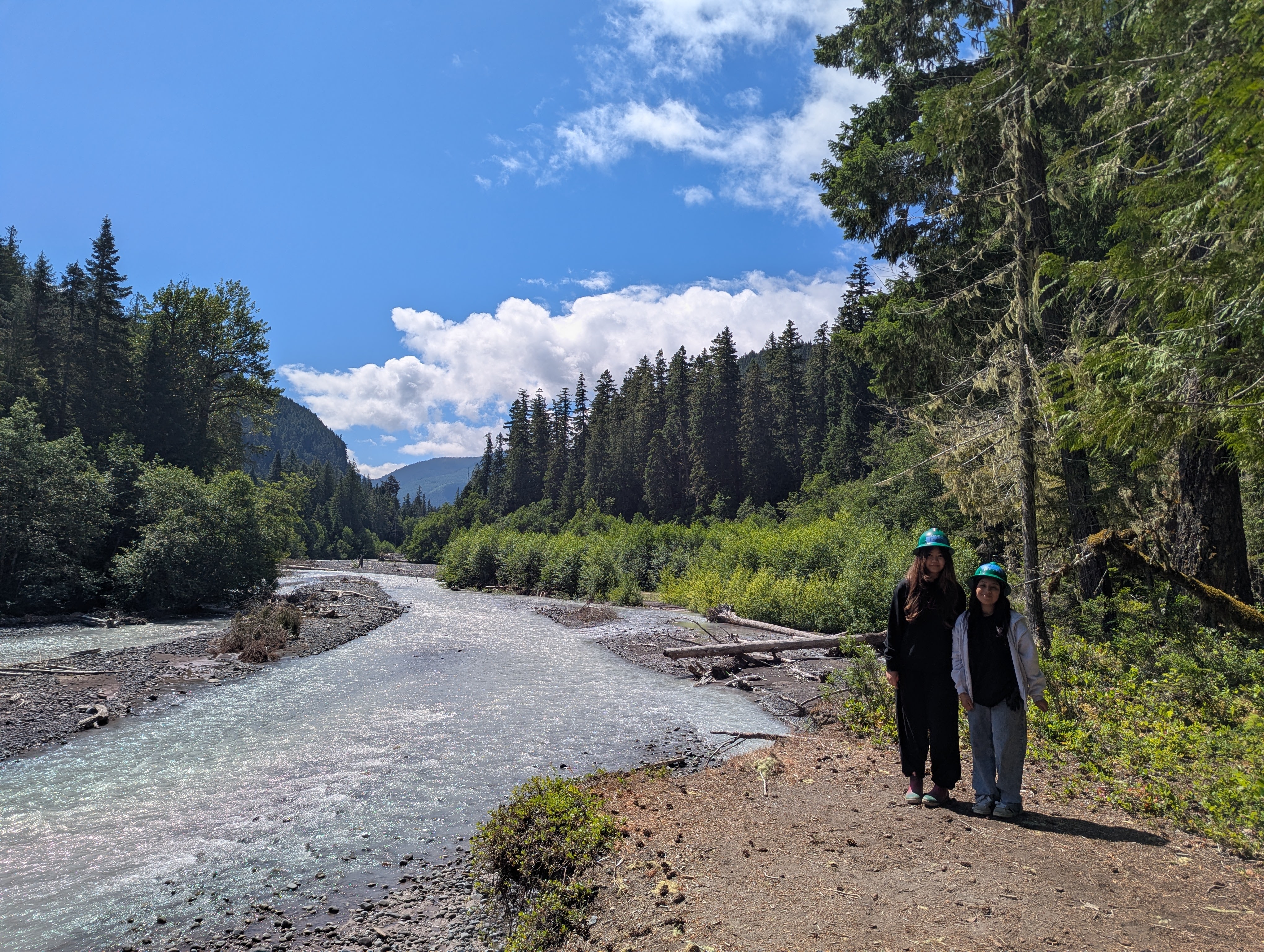
Photo of the river view and WTA trail volunteers by Karin Plagins.
This trail feels like a time warp. Everything slows and draws you in. From the scent of the forest, to the sound of the birds and the raging white river nearby. The whole trail captures your attention while simultaneously allowing you to float in your thoughts. The hike is gentle and has a few sections that are steep but very short. From end to end, the trail is about 8 miles. It is home to lots of old growth trees and various fungi. The best time for fungi is in the fall, you might see bear’s head tooth or the super fun Jelly fungi among others. Another highlight of this trail is the abundance of photo opportunities with the river or the old growth as your backdrop.
Chloe's Hikes
Chloe Ferrone (she/her) - Central Washington Regional Coordinator
Chloe originally hails from Nebraska, but traded prairies and sandhill cranes for the maple-covered mountains of Vermont, where she attended Middlebury College. She fell in love with hiking and trail running while in school, and hiked the Long Trail after graduating. From there, Chloe spent several years in Utah pursuing a wide range of outdoor-related jobs, working as a rock climbing instructor, dog sled guide, reporter, and backpacking guide. Although she loves the desert, she’s enthralled by the PNW and now calls Central Washington home. She was drawn to WTA by the prospect of doing good in the world and getting her community hyped about hiking and exploring the outdoors. When she’s not doing trail work or community outreach, you can find Chloe gardening, climbing, trail running with her dogs Tesser and Muppet, or attempting to befriend the local corvid population.


A view of Scatter Lake as we went up the scree slope. Photo courtesy of trip reporter rbs13.
This strenuous out and back trail is one of the best day hikes for larch spotting in the fall, with foliage usually peaking during the first two to three weeks of October. The trail follows Scatter Creek for a stretch before switchbacking up a steep slope to a meadow, with Scatter Lake beyond. This area is a great option as a day hike or an overnight backpack. The views of Abernathy Peak and the surrounding mountains, paired with the vibrant golden larches, make this hike worth the effort!

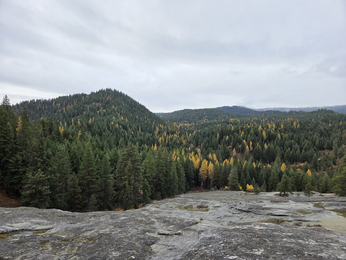 Larches from the sandstone slab on the cheese rock hike, photo courtesy of Emma Ledbetter .
The Cheese Rock trail in the Teanaway Community Forest is a short hike that can be done as an out and back or as a loop. It offers sweeping views of the Teanaway and the Stuart Range beyond, and the walk up the enormous sandstone slab is unique to the area. This trail is a great fall hike option for families with children, with views of lower elevation larches scattered throughout the Forest and the bright foliage of the cottonwoods along the river visible from the top of the rock.


View from our Lunch Spot Photo (c) David Hagen
This mellow trail parallels the Tieton River and wanders past basalt cliffs, beautiful cottonwood and oak trees that change color in the fall, and multiple access points that allow you to customize your mileage. The trail offers little shade, so be prepared with sunscreen and plenty of water.
Nicole’s Hikes
Nicole Masih-Théberge (she/her) - Senior Community Engagement Coordinator
Nicole grew up hiking and camping all around the Pacific Northwest. She has spent her career working in a variety of roles for nonprofits in youth development, volunteer management and grant writing. Leading several camping and hiking trips while working for Girl Scouts of Western Washington further ignited her excitement for increasing access to nature and outdoor recreation. Nicole is passionate about environmental and social justice and is thrilled to be working with WTA to support and grow community engagement with the outdoors. When she’s not working, you can usually find her on a walk, reading, or cooking.


Photo by Mary J. Hartman .
There are so many opportunities to see water in many forms in Washington. But there is something special about the open ocean. This park is right on the Pacific Ocean, and provides a chance to experience a gorgeous stretch of beach. There are ample opportunities to bird watch and see other coastal wildlife. It’s a 4-mile trail, and relatively flat. Along the trails available at this park, you can see sand dunes, a river, AND the Pacific Ocean.

 Photo by WTA trip reporter NIXOLY.
This hike in the Goat Rocks Wilderness is on the shorter side considering its elevation gain, so it has some pretty steep sections. Because of the interesting variation of things to look at, it can be a good introduction to backpacking with kids who are adventurous. There are some vibrant red vine maples on display in the fall, and there’s a lot of variety in just a short distance, including boulders, a creek, and varying terrain. Many folks enjoy a hike leading to a beautiful secluded lake. If that’s you, this would be a hike to check out!
Similar alternate hikes in the area:
- Angel Falls is good for kids, plus seeing old growth forest.
- Woods Creek Watchable Wildlife Trail is an accessible trail, great for learning about various wildlife in the area and seeing fall foliage.
Your Questions, Answered
There were so many great questions during Hike the State 2025, and we didn't have time to answer all of them. Here are a few we heard from several folks, along with our answers and links to WTA resources:
How do I know what pass or permit is needed for a particular trail?
Each hiking guide entry indicates what pass is needed to park at the trailhead, or if necessary, to camp in the area. You'll find it just above the photo for the hike, next to the heading "Parking Pass/Entry Fee". These passes and permits are determined by who manages the land you will be hiking on. To understand more about what is needed for different trails, WTA's Passes and Permits page explains the ins and outs of permits, including seasonal changes, costs, and why permits exist.
This fall, you will be able to buy a pass at some Forest Service trailheads using Scan and Pay. Learn more about this system here.
How can I enjoy a popular fall destination?
If you do want to see a popular larch destination, try to go during the week or super early to find safe and legal parking. Always go with a backup option or two nearby. It’s really important to park for the people. Emergency responders NEED to be able to get to a trailhead.
How can I find groups of people to go hiking with?
WTA has a resource page with links to a plethora of hiking groups around the state. Keep an eye out for upcoming events (like WTA's Hiker Happy Hours) in your area. If you are looking to explore a new area in a fun, safe way, consider volunteering on an upcoming work party with WTA.
How can I access trail information when I’m out of service?
Once you have a WTA account and you are logged into it on the Trailblazer app on your phone, you’ll automatically have offline access to all the hikes you have saved in My Backpack. We also recommend trying out a few map apps (like Gaia, OnX or CalTopo) to supplement any printed maps you bring.
I want to hike with my dog. any tips?
Our top tips: Learn where dogs are allowed to hike with you, keep your dog (and wildlife) safe by using a leash, and pick up and carry their waste out with you. (An old Tupperware or yogurt container is handy to prevent squish and smell.) In fall, dress them in bright colors, like a yellow, orange or pink reflective vest.
Raising a well-behaved hiking pup can be a challenging yet deeply rewarding process, and we want to help make it as easy (and fun!) as possible. From choosing dog-friendly hikes to keeping your four-legged buddy safe, we have more tips to help prepare you and your pup for a great time on trail.
What should I know about encountering wildlife on my adventures?
It is very common to have concerns about running into animals, large and small, while out hiking. Please keep in mind that a lot of behaviors that help keep humans safe are also important because they keep wildlife safe and protected, like staying on trail, not approaching or feeding wildlife (no matter how cute or friendly they are) and properly storing food, including packing out the waste from all the food you pack in, including pistachio shells, banana or orange peels, sunflower seeds, etc.
For more specific tips on hiking with various wildlife, check out the following guides to build up your knowledge: