

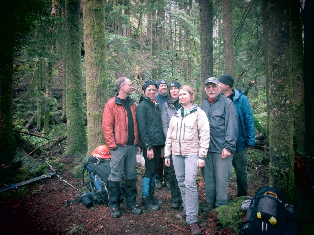
Snow was gone, no mosquitoes yet, cool working weather, sunny and mild weather and eleven WTA workers eager to open the Pratt River trail. What better conditions could we ask for?
Liz and I had scouted this trip a few days earlier for logs to cut and trail work to be done, see photos at
https://photos.app.goo.gl/GJSrqYDiCSdMndU18
Charlie Rosenberry, from Vashon Island, brought his 5 lamas over to the Taylor River Middlefork trail head and packed them up to 40 lb per animal with our tools and backpack gear. A beautiful sunny morning. Not hint of drenching rain to come, just a couple of days later.
After marching about 2 hrs across the Pratt Connector trail (reference 2), that’s trail # 1035 according to my brand new Middlefork Snoqualmie, 174SX Green Trails waterproof map, we arrived at the old Pratt River Bar camp. Charlie had unloaded our tools and gear there. A short cut to the camp from across the river would have been a welcome 3.2 mile distance saver, but in April the Middlefork of the Snoqualmie River is way too high for a safe crossing. See reference 3 for a crossing photo and a great historical narative. Pratt River Bar camp marks the end of the Pratt Connector trail and the beginning of the Pratt River trail, although both trails are labeled as 1035. I’m estimating Pratt Lake destination is about another 10 miles up the Pratt Valley. We cleared the old Pratt River Bar camp of ground debris for about a dozen tents. We expect lots of hikers in the 2018-2019 hiking season to camp here due to a trail closure (mud slide) upriver of the Middle Fork camp.
Early Thursday afternoon, Joe and his saw crew camped at the Pratt River Bar camp and went up trail to tackled the big log on the Pratt River trail, trail 1035, just a short distance from the Pratt River Bar camp. The other two saw teams headed up trail toward Pratt Lake.
For the next 1.1 miles and 300’ gain, we sloshed through trail mud and sword ferns, until we arrived at the Big Tree junction, elevation 1250’, mile post 3.5 from the parking lot trail head. Going right at the junction, our saw teams cut out several logs along the 1/3 mile trek to the awesome 10.5’ diameter (33’ in circumference) ancient fir tree where the Big Tree trail spur ends. I would guess its at least 650 years old. A worth while side trip, or a great destination. Our saw teams took out several large and medium size trees, lots of brushing and trail restoration work. The trail to this ancient wonder is now clear and easy to follow for hikers, but not recommended for stock. Stock should be left at the junction and the Big Tree spur visited on foot.
The third saw team headed left, up hill from the Big Tree junction. After another ¼ mile of steep trail grade, they reached an old truck road which soon merged into an old logging railroad grade. After another mile along the rail road grade, we found our first large creek and set up camps nearby, about 5.3 miles from the parking lot trail head. We passed remnant logging cables and even found an old rusted crosscut saw handle that an old-timer must have lost back in the 30’s or 40’s. If that old saw handle could only talk!
On Thursday and Friday, we logged out the length of the railroad grad, cleared the trail of debris, cut a lot of brush from the trail and restored damaged trail tread up to our camp location, about a mile past Big Tree junction.
On Friday night, the sky had already clouded up and we expected rain Friday night. It rained Saturday, day and all night long. We continued work on the trail through the railroad grade all day Saturday.
Mike and Carol scouted ahead along the rail road grade several miles above our camp. Here is their scouting report.
After talking to the hiker who got farther than Mike and I did, we figured we were a shy mile west of Kaleetan Creek. There was a big creek there as well, but not as big as Kaleetan.
Anyway, after guessing how many Liz and Co. cut east of camp, which we subtracted from our original count, we counted 44 small logs, 12 medium and 2 large to what we called "Artifact Camp". There is a large creek there and on the east side of the creek, there is a collection of artifacts right alongside the trail. The trail is really wide there and there is lots of room for tents. The biggest collection of logs to cut is just west of "Artifact Camp" and the creek.
We then continued hiking to a shy mile west of Kaleetan Creek. There is about 8 medium and 7 small logs, mostly just before you hit the creek we stopped at.
Additionally, there are 2 old-time culverts that have failed. Looks like the railroad built culverts out of wood and they are starting to fail. One would be easy to route the trail around and has a natural horse ford area. The other may be a lot more work.
It was raining so much my writing paper got pretty trashed. Mike and I are willing to do the hike again later this year on our own and do a better count, possibly even doing the loop. Mike is looking into getting a GPS as we really like the 1) take a picture and 2) take a waypoint approach. Would this help you?
The other note we wanted to make is someone has been through this year and made some cuts. This trail angel doesn't know about cutting back 4' on either side. I just wanted you to know that work wasn't ours. We made our cuts to code and threw downed branches well off the trail as we have been trained. We mostly lopped branches and cut saplings in the trail corridor. The trail is quite visible all along the railroad grade we hiked. I assume the visibility problem is when you take the turn to Pratt Lake.
The hiker said there is a big drainage problem area between where we stopped and Kaleetan Creek. Apparently the railroad made a cut so that there are banks on either side so the water has no place to drain. We saw some smaller drainage work areas but nothing like he reported.
Carol (and Mike)
Photos: https://photos.app.goo.gl/GJSrqYDiCSdMndU18
Comments
Gary, my friends and I did the length of the Pratt trail as a key exchange. We did a trip report on this site. I would be interested in doing it again; we did it in November, knowing the Pratt crossing and Kaleetan run high earlier in the season. We cut off the mileage and forded the river as you mentioned.
I am glad to see work being done on this section of the trail; it's been on the back burner for so long.
Posted by:
Kim Brown on May 27, 2018 10:53 AM