
Reference this trip report for more complete directions starting from the actual Tiger Mountain Trailhead: https://www.wta.org/go-hiking/trip-reports/trip_report-2025-01-30.084022207529
Started out on this hike from the Tiger Mountain Trailhead around 8:30am on a sunny clear Saturday, and there were only ~3 other cars parked along the road. The first part of the trail, before you reach South Tiger Traverse, takes you through a really nice forestscape. When you reach the Tiger Mountain/Horse Bypass split it doesn't matter which way you go as they both meet up about half a mile along with South Tiger Traverse. From here most of the remainder of the trail is steeper & exposed, taking you through a large clearcut. Be sure to have your sunscreen & hat ready for this section. There are still a few wildflowers holding on here, but mostly they're already dried out. Some blackberries that I expect will start to get ripe in a few weeks though.
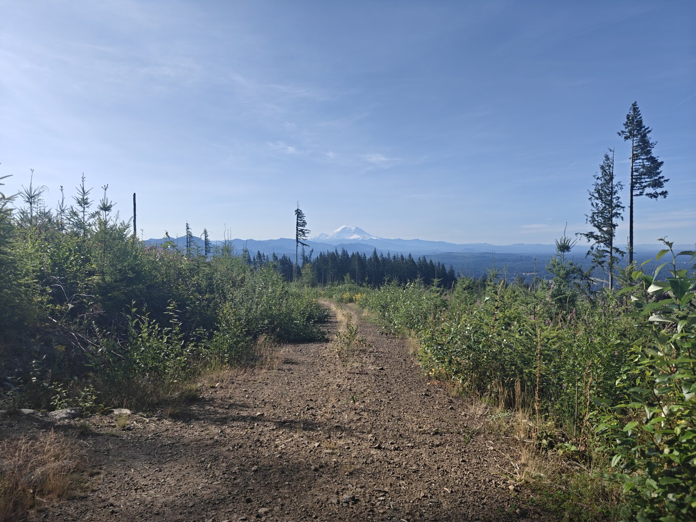
After turning from S Tiger Traverse onto S Tiger Summit, the trail gets more narrow & overgrown with grasses, blackberry vines, and foxglove. The foxglove in particular is all dried out now, and when you run into it (which is inevitable) it spreads seeds all over you. I took quite a lot of foxglove seeds & lots of blackberry vine scratches home with me. There are also a few holes in the trail near the summit, so watch your step. On the plus side, from most of this section of the trail you have expansive views South & West, with a great vantage point on Rainier.
I only passed 1 person while I was hiking up, but on the return there were a good number of hiking parties not far from the trailhead when I came down around 10:30am. There was still definitely room for more cars along the road at that time. Overall it was a nice little hike not too far from Seattle, and driving past the crowded Poo Poo Point parking lot made me pleased with my choice of a less popular trail for the day.

Comments