
3-night counterclockwise circuit of the Northern Loop.
Tl;dr: water sources are plentiful and predictable. River crossings are no problem. Surprisingly few bugs. Lots of bears. We had group sites at James, Carbon, and Mystic and were able to squeeze 7 tents into each of them on flat and durable surfaces (1 two-person tent, 1 three-person tent, and 5 one-person tents)
Road and permits: we arrived at the White River ranger station at 6:45 to pick up our permits (reserved, not walk up).We were 3rd in line. There was a steady stream of cars into the park before timed entry started at 7. The ranger station opens at 7:30, and by 7:45 they warned us that the lot was filling quickly. We hustled up to Sunrise and took one of the last spots in the gravel overnight lot on the north side. Saw our first bear along the road just past the station. We had our permit checked twice on trail.
Sunrise to Grand Park:
Trail in great shape with no obstacles. Berkeley Park is the only water source on this section. There were just a few mosquitoes at Berkeley Park where we stopped to use the toilet, otherwise bugs were a non-issue.
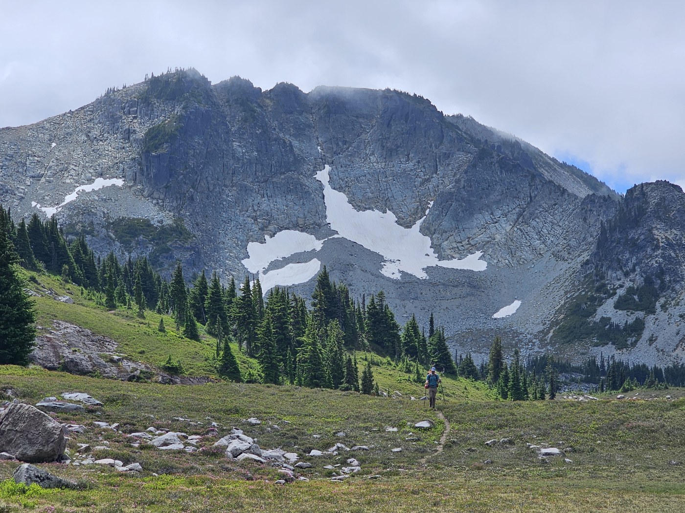
Grand Park to James Camp:
The only water source on the way down to White River is Fire Creek, which is quite a detour. White River was raging, but we found the bridges easily. The first one we encountered was a log without a handrail, which would be a little more nerve-wracking in wet conditions. One of our party chose to clamor through bushes instead of taking that bridge. The other single-log bridges had handrails and were not being splashed in mid-afternoon. The final part of the crossing is a short rock hop, where stepping stones are held sturdily in place by glacial till. White River is not suitable for filtering due to glacier runoff.
The ranger pointed out our water source at Van Horn Falls, but his inattention to topo lines didn't serve us well -- it seems that the water source is actually where the falls meets White River and not up a few switchbacks like our map and his pointing indicated. One of our party found a hidden, shallow water source about half a mile before James Camp, but it was not ideal.
There were 1 or 2 notable blowdowns on the ascent to James Camp. James Camp has 2 bear poles and the water source is where the trail crosses the creek .2 mile from camp. The toilet is open air. Very few mosquitoes. The lake is not very inviting.
James Camp to Windy Gap:
This section was riddled with blowdowns, some of which require multi-step climb overs and both hands. We ran into a mama bear and two cubs near one blowdown. Mama guarded the tree that the cubs fled into, and didn't exhibit any aggressive behavior, but we moved along quickly. The first big lake at Windy Gap is a better water source than the other two. We saw another bear traversing the scree slope to the south of us.
Windy Gap to Tyee Peak:
This boot trail starts flat, becomes rather steep, and eventually disappears at the ridge. Views and flowers up there were quite spectacular. Hikers who choose to come up here should review LNT principle 2 before attempting this side trip. From the rounded ridgeline, a few experienced scramblers chose to summit Tyee Peak, which is a class 3 scramble and helmets are recommended. The craggy peak is actually lower than the rounded ridge and the views are the same.
Windy Gap to Carbon River:
After spotting another bear under Yellowstone Cliffs, we started the long descent to Carbon River. Having done this trail both ways, I can honestly say that going down feels worse at the end of the day, however the trail is also dry so CW hikers should fill at Carbon River. The suspension bridge is in great shape, and the water source is just after the bridge, so its a good idea to fill on the way into camp. There is just one bear pole for all of Carbon River camp. Some of our party were carrying Ursacks and chose to hang those separately when the pole ran out of room that night. The toilet has 2 privacy walls.
Carbon River to Mystic Camp:
Rocky with some occasional step-over sections where things have shifted around. Dick Creek camp is a good water source. The camp is a little ways past the lake, and the group site is even farther removed. The group site at Mystic is very nice: lots of space, its own bear pole, easy access to the creek, and its own toilet with a privacy wall. Another bear was spotted along the trail between the lake and camp.
Mystic Camp to Mystic Lake and Moraine Park Trail:
Some in our party explored around the lake and highly recommend the view from the patrol cabin - this is the only place near camp where you can get a view of Rainier proper. And a few went back up the boot trail overlooking the Carbon Glacier that starts in Moraine Park. This route is dry after the lake. Another bear was spotted.
Mystic Camp to Sunrise:
The trail dips in and out of the trees, and is rocky and dusty for large sections. Winthrop Creek bridge was in and dry around 9am. Granite Creek is a good water source, and also marks the end of the steepest parts of the trail -- the final switchbacks are very pleasant. Skyscraper Peak is worth the side trip, but the very top is home to a thick swarm of flies.
There is no shade from Skyscraper Pass until Sourdough Ridge. Water can be found just above Berkeley Park -- there are a couple of low flow streams and one large one. No more water until Sunrise. One goat spotted in the Sunrise Lake basin around 2:30pm.


 site.")
Comments