This was a 42 mile, 3-day backpack of the Grand Loop in Olympic National Park.
Map of route: https://www.alltrails.com/explore/map/m ... d8a23?u=i
This route is listed in the book, "Trekking Washington" by Mike Woodmansee. I've also listed the Alltrails route including waypoints for my two camps.
I was able to get a backpacking permit a week before the trip. I didn't book the permit online instead I called the Wilderness Information Center.
Day 1: Obstruction Point to Lost Pass. 12.5 miles with 4530 ft elevation gain.
I took the first Bainbridge Ferry from Seattle at 5:30 AM. I was hiking by 10AM from the start at Obstruction Point. I went along the scenic Lillian Ridge and passed Grand and Moose Lake. I saw more people on this section up to Moose Lake than any other section of the route. I then crossed over Grand Pass and Cameron Pass and made my way to Lost Pass. The initial descents over these passes are steep so take your time. The ascent to Cameron Pass is steep and was about the least enjoyable part of the whole trip. The Grand Valley and Cameron Valleys were however very beautiful. I saw just one party of two in between Grand Pass and Lost Pass. I got to Lost Pass just before 6PM where I set up camp. While there was very little wind, it was cold and I awoke to a frost covered tent.
Day 2: Lost Pass to Three Forks Camp. 17 miles with 2900 ft elevation gain
I dropped down from Lost Pass to the Dosewallips River Trail. The descent from Lost Pass was steep but once I got onto the Dosewallips it was a nice forest walk. I then took the Gray Wolf Pass Trail and made the ascent to Gray Wolf Pass. The views up near Gray Wolf Pass were great and the descent after the pass was maybe my favorite part of the trip. There was a nice waterfall, lake and valley. Then it was a long descent to Three Forks along the Gray Wolf River Trail. I met some wonderful people in camp that made the time there all the more enjoyable.
Day 3: Three Forks Camp to Obstruction Point. 12 miles 5230 ft elevation gain
I got an early start for the climb up to Deer Park. From there I took the Obstruction Point Trail back to the start. I've done this section before and the views were spectacular.
Misc: There was no snow at all to cross. Bugs weren't out at all. I think the recent cold nights got rid of them.
Days 1 and 2 had plenty of water. Day 3 is very limited. I heard there was a water source at Deer Park but I didn't really need it as I filled my bottles at Three Forks which lasted me to the finish.
Trip Report
Grand Pass, Cameron Pass, Lost Pass Primitive, Upper Gray Wolf River to Gray Wolf Pass, Lower Gray Wolf River, Three Forks & Grand Ridge — Monday, Aug. 23, 2021
 Olympic Peninsula > Northern Coast
Type of Hike
Multi-night backpackTrail Conditions
Trail in good conditionRoad
Road suitable for all vehiclesBugs
No bugsSnow
Snow free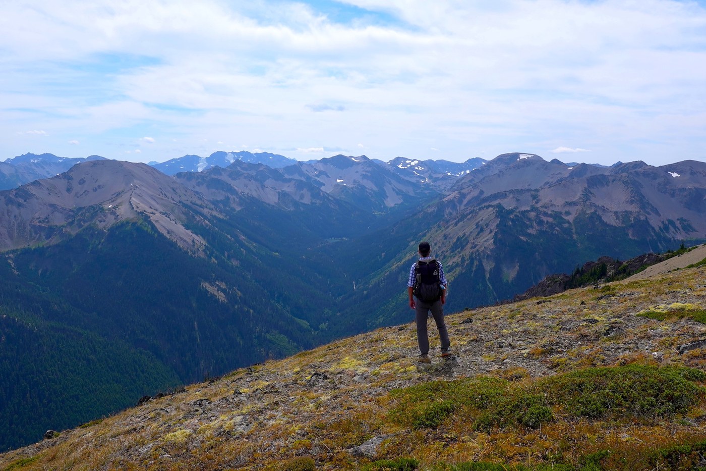

Comments
mtnwalker on Grand Pass, Cameron Pass, Lost Pass Primitive, Upper Gray Wolf River to Gray Wolf Pass, Lower Gray Wolf River, Three Forks, Grand Ridge
I was just looking at my map, planning a loop this summer and this looked good so I found your report and had a couple of questions. In looking at the trip I thought it might be good to hike down from Deer Park the first day so you don't have that climb at the end. Any reason you chose to go the other direction? Also wondering if there is sketchy, exposed trail on this loop? Thanks for the report! I'm going to watch the whole video... it looks great!
Posted by:
mtnwalker on Mar 15, 2022 04:01 PM
CascadeBackpacker on Grand Pass, Cameron Pass, Lost Pass Primitive, Upper Gray Wolf River to Gray Wolf Pass, Lower Gray Wolf River, Three Forks, Grand Ridge
mtnwalker, there was no real reason I did it in this direction. I know other folks have gone in the opposite direction. I would say the only slightly "sketchy" section was the climb up to Cameron Pass. There were a couple of spots that were steep with loose rocks that involved a little bit of a scramble. There was no snow when I did it which made it much easier. If there were snow, I'd for sure bring along the micro spikes and consider an ice axe. I had neither since I was doing it in August when all the snow was melted out on the all the passes. If I had to do it again, I'd probably start at the same spot (Obstruction Pt) but go in the opposite direction. The last day on my trip did involve a decent amount of elevation gain which is not how I usually wish to end a trip. Anyway, let me know if you have any other questions. Cheers
Posted by:
CascadeBackpacker on Mar 15, 2022 04:54 PM
mtnwalker on Grand Pass, Cameron Pass, Lost Pass Primitive, Upper Gray Wolf River to Gray Wolf Pass, Lower Gray Wolf River, Three Forks, Grand Ridge
Thank you! This info is very helpful. I'll be going in late summer or early fall so all sounds good regarding the trail. It sounds like either direction works well... I think I'll avoid the climb out to Deer Park on the last day and see how starting there or at Obstruction Point and walking toward Three Forks goes. I appreciate your answers to my questions...
Posted by:
mtnwalker on Mar 15, 2022 07:56 PM