Trails for everyone, forever

Home Go Hiking Hiking Guide Westside Road

Westside Road

Mount Rainier Area > SW - Longmire/Paradise
46.7424, -121.8995 Map & Directions
Length
11.0 miles, roundtrip
Elevation Gain
1,788 feet
Highest Point
3,534 feet
Calculated Difficulty About Calculated Difficulty
Moderate/Hard
Mountains tower above Westside Road Trail. Photo by Crazy4Birds. Full-size image
  • Dogs not allowed
  • Mountain views
  • Old growth
  • Rivers

Parking Pass/Entry Fee

National Park Pass
Saved to My Backpack

Mount Rainier's Westside Road is closed in winter at the junction with Highway 706, leaving hikers and snowshoers with up to 12 miles of relatively flat and wide road with a gentle grade to enjoy. Continue reading

Rating
1.80 out of 5

(5 votes) Log in to rate

Hiking Westside Road

From the junction, make your way along the road as it follows Tahoma Creek. After 3.2 miles, you'll come to the summer trailhead at Dry Creek, marked with a closed gate. Traveling past this point requires knowledge of avalanche terrain and current conditions, as avalanches coming down from Mount Wow to your left have the potential to reach the road. This area also has a high risk of rockfall.

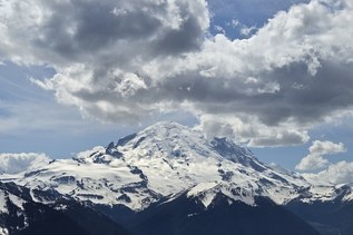
If you continue past Dry Creek, you'll gradually climb to Round Pass, enjoying views of Tahoma Creek and a brief view of Mount Rainier on a clear day. Stop for a moment of reflection at the Marine Memorial on the east side of Round Pass, a tribute to the 32 U.S. Marines who were lost when their plane crashed into the Tahoma Glacier in 1946. Take in the views of the mountain here before continuing or heading back down the road. The road continues another 5.3 miles to its terminus at Klapatche Point. 

Westside Road

Map & Directions

Trailhead
Co-ordinates: 46.7424, -121.8995 Open in Google Maps

Before You Go

See weather forecast

Parking Pass/Entry Fee

National Park Pass

WTA Pro Tip: Save a copy of our directions before you leave! App-based driving directions aren't always accurate and data connections may be unreliable as you drive to the trailhead.

Getting There

From the Nisqually entrance of Mount Rainier National Park (off Highway 706), drive east on Nisqually-Longmire Road for 1 mile. The turnoff for the Westside Road is on your left. There is no designated parking area, so be sure to park in such a way that traffic can flow uninterrupted along the road.

More Hike Details

Trailhead

Mount Rainier Area > SW - Longmire/Paradise

Mount Rainier National Park

You can improve or add to this guidebook entry!

Westside Road

111 Trip Reports

Hiked here recently?

Submit a trip report!
 
Trip Reports