

Tatoosh Ridge can be a destination unto itself; there are two trailheads to permit a one-way hike along a slope covered in wildflowers. But you can see everything from the north trailhead in one reasonable-length out-and-back day hike.
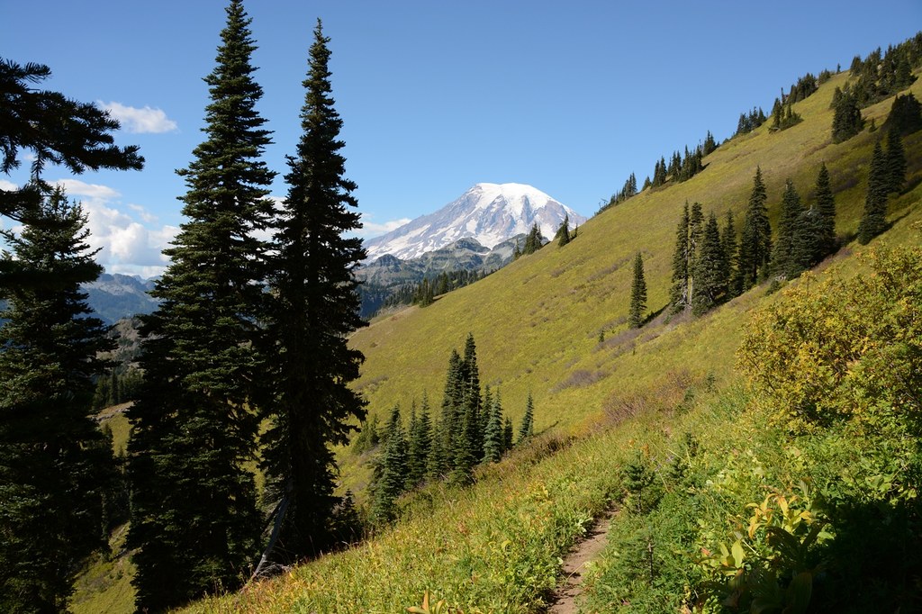
Yes, the beginning of the trail is steep, but at least most of the elevation gain is done in the shade. Begin by ascending through moderately open forest sprinkled with a few old-growth trees. Undergrowth is sparse among the trees, but the trail is bordered by blueberries and huckleberries at various places, and even a patch of wild strawberries. At two miles, the trail breaks free of the tree canopy into sloped open meadow. At 2.4 miles, where the trail continues straight uphill on some stone steps, an unmarked path is visible to the left. This leads to a viewpoint of Mount Rainier in 0.3 mile, and eventually into the National Park. But much better views are straight ahead.
The Tatoosh Trail is seldom flat; most of it is along a steep sidehill covered in wildflowers. Lingering snow could make it somewhat treacherous and also difficult to follow. Even when fully melted out, the trail is concealed by its surrounding vegetation, often preventing you from seeing where it is heading.
Continue to 2.5 miles and a signed junction with Tatoosh Lakes Trail (#161B) at 5,600 feet. This spur trail climbs 150 feet, crests over a ridge, then drops over 600 feet to two picturesque lakes tucked into a cirque. The lake basin is closed to camping.
If you choose to go further, continue south-southeast from the junction, contouring along the steeply sloped natural meadowlands. Views of Mount Rainier open up behind you until a small pass at 3 miles, the trail heads east and slightly downhill, blocking the views of Mount Rainier temporarily. The mileage shown in this guide assumes a turnaround point here.
To get to the site of the former Tatoosh Lookout, continue over and around the small pass, heading east, then south once again, passing beneath Tatoosh Peak and a frequent rock slide area at 3.6 miles.
At 4.5 miles and 5,800 feet is the signed junction for trail #161A to Tatoosh Peak. Switchback sharply to the left and begin climbing on it. The 0.7-mile spur trail is somewhat rutted and can be windy once you are on the exposed ridge. From the former lookout site at 6,400 feet, a turquoise tarn is visible below, providing a photogenic foreground for Mount Rainier, to the north. On a clear day, Mount Adams, Mount Hood and Mount St. Helens are also visible, scanning from south to southwest.

 Trailhead


