 Washington Trails
Association
Trails for everyone, forever
Trails need routine maintenance and trail systems need innovative, intentional updates to accommodate the changing needs of Washington's hikers. The Gifford Pinchot National Forest is taking proactive steps to make that happen | By Joseph Gonzalez and Anna Roth
If you’ve done trail work with us, you may have stepped back at the end of the day and thought the section you worked on should never need maintenance again. You might be tired, but your efforts have ensured the trail will be perfect forever, right? Right?
Not quite. Most trails need maintenance every year. However, trail crews can’t always return year after year. When WTA works a remote trail, we try to do maintenance that will last multiple years, whether it's removing a wider corridor of foliage from the trail or more meticulous drain clearing. It’s aspirational work though; it’s not uncommon to be foiled by winter storms that drop trees or wash out trails.
As WTA’s trail maintenance program has grown, we’ve made efforts to revisit hard-to-reach trails more often. It's a good way to see just how well our maintenance is holding up. After all, without major incidents, well-executed brushing, drainage and treadwork can last for years.
But occasionally crews find that in just a handful of years treefall has all but obscured the trail. Just a couple of seasons of bad storms can render a trail impassable; how can we future-proof trails so trees falling in the winter will be addressed the following season?
The Gifford Pinchot National Forest (GPNF) is larger than the state of Delaware. Between its size and the stunning Goat Rocks Wilderness, it’s no wonder the forest attracts over a million visitors every year. In addition to the Goat Rocks, views of Mount Adams, Mount St. Helens and the gorgeous Pacific Crest Trail are highlights for locals and visitors alike.
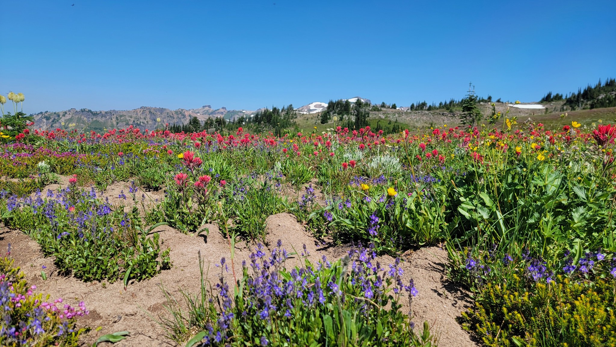
Despite its size, recreation here is concentrated on a couple trailheads that offer quick access to the main attractions in the region, Cispus Basin and the Nannie Ridge loop, both found on the southern flanks of the wilderness area. Two trailheads serve these areas, Berry Patch and Snowgrass Flat, and they regularly see dozens if not hundreds of vehicles on sunny summer days, when hikers vie for optimal parking spots.
Some of the pressure on these trailheads could be alleviated. Another trailhead offers access to the same area: the Angry Mountain trailhead. Though it offers similarly rewarding hiking opportunities, it is often overlooked because the trail is frequently challenging to hike due to downed trees that block the path. With maintenance, however, it could be a viable alternate to these crowded trailheads.
But it would take work. A trip reporter in 2013 was unable to finish the hike and a 2014 scouting trip counted more than 300 trees across the trail. In fact, the trail was so bad, a Green Trails map researcher suggested removing it from maps. We knew it would be a massive undertaking, but WTA began maintenance in 2015, and it took four years to get the full length of the route open.
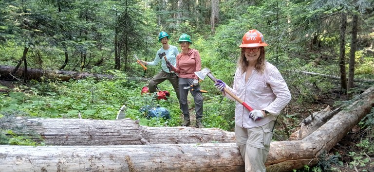
While there was interest in our volunteer community for clearing the trail, its length and steepness combined with how late the snow melts and a lack of water for camping makes it challenging for crews. Although we have one full time paid crew leader in the region, volunteer crew leaders are essential in the summer busy season.
“If the snow melt window doesn’t line up with blue hat availability, we can’t run a trip; sometimes we can get help with the Back Country Horsemen of Washington to pack in water but they are in high demand too," shares Ryan. "If I were to go back in time to design this trail I’d be sure it included a decent spot to camp a crew to get the maintenance done.”
In 2019, crews completed clearing the trail up Angry Mountain, opening up day-hike and overnight possibilities where hikers could enjoy the panoramic views of Mount Rainier and Mount Adams along the final ridgeline. But we didn’t return for four years, and in the intervening time, trip reporters described an increasingly dire situation.
The way was passable through 2022, but in 2023, trip reporters documented trees across the trail; one had even knocked out a section of the trail completely.
By July 5 of 2024, even the trailhead wasn’t accessible because of a tree on the road.
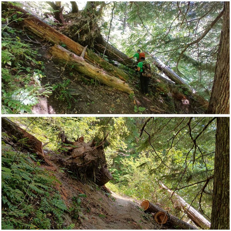
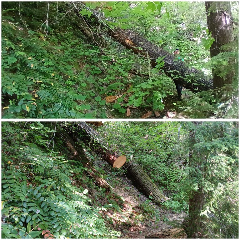
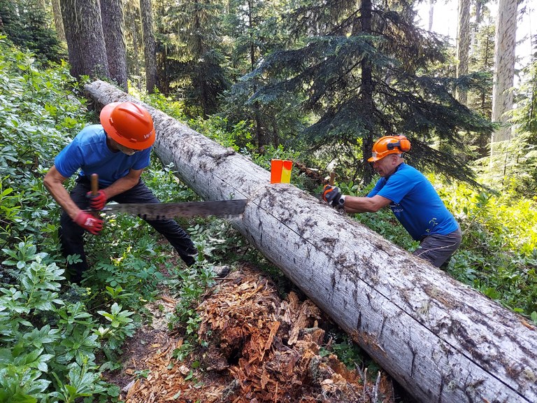
It was past time to come back. A backcountry response team (BCRT) was dispatched in July, and while the crew didn’t have to contend with the tree in the road, they found approximately eighty trees down on the trail.
The crew of 12 split into four teams and spent three days working our way up the trail, clearing up to the 4.5 mile mark. Trees remain past this point, but no WTA crews will return this season.
It’s passable, but remains challenging for hikers as they get further from the trailhead, limiting the use of this trail that was reopened just 4 years ago and, with more regular maintenance could be an alternate gateway to the Goat Rocks Wilderness.
Older trails, sometimes referred to as “legacy” trails, were often designed with the intention of getting a hiker from point A to point B. Sometimes this results in steep or monotonous trails. Routes are often out and back (one-way), and while they usually lead to a nice view or feature, the hikes themselves aren’t always especially scenic.
Modern trail philosophies prioritize both the journey and the destination, diverting the trail to views and highlighted features, using slope and topography to minimize soil erosion, even at the cost of adding mileage. Most trail systems developed in the last 15-20 years are designed with this philosophy in mind. However, much of the Gifford Pinchot National Forest’s trails are still of legacy design, including Angry Mountain.
Out-and-back trails like Angry Mountain can discourage users who seek solitude. With one way in and one way out, you’re likely to cross paths with a fair number of other hikers. But looped trail systems can provide a feeling of solitude while absorbing a relatively large number of users. Designed this way, trails can serve many hikers before the number of user interactions begins to feel crowded.
Cispus Basin, Nannie Ridge and Goat Lake are popular destinations in the Goat Rocks Wilderness that see scores of hikers every summer. They’re part of a well-known loop, and a hint at another possible improvement for Angry Mountain: inspire hikers to visit new areas by maintaining more loop options!
For land managers, it’s easier to connect existing trails to create a loop than it is to build a completely new trail. An interesting area to explore this potential idea is between Angry Mountain and the Jordan Creek Trail, which is less than a mile away. A connector between the two would make a brand-new loop on the west side of the Goat Rocks.
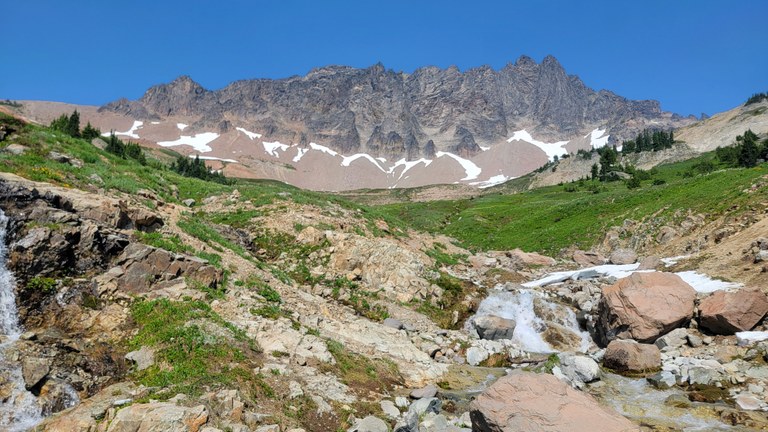
New trail can take a long time to build, but this sort of renovation would make Angry Mountain more accessible to hikers entering from other trailheads, providing some relief to already well-loved neighboring trails. And building a connector trail between two currently-existing trails is much easier than making a whole new route.
By creating a trail system with attractive and convenient loops available, hikers have more options to choose from, alleviating the volume of visitors to GPNF’s tried and true classic hikes.
Developing the trail systems of tomorrow takes a lot of effort. Intentional development of sustainable trails requires forethought and an understanding of what users and the community nearby want. Sustainable trails exist at the intersection between social, natural and economic factors. We need to consider who visits trails, why they visit and how they get there.
Ecological factors mean that trails require regular maintenance, as well as responding to the impacts of extreme weather events and climate change. Reliable funding is necessary for beloved trails to stay open and safe.
And besides advocating for funding and providing public input on recreation management, there’s the actual trail work that needs to be done each year.
The US Forest Service has maintenance crews of their own who do what work they can, but until agencies see full funding and eliminate the backlog of deferred maintenance, WTA volunteers and paid crews, as well as crews from other nonprofit trail stewardship partners, are filling the gaps. Of course, WTA's work wouldn’t be possible if not for the support of our donors. Their support ensures we can actually send folks into the field to do the dirty work, helping to pay for staff support and tools.
In addition to Angry Mountain, this summer WTA crews logged out the Clear Fork trail with Back Country Horsemen of Washington. And we worked on Lost Lake as well. All these trails are alternate routes into this popular area, and given regular maintenance, could improve access and impact on the ground across the wilderness area.
And when the work is done, hikers notice. This year, trip reporter melissbee left this note in their report from Angry Mountain:
Gifford Pinchot National Forest is taking steps towards a new paradigm in recreation sustainability. The national forest gathered public input on the Gifford Pinchot Sustainable Trail System plan last September.
The goal of the plan is to inform and guide future projects in the forest to ensure the land is protected while also benefiting its community. WTA is proud to be an invested partner in the future of Gifford Pinchot National Forest — both as a recreation management thought leader and as a tool for restoring lost trails in the forest.
Angry Mountain suffers the misfortune of having an intimidating name and sitting in the shadow of its iconic neighboring trails. But it doesn’t have to be that way. Trails and public lands are in a constant state of transition. Trail health is cyclical by nature — one year, they’re immaculately maintained; a few years later, they’re overgrown.
At the end of the hike, it’s everyday people who breathe life into these trails year after year. The future of Angry Mountain and Gifford Pinchot National Forest doesn’t fall directly on your shoulders, but it could fall into your hands — all you need to do is sign up for a work party and pick up a tool.
Trails statewide need your help. Signup for a work party and take action for trails today.