Even before the historic Paradise Inn was constructed in 1916, Paradise Valley has long been one of the state’s most beloved hiking destinations because of its southern exposure, giving it a longer season than its north side counterpart, Sunrise. In peak season (July and August), your trip along the Skyline Trail will be filled with views of cascading waterfalls, mighty glaciers and subalpine meadows brimming with colorful splashes of lupines, mountain heather, scarlet paintbrush, cascade asters and bistort.
Depart from the Paradise parking lot and locate the trailhead behind the Jackson Visitor Center. The crosshatched system of trails heading out of Paradise is intricate, so make sure to stop by the visitor center to pick up a map if you didn't bring one in your pack. Proceed north, following signage for the Skyline Trail. Continuing on, you will quickly encounter a split for a few ancillary trails, including the Waterfall Trail and the Deadhorse Creek Trail. The west leg of the Waterfall Trail is a nice detour in wildflower season as it leads you through lupine-filled switchbacks, but for now, continue straight on the Skyline Trail.
The initial grade from the parking lot is steep, but it will eventually ease into a more forgiving climb after about 0.4 mile. As the intensity of the trail grade lessens, you will come to another split for the Deadhorse Creek Trail and Glacier Vista. Keep right and navigate a few sets of stone-carved staircases where you will be treated to some dazzling views of the commanding 14,410-foot peak known as Tahoma, or "great white mountain," to native tribes.
You will eventually pass Glacier Vista on your left, where hikers often congregate for some of the best photo opportunities that the trail offers. At 6,300 feet, Glacier Vista also serves as an unofficial turnaround for many visitors who are not enthused by the prospects of taking on some of the more serious climbing that lies ahead. As a result, the foot traffic tends to thin out a bit after Glacier Vista, but be on the lookout for a new crowd, hoary marmots. These cute rodents often claim lazy ownership over the path and can be seen exercising their unique brand of mischievous grazing as they prepare for their eight to nine months of winter hibernation. Although the natural beauty of Mount Rainier incites a powerful desire to explore and wander off trail, you are reminded to stay on the path and avoid approaching any wildlife you encounter, so as to preserve the park’s delicate ecosystem.
Over the next half mile, hike along the Nisqually Glacier as the trail loops around in a hairpin turn and moves southeast toward Panorama Point. After that half mile, you will reach a junction for Pebble Creek and Camp Muir. This is the point where summit-bound climbers diverge, destined for the seemingly endless trek up the Muir snowfield to reach Camp Muir for the night. You, however, will continue straight to the southeast and arrive at Panorama Point after a short quarter mile of travel. Just a shade under an elevation of 7,000 feet, Panorama Point provides stunning views of the Paradise valley, Mount St. Helens, Mount Adams and even Mount Hood on a clear day.
Panorama Point also has a pit toilet to the northwest that is open in the summer and stands as the highest elevation facilities available to hikers outside of Camp Muir. If you do use these facilities, please make sure to latch the door from the outside when you leave so wildlife does not mistakenly wander in and become trapped. This comfort station is closed during the winter, normally from mid-October to mid-June.
From Panorama Point, you will be directed along a path carved into a steep snowfield to the east. Although the signage labels this as part of the Skyline Trail, some consider this section of the "low skyline" to be a shortcut and prefer the more stable footing of the high skyline trail to the north. If you do not wish to brave the steep and icy conditions of the snowfield, continue north up the high Skyline Trail. After half a mile of travel, you will loop around and rejoin the low skyline.
Following this merger, continue your descent for another half mile to reach the junction for the Golden Gate Trail. This is a more direct route back to the Paradise parking lot that shaves a mile off your overall journey, but deprives you of the serene Sluiskin Falls, the Van Trump Monument and the accomplishment of completing the full Skyline loop. So, proceed southwest and continue on the Skyline Trail. You will arrive at the Sluiskin Falls and Paradise Glacier Trail junction after 0.6 miles.
The Paradise Glacier Trail to your left is a dead-end spur trail that once hosted views of large ice caves at the edge of the glacier. Unfortunately, the caves have since thawed and, as a result, the Glacier Trail has waned in popularity. Continue south and you will immediately encounter the Stevens Van Trump Historic Monument, which commemorates the first documented ascent of Mount Rainier by P.B. Van Trump and General Hazard Stevens in 1870.
You will then hike 0.4 mile past the monument and arrive at the Lakes Trail turnoff, a 4-mile trail that detours toward Reflection Lakes and Louise Lake and eventually loops back to Paradise. If you are not looking to extend your journey significantly, proceed west. After about a mile of travel, the Golden Gate Trail will rejoin the Skyline Trail, and you will soon arrive at the sublime Myrtle Falls. Cross the bridge over the Edith Creek Basin and quickly take a left off the path for the Myrtle Falls viewpoint and one of the trail’s best sights. After snapping some photos, rejoin the trail and continue on. A half mile later, you will reach the Paradise parking lot, completing the 5.5-mile journey on the Skyline Loop.
WTA Pro Tip: While these directions are written for a clockwise journey of the loop, the trail can be hiked counterclockwise as well.
Hiking counterclockwise offers a more tranquil beginning and a lower initial elevation grade, while hiking clockwise quickly offers breathtaking views and a number of ancillary trails to explore.

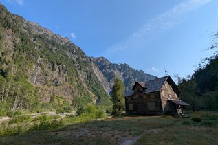
 Trailhead