Trails for everyone, forever

Home Go Hiking Hiking Guide Saddle Mountain East

Saddle Mountain East

Central Washington > Tri-Cities
46.7919, -119.4462 Map & Directions
Highest Point
1,988 feet
View of the Columbia. Photo by David Hagen. Full-size image
  • Dogs allowed on leash
  • Mountain views
  • Ridges/passes
  • Rivers
  • Wildflowers/Meadows
  • Wildlife

Parking Pass/Entry Fee

None
Saved to My Backpack

Take in sweeping views of the Hanford Reach National Monument and the surrounding arid landscape from a scenic overlook in the Saddle Mountains. Continue reading

Rating
3.25 out of 5

(4 votes) Log in to rate

Hiking Saddle Mountain East

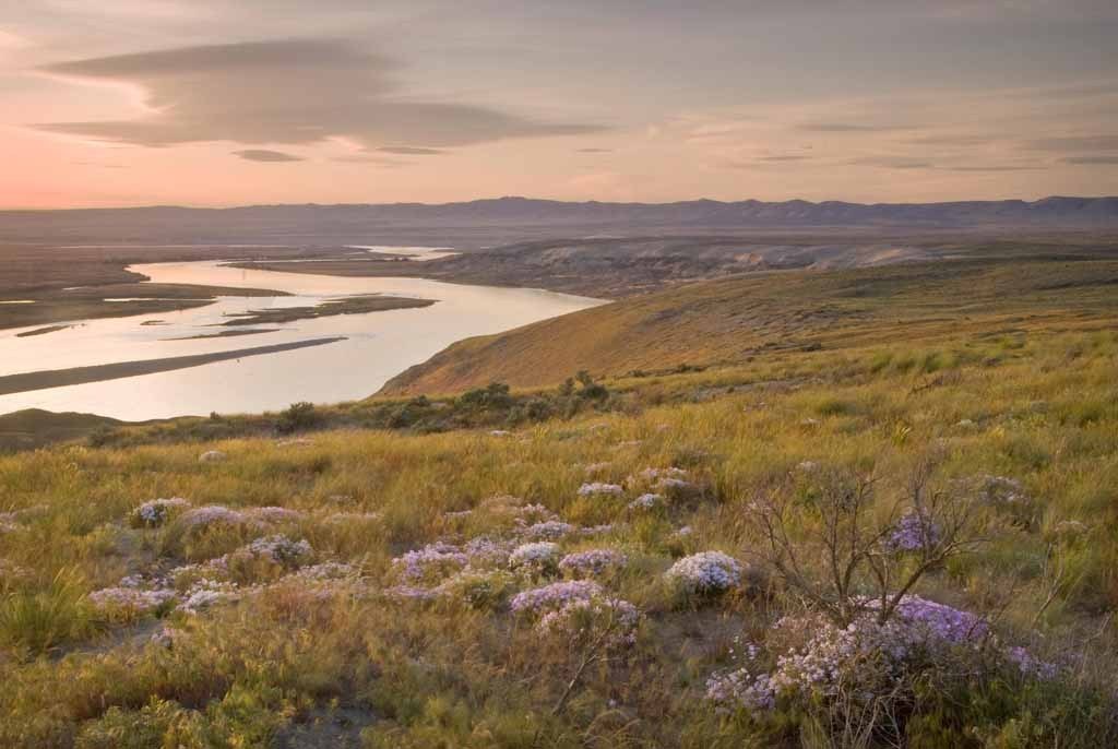
The Saddle Mountains are a range of hills in the arid land of Eastern Washington. The Saddle Mountain National Wildlife Refuge is part of the bigger Hanford Reach National Monument.

No official trails exist at the overlook, but you can wander through the shrub-steppe and enjoy expansive vistas of farmland and pothole lakes to the north, and the Hanford Reach of the Columbia River to the south. In the spring, wildflowers are abundant. 

Toilet Information

  • No toilet at trailhead

More information about toilets

Hike Description Written by
Multiple authors contributed to this report, WTA Community

Saddle Mountain East

Map & Directions

Trailhead
Co-ordinates: 46.7919, -119.4462 Open in Google Maps

Before You Go

See weather forecast

Parking Pass/Entry Fee

None

WTA Pro Tip: Save a copy of our directions before you leave! App-based driving directions aren't always accurate and data connections may be unreliable as you drive to the trailhead.

Getting There

From Othello, drive west on WA-24 for about 18 miles, then turn right onto a gravel access road. You’ll see a kiosk with information about the Hanford Reach National Monument. Drive north on this road, which starts out paved, but gets rougher as it climbs. After 4.2 miles, turn right and proceed 1 more mile to the end of the road, where there’s ample room for multiple vehicles.

Alternatively, from Tri-Cities, drive west on WA-240. At about 30 miles, continue straight on WA-24. After crossing the Vernita Bridge over the Columbia River, turn right onto WA-24. Drive 16 miles and look for a road on your left and follow the directions above.

 This is a remote area, so the road conditions may vary based on recent weather conditions. 

More Hike Details

Trailhead

Central Washington > Tri-Cities

U.S. Fish and Wildlife Service, Hanford Reach National Monument

Guidebooks & Maps

Best Desert Hikes: Washington (Bauer & Nelson - Mountaineers Books)

Washington State Department of Natural Resources (DNR) Priest Rapids

USGS Wahatis Peak

You can improve or add to this guidebook entry!

Saddle Mountain East

17 Trip Reports

Hiked here recently?

Submit a trip report!
 
Loading trip reports...
Trip Reports