Trails for everyone, forever

Home Go Hiking Hiking Guide River Run

River Run

North Cascades > Methow/Sawtooth
48.5974, -120.4492 Map & Directions
Length
7.0 miles, roundtrip
Elevation Gain
160 feet
Highest Point
2,325 feet
Calculated Difficulty About Calculated Difficulty
Moderate
Hiker on River Run. Photo by trip reporter Austineats. Full-size image
  • Dogs allowed on leash
  • Good for kids
  • Rivers

Parking Pass/Entry Fee

None
Saved to My Backpack

Nearly level double track runs alongside the Methow River alternating between open meadows and Ponderosa forests. Do this quiet trail as an out and back or connect to Jack's Trail for a nice loop. Continue reading

Rating
0.00 out of 5

(0 votes) Log in to rate

Hiking River Run

The first hundred yards of this trail is shared with Jack’s Trail. At a T intersection, turn right onto what is also the Methow Community Trail (MCT). Through early June flowers will be your companion through out this hike.

After another hundred yards or so the main trail (MCT) trends off to the right. Stay straight or to the left here to stay on River Run. Signs will designate this trail being closed to bikes from this point forward.

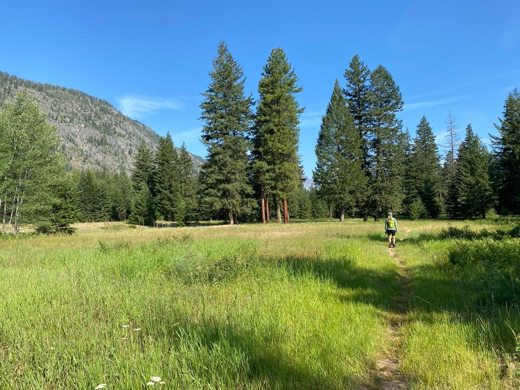
This old double track winds another three miles through birch clusters near the river, second growth Ponderosas, and along grassy meadows. Though there is a little up and down there is no real elevation gain to speak of. Occasionally the remnants of old homesteads can be made out fading into the fabric of the land. Large cliffs rise on both sides of the valley split periodically by secretive waterfalls draining upper basins.

Route-finding is easy though be sure to trend rightward at the ski warming hut two plus miles into the hike. The very end of River Run is  short, steep  climb of 50 feet or so. If you want to loop with Jack’s back to your car either direction will get you there, turning left is shorter.

Keep in mind that this trail does not allow bikes. It is also part of the winter ski trail system and snow shoeing is not allowed. As this trail is primarily on private land please respect all closure signs and no camping is allowed.

Toilet Information

  • No toilet at trailhead

More information about toilets

Hike Description Written by
Austin Smith, WTA Correspondent

River Run

Map & Directions

Trailhead
Co-ordinates: 48.5974, -120.4492 Open in Google Maps

Before You Go

See weather forecast

Parking Pass/Entry Fee

None

WTA Pro Tip: Save a copy of our directions before you leave! App-based driving directions aren't always accurate and data connections may be unreliable as you drive to the trailhead.

Getting There

From Mazama, drive the Lost River Road out to highway 20. Turn right, westward towards Newhalem. In a mile plus you will pass Early Winters Campground. Shortly afterwards there is a large pull out with a DOT gravel shed. The western end of this parking lot is your trailhead.

More Hike Details

Trailhead

North Cascades > Methow/Sawtooth

Methow Trails

You can improve or add to this guidebook entry!

River Run

1 Trip Report

Hiked here recently?

Submit a trip report!
 
Loading trip reports...
Trip Reports