The trail starts out climbing at a pretty steep grade. After the first mile, you're about 1,000 feet higher in elevation and the pitch flattens out at the wilderness border. Then it climbs again, passing a small lake at about 5,200 feet. The trees start to thin out and are broken by small openings with ephemeral ponds and some small meadows.
Once you reach Riley Meadows, Mount Adams comes into view. Look for posts to guide you across the meadows and stay to the south side of Riley Creek to follow the trail. The route traverses Riley Creek across a broad rock-strewn wash. Again, look for posts (installed by WTA volunteers) to lead the way. The last 1/8 mile climbs up to the junction with the PCT.
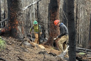
WTA volunteers restored a section of trail heading across Riley Meadows in 2009.

 Trailhead