Trails for everyone, forever

Home Go Hiking Hiking Guide Rainier Woods Park

Rainier Woods Park

Puget Sound and Islands > Seattle-Tacoma Area
47.1659, -122.2602 Map & Directions
Length
0.6 miles, roundtrip
Elevation Gain
0 feet
Highest Point
450 feet
Calculated Difficulty About Calculated Difficulty
Easy
Tall Douglas-firs line the short park trails. Photo by Shelly Sundberg. Full-size image
  • Dogs allowed on leash
  • Good for kids

Parking Pass/Entry Fee

None
Saved to My Backpack

This small park has a playground, picnic area, off-leash dog park and more, as well a short walking trails in a wooded area. Continue reading

Rating
2.00 out of 5

Hiking Rainier Woods Park

Rainier Woods Park in Puyallup is a small, 9-acre park that offers several possible activities for visitors, as well as a small wooded area with short hiking trails that WTA has helped maintain. 

The park amenities include a playground, picnic table area in a grassy grove of tall Douglas-firs, off-leash dog park, baseball field and a small basketball court.

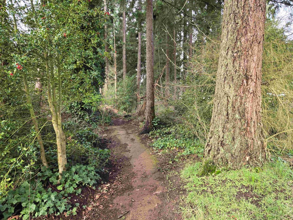
The two short trails, each about 0.15-mile long, allow for a 0.6-mile roundtrip walk through a narrow forest lined by tall Douglas-firs, holly and ivy. The two unmarked short trails are tucked away on the south side of the park. One of the trails departs from the southwest corner of the basketball court and runs along the south side of the dog park; the second starts at the southeast corner of the picnic table area and heads east toward the baseball field.  

Toilet Information

  • Toilet at trailhead
  • Accessible toilet
  • Toilet has running water

More information about toilets

Wheelchair Accessibility

Because WTA has removed the largest rocks from the trails, both packed dirt trails would allow for a wheelchair, and the park bathroom is also wheelchair-accessible.

WTA worked here in 2024!

Hike Description Written by
Shelly Sundberg, WTA Correspondent

Rainier Woods Park

Map & Directions

Trailhead
Co-ordinates: 47.1659, -122.2602 Open in Google Maps

Before You Go

See weather forecast

Parking Pass/Entry Fee

None

WTA Pro Tip: Save a copy of our directions before you leave! App-based driving directions aren't always accurate and data connections may be unreliable as you drive to the trailhead.

Getting There

From I-405, take exit 2 to Highway 167 South. Go 18.7 miles on Highway 167 South and exit onto Highway 410 East Buckley. Stay in right lane when exiting onto Highway 410 and take first exit (almost immediately) signed E Main/Traffic Ave. Turn right at the stoplight onto E Main Avenue. Go 0.5 mile and turn left onto Shaw Rd E. Go 1.7 miles and turn right onto Cherokee Blvd. Go 0.3 mile and turn left into signed Rainier Woods Park.

Between Oct 1 and March 31, the park's open hours are 6 a.m. to 8 p.m. The rest of the year (April 1 to Sept 30), the park is open 6 a.m. to 10 p.m. 

The off-leash dog park is open daily from 8 a.m. to 8 p.m.

More Hike Details

Trailhead

Puget Sound and Islands > Seattle-Tacoma Area

City of Puyallup

Guidebooks & Maps

https://www.puyallupwa.gov/DocumentCenter/View/25178/Rainier-Woods-Trail-Map

You can improve or add to this guidebook entry!

Rainier Woods Park

1 Trip Report

Hiked here recently?

Submit a trip report!
 
Loading trip reports...
Trip Reports