Trails for everyone, forever

Home Go Hiking Hiking Guide Moss Lake Loop

Alert: On Oct. 1 the federal government began a partial shutdown that will impact National Parks, National Wildlife Refuges and U.S. Forest Service lands in Washington. Here's the latest information we have for hikers and campers


Moss Lake Loop

Mount Rainier Area > Chinook Pass - Hwy 410
47.0359, -121.5600 Map & Directions
Length
0.8 miles, roundtrip
Elevation Gain
40 feet
Highest Point
2,475 feet
Calculated Difficulty About Calculated Difficulty
Easy
Trail sign. Photo By: M Wisener Full-size image
  • Dogs allowed on leash
  • Good for kids
  • Old growth

Parking Pass/Entry Fee

Northwest Forest Pass
Saved to My Backpack

The Moss Lake Nature Trail is wheelchair-accessible, by design. Bring along a copy of the interpretive guide for a more informational hike. Continue reading

Rating
0.00 out of 5

(0 votes) Log in to rate

Hiking Moss Lake Loop

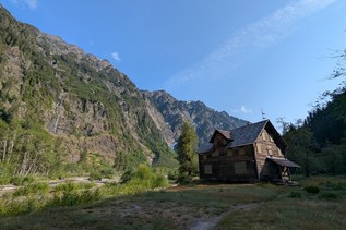
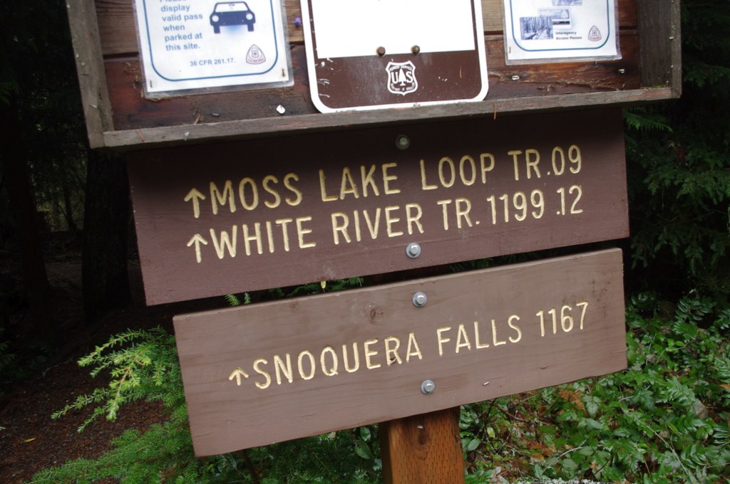
Originally an Eagle Scout project, the Moss Lake Nature Trail is adjacent to Camp Sheppard, which is managed by Boy Scouts of America. But the trail is on Forest Service land. It shares a parking lot and trailhead with the Snoquera Falls trail, and requires the usual Northwest Forest Pass.

From the parking lot, the approach to the loop is just 400 feet. When you see the scout amphitheater, go right on the (currently) unmarked trail. The counter-clockwise loop has 21 interpretive stations over its 0.7-mile length. Moss Lake Interpretive Trail guides are available at the Forest Service Ranger Station, at 450 Roosevelt Avenue East in Enumclaw.

For the full effect, walk along the path, referring to the interpretive guide. Become aware of the different trees, shrubs, and berries. Witness fire damage. Read detailed descriptions of the plant life around you.

But where is the lake? Spring runoff can encroach upon the trail, but Moss Lake is seldom more than a swampy pond. And it dries up completely in summer.

Note: As of this writeup, many of the interpretive signposts have rotted at the base, and are just leaning against a tree, not in their correct locations. The interpretive guide is in need of updating too, but is still informative.

In 2023, WTA completed repairs on a section of puncheon, returning the entire loop to being wheelchair-friendly. Work parties also installed a raised walkway where flooding has occurred in the past. Check it out!

Toilet Information

  • Toilet at trailhead

More information about toilets

Wheelchair Accessibility

The trail is a combination of paved, boardwalk and packed dirt, so chairs should be able to navigate all three surface types. It is an almost completely flat trail with minimal cross slope.

WTA worked here in 2023!

Hike Description Written by
Ken Giesbers, WTA Correspondent

Moss Lake Loop

Map & Directions

Trailhead
Co-ordinates: 47.0359, -121.5600 Open in Google Maps

Before You Go

See weather forecast

Parking Pass/Entry Fee

Northwest Forest Pass

WTA Pro Tip: Save a copy of our directions before you leave! App-based driving directions aren't always accurate and data connections may be unreliable as you drive to the trailhead.

Getting There

Drive east from Enumclaw on Highway 410 for 17 miles. When the speed limit drops, be ready to note your mileage as you cross the Greenwater River. From that bridge, travel 9.9 miles. Turn left on Forest Road 7155 (Camp Sheppard), then turn right on the one-way road to the paved trailhead. There is a vault toilet here, and room for about 20 vehicles.

If you are approaching this hike from the south on Highway 410, the right turn onto Forest Road 7155 is 0.3 mile after milepost 53.

More Hike Details

Trailhead

Mount Rainier Area > Chinook Pass - Hwy 410

Moss Lake Nature Trail, aka Moss Lake Loop (#1168)

Mt. Baker Snoqualmie National Forest, Snoqualmie Ranger District

Guidebooks & Maps

Green Trails Greenwater No. 238

You can improve or add to this guidebook entry!

Moss Lake Loop

22 Trip Reports

Hiked here recently?

Submit a trip report!
 
Trip Reports