

The name “Badger Mountain” is given to a huge block of higher terrain north and east of Wenatchee, bounded on the west by the Columbia River, on the southeast by Moses Coulee, and on the north by the Waterville Plateau. Maps paste the name Badger in various places on this massif. The Badger Mountain Lookout used to be on its western edge, overlooking the Columbia River; the building has been moved to the Columbia Breaks Fire Interpretive Center near Entiat. A small ski area is on the northwest corner of Badger Mountain, not far from Waterville. This is the only bit of Badger Mountain that receives enough precipitation to support trees.
The focus of this Hiking Guide entry is on the southeast portion of Badger Mountain, where the BLM’s Duffy Creek and Douglas Creek Recreation Area offers several hiking opportunities.
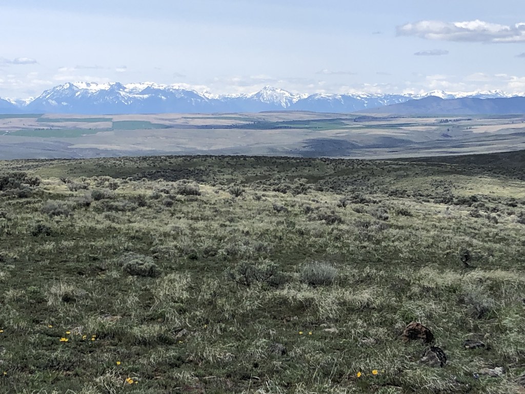
This hike starts high and goes along a ridge to a high point known as Moses Stool and to another high point that is usually one of the spots labelled Badger Mountain. The terrain is shrub-steppe, with sagebrush and other low to the ground plants.
From Rock Island Grade, go through the gap in the fence and begin walking along a two-track toward the radio tower ahead. There are several gates along the way. One requires climbing over and the others must be opened and closed. Most of the way is on BLM land but two parcels of private land are also crossed, including Moses Stool itself. Walkers are tolerated, but please take care to stay on the trail. Go about 1.5 miles on the two-track, gaining most of the elevation on the hike, and reach the radio tower on Moses Stool.
Take in the astounding views. To the north is the Waterville Plateau with its patchwork of farms. East and south are lower terrain including deep canyons incising Badger Mountain. You should be able to catch a glimpse of the Columbia River in the distance. To the west, you can see what looks like the entire Cascade Range.
Continue walking along the two-track, dipping down about 100 feet then regaining the elevation. About half a mile from Moses Stool, continue straight along the ridge on a fainter two-track where the main two-track turns right. In another 1.3 miles, reach the high point labelled Badger. Here you can turn back, having summited Badger Mountain, though the two-track continues along the ridge for some distance.
This is a hike for the shoulder seasons. Summer conditions are punishingly hot, with zero shade of any kind available. There is no water on this ridge. In winter, it can be bitterly cold, with deep snow at times. At any time of year, the wind can be brutal. But springtime wildflowers abound, including asters, phlox and lupine. The tremendous views are the main draw. And a herd of pronghorn, rare in Washington, lives in the area. The animals were reintroduced by the Colville tribes in 2020, the latest effort to bring pronghorn back to Washington after they were extirpated a century ago.
Note that some older trip reports begin from Douglas Creek Canyon, both the north and south trailheads. You can still do this, though it does require a wet crossing of Douglas Creek, a climb of 2000 feet and some cross-country navigation. The route described here is definitely easier, with great views from the start.
Alternative hikes
Other walks are available in the Duffy Creek and Douglas Creek area. Study the BLM map and invent your own hikes. About 0.7 mile back from the trailhead on Rock Island Grade, where the BLM map has a “P,” you can walk a mile or more along Duffy Creek itself, which has interesting riparian areas.
A somewhat less rewarding hike is possible on the rough road by the BLM sign (on the map as “P” and “?”).
 Trailhead


