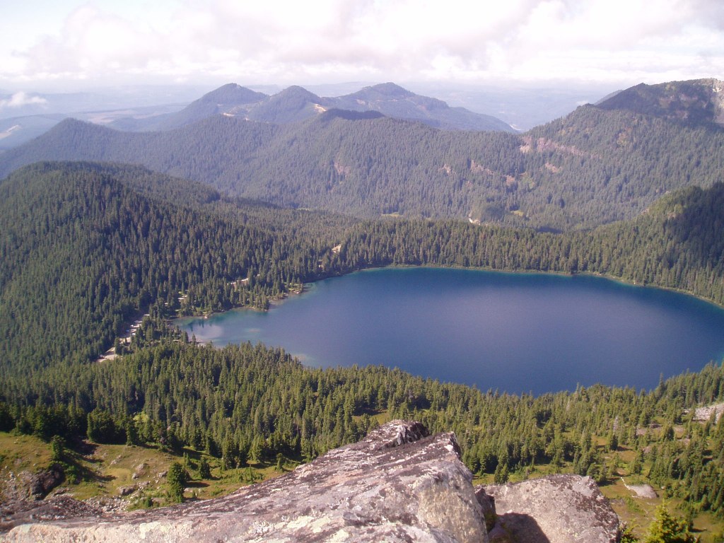
Fay Peak https://adminonly.wta.org/go-hiking/hikes/knapsack-pass-fay-peak-and-mt-pleasant https://adminonly.wta.org/site_images/hikes/fay-peak.jpeg/@@download/image/Fay Peak.jpeg Fay Peak Mount Rainier Area > NW - Carbon River/Mowich Full-size image Add Hike to My Backpack Saved to My Backpack Continue reading Rating 3.67 out of 5 (3 votes) Log in to rate 23 trip reports for this trail Write a trip report Hiking Fay Peak Fay Peak Map & Directions Before You Go WTA Pro Tip: Save a copy of our directions before you leave! App-based driving directions aren't always accurate and data connections may be unreliable as you drive to the trailhead. More Hike Details Trailhead Mount Rainier Area > NW - Carbon River/Mowich Mount Rainier National Park News Hiker Headlines: Harts Pass Rd closed, road to Enchanted Valley damaged, Rainier and North Cascades permits, Mountain Loop Hwy opens April 23, 2026 Learn A quieter side of Mount Rainier You can improve or add to this guidebook entry! Update page