Trails for everyone, forever

Home Go Hiking Hiking Guide Iwetemlaykin State Heritage Site (Oregon)

Iwetemlaykin State Heritage Site (Oregon)

Southwest Washington > Columbia River Gorge - OR
45.3430, -117.2239 Map & Directions
Length
2.5 miles of trails
Elevation Gain
100 feet
Highest Point
4,400 feet
A late season storm clearing at Iwetemlaykin State Heritage Site. Photo by Austin Smith. Full-size image
  • Dogs allowed on leash
  • Good for kids
  • Lakes
  • Mountain views
  • Rivers
  • Wildflowers/Meadows
  • Wildlife

Parking Pass/Entry Fee

None
Saved to My Backpack

Enjoy the shrub steppe just on the edge of town. Perfect for a short run or exploring with kids. Continue reading

Rating
0.00 out of 5

(0 votes) Log in to rate

Hiking Iwetemlaykin State Heritage Site (Oregon)

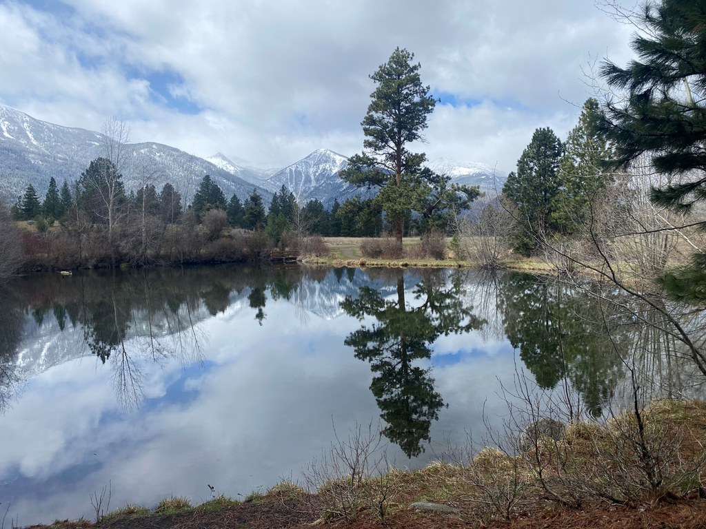
This small park hosts a pond, several creeks (actually irrigation ditches) and frequently mule deer and other wildlife. 

Starting from the trailhead, you will switchback gradually up to a general plateau. There are ups and downs, but really not much elevation change. Wander about as you like. All three main trails dead-end at roads. A quiet little pond is a great place to sit and reflect. Dry pine forest and shrub-steppe environments are well represented here.

Extend your hike

A great addition to this walk is to visit a nearby National Park Service administered grave site. Chief Joseph’s grave is here in a fittingly beautiful spot.

To reach this second location, turn left (southeast and uphill, eventually) when you reach the little pond. This trail will end at Wallowa Lake Highway. Walk 200 yards down this road to the gravesite park on the right. You may also drive there from the original trailhead just a quarter mile down the road. Trail distance includes all trails in the park.

Toilet Information

  • No toilet at trailhead

More information about toilets

Hike Description Written by
Austin Smith, WTA Correspondent

Iwetemlaykin State Heritage Site (Oregon)

Map & Directions

Trailhead
Co-ordinates: 45.3430, -117.2239 Open in Google Maps

Before You Go

See weather forecast

Parking Pass/Entry Fee

None

WTA Pro Tip: Save a copy of our directions before you leave! App-based driving directions aren't always accurate and data connections may be unreliable as you drive to the trailhead.

Getting There

From the center of Joseph, OR, drive south of Wallow Lakes Highway. As you head of of town, watch for the "30 mph" speed limit sign. The trail head will be shortly after this on the right. If you get to the point where you can see Wallow Lake you’ve gone too far.

More Hike Details

Trailhead

Southwest Washington > Columbia River Gorge - OR

Oregon State Parks

You can improve or add to this guidebook entry!

Iwetemlaykin State Heritage Site (Oregon)

0 Trip Reports

Hiked here recently?

Submit a trip report!
 
There aren't any trip reports for this hike yet.
Loading trip reports...