Trails for everyone, forever

Home Go Hiking Hiking Guide Huckleberry Creek

Huckleberry Creek

Mount Rainier Area > Chinook Pass - Hwy 410
47.0093, -121.6171 Map & Directions
Length
8.6 miles, one-way
Elevation Gain
3,835 feet
Highest Point
6,778 feet
Calculated Difficulty About Calculated Difficulty
Hard
Historic NPS ranger patrol cabin on Huckleberry Creek trail. Photo by dontraille. Full-size image
  • Good for kids
  • Mountain views
  • Old growth
  • Ridges/passes
  • Rivers
Saved to My Backpack

This lesser known trail starts in the Mt. Baker-Snoqualmie National Forest and then enters the northeast corner of the park, is snow-free early in the season and goes through some amazing old growth. Continue reading

Rating
3.58 out of 5

(12 votes) Log in to rate

Hiking Huckleberry Creek

Huckleberry Creek Trail leaves Road 7340, an old spur road, in second-growth timber. Quickly, it becomes an established trail; after 0.1 mile, it crosses Lost Creek on a footlog and enters old-growth timber.

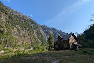
The trail follows Huckleberry Creek to the boundary with Mount Rainier National Park at mile 0.9. Here is a nice stopping point for families, or you can continue your hike into the national park on the Lake James trail. Remember that if you're hiking with pups, you'll need to turn around at the park boundary, since dogs are not allowed in the national park.

From the park boundary, the trail continues for another 7.5 miles, following Huckleberry Creek up the valley into a mountain basin before climbing to the trail's end at Sourdough Ridge. From here, it's a quick jaunt to the Sunrise Visitor Center, which can act as an alternate access point to the Huckleberry Creek Trail. 

WTA worked here in 2023, 2022, 2011, 2008 and 2007!

Hike Description Written by
Multiple authors contributed to this report, WTA Community

Huckleberry Creek

Map & Directions

Trailhead
Co-ordinates: 47.0093, -121.6171 Open in Google Maps

Before You Go

The gate to FR 73 is closed between Dec 15 and May 15 annually.

See weather forecast

WTA Pro Tip: Save a copy of our directions before you leave! App-based driving directions aren't always accurate and data connections may be unreliable as you drive to the trailhead.

Getting There

Drive east on State Highway 410 from Enumclaw 24.8 miles to Huckleberry Creek Road 73. Turn right (south) onto 73 and follow 6.5 miles. Trailhead is on left side before crossing Huckleberry Creek. There is room for about 5 cars on the road's shoulder.

More Hike Details

Trailhead

Mount Rainier Area > Chinook Pass - Hwy 410

Mt. Baker-Snoqualmie National Forest, Snoqualmie Ranger District; Mount Rainier National Park

You can improve or add to this guidebook entry!

Huckleberry Creek

121 Trip Reports

Hiked here recently?

Submit a trip report!
 
Loading trip reports...
Trip Reports