Trails for everyone, forever

Home Go Hiking Hiking Guide Falls Creek Falls (Joseph, OR)

Falls Creek Falls (Joseph, OR)

Southwest Washington > Columbia River Gorge - OR
45.3114, -117.3072 Map & Directions
Length
1.5 miles, roundtrip
Elevation Gain
400 feet
Highest Point
5,300 feet
Calculated Difficulty About Calculated Difficulty
Easy
Falls Creek Falls is fed by a 9000-foot ridgeline above it. Photo by Austin Smith. Full-size image
  • Waterfalls

Parking Pass/Entry Fee

None
Saved to My Backpack

A short hike not far from Joseph, OR, gets you to a fun little waterfall perhaps perfect for a hot day. Continue reading

Rating
0.00 out of 5

(0 votes) Log in to rate

Hiking Falls Creek Falls (Joseph, OR)

Initially, you will begin hiking on the Hurricane Creek trail. In a very short distance, turn right onto the Falls Creek trail.

The full Falls Creek trail is a monster, climbing over 4,000 feet in just a few miles. The side trail to the falls turns off the Falls Creek trail, less than a few hundred yards from the parking lot.

As you head up Hurricane Creek, be sure to fork right at the signed junction. Five minutes later you’ll encounter another, less obvious trail to your left. This is the trail to the falls. This narrow trail sidehills for a hundred yards quickly gaining elevation, then losing it.

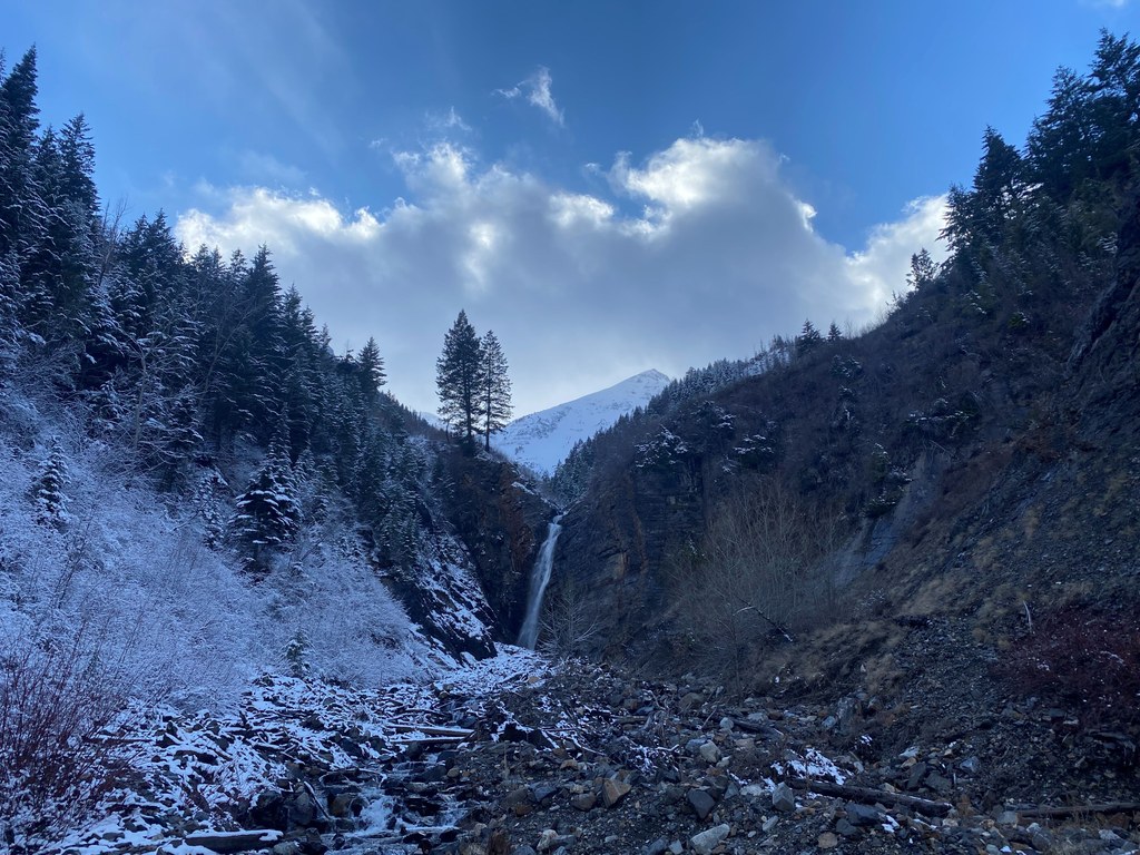
When you’ve reached the stream bed, continue to your right as far as you’d like. 9000-foot peaks, clad in snow, peek out in the background. Imagine their snow-melt making its way to this waterfall. Enjoy your stay.

Traveling further up Hurricane Creek is easily done by bearing left at the first signed trail junction.

Toilet Information

  • Toilet at trailhead

More information about toilets

Hike Description Written by
Austin Smith, WTA Correspondent

Falls Creek Falls (Joseph, OR)

Map & Directions

Trailhead
Co-ordinates: 45.3114, -117.3072 Open in Google Maps

Before You Go

See weather forecast

Parking Pass/Entry Fee

None

WTA Pro Tip: Save a copy of our directions before you leave! App-based driving directions aren't always accurate and data connections may be unreliable as you drive to the trailhead.

Getting There

From Enterprise, OR, head south on Hurricane Creek Road. As you leave the valley, the road will twist and turn entering the mountains. In a couple of miles, this road dead-ends at the Hurricane Creek trailhead.

There is both dispersed camping just before the trailhead and a Forest Service campgroundon your way. Please watch your speed through this neighborhood.

More Hike Details

Trailhead

Southwest Washington > Columbia River Gorge - OR

Wallowa-Whitman National Forest

You can improve or add to this guidebook entry!

Falls Creek Falls (Joseph, OR)

0 Trip Reports

Hiked here recently?

Submit a trip report!
 
There aren't any trip reports for this hike yet.
Loading trip reports...