Trails for everyone, forever

Home Go Hiking Hiking Guide Bypass Trail
link

Bypass Trail

South Cascades > Goat Rocks
46.4890, -121.4770 Map & Directions
Length
1.0 miles, one-way
Elevation Gain
400 feet
Highest Point
6,000 feet
Calculated Difficulty About Calculated Difficulty
Easy
Hiker crossing Snowgrass Creek on the Bypass Trail. Photo by Susan Saul. Full-size image
  • Dogs allowed on leash
  • Fall foliage
  • Mountain views
  • Wildflowers/Meadows
  • Wildlife
Saved to My Backpack

Use this trail to hike a loop with Snowgrass Trail (96) and the Pacific Crest Trail (2000), or use it to skip (bypass) the crowds at Snowgrass Flats by heading straight over to the PCT. Continue reading

Rating
0.00 out of 5

(0 votes) Log in to rate

Hiking Bypass Trail

This connector trail links Snowgrass Trail 96 with the Pacific Crest Trail. From the Snowgrass Trail, turn onto the signed Bypass Trail. Walk through stands of firs and mountain hemlocks alternating with subalpine meadows of lupine, paintbrush, arnica, valerian, bistort and sego lilies.

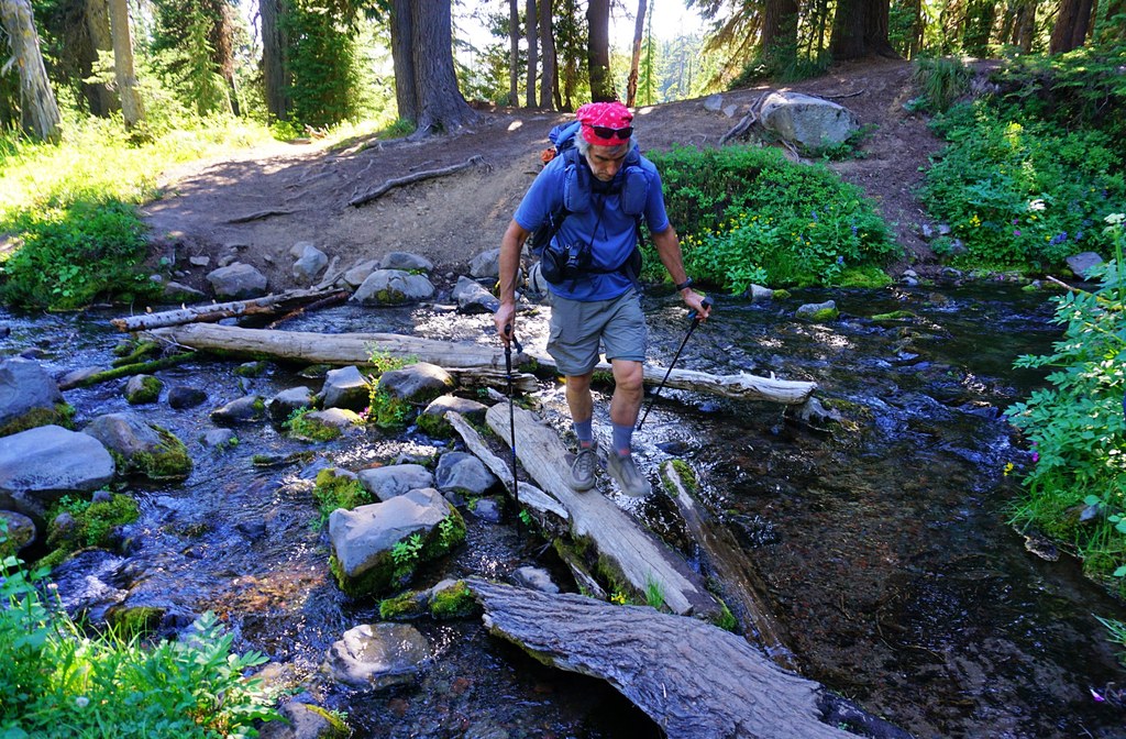
In less than a half-mile, cross rushing Snowgrass Creek with a mix of rock-hopping and log-walking. Once across the creek, avoid dead-end paths that lead to several campsites by looking for signs and the most-used trail.

The trail climbs through more colorful meadows alternating with shady forest and passing several smaller stream crossings to the junction with the PCT. Turn left (north) on the PCT and climb towards the junction with the Snowgrass Trail and the return portion of the loop. Your other option is to turn right (south) on the PCT and hike high above the Cispus River towards it headwaters in the Cispus Basin.

The Bypass Trail is a segment of the Klickitat Trail, the historic Native American ridgetop route between the Cowlitz River and Klickitat River crossing the Cascades Mountains at Cispus Pass.

Toilet Information

  • No toilet at trailhead

More information about toilets

Hike Description Written by
Susan Saul, WTA Correspondent

Bypass Trail

Map & Directions

Trailhead
Co-ordinates: 46.4890, -121.4770 Open in Google Maps

Before You Go

See weather forecast

WTA Pro Tip: Save a copy of our directions before you leave! App-based driving directions aren't always accurate and data connections may be unreliable as you drive to the trailhead.

Getting There

From I-5, drive east on Highway 12 for about 57 miles to the intersection with Forest Road 21, signed for Chambers Lake/Walupt Lake. Take gravel FR 21 for 13 often rough miles. Turn left on FR 2150, signed for Snowgrass Trail No. 96/Chambers Lake.

After 1 mile, keep left at an unmarked intersection to stay on FR 2150. In 2 miles, turn right at a sign pointing toward the Snowgrass Trail onto a loop road. Drive 0.3 mile to the hiker-only trailhead located on the right and parking along both sides of the road. The Bypass Trail is about 4 miles up the Snowgrass Trail.

Note that the gravel trailhead parking is often full on peak summer days. The Forest Service notes that this area is the most crowded part of the Goat Rocks in the summer months: expect to see a hundred or more people on the trails. Parking lots at Snowgrass and Berry Patch trailheads fill early even on weekdays as do places to camp along the trail. 

More Hike Details

Trailhead

South Cascades > Goat Rocks

Bypass (#97)

Gifford Pinchot National Forest, Cowlitz Valley Ranger District

Guidebooks & Maps

Day Hiking Mount Adams and Goat Rocks by Tami Asars, Mountaineers Books, 2014

Green Trails Goat Rocks/William O Douglas Wilderness No. 303S

Gifford Pinchot National Forest Goat Rocks plus Tatoosh and Glacier View Wildernesses (2018)

Buy the Green Trails Goat Rocks-William O Wilderness No. 303S map

You can improve or add to this guidebook entry!

Bypass Trail

1 Trip Report

Hiked here recently?

Submit a trip report!
 
Loading trip reports...
Trip Reports