

Set off from the trailhead just off of Highway 20, immediately entering forested lowlands. Cross a creek on a large log bridge, complete with a stairstep approach and a handrail for safety while crossing wide, silty Granite Creek. Note how close you are to the trailhead; you may want to take a dip in the creek on the way back to your car, particularly if the day is hot.
Continue through rolling forest, surrounded by queen's cup, vanilla leaf and other flora sprinkled among the trunks of cedars and pines. The trail takes you up and down through this landscape, but generally gains elevation for about a mile and a half.
Arrive at a creek crossing spanned by several logs not very securely set across the stream. This is Easy Pass Creek and in spring, it can run high. Have your trekking poles at the ready — they are invaluable in getting safely across. But if the water is running high, consider making this your turnaround point and trying for the pass another time.
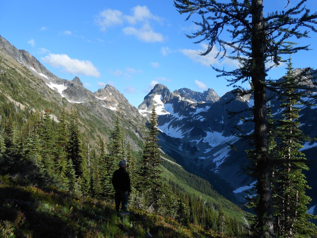
Cross Easy Pass Creek and leave the forest behind. Now you’re hiking along the floor of a valley, in a wide, rocky alpine meadow. From here on, the hike is exposed, with very few opportunities for shade, so slather on some sunscreen and proceed through the valley. Two passes are in evidence here — Easy Pass is the one directly in front of you, with a large rocky peak to the north. Many a hiker has exclaimed, “That can’t be it, it looks too easy!” Don’t be fooled; it’s still quite a climb.
At the head of the valley, re-enter forest for a short while. After a couple of switchbacks through welcome shade, re-cross Easy Pass Creek (this time, it’s a much more secure crossing) and begin switchbacking up a steep talus slope. Easy Pass is on a fault line, so the talus frequently slides, and WTA work parties clear trail here over the summer, moving tons of loose rock to re-establish the trail.
Continue through a lush green section of the trail, with Easy Pass Creek always within earshot, if not visible. Consider refilling your water bottle here the next time you see the creek. There is no more reliable water source until the pass; it's only about a mile away, but it's a very steep, exposed mile. And in late summer, if the snow is melted, there may be no water at all at the pass.
Climb up several switchbacks into a hanging valley. Now comes the final push. The trail carries you along the edge of the meadow, with a rocky boulder field on your left. Gradually leave the greenery for the rocks as you hike ever higher to the pass. Here too, WTA work parties have improved trail, installing rock steps and recarving the trail that leads to your destination.
Throw down your pack and have a drink of water. Maybe reapply some sunscreen, and grab your camera. The views in every direction are spectacular and will keep you occupied for a long rest. Explore the pass in every direction, and then head back the way you came. The way down is easier than the way up.
WTA Pro Tip: Incorporate Easy Pass into a fall “Larch March.” Take a long weekend and head to the North Cascades, an area chock-full of hikes lined by larches, which turn an arresting gold in the autumn.

 Trailhead


