Transit-accessible hikes around Washington
Hiking by transit is a great way to see trails and get to know your city a little better. Plus, you don't need to worry about finding parking or heading to a second location when the lot is full.
There are a remarkable number of trails accessible by bus across Washington, many of which are well-known and popular, but many are little-known treasures.
Below are some highlights near the major cities in Washington. If you want to find more trails accessible by transit, check the Getting There section on each trail in our Hiking Guide. If it's transit-accessible, we offer transit information underneath the driving directions. Did we miss one? Let us know by writing a trip report about your transit hike.
If it's your first time hiking by bus, don't miss the tips we put together from TransitTrekker, a transit hiking enthusiast, such as checking (and re-checking) bus schedules, ensuring you have cash (yep, some places still don't take cards) and packing extra snacks for the bus.
Vancouver area
Blandford Canyon
Length: 0.9 miles of trails
Elevation Gain: 75 feet
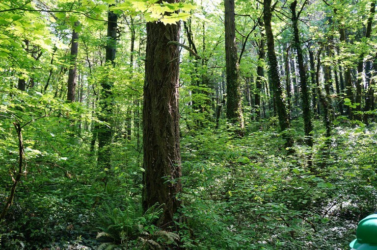
Lush Blandford Canyon has been the backdrop for many WTA work parties. Photo by Aaron Bredl.
This tiny neighborhood park has seen several WTA work parties, and worth the visit! Coming via transit, it's about an extra half-mile each way from the bus stop. But it's a lovely stroll through a quiet neighborhood, and bussing here means you don't have to contend with finding parking.
> Plan your transit trip to Blandford Canyon using WTA's Hiking Guide.
Cape Horn
Length: 7.2 miles, roundtrip
Elevation Gain: 1300 feet
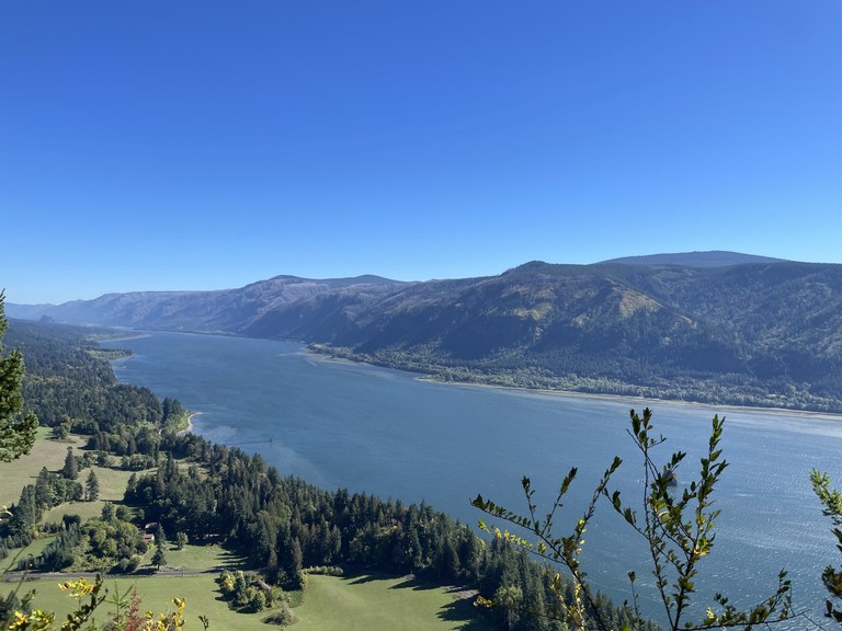
Cape Horn is a beautiful, robust day hike accessible via transit, and is gorgeous well into autumn. Photo by trip reporter Steve Mathews.
The Skamania County bus is a great option for hikers to access this gorgeous hike in the Columbia River Gorge, which offers two segments of trail split by Highway 14. While there is a seasonal closure for peregrine falcon nesting that hikers must observe between February and July, even an out-and-back hike here is fulfilling.
> Plan your transit trip to Cape Horn using WTA's Hiking Guide.
Lacamas Park - Lacamas Creek
Length: 4.5 miles, roundtrip
Elevation Gain: 350 feet
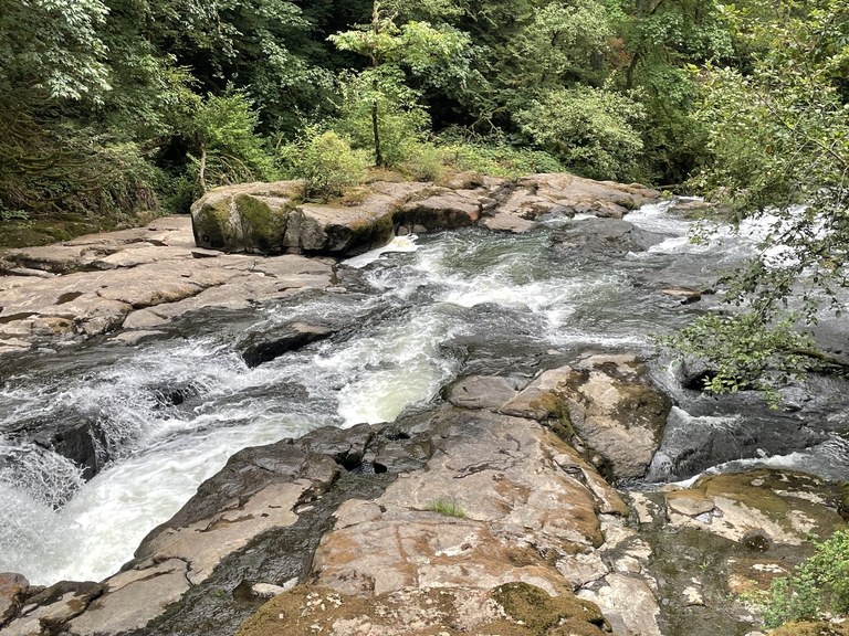
Lacamas Creek is a beautiful destination along this loop hike in a small park in Camas. Photo by trip reporter drpeeper.
Tucked in the heart of Camas, Lacamas Park is bussable using the Vancouver or Camas bus systems. There are several loops to explore here, but this is a "lollipop" loop starting at the south end of the park: You'll be visiting the Lower Falls, then circling around through the park past Round Lake and returning along Lacamas Creek.
> Plan your transit trip to Lacamas Park using WTA's Hiking Guide.
Spokane area
Nimbus Knob Loop
Length: 3.0 miles, roundtrip
Elevation Gain: 400 feet
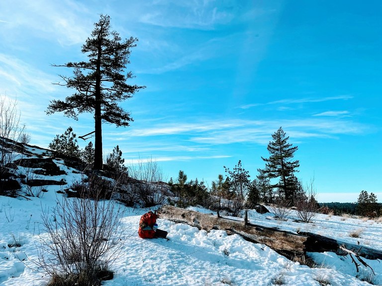
The striking Dishman Hills area is a wonderful hiking spot in Spokane just a short bus ride away from the center of town. Start off from Camp Caro and do this loop, or craft your own. Regardless, do bring a map with you — unsigned intersections abound and have confused previous hikers!
> Plan your transit trip to Nimbus Knob using WTA's Hiking Guide.
Waikiki Springs
Length: 4.8 miles of trails
Elevation Gain: 588 feet
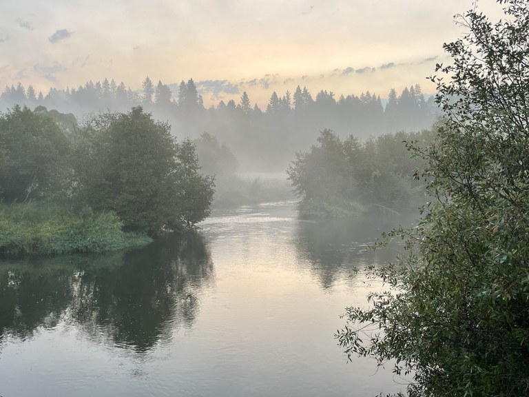
The relatively new Waikiki Springs area has been improved by WTA crews and offers miles of riverside wandering. Photo by Holly Weiler.
This is a lovely urban trail system outside of Spokane and near the Little Spokane River. The multi-use trails here have recently received a complete upgrade and now boast interconnected loop trails that total nearly 5 miles. Bus lines that service the trailhead are between a 7- and 10-minute walk away.
> Plan your transit trip to Waikiki Springs using WTA's Hiking Guide.
Spokane Centennial Trail
Length: 37.0 miles, one-way
Elevation Gain: 600 feet

Views from the Spokane Centennial Trail at the Mirabeau Trailhead. Photo by trip reporter California Girl.
The Spokane Centennial Trail is a paved route that stretches through Spokane to the Idaho border and beyond. There are several ways to access the trail, including from Riverside State Park, but hikers can consider taking the 74 east to Mission and Bitterroot, then walking a mile north to the trail and heading west back into town.
> Plan your transit trip to the Spokane Centennial Trail using WTA's Hiking Guide.
North Puget Sound area
Kettles Trail System
Length: 35.0 miles of trails
Elevation Gain: 200 feet
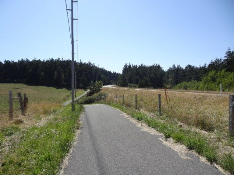
The Kettles Trails occasionally parallels the main road on Whidbey Island, but ducks off into the forest and off to the bluffs. Photo by trip reporter Mike.
The robust trail system on Whidbey Island traverses forest and bluffs, coastline and interior island. The way is paved or graveled or dirt and visitors can hike or bike it. It's great for one hour or one day. Whatever you do, we love seeing trip reports for it.
> Plan your transit trip to the Kettles Trail System using WTA's Hiking Guide.
Whatcom Falls Park
Length: 4.0 miles, roundtrip
Elevation Gain: 50 feet
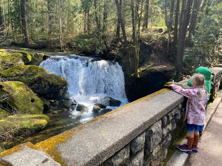
Kiddos enjoy the view of the waterfall from the signature bridge at Whatcom Falls Bridge. Photo by trip reporter Kjmorty.
Home to a signature CCC-era stone bridge and waterfall, Whatcom Falls Park is a gorgeous little park just a few minutes from Bellingham. The bonus of traveling here by bus? Kids love the extra adventure of a bus ride.
> Plan your transit trip to Whatcom Falls Park using WTA's Hiking Guide.
Little Mountain Park - Bonnie and Clyde
Length: 1.6 miles, roundtrip
Elevation Gain: 600 feet

This sweet little loop is made a little longer when taken by bus, where you'll have to walk an extra mile both ways from the bus stop. But the surrounding area is beautiful and it makes for a great warm up and cool down. Feeling more ambitious? Try the Darvill Loop, which starts from the other side of the park.
> Plan your transit trip to Little Mountain Park - Bonnie and Clyde using WTA's Hiking Guide.
Olympic Peninsula Area
Kah Tai Lagoon Park
Length: 1.1 miles, roundtrip
Elevation Gain: minimal
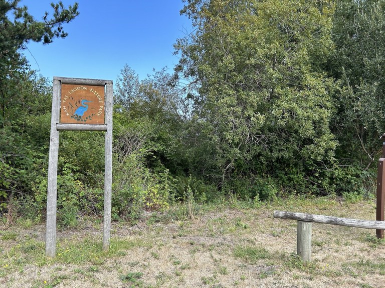
The Landres Street entrance to Kai Tai Lagoon. Photo by Daffodilia.
This sweet little short loop around a former part of Puget Sound is wheelchair-friendly and transit accessible! Enjoy the wide gravel path around the small lagoon, and don't miss the interpretive signs with the history of the area. Jefferson Transit routes 1, 2, 3, 4, 6A, 6B and 7 all stop at the Haines Place Park and Ride, which connects to the trails in the park.
> Plan your transit trip to Kah Tai Lagoon using WTA's Hiking Guide.
Ludlow Falls Interpretive Trail
Length: 0.6 miles, roundtrip
Elevation Gain: 100 feet

The Ludlow Falls trail disappearing into the forested area of the interpretive trail here. Photo by trip reporter Brian Lohr.
Ludlow Falls is a cute little spot tucked away on the Peninsula. It transitions between a beautiful wide trail through a small field and heads into forest and a small waterfall view.
> Plan your transit trip to Ludlow Falls Interpretive Trail using WTA Hiking Guide.
Peabody Creek Trail
Length: 5.6 miles, roundtrip
Elevation Gain: 800 feet
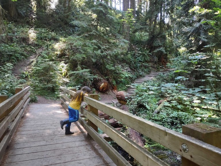
Kids enjoy the structures along the Peabody Creek Trail. Photo by ToddlerTrekking.
Peabody Creek is a wonderful interpretive trail in Port Angeles, and it's a great option if you can't make it up to Hurricane Ridge. The wide bridge and rambling trails through forest are a great diversion.
> Plan your transit trek to Peabody Creek using WTA's Hiking Guide.
Greater Puget Sound Area
Tumwater Falls Park
Length: 0.5 miles, roundtrip
Elevation Gain: 30 feet
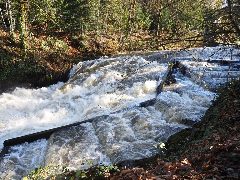
Deschutes Park is a great visit year-round because the river flow varies so dramatically. Photo by trip reporters Bob and Barb.
Check out this gorgeous trail alongside a fish ladder and the former Olympia Brewing Company. This route is great in the fall when the leaves are changing, and it's so close to Olympia, you can make a half-day out of it and go get a meal afterward.
> Plan your transit trek to Tumwater Falls Park using WTA's Hiking Guide.
North Kitsap Heritage Park
Length: 10.0 miles of trails
Elevation Gain: varies

A tractor is vanishing into the forest at North Kitsap. Photo by trip reporter TransitTrekker.
The system of trails that are in this part have plenty for hikers to enjoy and they're hikeable by transit either locally, or you can get here all the way from Seattle. Just check out TransitTrekker's itinerary and get some tips from her.
> Plan your transit trek to North Kitsap Heritage Park using WTA's Hiking Guide.
Clear Creek Trail
Length: 2.8 miles, roundtrip
Elevation Gain: 35 feet
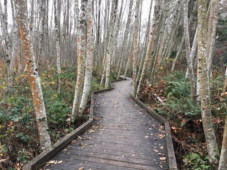
The Clear Creek trails are a great transit-accessible destination, and the deciduous trees in the fall make for great colors. Photo by trip reporter Lezlie.
The Clear Creek Trail system offers respite from the busy commercial scene of Silverdale. Both paved and unpaved, the trail is gentle, making it a family- and pet-friendly destination that is popular with walkers, runners and bikers. There are sections of the trail that are wheelchair friendly, as well!
> Plan your transit trek to Clear Creek Trail using WTA's Hiking Guide.
Hilburn Preserve
Length: 2.0 miles of trails
Elevation Gain: variable
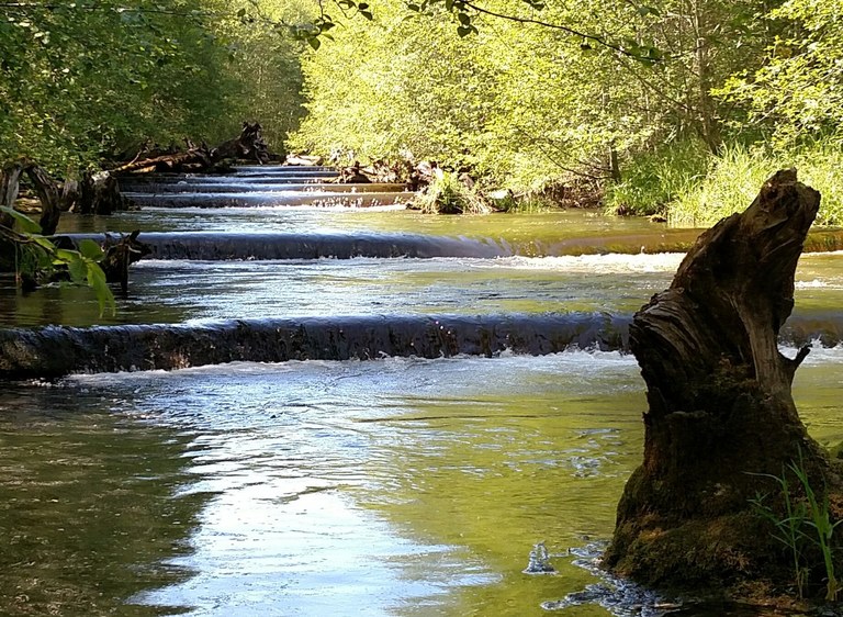
Meandering along Goldsborough Creek through the 9.4-acre Hilburn Preserve, this trail follows the water from clay cliffs to muddy banks. There are a couple bus options, though, if you're already in Shelton, you might consider simply walking to the trailhead.
> Plan your transit trek to Hilburn Preserve using WTA's Hiking Guide.

