Beyond the summit: Where to snowshoe besides Snoqualmie Pass
- Know before you go

- - Snowshoeing 101
- - Avalanche safety
- - What to wear on a winter hike
- - Hot drinks for chilly days
As winter weather begins to set in and snow blankets the hills, many of us pull our snowshoes out of storage and head for the mountains.
A popular choice for snowshoeing has always been the Summit at Snoqualmie and the Gold Creek Pond areas. But the parking areas for both are often quite full on the weekends, and there's a (somewhat confusing) paid parking system this year at the Snoqualmie ski area.
Luckily, there are plenty of other places to snowshoe in Washington, so if you’re not an early bird or you want snowshoeing options with free (and less confusing!) parking, read on.
West of Snoqualmie Pass
Talapus Lake Snowshoe
Location: Snoqualmie Pass region
Length: 10 miles, roundtrip
Elevation gain: 1,600 feet
Good for: Snowshoers with some experience and winter backcountry skills

Snow-covered Talapus Lake on a sunny afternoon. Photo by trip reporter QueenoftheCascades.
A moderate out-and-back route that starts on a road before winding its way up to Talapus Lake. This trail tends to be less crowded on the weekends and can be adapted into just a snowshoe on the road for small children or those wanting a less strenuous hike.
> Plan your visit to Talapus Lake Snowshoe using WTA's Hiking Guide
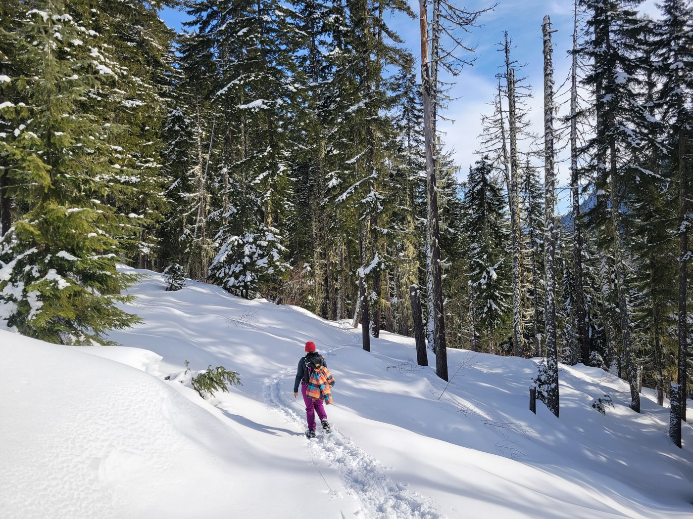
Palouse to Cascades Trail via McClellan Butte
Location: North Bend Area
Length: 4 miles, roundtrip to Harris Creek
Elevation gain: 696 feet
Good for: Intermediate snowshoers

Two snowshoers take a break after breaking trail on the Palouse to Cascades Trail in fresh snow. Photo by trip reporter nwroth.
The great thing about this route is you can hike for as long (or short) as you want! The Palouse to Cascades trail is a lovely, flat snowshoe. As long as you can make the slightly steeper climb up from the McClellan Butte Trail, you can hike for miles in either direction. Heading east, it's just a couple miles to Harris Creek, which makes for a nice turnaround point for day trippers.
> Plan your visit to Palouse to Cascades Trail via McClellan Butte using WTA's Hiking Guide.
Rattlesnake Mountain
Location: North Bend Area
Length: 7.7 miles, roundtrip
Elevation gain: 2,240 feet
Good for: Intermediate to advanced snowshoers

Stan's Overlook on a sunny March day. Photo by trip reporter Outside Nancy.
Tackle Rattlesnake from the less popular side! Starting from Snoqualmie Point Park, this hike ascends moderately through second-growth forest to various overlooks along the way. For the full mileage listed here, you'll head for Grand Prospect, but the view above is at Stan's Overlook, about halfway along this route.
> Plan your visit to Rattlesnake Mountain using WTA's Hiking Guide.
East of Snoqualmie Pass
KACHESS LAKE Trail
Location: near Snoqualmie Pass
Mileage: 1 mile, roundtrip
Elevation gain: 50 feet
Good for: Beginners or families with young children
 Snowshoe up to Kachess Lake in winter. Photo by trip reporter Zipster.
The short Kachess Lake trail is a delight for campers in summer and just as lovely for snowshoers in winter. It's a big payoff with relatively little work — that is, quite a short distance and little elevation gain — and makes for a beautiful outing for the whole family.
> Plan your visit to the Kachess Lake using WTA's Hiking Guide
Coal Mines Trail
Location: Cle Elum area
Mileage: 5.5 miles, one-way
Elevation gain: 453 feet
Good for: Beginners or families with young children, or those looking for elevation but a good amount of distance
 Enjoy a wide track on the Coal Mines trail. Photo by trip reporter hikingwithlittledogs.
The Coal Mines Trail connects Cle Elum to Roslyn and is relatively flat and very wide, making it great for beginner snowshoers and folks of all hiking/snowshoeing abilities. With its long length and convenient urban-ness, it's not only great for an outdoor adventure, but also for a nice cozy drink or meal afterward.
> Plan your visit to the Coal Mines Trail using WTA's Hiking Guide
South Cle Elum Trailhead
Location: Salmon La Sac/Teanaway Region
Mileage: Varies
Elevation gain: Varies
Good for: Beginners or families with young children

Snow-covered trees line the Palouse to Cascades trail near south Cle Elum. Photo by trip reporter ngie.
This section of trail features snow-covered trees and beautiful views of Peoh Point and Cle Elum ridge in the distance. Bonus, you’re close to both Cle Elum and Roslyn, so post-hike provisions are easy to come by.
> Plan your visit to Palouse to Cascades Trail - South Cle Elum using WTA's Hiking Guide
Lake Easton State Park
Location: Salmon La Sac/Teanaway Region
Mileage: Varies
Elevation gain: Varies
Good for: Beginners or families with young children, or anyone who wants to keep elevation to a minimum
 Lake Easton State Park and surrounding area. Photo by trip reporter OtterTravelMore.
You can snowshoe on the groomed loop trails at Lake Easton State Park, or hop on the Palouse to Cascades trail and head west as far as you’d like. Palouse to Cascades is an out and back trail, which means it’s perfect whether you’ve got an hour or all day.
> Plan your visit to Palouse to Cascades Trail - Lake Easton State Park using WTA's Hiking Guide
Cooper River snowshoe
Location: Salmon La Sac/Teanaway Region
Length: 8 miles, roundtrip
Elevation gain: 400 feet
Good for: Intermediate snowshoers with some backcountry knowledge and skills
 The trail wanders through moderate hills and has views of the river throughout the hike. Photo by trip reporter HikingGaga.
This hike is both timeless and breath-taking, not to mention easy to get to! The trail follows the river for most of the way, offering scenic views of the riverbed and opposite ridge.
> Plan your visit to Cooper River Snowshoe using WTA's Hiking Guide
Sasse Ridge Snowshoe
Location: Salmon La Sac/Teanaway Region
Length: 15 miles, roundtrip
Elevation gain: 2,700 feet
Good for: Experienced snowshoers with winter backcountry and navigation skills

A snowshoer traverses Sasse Ridge. Photo by trip reporter Eve.
A combination of forest road walking and ridge navigating offers spectacular views of the surrounding ridges, with the Stuart Range and Cascades in the distance. Be sure to check avalanche conditions and come prepared with your winter backcountry essentials.
Tip: While you may encounter other tracks, don't rely on them as your route-finding source.
> Plan your visit to Sasse Ridge Snowshoe using WTA's Hiking Guide
Rye creek to camp lake Snowshoe
Location: Teanaway Community Forest
Length: 5.6 miles, roundtrip
Elevation gain: 260 feet
Good for: Intermediate snowshoers and those who don’t mind taking the road less traveled

The sun peeks through clouds and tree tops along Rye Creek. Photo by trip reporter Kari and Marty.
The Teanaway’s network of old logging roads offers a maze of choose your own adventure options, so if you love Rye Creek, you’ll find plenty more adventuring in that neck of the woods. However, cell service is limited in this area so be sure to bring a map or GPS to aid with navigation.
> Plan your visit to Rye Creek to Camp Lake Snowshoe using WTA's Hiking Guide
Parking structure at Summit at Snoqualmie for the 2025-2026 season
Looking for some clarity on the paid parking situation at Summit at Snoqualmie this season? We've got you covered:
- Day-use parking requires a parking permit on Saturdays, Sundays and holidays between 7 a.m. and 3 p.m. (Note that this means if your vehicle is in the lot anytime between 7 a.m. and 3 p.m., you will need a permit, even if you show up before 7 a.m.)
- Day parking permits cost $15 per car in the Summit West, Central and East lots, and $25 in the Alpental lot.
- Carpools of 3+ folks can park for free in select Summit lots and the Alpental lot as space allows or until 10 a.m.
- Visitors can buy an uphill travel season pass for $40 if they are interested in hiking or touring, but that will only offer free parking on the days not listed above. (In other words, uphill travel passholders only get free parking on weekdays and non-holidays, and will need to pay the daily fees above on weekends and holidays.)
- Summit at Snoqualmie passholders with lift or Nordic access still get free parking for the season.
Willing to go a little farther? Check out our list of trails for beginners to backcountry pros all over the state. Or, consider exploring Washington's hidden snowy gems: forest service roads. These roads, typically gated in the winter, create a seasonal network of trails that are the perfect go-to for snowshoeing and cross-country skiing. Here's a tip, though: Depending on where you go, you may share the road with snowmobiles.


