


22 Short Summer Hikes with Giant Views
Dramatic views are kind of Washington's thing. So many of our summer alpine trails turn a corner or pop over a ridge and *bam*! Mountain views stretching on for miles. Alpine cirques. Hanging lakes. Seas of wildflowers. The hulking face of a glacier. And you might not always want to put in 7, 12 or 25 miles to reach those kind of views. These are a sampling of bigger views without the long miles. But that doesn't mean they're easy.

Klahhane Ridge is a nice, relatively easy hike on the Olympic Peninsula. Photo by Michelle Ascensio.
Don't underestimate the challenge of shorter hikes! There are two ways to reach these kind of views in less than 2.5 miles: by letting a car or bike do most of the work, or by hauling yourself up.
To reach high points with great views in short mileage, expect trails that climb and descend more steeply than more moderately-graded hikes or more accessible trails. Trail tread and exposure can also make these trails more difficult than your average hike. Depending on the condition of the road leading to the trailhead, you may also need to tack on extra road-walking miles.
Read the full hike descriptions, recent trail or road conditions and pay attention to the gain to figure out which hikes are right for you. If you like hikes like this, save them to your My Backpack account, and our hike recommender will offer you more hikes like these!
Southwest Washington


A colorful carpet of wildflowers on the Silver Star Mountain trail complete with peek-a-boo views of Mount Adams. Photo by justpeachy.
The view from Silver Star Mountain is one of the best around. Sitting in the center of the Chinook Trail System near Battle Ground, Silver Star offers expansive vistas from the get-go, and is one of the absolute best spots in Southwest Washington for wildflowers in the springtime. (It's pretty spectacular in the fall as well.)

The views from Little Huckleberry Mountain are stunning. Photo by jrdearman.
Hike along the slopes of this mountain and snack on huckleberries during the right season. Once on top, feast your eyes on the surrounding peaks including Mount Adams, Mount Rainier, Mount St. Helens and Mount Hood.

The views from Little Huckleberry Mountain are stunning. Photo by jrdearman.
If you're willing to brace some thick poison oat, check out this short, moderate trail in the Eagle Creek Recreation Area, just a half-mile from the popular Eagle Creek trail. Hiking to Wauna Viewpoint, you’ll enjoy a nice view of the Bonneville Dam as well as the Columbia River Gorge and even a bit of the up-valley views of the Eagle Creek drainage.
Olympic Peninsula


The Klahhane Ridge trail unfurling across the landscape in Olympic National Park. Photo by Bob and Barb.
You can approach the very popular Klahhane Ridge from multiple trails within Olympic National Park, but they all lead to stunning views of the Olympics. The way via the Switchback Trail is steep, so if you don't have the climb in you, approach the ridge via the Hurricane Ridge parking lot on the Mount Angeles trail.
The Lillian Ridge trail meanders across a high alpine meadow before plunging down into Grand Valley. Photo by main_jane.
Another popular Olympic National Park trail that lets the road to the trailhead do most of your climbing. With big views of the Olympics and the Cascades from the get-go, you can make this hike a short stroll, or a much longer experience. Just be sure to plan your visit on a day without thunderstorms, and bring plenty of water and sunscreen. The road from Hurricane Ridge to the trailhead has a fair amount of exposure.

An inlet along the Striped Peak Trail. Photo by parisrobin.
The best views of this trail within Clallam County’s 196-acre Salt Creek Recreation Area are not alpine views, but those of the big, blue Strait of Juan de Fuca. Plus, with nearby camping, playgrounds and Port Angeles not far away, a short hike can just be the start of your visit.
Eastern Washington


Hikers on a high point at Iller Creek. Photo by Todd Dunfield.
Like many other short hikes with big views, Iller Creek is no secret. But this Spokane favorite is a reliable get away when you just need to get out of town for a couple of hours and take in the valley views from a perch. This little loop can even be a great way to reconnect with the wonder of the Palouse while you wait out traffic (it's only 15 minutes from the I-90) on your commute.
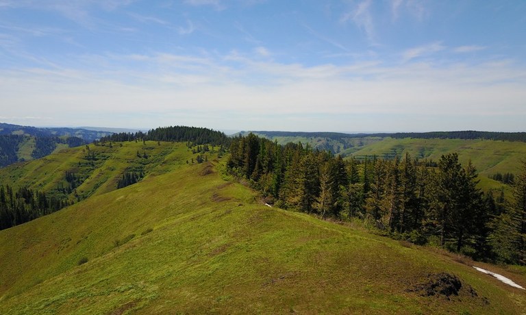
A large rolling field on Grouse Mountain. Photo by Greg Brown.
This trail an hour from Walla Walla is one of the few ridge hikes that you will hike down to. That means the road does a lot of your work here. You'll get classic Blue Mountain views on this ridgeline worth walking.
 The lookout at Table Rock is a unique, interesting spot to visit. You may even be able to drive to it! Photo by Greg Brown.
While the views are spectacular, geology buffs will find this unique spot most worth a visit. When the road is dry and good shape, you might be able to drive to this fire lookout view of the Palouse. But go planning on walking the short road up. (Looking for a longer hike to a lookout? Try Oregon Butte instead.)
North Cascades
Tiffany Mountain via Freezeout Ridge


8.6.26: The trail is closed until further notice due to the Sinlahekin Fire.
-
 Length
- 4.2 miles, roundtrip
-
 Elevation Gain
- 1,685 feet

The rocky summit and big views from Tiffany Mountain. Photo by RichP.
As one of the higher trailheads in the state, Tiffany Mountain via Freezeout Ridge will boast views that will take your breath away just as much as the elevation.

Appropriately expansive views from Lookout Mountain Lookout. Photo by Hiking Mom.
The historic lookout is not the only perk of this hike. In under two hours you will enjoy panoramic views, lush forests and wildflowers in addition to your destination. Note: If the lookout is closed, please respect the closure and don't try to enter it.

The Goat Peak lookout is visible for a lot of the hike to it! Photo by Hiking Mom.
Goat Peak and it's iconic fire lookout comprise the most prominent landmark in the Methow Valley. Visible from nearly every angle between Mazama and Winthrop, the lookout provides sweeping views of the North Cascade's summits.
Puget Sound and Islands


Little islands dotting the water around Orcas Island. Photo by kj15.
Turtleback Mountain Preserve is one of the largest conservation success stories in the San Juans. From the top of the mountain you are provided a vantage point at which you can view everything from the rolling pastures of the Crow Valley to the emerald hulk of Mount Constitution.

Chambers Bay Loop. Photo by Otter50.
This scenic golf course is not just for golfers. With a public path that circles the greens, and some steep sections climbing to views of Chamber's Bay this nearby park offers sweeping views of the Puget Sound.
Snoqualmie Area
Thorp Mountain via Knox Creek

8.7.26: The trail is closed due to the Three Queens Fire.
-
Length
- 4.4 miles, roundtrip
-
Elevation Gain
- 1,734 feet

The road to Knox Creek trailhead is rough but the views from Thorp Mountain are amazing. Photo by yasobara.
Short but steep with a big payoff at the end. The vista from the look out is the highest point for many miles in all directions. Enjoy wildflowers, berries and gorgeous views along your path to the summit.

View of the Middle Fork Valley from the end of the Garfield Ledges trail. Photo by Scotty22.
This trail reaches a scenic viewpoint in just over a mile. From the ledges, hikers can take in the expansive Middle Fork Valley and watch the river wind its way through the forest.
Mount Rainier Area
Mount Rainier's high elevation hubs are Paradise and Sunrise, both a treasure trove of big view hikes. Views smack you in the face from these parking lots, but head a mile or two down any trail here and you'll be rewarded with wildflowers, the chance to spot some wildlife and a slightly different perspective. Here are a few to get you started.

A carpet of heather and paintbrush make a beautiful foreground to the Golden Gate Trail. Photo by JenPhong.
The Golden Gate Loop climbs up through meadows is best done at the height of wildflower season after snow has melted off the trail. (Snow can stick around through July this high on the mountain.) Check trip reports before you go to get a sense of the wildflower situation.
Dege Peak

9.5.26: Sunrise Road is closed to vehicles due to the Grand Park 2 and Wonderland Complex Fires. Foot and bike traffic is permitted past the closure.
-
Length
- 4.0 miles, roundtrip
-
Elevation Gain
- 600 feet

Two hikers head down the Dege Peak trail out of Sunrise with a cloud layer between them and the ground. Photo by LostWisconsinite.
This relatively gentle climb features the in-your-face views of Mount Rainier typical of Sunrise. But on a clear day, the end of the trail where you perch above Sourdough Ridge also offers views of peaks ranging from the Cowlitz Chimneys to the far-off peaks of Mount St. Helens, Mount Adams, Glacier Peak and Mount Baker. The peak itself is small, so bit of summit courtesy (getting a look, and then moving off the small summit) may be in order if you visit when things are hopping.

A hiker examines the view from the Pinnacle Saddle trail on a cloudy day. Photo by David Hagen.
If you want a telescope quality view of Mount Rainier, then Pinnacle Saddle is where you want to be! Seemingly so close you can touch it, this view of our state's iconic peak is coupled with the beautiful lushness of the Nisqually River valley below.
South Cascades
Windy Ridge Trail

This trail is closed all M-F between May 15 and Oct 31 through the end of 2027. The trail will remain open on all weekends and federal holidays.
-
Length
- 4.0 miles, roundtrip
-
Elevation Gain
- 200 feet

Mount St. Helens is the star of most trails that surround it. Photo by Hiking Nerds.
Like many of the trails around Mount St. Helens, you don't need to get high to get spectacular views. The recovering blast zone has so few standing trees that vistas abound across this unique landscape. Windy Ridge is a great view hike without a lot of effort, and the visitor center offers a nice launching point. WTA Pro-Tip: Hike here early or late in the day. You'll stay cooler and enjoy the shadows created by the lower-angle light.

The lookout remnants at the top of Sunrise Peak make the top interesting, but the views are really the stunner here. Photo by austineats.
Visit Sunrise Peak at the right time, and you'll see why it got its name. The site of a former fire lookout, the trail is steep but short. Along the way, you'll have views of Mount Adams and Mount Rainier, and from the summit, you can enjoy a 360-degree panorama of the incredible geology in the Dark Divide.
Central Cascades


The Sugarloaf Lookout has still been used as a fire lookout during wildfire season. Photo by Birb.
Most of the climb to the lookout on Sugarloaf Mountain is actually drivable, so if you have a vehicle that can handle it, your hike may only be about a quarter of a mile to get great views of the Entiat Mountains and beyond.

Mount Index on a snowy day from Heybrook Ridge. Photo by thenomadicartist.
The Leovy Trail takes you up to Heybrook Ridge from the town of Index. Along the way, walk through a rocky, moss covered forest to incredible views of the surrounding peaks.