


Shady Hikes for Hot Summer Days
Nothing beats a shady trail meandering alongside a babbling brook, splashing stream or rushing river — especially in the heat of a Pacific Northwest summer afternoon. This summer, take to the trees to enjoy some respite from the sun, and while away the hours basking in the simple sounds and delights that can only be found outside. Here are shade-loving hikes to try across the state.
TIPS FOR HIKING IN SUMMER HEAT
- Check the weather.
- Brush up on basics. Be prepared and carry the Ten Essentials with you on every hike. Remember to carry extra water during the hot summer months!
- Pack it in, pack it out. On every hike, practice Leave No Trace ethics.
- Stay cool, stay hydrated. Learn some valuable tips and tricks to stay cool on trail during a hot day.
Mount Rainier Area


One of four waterfalls viewable along the Stevens Canyon Waterfalls trail. Photo by ServeItForth.
Many Mount Rainier visitors tend to flock to either Paradise or Sunrise for in-your-face views of the mountain, but this relatively quiet hike in the southeast corner of the park offers a very different perspective on the geology and flora of the area. Instead of mountain peaks, you’ll find old-growth forest and cascading waterfalls — no fewer than four!

Dappled sunshine along the Twin Firs Loop. Photo by trip reporter Eekhoorn 1.
This short, family-friendly trail is a great spot for viewing impressive old growth and finding a reprieve from the strong summer sunshine.
Southwest Washington


A perfect place to rest and lunch in the shade. Photo by Emma_G.
Travel along the “Green Tunnel” — an iconic portion of the Pacific Crest Trail comprised of dense tree canopies and foliage arching overhead. This is a working forest with an active logging road, and while signs of civilization (in the form of power lines) persist here, so too do the impressive natural landscapes.

The trail gets plenty of shade from the tree canopy. Photo by trip reporter mbmc.
Located in a 112-acre old-growth forest, this short, peaceful stroll through a deep, quiet forest is perfect for children and grown-ups alike. The old-growth grove begins immediately upon entering the forest from the road with a tall canopy and fern-dominated understory.
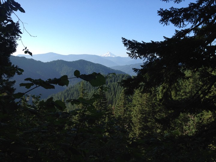
Peek-a-boo view of Mount Hood from the trail. Photo by trip reporter VeganHiker.
Hike a short section of the Pacific Crest Trail through an experimental forest up to a high point at Big Huckleberry Mountain (though the views aren't much from the top, you'll enjoy some peek-a-boos from the forest on the way up).
South Cascades


The trail's shade means you might see some cool foliage on your hike. Photo by Susan Saul.
With only 350 feet of total elevation gain, this trail is hikable by almost all. It also hosts an impressive old-growth forest, complete with Douglas firs, bigleaf maples and hemlocks. At about 4 miles in, you’ll get a chance to cool your feet in Bourbon Creek.
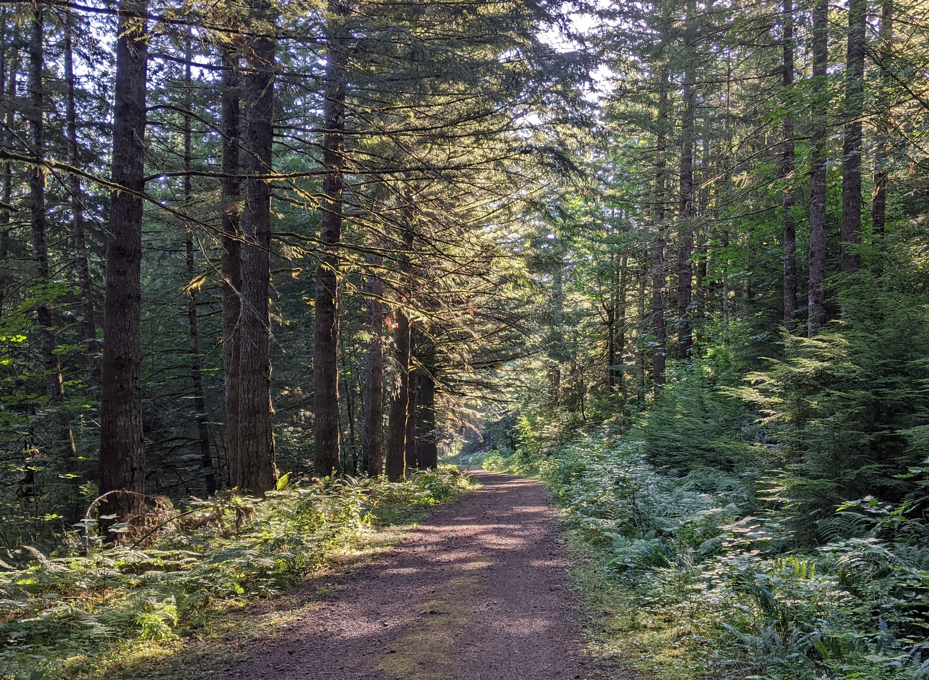
A shady walk on the Appaloosa Trail. Photo by Windwave.
Meander through the forest on this trail, walking alongside creeks and eventually reaching Hidden Falls where you can take a breather before heading back. Appaloosa Trail is a great hike all on its own, but it also connects to the longer Tarbell Trail Loop if you're hoping for something longer.
Central Cascades


Creeks, waterfalls, bridges, and shady canopies galore on the Kelley Creek trail. Photo by YoshiSan.
Traverse underneath old bridges and the concrete remains of trestle supports. Be sure to take time to pause and read the interpretive signs sprinkled along the beginning portions of this shade-filled hike to learn a little of the history of this area. Bonus: WTA worked here to connect the old Kelley Creek trail, allowing greater accessibility to the Iron Goat trail.

The tall trees along the first couple miles of the trail to Heather Lake protects hikers from the hot sun or classic PNW drizzle. Photo by trip reports Brian W. Kim.
Though the trail eventually opens up, the first section of the trail to Heather Lake near Lake Wenatchee (not to be confused with the popular trail on the Mountain Loop Highway) wanders through old-growth forest, with hemlock and cedars providing plenty of shade for hikers.

Interpretive signs tell hikers more information about the area's flora. Photo by trip reporter jkwayland.
This tree-lined trail is a wonderful place to learn about woodland ecosystems with 25 different interpretive stops and five log benches throughout that provide fascinating views. It also gives insight into an area recovering after a burn towards the end of the trail.
Snoqualmie Region


A quiet trail through the trees in the busy Snoqualmie area? Absolutely. Photo by I-90 Hiker.
Looking for a shady, less-traveled hike along the I-90 corridor this summer? Try hiking the CCC Road: Upper Trailhead. Enjoy small stream crossings, peek-a-boo views and verdant forest as you meander along this 1930s-era Civilian Conservation Corps-built road.
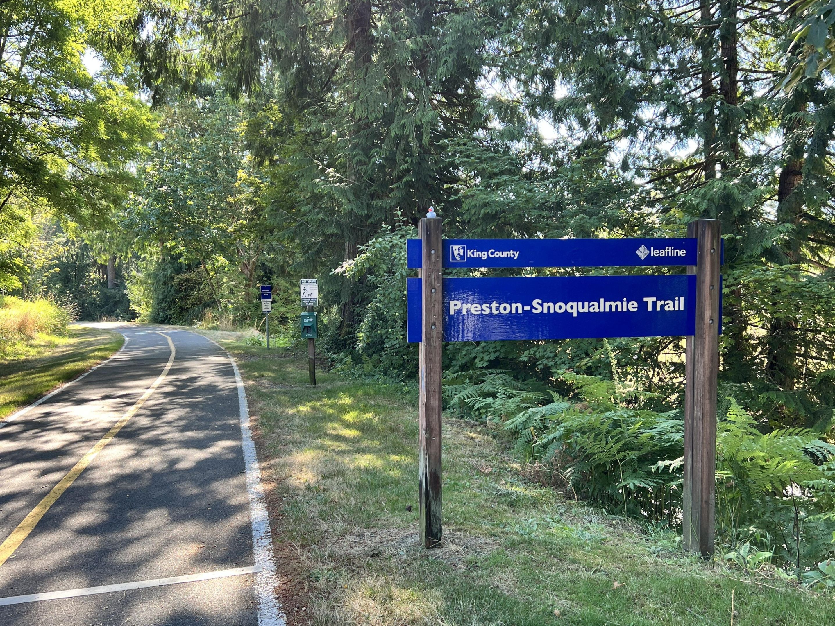 The long Preston-Snoqualmie Trail is surrounded by trees and shaded in several segments. Photo by trip reporter BeaverDawg.
Open to hikers, bikers and equestrians, this trail meanders through a densely wooded path, and intermittently offers unique perspectives of the Snoqualmie River Valley. Ultimately, it leads to a quiet, zoomed-out viewpoint of Snoqualmie Falls against the backdrop of Mount Si.

This mild trail starts from the same trailhead as the Annette Lake trail. Photo by vikr.
The Asahel Curtis Nature Trail, named after a prominent Seattle photographer, is a super short loop just off of Interstate 90. With plenty to keep little ones occupied, and just enough length to give your legs a little workout, this is a delightful detour for anyone venturing west or east over Snoqualmie Pass.
North Cascades


Cast away your cares and cool off with a dip in lovely little Peek-A-Boo Lake. Photo by TruckinTrunks.
Start in second-growth forest that quickly gives way to old-growth. Lovely Peek-a-Boo lake gets little traffic and even less in the way of regular trail maintenance, but what you’ll find here instead is solitude and a great place for a summer swim.

Lots of shade and streams, but little traffic on the Swift Creek Trail. Photo by DaphneF.
There are no bridges built to ford either Swift Creek or Rainbow Creek, so late summer is a perfect time to hike this relatively seldom-visited portion of the Pacific Northwest Trail, as water levels tend to be lower. Route-finding may be necessary on this shade-and-stream-filled hike.

The foliage provides shade on much of this hike, though it opens up for this waterfall. Photo by jennekehikes.
This relatively short trail takes hikers through a mossy forest to the Sourdough Creek waterfalls. If you have littles or hikers in your party that could use rests along the way, there are a few benches on the trail, so this is also a great hike for hikers of many experience and skill levels.
Eastern & Central Washington
Dishman Hills Natural Area - Deep Ravine Loop Trail

-
 Length
- 2.0 miles, roundtrip
-
 Elevation Gain
- 200 feet

Even in the heat of summer, hikers can find shade on this trail in the Dishman Hills. Photo by TransitTrekker.
You'll have your pick of trails when you hike in the Dishman Hills Natural Area, and the Deep Ravine Loop trail is a good option if you're hoping to find some shade. There's plenty to see here, as it's a showcase of the valley's geology, and — as a bonus on hot days — the moisture-rich ravine tends to stay cooler than the surrounding area.


Find shade and relative solitude at Umtanum Creek Falls. Photo by JimK.
An easy ramble underneath Douglas fir and Ponderosa pines, culminating at a sweet, 40-foot waterfall that sometimes cascades and sometimes trickles into the clearly defined bowl beneath. Enjoy the views from the top, or scramble below to feel the cooling mists.
Olympic Peninsula


A perfect place to cool off in the heat of a summer afternoon. Photo by DonnaK.
A delight for those who love wandering in the woods, Duckabush offers moss, ferns, old-growth tree canopies and a gorgeous blue-green river rushing nearby. This is an old burn area, and WTA volunteers and staff are often on trail to clear fallen trees and make repairs.

A wooden bridge over a stream along the Tunnel Creek trail. Photo by Phacelia.
Although no actual tunnel exists on the Tunnel Creek trail, you will find two charming lakes, stands of old-growth Douglas fir and hemlocks and shade aplenty.
Puget Sound and Islands

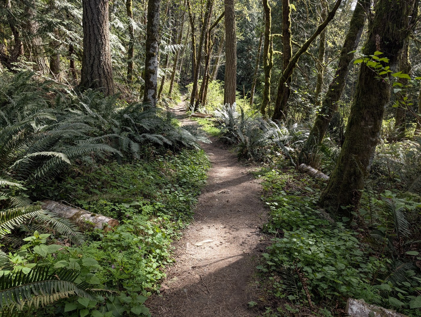
Get away from it all without leaving the city. Photo by ejain.
This 350-acre preserve of undisturbed old-growth forest is accessible by public transportation — a bus stop is located directly across from the parking lot — making this urban retreat even easier to enjoy on a hot summer day.

Explore 17 miles of non-motorized trails at Black Diamond Open Space. Photo by earthisawakening.
Two miles north of Black Diamond (and less than an hour from Seattle) lies this 1,240-acre swath of forest, wetlands, peat bogs and streams. Bonus for birders: The area is one portion of the Wildlife Habitat Network, offering a protected migratory corridor for wildlife. Double bonus: Public transportation options exist for trailhead access.

The contrast of colors at Washington Park makes for spectacular scenery. Photo by Kijo.
Washington Park offers a multitude of trails that go between shady forest and the sunny bluffs overlooking the water. Do the loop to take in all the scenery, then end at the beach and boat dock for a swim.