Spring wildflower hikes in Central Washington
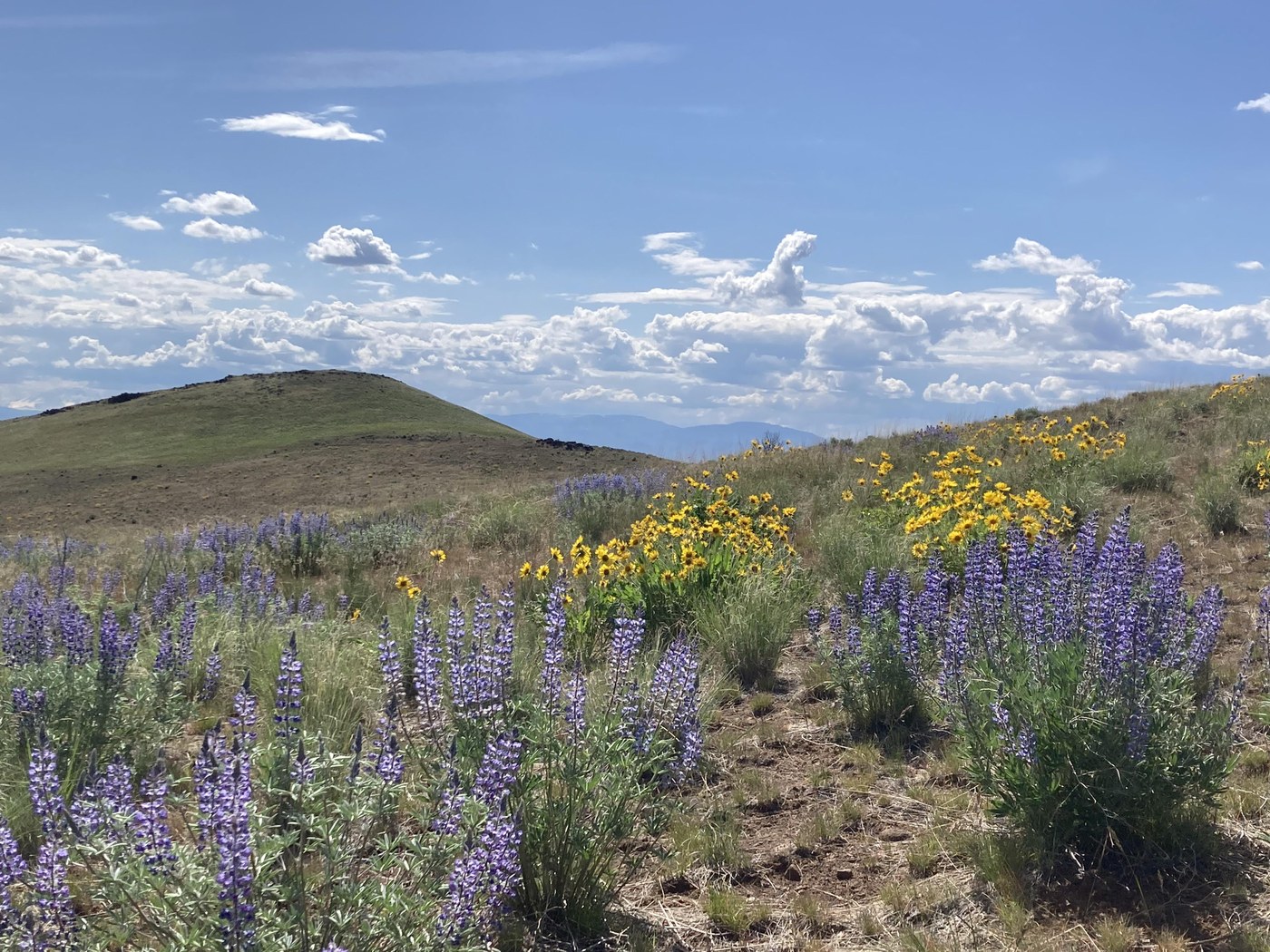 Blue skies, balsamroot, and lupine create a spectacular landscape along the Yakima Skyline Trail. Photo courtesy of trip reporter LJose.
Each year, the foothills and shrub-steppe areas of Central Washington explode with vibrant color as balsamroot, lupine, phlox and other wildflowers appear.
Arrowleaf balsamroot blooms in bunches of golden yellow, dotting entire hillsides and creating a perfect backdrop with every step. It’s no secret that Central Washington is the place to be if you’re looking for show-stopping views and Insta-worthy photos.
With the ability to wander the trails surrounded by blooms comes the responsibility to be good stewards of these gorgeous areas. The wildflower season usually begins in early to mid-April and peaks within a few weeks at lower elevations, often leading to heavy visitation at trails and trailheads that remain quieter throughout the rest of the year.
As you head out on your adventure, remember to walk with care, and stay on established trails to prevent crushing flowers and disturbing pollinators. Take as many photos as you want, but don’t pick wildflowers. Pack out your trash, be considerate of fellow hikers and have a backup plan if the trailhead doesn’t have capacity for additional vehicles.
Manastash Ridge - Westberg trail
Location: Central Washington > Yakima
Length: 4 miles round trip
Elevation: 1,800 feet
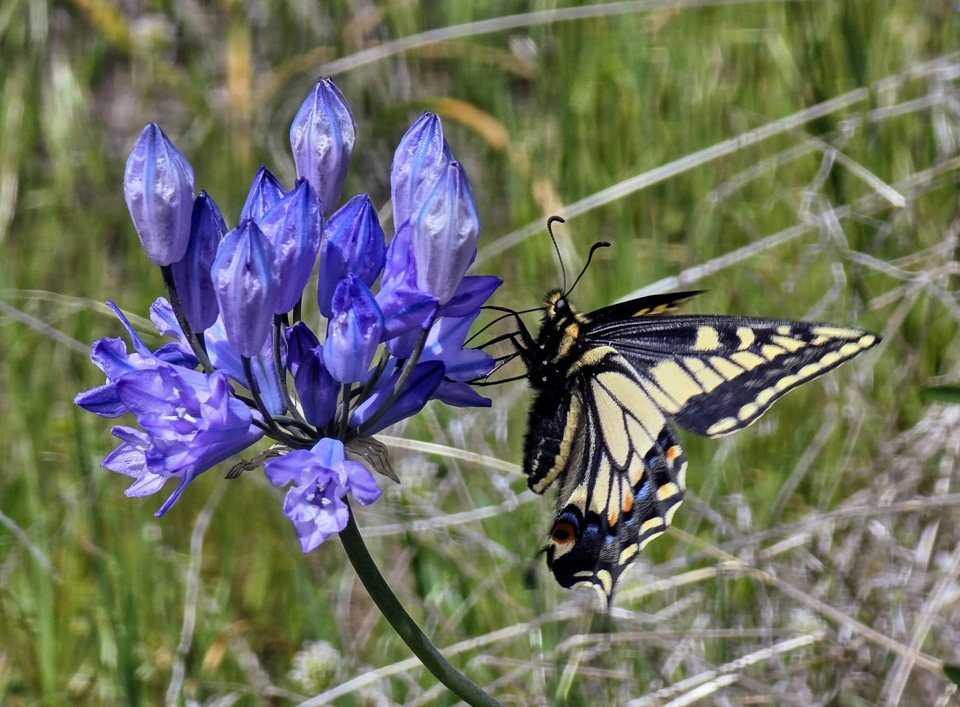 Manastash Ridge boasts a variety of both flowers and butterflies. Photo courtesy of trip reporter AlpsDayTripper.
This trail is popular with both Ellensburg locals and hikers from all over the state. There are several milder segments that wind their way to the top of the ridge, but if your quads are up for the challenge, the Westberg trail will be a steep but rewarding hike passing through wildflowers and offering sweeping views of the Ellensburg valley area and Stuart range in the distance. On a clear day, Mount Rainier and Mount Adams can also be seen from the top of the ridge.
If you’re looking for a milder route, consider the Observatory Road where you can still see the rolling hills and gorgeous blooms without the grueling hike.
> Plan your hike to Manastash Ridge - Westberg Trail using WTA's Hiking Guide
> Plan your hike to Manastash Ridge - Observatory Road using WTA's Hiking Guide
Beezley Hills Preserve
Location: Central Washington > Grand Coulee
Length: 2.3 miles round trip
Elevation: 400 feet
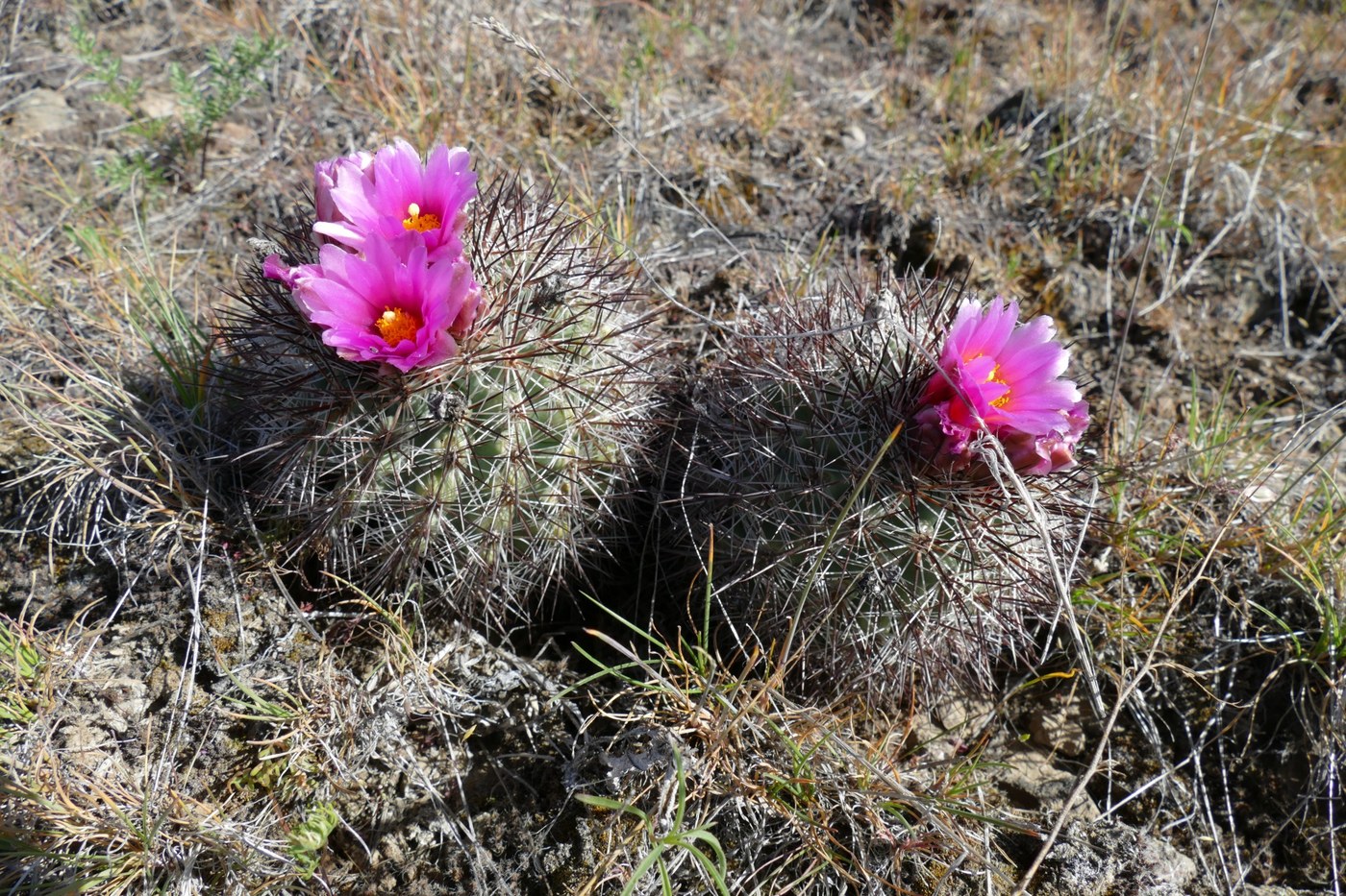 Hedgehog cacti might be harder to spot, but their bright pink flowers are a rewarding discovery. Photo courtesy of trip reporter Palü and Tuoi.
If you’re looking for solitude off the beaten path, head to Beezley Hills Preserve to find balsamroot, lupine, death camas, and hedgehog cactus, among other flowers. The trail here is short, but Beezley Hills makes an excellent stop on a trip from Ancient Lakes up to Dry Falls State Park and Grand Coulee.
> Plan your hike to Beezley Hills Preserve using WTA's Hiking Guide
> Plan your hike to Sun Lakes-Dry Falls State Park using WTA's Hiking Guide
Sage Hills Trail
Location: Central Washington > Wenatchee
Length: 5.5 miles round trip
Elevation: 650 feet
 Balsamroot and lupine blooming on the Sage Hills trail system. Photo courtesy of trip reporter rain-or-shine-hike-hunter.
This trail network offers great options for hiking, trail running or mountain biking amidst balsamroot and lupine-covered hills. The trails at Sage Hills have multiple access points, so if you get to a parking area that is full, please park at another trailhead. Horse Lake Reserve is another area close by where the flowers are equally stunning.
> Plan your hike to Sage Hills using WTA's Hiking Guide
> Plan your hike to Horse Lake Reserve using WTA's Hiking Guide
Icicle Ridge
Location: Central Cascades > Leavenworth Area
Length: 6 miles round trip
Elevation: 1,800 feet
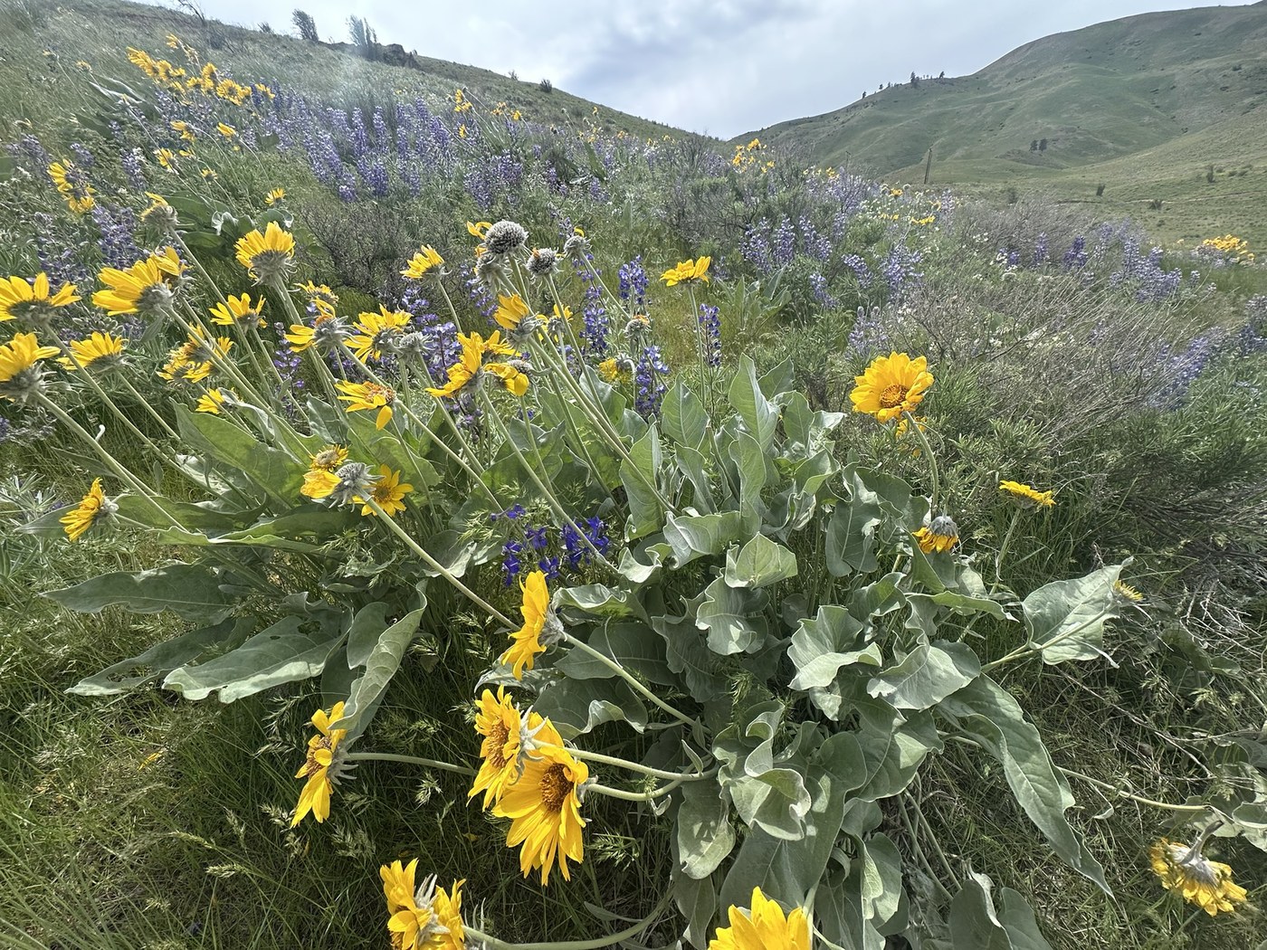
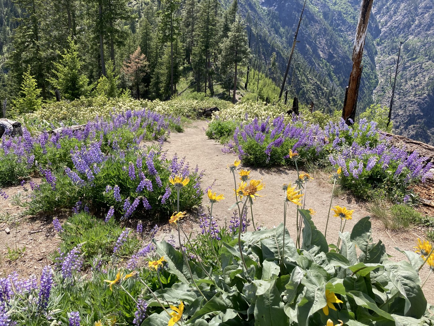 The Icicle Ridge trail offers lupine and balsamroot, plus a range of understory and shade loving blooms as you hike the wooded portions of the trail. Photo courtesy of trip reporter ElliotSchmelliot.
This hike is popular for its early season accessibility and understory wildflowers such as anemones and glacier lilies, plus larkspur, lupine and balsamroot. The trail climbs up Icicle Ridge and offers beautiful views of Tumwater Canyon and the Icicle Creek valley below. Icicle Ridge is often snow-free by the beginning of April, and spring blooms appear mid-April and usually peak a month later in mid-May.
> Plan your hike to Icicle Ridge using WTA's Hiking Guide
Coal Mines Trail & Roslyn Urban Forest
Location: Snoqualmie Region > Cle Elum Area
Length: 5.5 miles one way
Elevation: 450 feet
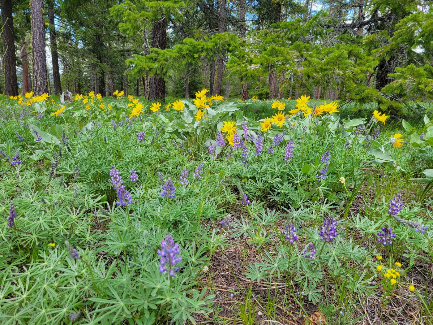 Deep purple lupine and bright yellow balsamroot bloom in large patches in and around the Roslyn Urban Forest. Photo courtesy of trip reporter bentley-edelman.
The Coal Mines Trail can be accessed along multiple points in Cle Elum, Roslyn or Ronald, offering visitors a mellow stroll within walking distance of each community. You’ll find lupine and paintbrush along this trail later in the spring and early summer, along with pockets of sweet pea and California poppies. Hikers can connect into the Roslyn Urban Forest from the Coal Mines Trail for a longer outing on the series of interconnected trails along the ridge.
> Plan your hike to the Coal Mines Trail using WTA's Hiking Guide
> Plan your hike to the Roslyn Urban Forest using WTA's Hiking Guide
Umtanum Ridge Crest
Location: Central Washington > Yakima
Length: 6 miles round trip
Elevation: 2,400 feet
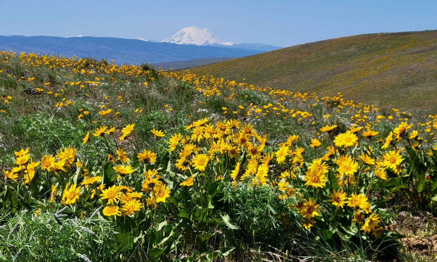 The higher you climb, the more rewarding the views on Umtanum. Photo courtesy of trip reporter Maddy.
Hike the Vista Trail to the top of Umtanum Ridge for breathtaking views of Yakima Canyon and hillsides covered in yellow-gold balsamroot. The parking lot has ample parking as well as campsites that are first-come, first-serve until May 1, after which they are reservable on recreation.gov. Be sure to bring your Northwest Forest or America the Beautiful pass, or be prepared to pay the $5 fee for parking.
> Plan your hike to Umtanum Ridge Crest using WTA's Hiking Guide
Yakima Skyline Trail
Location: Central Washington > Yakima
Length: Varies
Elevation: Varies
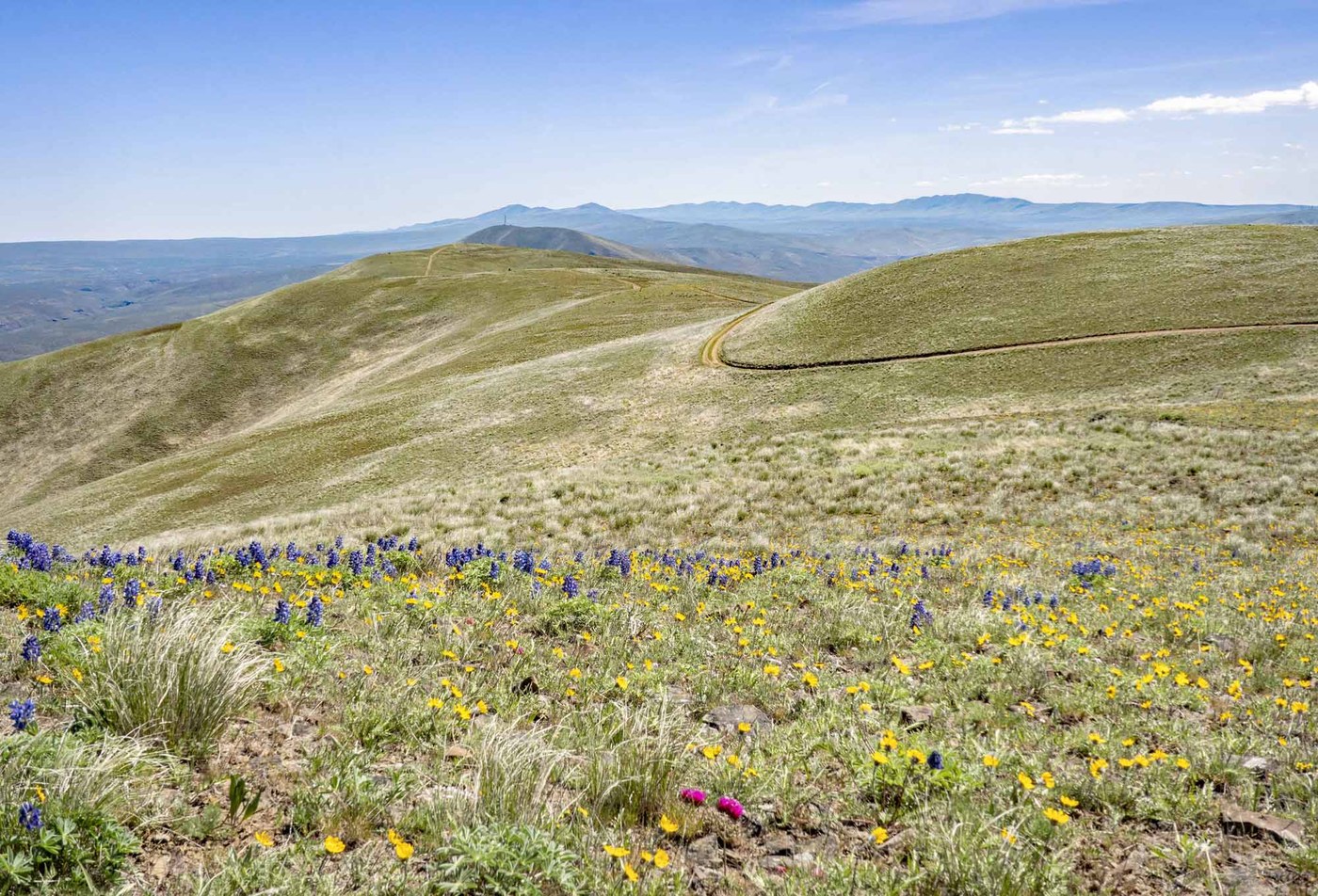 If you're looking for big skies, wide stretches of flowered hills and relative solitude, head to the Yakima Skyline Trail. Photo courtesy of trip reporter mytho-man.
Another beautiful and relatively quiet route that takes you atop the ridgeline and offers sweeping views of Yakima Canyon and surrounding fields of wildflowers. Balsamroot shares the stage with phlox, lupine and clover. Two miles in, the trail offers a view of the almost 500-foot Roza Dam. Farther up, Mount Adams and Mount Rainier can be seen in the distance. Parking here is in a primitive lot with no water or restrooms. Be sure to bring plenty of water for your hike.
For those looking for a higher mileage point to point hike, you can start here and traverse 15 miles, dropping down into the Umtanum Ridge trailhead.
> Plan your hike to Yakima Skyline Tail using WTA's Hiking Guide


