Trails for everyone, forever

Home Go Hiking Hiking Guide Trapper Creek

Trapper Creek

Southwest Washington > Lewis River Region
45.8816, -121.9800 Map & Directions
Length
13.0 miles, roundtrip
Elevation Gain
3,050 feet
Highest Point
4,207 feet
Calculated Difficulty About Calculated Difficulty
Hard
Trapper Creek. Photo by Dean.
  • Dogs allowed on leash
  • Good for kids
  • Old growth
  • Rivers
  • Waterfalls
  • Wildflowers/Meadows
  • Wildlife

Parking Pass/Entry Fee

Northwest Forest Pass
Saved to My Backpack

This trail climbs from the Trapper Creek trailhead through an old-growth forest to views of the many mountains of the South Cascades from Observation Peak. Continue reading

Rating
3.71 out of 5

(7 votes) Log in to rate

Hiking Trapper Creek

This trail climbs from the Trapper Creek trailhead through an old-growth forest to views of the many mountains of the South Cascades from Observation Peak. Some portions of the trail were burned in the Big Hollow Fire in 2020.

Shortly after beginning your hike, your route crosses the Dry Creek Trail. At the first junction near the wilderness boundary, take a right onto the Observation Trail.

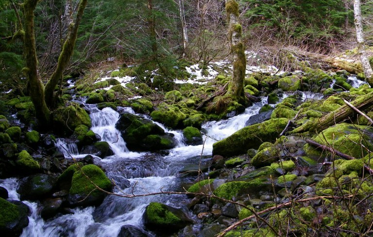
Stay left, and continue hiking through old-growth forest, along babbling brooks in quiet forest for 5.1 miles to the summit of Observation Peak.

It's possible to make this hike a loop by following the Observation Peak trail around the summit of the peak and back down the way you came, rejoining the Trapper Creek Trail a mile from the trailhead.

If you opt to do this, your total mileage will be 10.5 miles.

Toilet Information

  • Toilet at trailhead

More information about toilets

WTA worked here in 2022, 2021, 2020, 2019 and 2018!

Trapper Creek

Map & Directions

Trailhead
Co-ordinates: 45.8816, -121.9800 Open in Google Maps

Before You Go

See weather forecast

Parking Pass/Entry Fee

Northwest Forest Pass

WTA Pro Tip: Save a copy of our directions before you leave! App-based driving directions aren't always accurate and data connections may be unreliable as you drive to the trailhead.

Getting There

From Carson, follow the Wind River Road north for about 13.5 miles. Make a left on Mineral Springs Road (FR-3065). At Following the Trapper Creek Wilderness sign, take the next right onto Little Soda Springs Road (some maps refer to Trapper Creek Road/NF 1504) and follow it for about a half mile to the trailhead.

More Hike Details

Trailhead

Southwest Washington > Lewis River Region

Trapper Creek (#192.1), Observation Trail (#132), Observation Peak (#132A)

Gifford Pinchot National Forest, Mount Adams Ranger District

Guidebooks & Maps

Day Hiking: Columbia River Gorge (Romano - Mountaineers Books)

Buy the Green Trails Wind River No. 397 map

You can improve or add to this guidebook entry!

Trapper Creek

46 Trip Reports

Hiked here recently?

Submit a trip report!
 
Trip Reports