24 Trails Worth the Trip: Take a Scenic Drive to the Trailhead
Supported by your Western Washington Honda Dealers
Many of us depend on nearby trails to get a daily dose of the mental and physical benefits of being outside. But an advantage of living in Washington is that even the drive to a trailhead can be fantastically scenic. Our state is filled with breathtaking forest roads and scenic highways that make getting to the trailhead (even if you encounter a few potholes) a lot more fun.
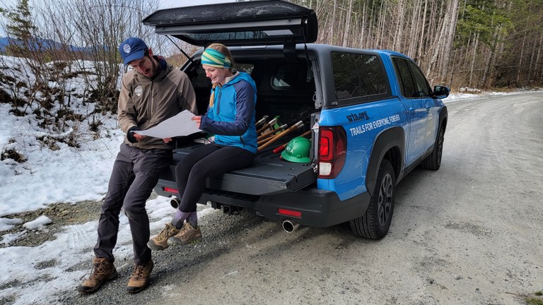
WTA has worked with our presenting partner, Western Washington Honda Dealers, to highlight some especially pretty drives to trailheads. Western Washington Honda Dealers has been a leading supporter of WTA by powering our trail work through donated vehicles and financial support of our programs. They’ve even put boots to the ground, joining WTA on work parties to maintain the wild places hikers depend on.
Before you head out, be sure to check current conditions using WTA's Hiking Guide. And check out WTA's Hike Finder Map, which has layers that can tell you about where wildfires are and the air quality in the area. Long trips are also a great reason to carpool or even combine your hike with a camping or backpacking trip.
Olympic Peninsula
Shi Shi Beach and point of the arches
Location: Pacific Coast
Length: 8 miles, roundtrip
Elevation gain: 200 feet
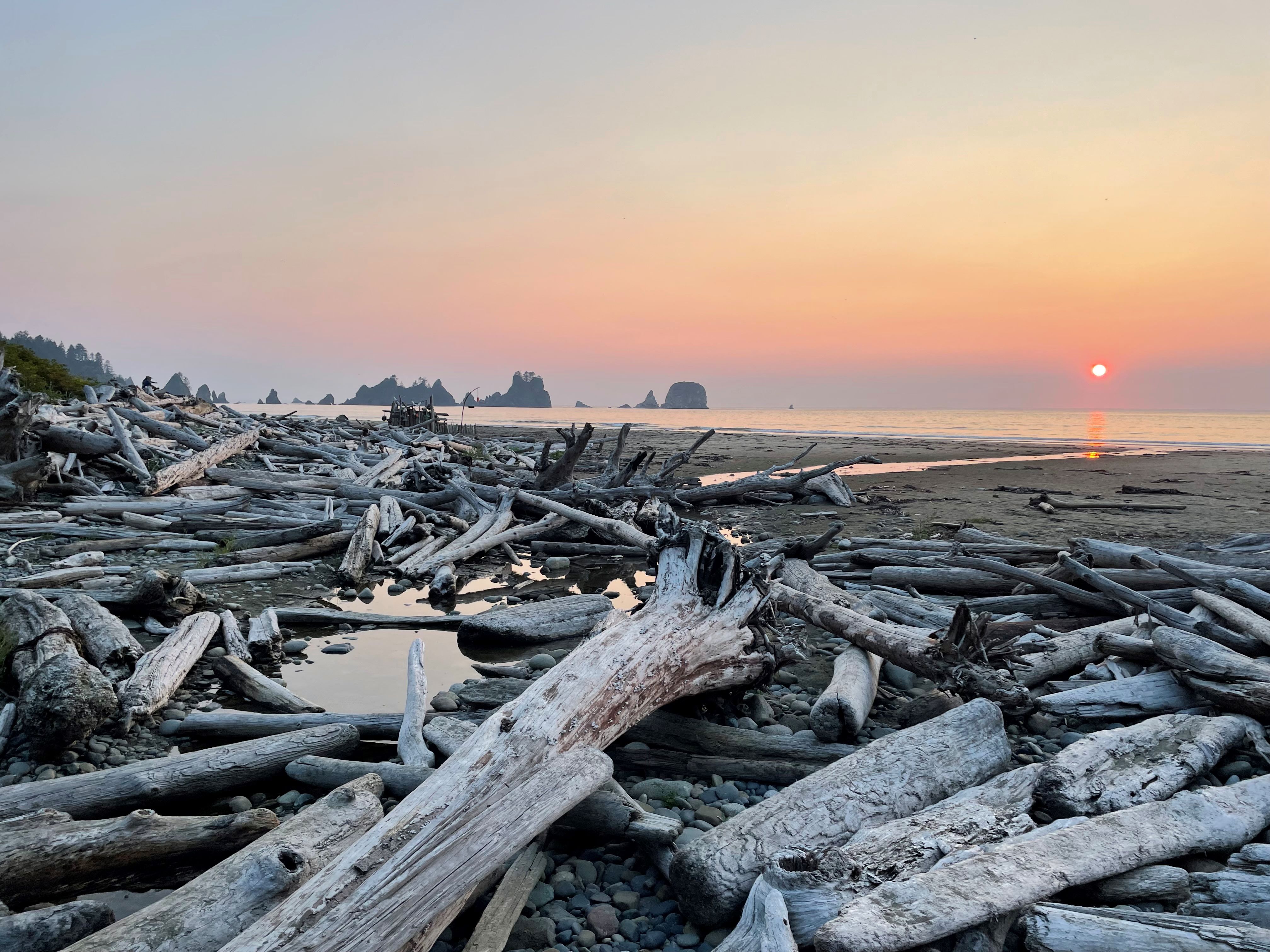
Shi Shi Beach at sunset. Photo by tvut.
The last section of this drive is along Highway 112, which hugs the northern coast of the Olympic Peninsula. Throughout your trip to the trailhead, you’ll be treated to views of the Salish Sea. It’s good to note that the trail to Shi Shi Beach is pretty muddy most of the time, but you’ll be rewarded with a fairly flat trail to a beautiful destination.
> Plan your trip to Shi Shi Beach and Point of the Arches using WTA's Hiking Guide
Lower Big Quilcene River
Location: Hood Canal
Length: 12.9 miles, roundtrip
Elevation gain: 1,890 feet
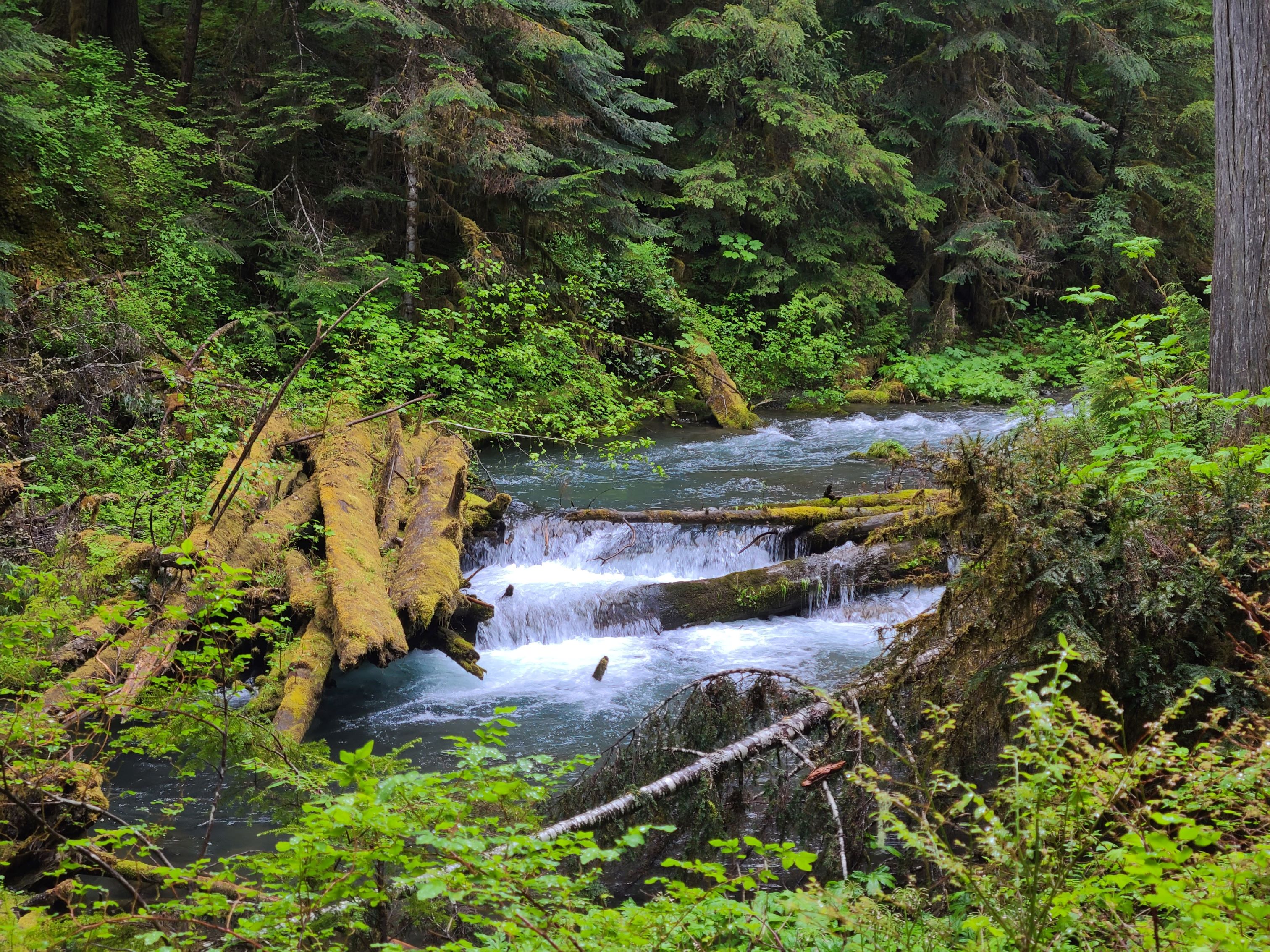
Lush, green forest surrounds the Lower Big Quilcene River. Photo by Luffles.
Highway 101, along the Hood Canal side of the peninsula, offers a journey along the sound and foothills of the Olympics. This trail is truly a “choose your own adventure” scenario, with several campsite options along the way for turning your adventure into a backpacking trip. While destinations high in the Olympics may get early-season snowfall, Lower Big Quilcene is a great shoulder season option.
> Plan your hike on the Lower Big Quilcene River using WTA's Hiking Guide
Quinault Rainforest Nature Loop
Location: Pacific Coast
Length: 0.5 miles, roundtrip
Elevation gain: 40 feet
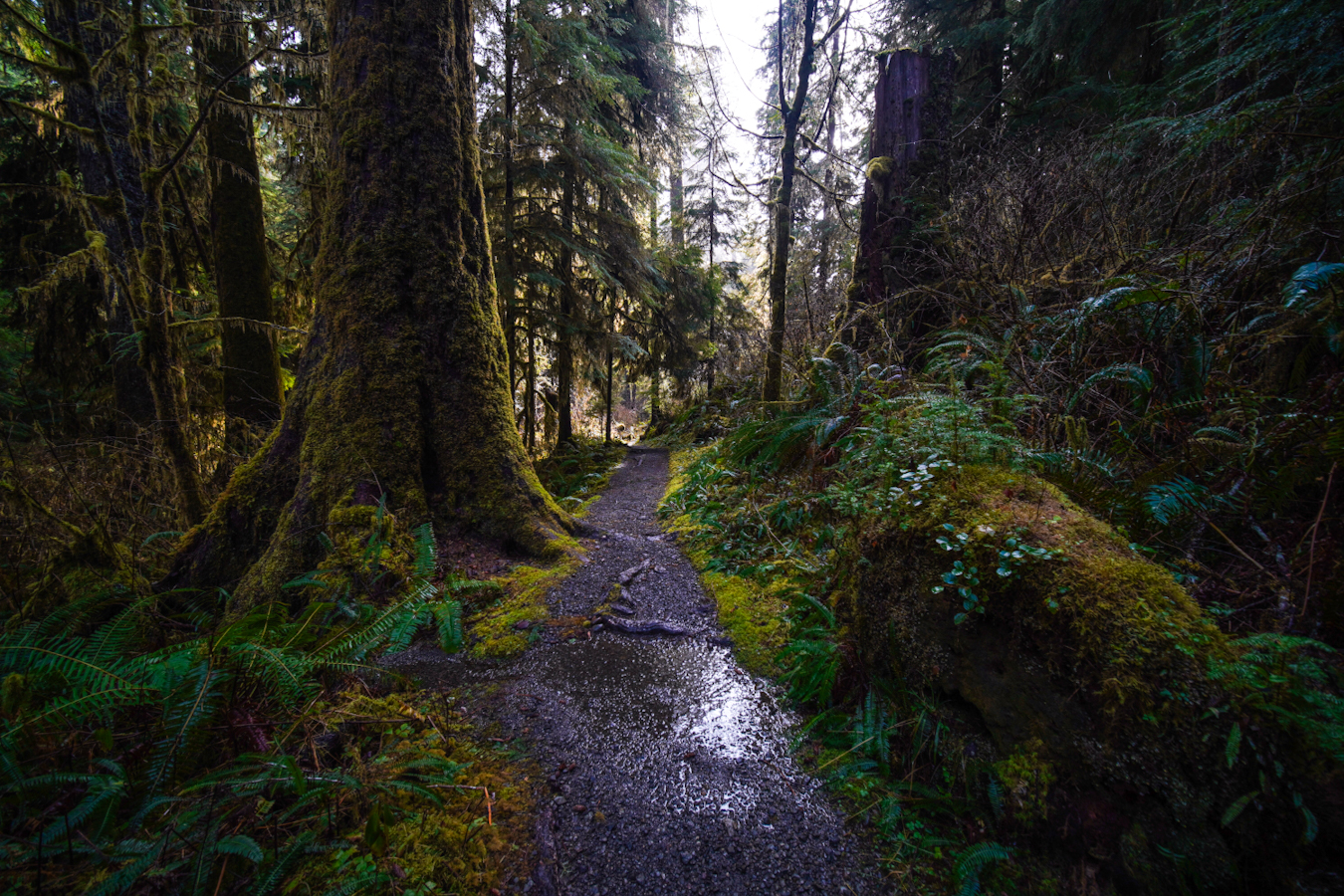
This short hike is a stunner in fall once the leaves start to change color. Photo by Brittanywanderlust.
Dive into Washington’s incredible rainforest when exploring this section of Highway 101. Lake Quinault is a destination in and of itself, with camping options nearby. This short trail is kid- and dog-friendly, and will leave you in awe of Washington’s forests.
> Plan your hike on the Quinault Rainforest Nature Loop using WTA's Hiking Guide
North Cascades
Artist Ridge - Huntoon Point
Location: Mount Baker area
Length: 1.2 miles, roundtrip, but boundless options to extend or shorten your trip
Elevation gain: 200 feet
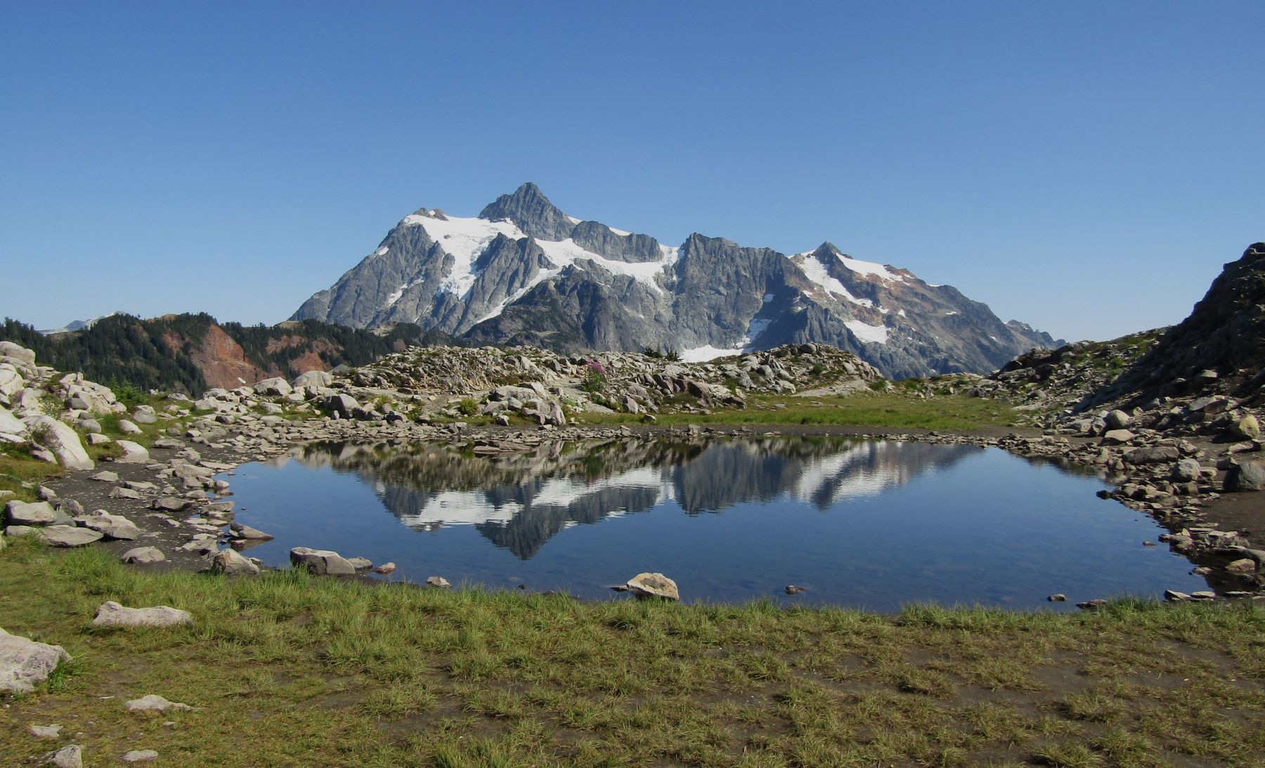
Many trails at Artist Point offer stunning views of speaks like Mount Shuksan. Photo by Ups and Downs.
This is many WTA staffers’ favorite drive in Washington, and for good reason: The views as you wind up the road to Artist Point are nearly as good as the views from the trails. Artist Point is an excellent jumping-off point for a range of hikes — for instance, the short Fire and Ice Trail or the 9-mile stunner Ptarmigan Ridge, which lands you remarkably close to Mount Baker. WTA pro tip: There are ongoing trail construction projects throughout the Artist Point area in 2023. Only Table Mountain is closed, but be prepared for detours.
> Plan your trip to Artist Ridge - Huntoon Point using WTA's Hiking Guide
Oval Lakes
Location: Methow/Sawtooth
Length: 20 miles, roundtrip
Elevation gain: 6,720 feet
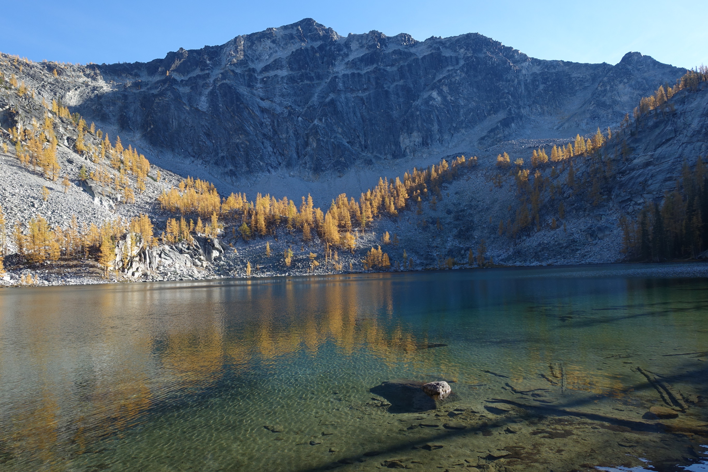
Visit these stunning lakes for some solitude... and larches! Photo by Perry.
With Highway 20’s intermittent closures in 2023, this hike is best enjoyed by those approaching from the east side of the North Cascades Highway. Be sure to obey any road closures and keep up to date on current conditions in the area (WTA's Hiking Guide is a great resource for this). This long hike makes an excellent backpacking trip through a burn area from a wildfire in 2018. And the high mountain lake offers a breathtaking trip for those seeking solitude.
> Plan your hike to Oval Lakes using WTA's Hiking Guide
Goat Mountain
Location: Mount Baker area
Length: 8.2 miles, roundtrip
Elevation gain: 3,100 feet
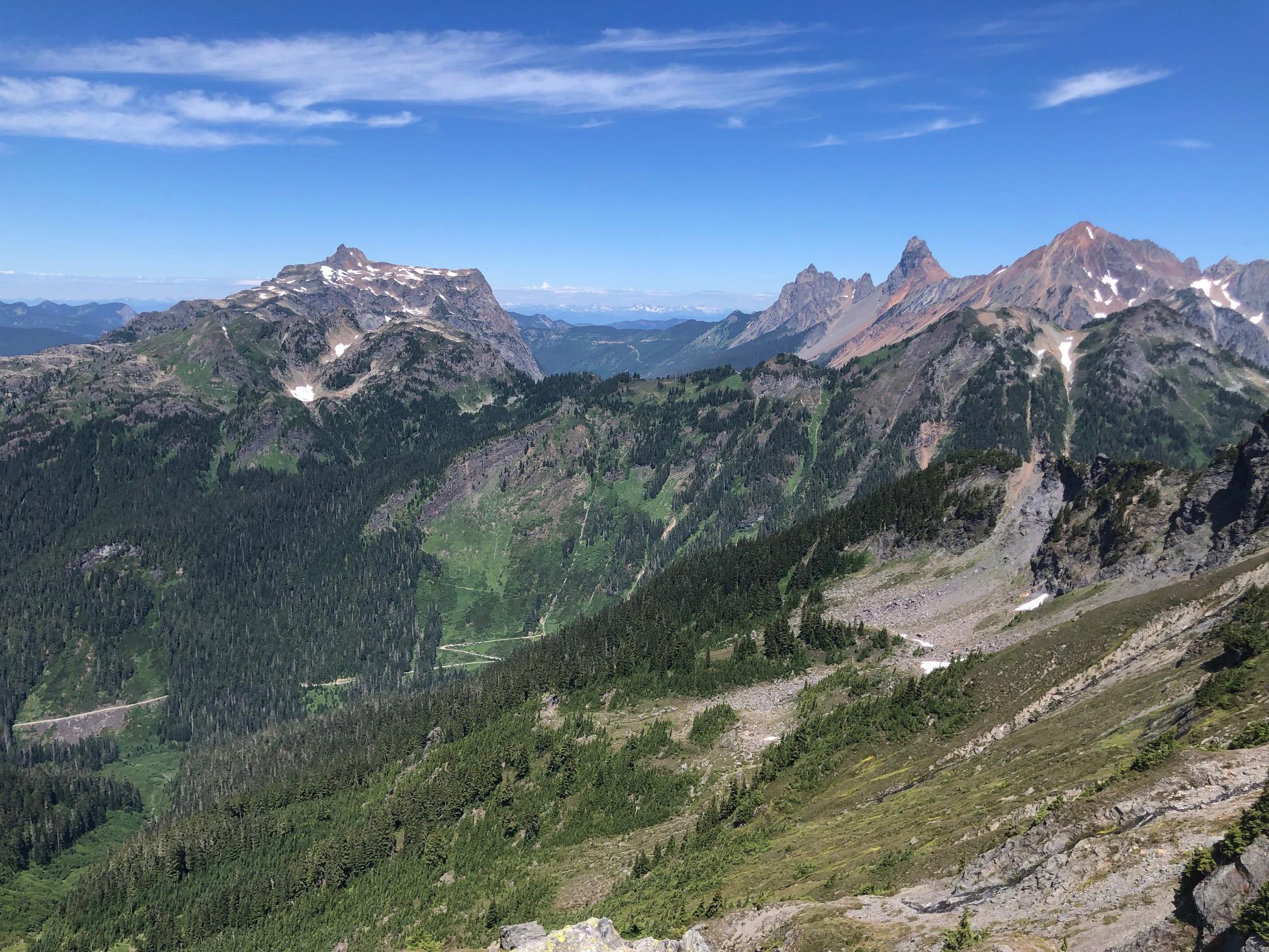
The North Cascades greet you from the top of Goat Mountain. Photo by dolomighty.
If you’re looking for other options along Highway 542 but want a bit more solitude, turn off early for the Goat Mountain trail. You’ll work hard for the excellent views of Mount Baker, Mount Shuksan and other peaks on this trail, plus alpine meadows. In the fall, you might be lucky enough to be rewarded with huckleberries for your efforts.
> Plan your trip to Goat Mountain using WTA's Hiking Guide
Central Cascades and Mount Rainier
Golden Gate
Location: Mount Rainier - Longmire/Paradise
Length: 3.2 miles
Elevation gain: 1,000 feet
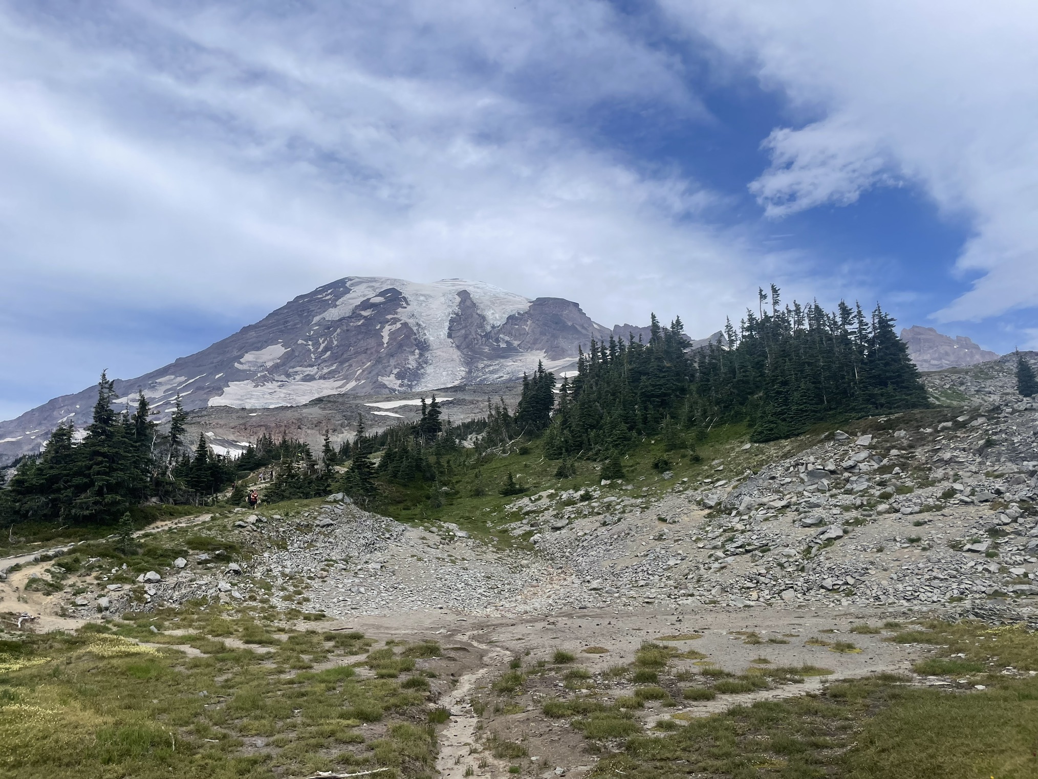
Views of Rainier from the road or the trail never get old. Photo by Pnwtrailsandtails.
Any drive through Mount Rainier National Park is sure to be a stunner. A particularly fun section is visiting the Paradise area from the Nisqually entrance. There is a wealth of wonderful trails from this section of the park, but Golden Gate has it all: seasonal views of wildflowers or fall colors, the Tatoosh Range and — of course — the main attraction, Mount Rainier itself. Be sure to check before traveling to the area if a reservation is needed to enter the park during your chosen hours.
> Plan your hike on the Golden Gate trail using WTA's Hiking Guide
Entiat River Trail
Location: Entiat Mountains/Lake Chelan
Length: 15.25 miles, roundtrip
Elevation gain: 2,690 feet
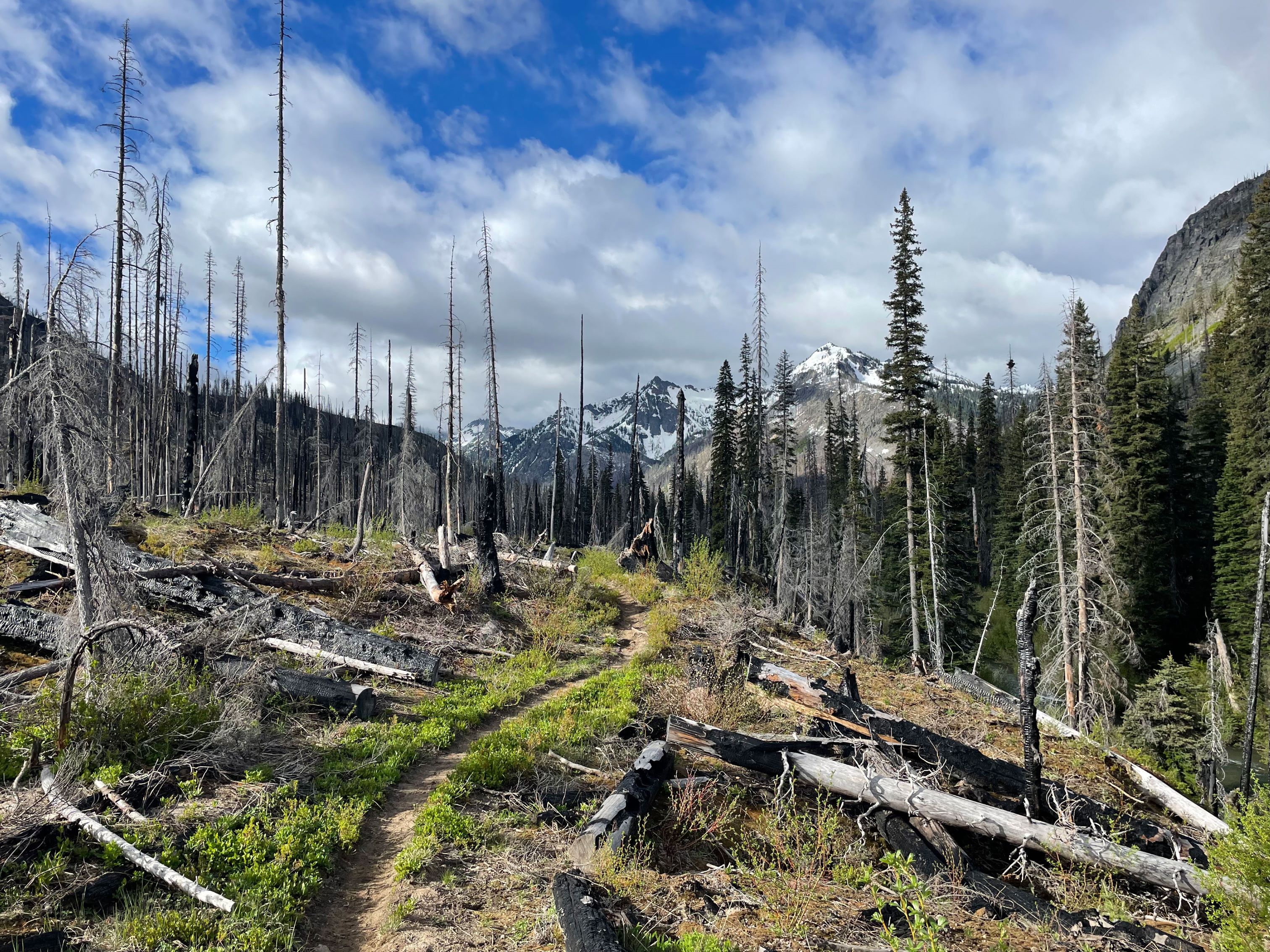
We can see why hikers describe this trail as a "backpacker’s paradise." Photo by jndupuy.
WTA’s Lost Trails Found crew has worked hard to recover trails in the Entiat after a wildfire in 2015. This entire area is considered a backpacker’s paradise, and the views begin before you even reach the trailhead. This trail is fairly exposed, so go prepared with sufficient water and sun protection.
> Plan your hike on the Entiat River using WTA's Hiking Guide
Lake Valhalla
Location: Stevens Pass - East
Length: 7 miles, roundtrip
Elevation gain: 1,500 feet
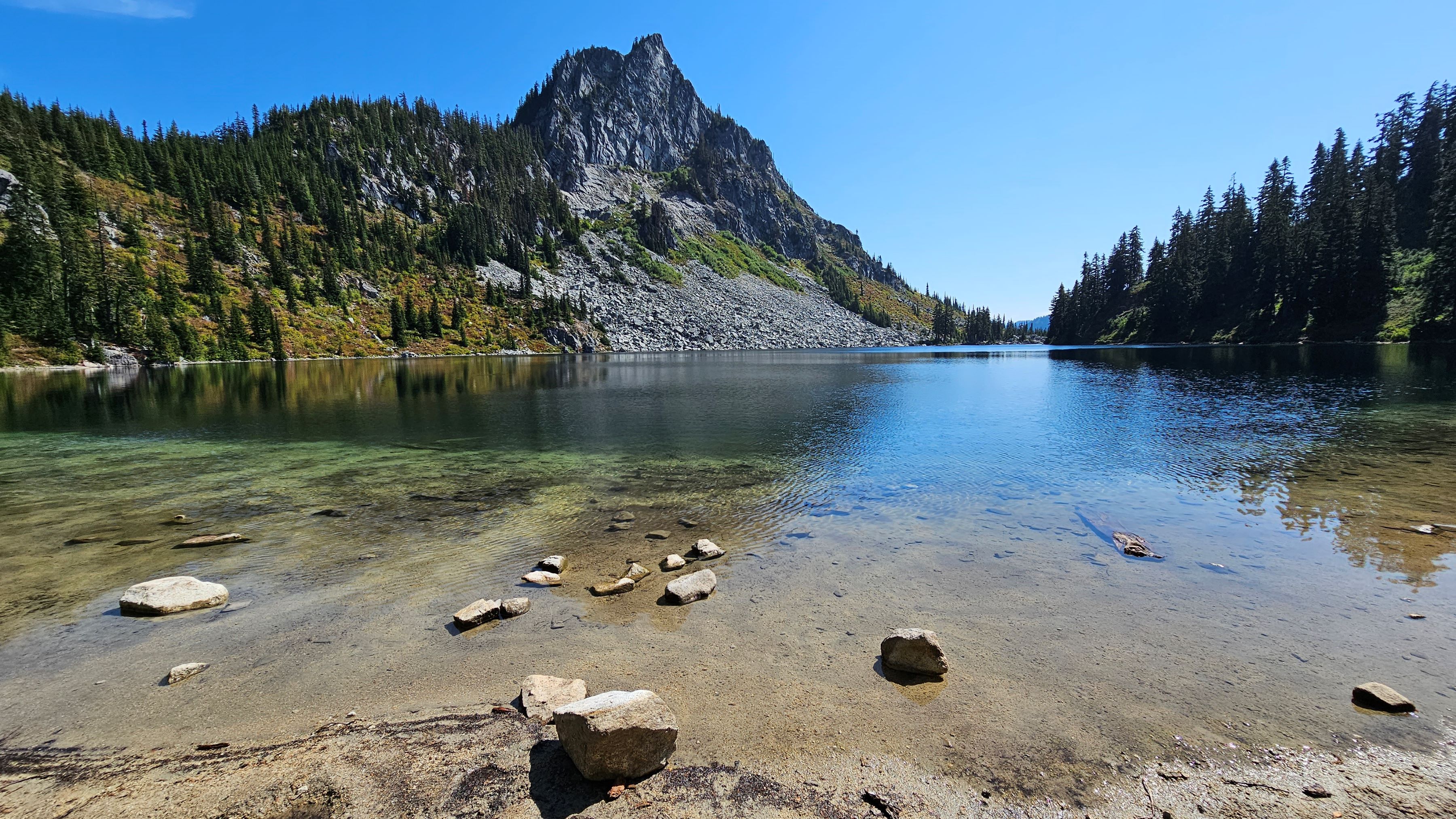
The calm waters of Lake Valhalla, under the towering Lichtenberg Mountain. Photo by Rayan.
If you’re driving east, the trailhead for Lake Valhalla is right after some of the most dramatic scenery along Stevens Pass. This hike joins up with the PCT — say hello or maybe even perform a little trail magic for the thru-hikers you’ll likely encounter on trail here in the fall. Once you arrive at your destination, you’ll see a beautiful lake tucked under two mountain peaks. Consider making a side trip up Mount McCausland for sweeping mountain views.
> Plan your hike to Lake Valhalla using WTA's Hiking Guide
Lake Wenatchee State Park
Location: Stevens Pass - East
Length: 4 miles, roundtrip
Elevation gain: 70 feet
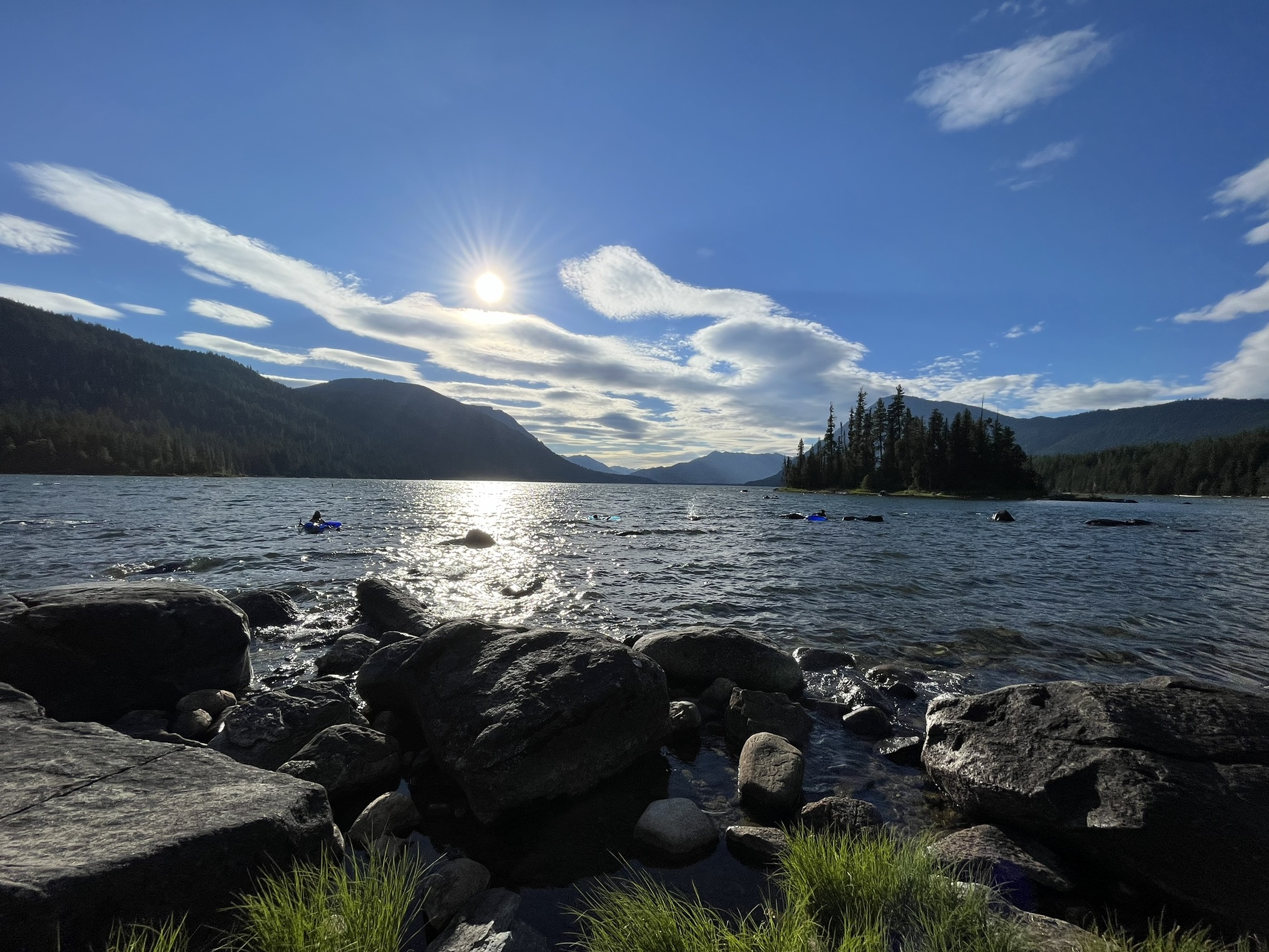
Choose your own adventure on this trail: hike, snowshoe or even kayak in the summer months! Photo by hikingwithlittledogs.
The area around Lake Wenatchee offers stunning alpine views, and this trail is a great way to experience the beauty of this region without big miles. In summer and fall, you can find people kayaking and exploring Lake Wenatchee, and in winter this hike turns into a great option for snowshoeing. There are plenty of camping options nearby if you want to extend your trip.
> Plan your trip to Lake Wenatchee State Park using WTA's Hiking Guide
Puget Sound and Snoqualmie Area
Obstruction Pass State Park
Location: San Juan Islands
Length: 1.9 miles, roundtrip
Elevation gain: 305 feet
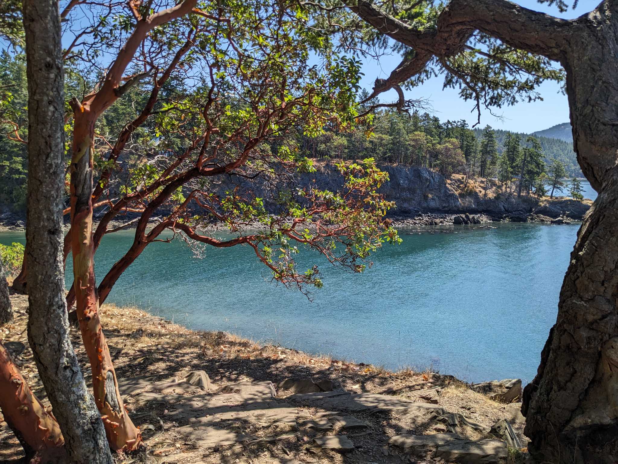
Madronas abound on this forested hike to Obstruction Pass State Park. Photo by Travel&Hike.
If you really want to make the most of your journey to a destination, there’s no better way than taking a ferry to one of Washington’s islands. Obstruction Pass State Park (not to be confused with Obstruction Island!) is located on Orcas Island, a forested gem on the Salish Sea. This short out-and-back hike takes you to a secluded beach, perfect for a lunch break. Remember that ferry reservations fill up quickly, so plan ahead to secure your spot.
> Plan your trip to Obstruction Pass State Park using WTA's Hiking Guide
Larrabee State Park - Rock Trail
Location: Bellingham area
Length: 2.4 miles, roundtrip
Elevation gain: 1,200 feet
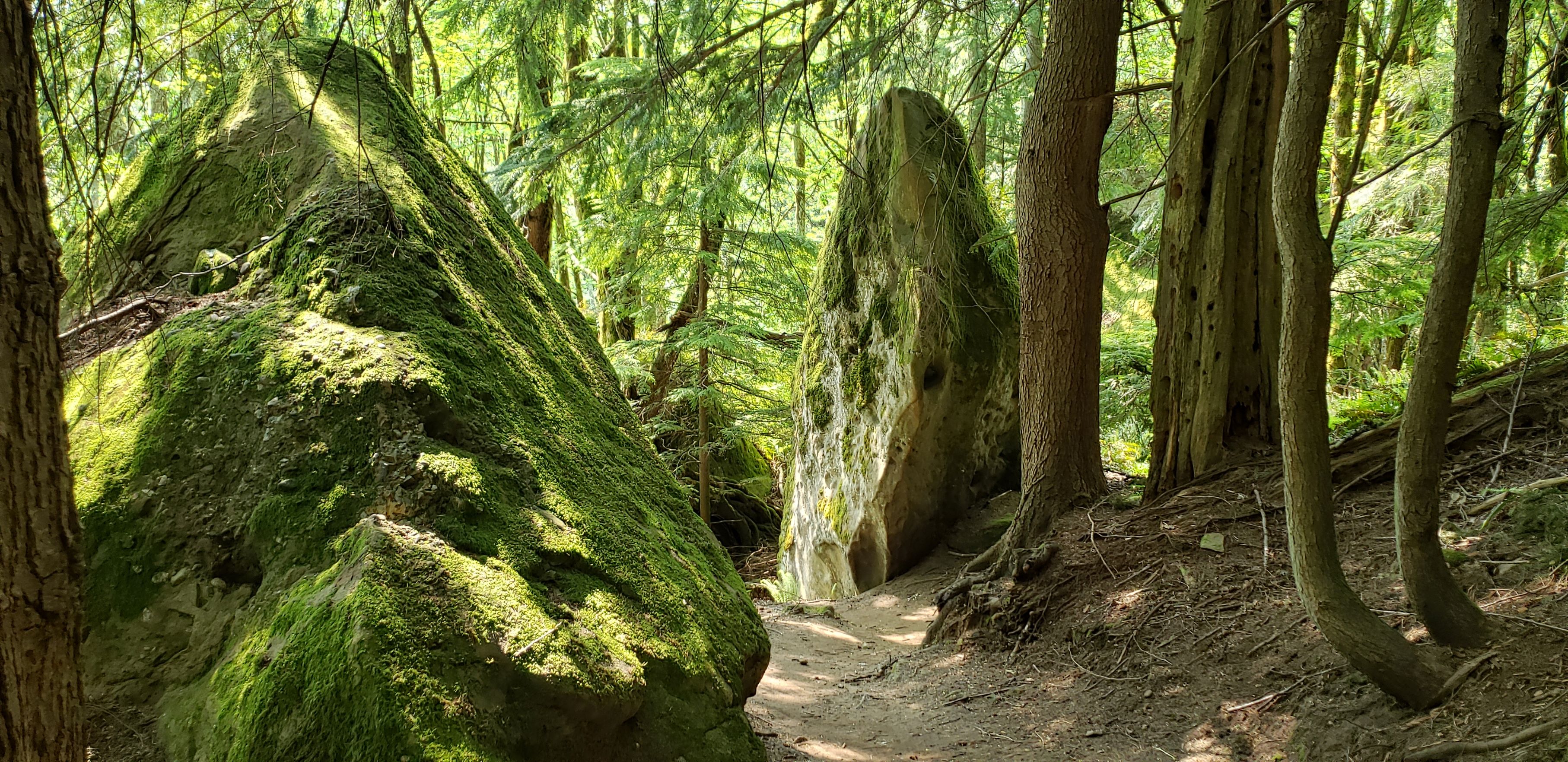
Check out fascinating rock formations on the aptly named Rock Trail. Photo by seabeav.
The Rock Trail is close to WTA’s heart — our crews built the trail, and have maintained it for well over a decade. This short, steep hike has impressive views of Mount Baker before winding into the lush forest of Larrabee State Park. On the way to the trailhead, you’ll be treated to gorgeous views along Chuckanut Drive — beautiful any time of year, but especially in fall.
> Plan your hike on the Larrabee State Park - Rock Trail using WTA's Hiking Guide
Gold Creek Trail to Alaska Lake
Location: Snoqualmie Pass
Length: 14 miles, roundtrip
Elevation gain: 2,024 feet
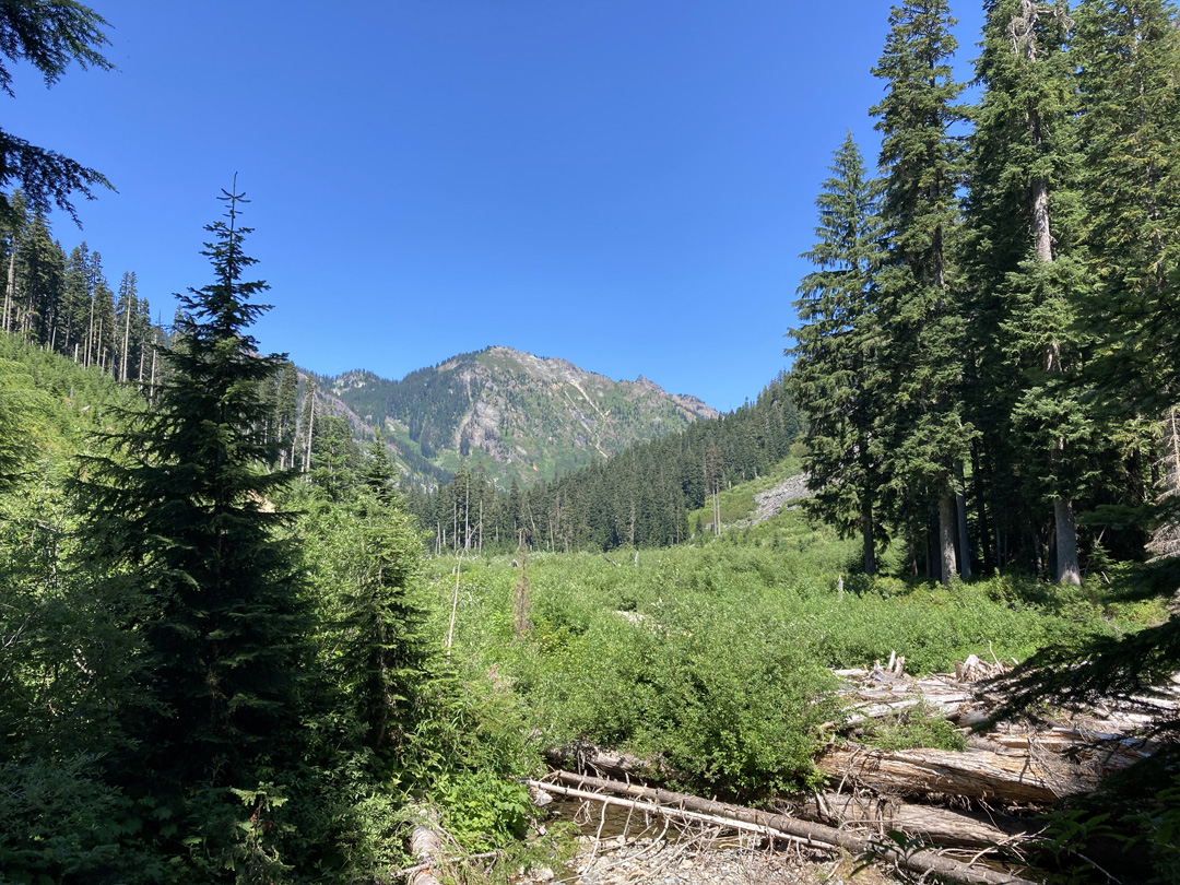
This forested hike is great at any time of year, but especially beautiful in fall. Photo by Hike-of-the-Week Club.
As part of the iconic Mountains to Sound Greenway, the Gold Greek Trail to Alaska Lake is a hike where you can get a bit of solitude in the mountains. You can expect excellent fall colors on this hike. Pro tip: If you want a shorter, flatter hike experience, you can turn back at Gold Creek, which runs high in fall and winter.
> Plan your hike on the Gold Creek Trail to Alaska Lake using WTA's Hiking Guide
South Cascades and Southwest Washington
Lewis and Clark Discovery Trail
Location: Long Beach area
Mileage: 8.2 miles
Elevation gain: 15 feet
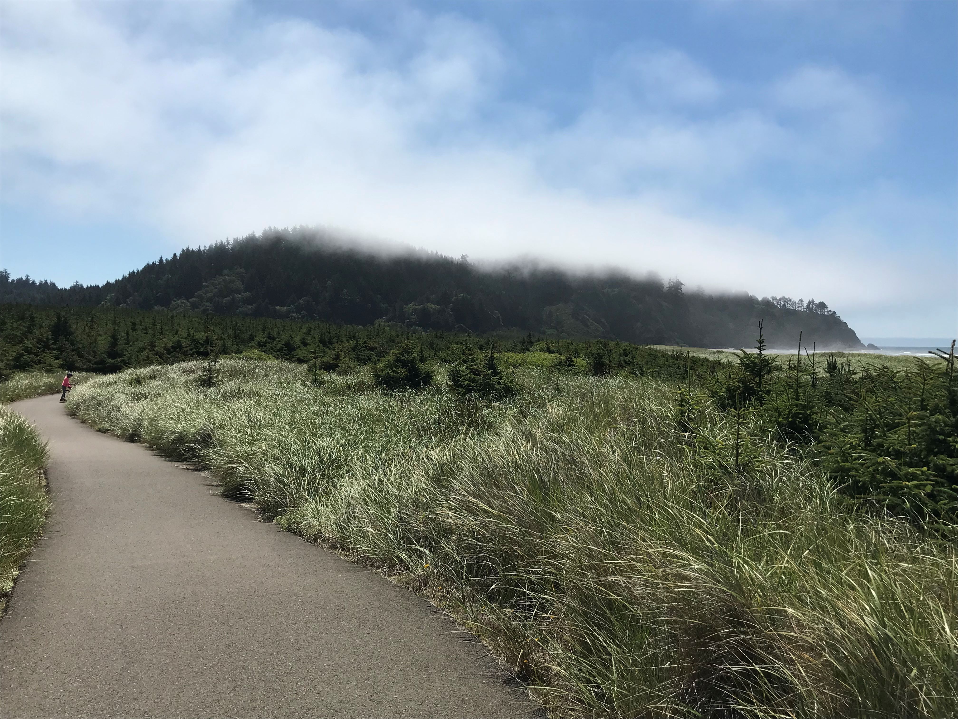
This paved trail winds among beach grasses. Photo by slow n steady.
The Lewis and Clark Discovery Trail will take you through history, with several landmarks from Lewis and Clark’s voyage. This trail has two options for hikers: a boardwalk and a paved trail. They travel next to each other for much of this trail, and it is accessible from many points within Long Beach. For stunning scenic views, we recommend driving over the Highway 101 bridge that connects Washington and Oregon over the Columbia River.
> Plan your hike on the Lewis and Clark Discovery Trail using WTA's Hiking Guide
Surprise Lake
Location: Goat Rocks
Length: 13 miles, roundtrip
Elevation gain: 1,505 feet
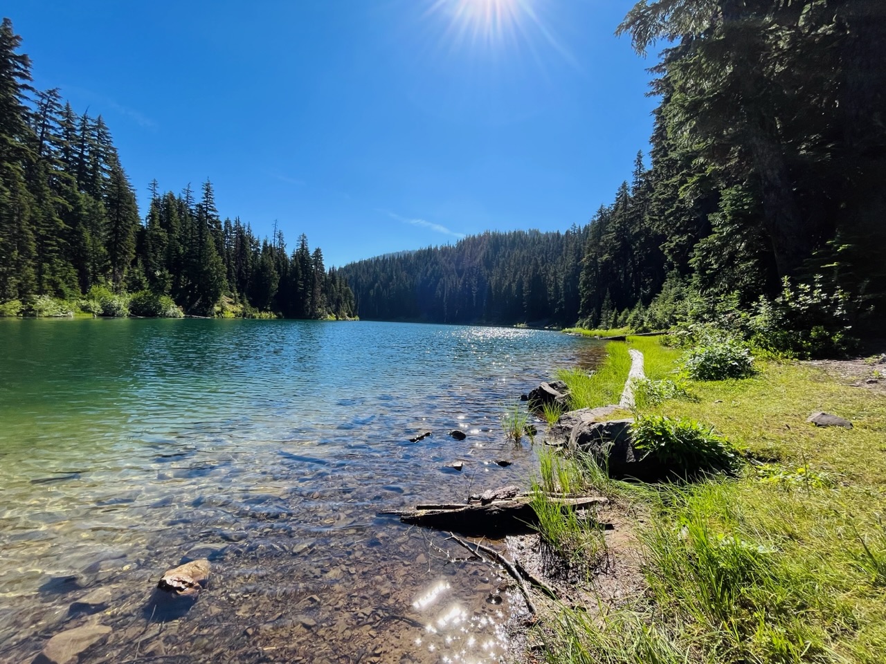
A shimmering lake rewards you on this 13-mile trek. Photo by wishfulwanderer.
This trail has plentiful options to turn your hike into a backpacking trip, with the added bonus of starting from the lesser-known side of Goat Rocks. You’ll journey to the trailhead along the forested beauty of Highway 12. It’s important to note that you might share this wilderness area with equestrians so you may want to brush up on your right-of-way etiquette.
> Plan your hike to Surprise Lake using WTA's Hiking Guide
Goat Marsh Research Area
Location: Mount St. Helens
Length: 2.8 miles, roundtrip
Elevation gain: 180 feet
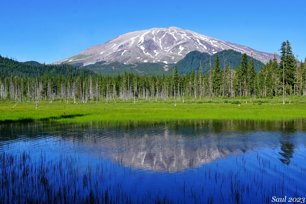
The road to Goat Marsh is long, but how could you resist views like these? Photo by Susan Saul.
You’ll need to drive up an 11-mile forest road to reach the Goat Marsh trailhead, but it will be well worth the effort. This short hike will treat you to stunning views of Mount St. Helens and Goat Marsh Lake. The old-growth forest here is full of Douglas firs, western hemlocks and noble firs.
> Plan your trip to the Goat Marsh Research Area using WTA's Hiking Guide
Weldon Wagon Road
Location: Columbia River Gorge - WA
Length: 5.4 miles, roundtrip
Elevation gain: 1,290 feet
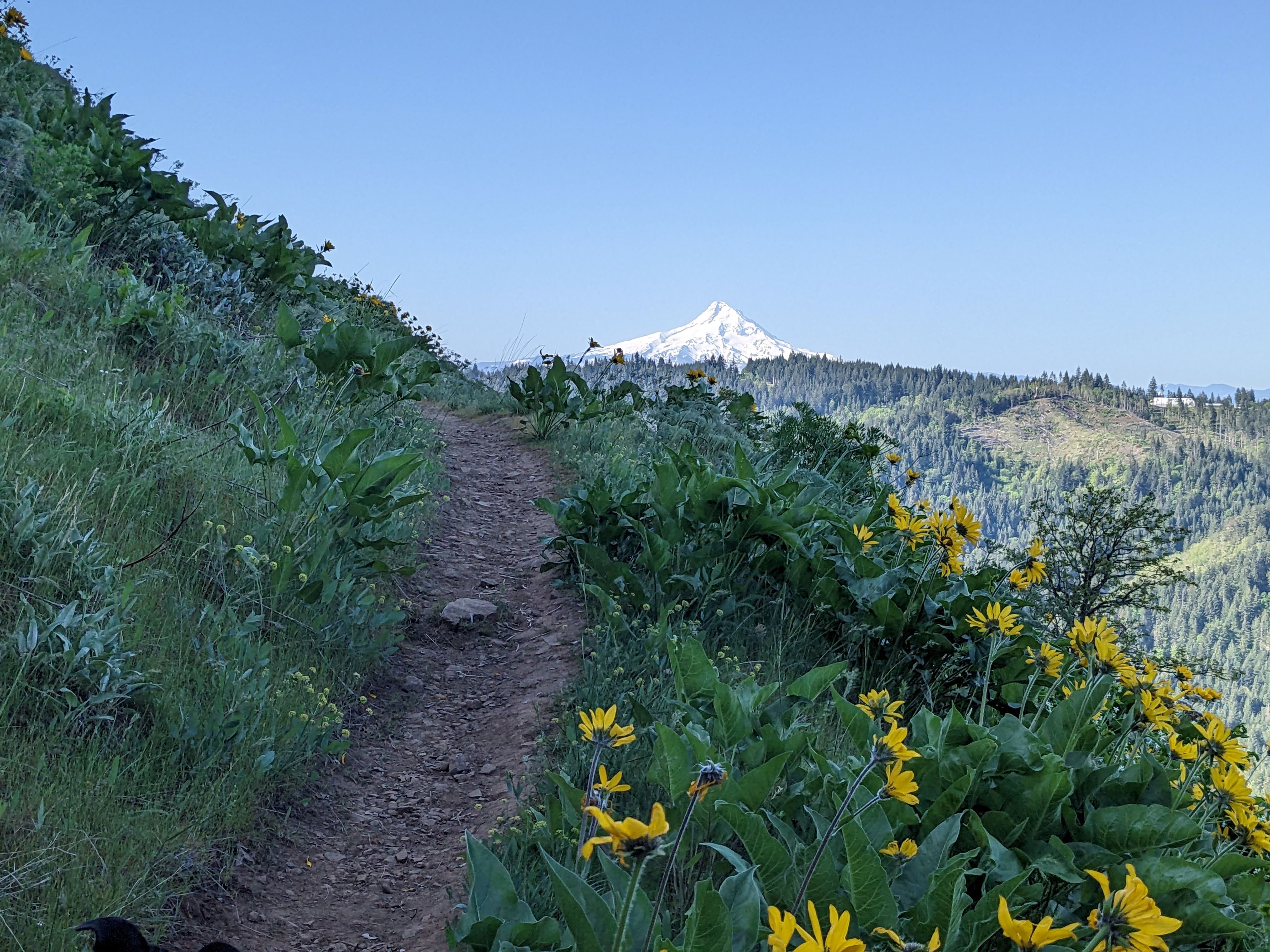
Catch glimpses of Mount Hood as you hike higher and higher in the Gorge. Photo by gumbypuppy.
Driving along the scenic Columbia River Gorge is a great way to spend a day, but it’s made even better by making side trips to trails like Weldon Wagon Road. This hike offers sweeping views of the White Salmon Valley while winding through Oregon white oak. Pro tip: This trail passes near private property, so observe trail signs and stay on the trail.
> Plan your hike on the Weldon Wagon Road using WTA's Hiking Guide
Central Washington
Snow Mountain Ranch and Cowiche Mountain
Location: Yakima
Length: 14 miles of trails
Elevation gain: 1,140 feet
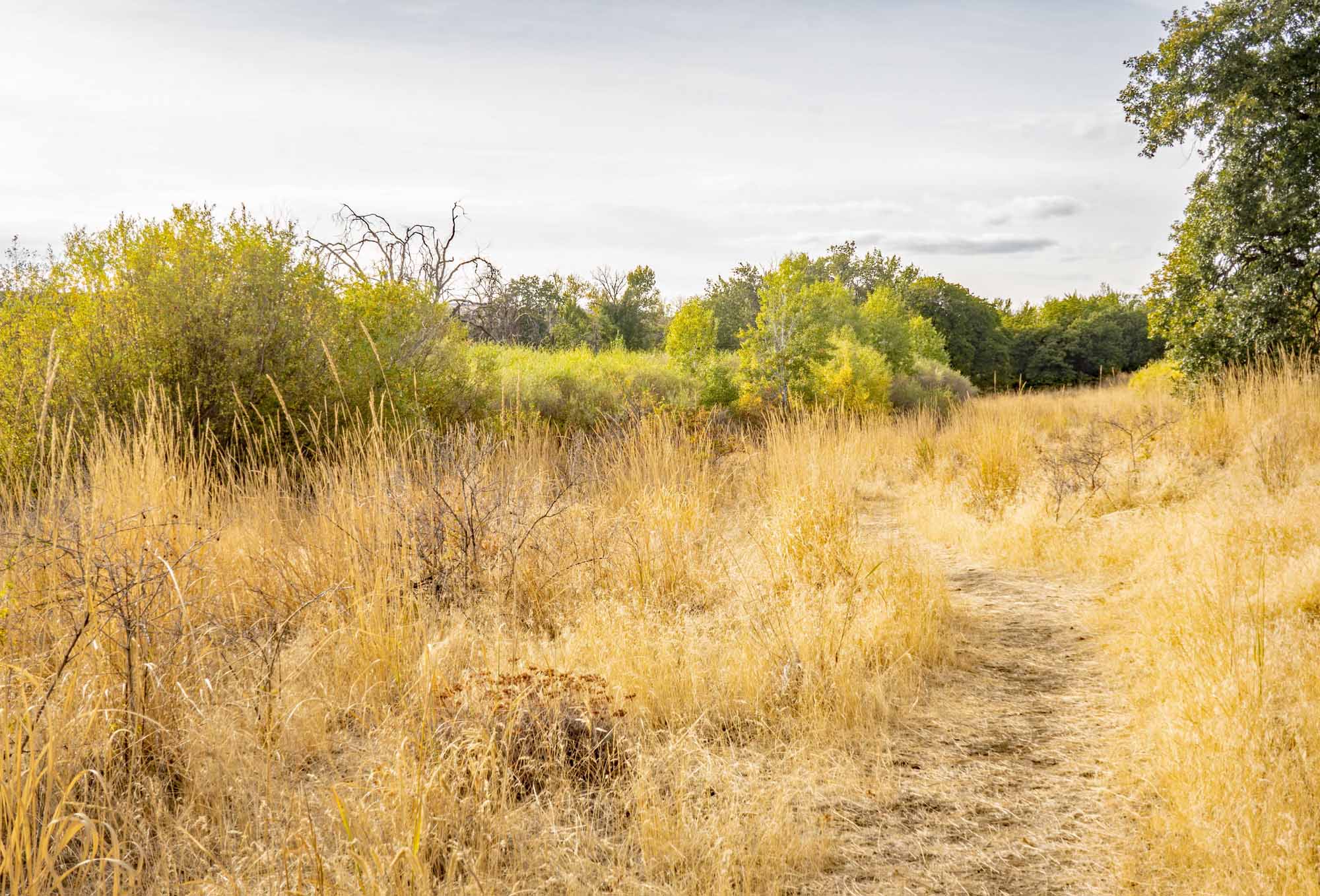
With numerous trail options, it’s hard to choose which journey to take at Snow Mountain Ranch and Cowiche Mountain. Photo by David Hagen.
You don’t have to go far from the core of Yakima to experience the beauty of the region’s shrub-steppe. This recreation area provides a range of hiking options: If you want a short, flat trail, try the Riparian Trail; if you’d like mountain views that can span as far as Mount Hood, check out Cowiche Mountain Trail West. Fall is an especially beautiful time on this trail, with oaks, aspens, cottonwoods, wild roses and willows changing their leaves.
> Plan your trip to Snow Mountain Ranch and Cowiche Mountain using WTA's Hiking Guide
Umtanum Creek Canyon
Location: Yakima
Length: 6.5 miles, roundtrip
Elevation gain: 500 feet
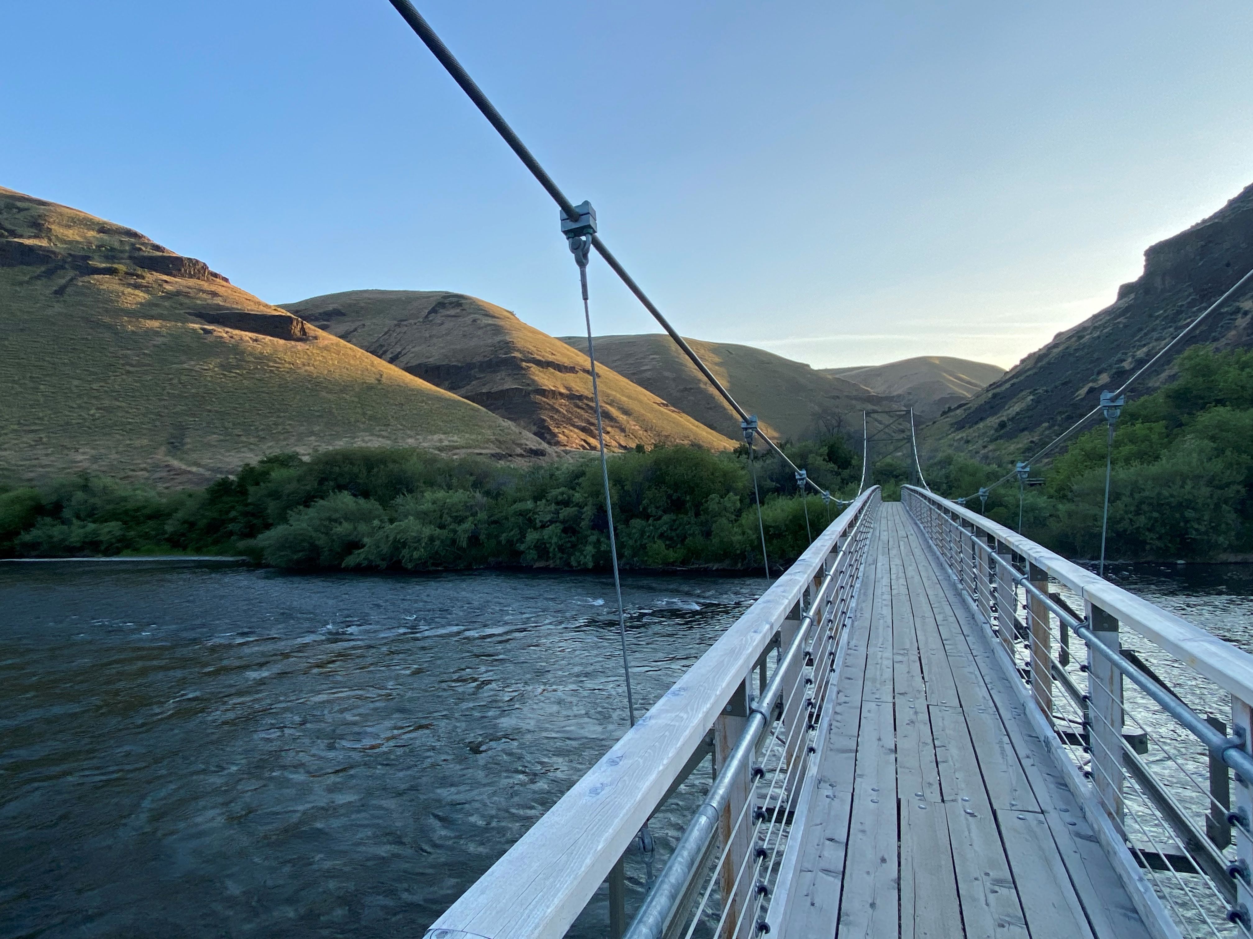
A suspension bridge safely guides hikers over Umtanum Creek. Photo by austineats.
Follow Highway 812 along the stunning Yakima River to reach Umtanum Creek Canyon. This trail winds through a canyon, allowing you to get a close view of basalt formations and bighorn sheep, though those should definitely be viewed from afar. A suspension bridge guides you across the creek. Keep an eye out for rattlesnakes, especially in late summer and early fall.
> Plan your trip to Umtanum Creek Canyon using WTA's Hiking Guide
Steamboat Rock
Location: Grand Coulee
Length: 6 miles, roundtrip
Elevation gain: 650 feet
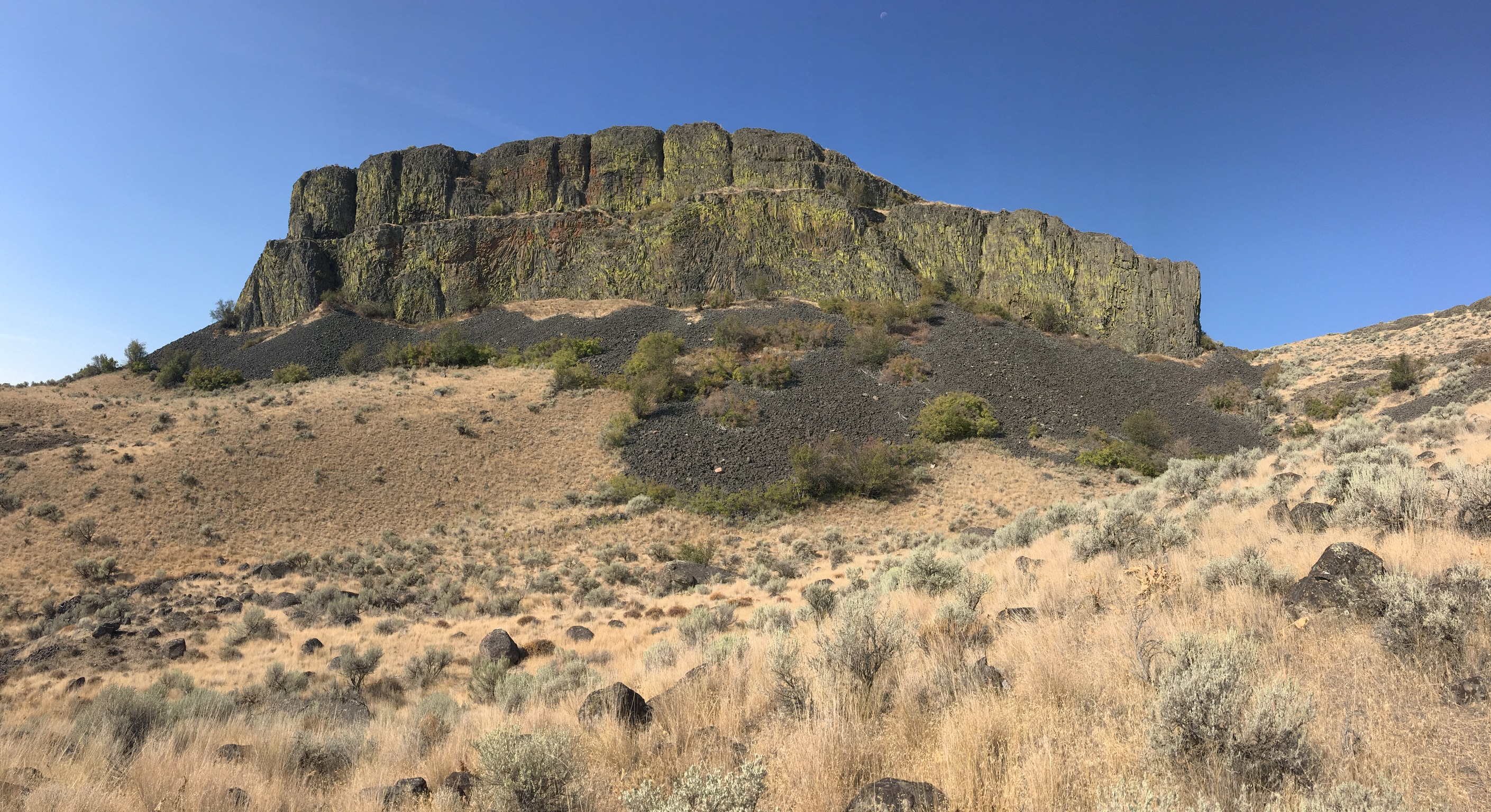
The iconic Steamboat Rock will give you a true central Washington trail experience. Photo by Gia P.
The road to Steamboat Rock is surrounded by basalt buttes, and — depending on the direction you come from — either Banks Lake or the Columbia River. This trail leads you up Steamboat Rock, offering views of the lake below it. Like many hikes in Central Washington, stay aware of your surroundings and look for wildlife like rattlesnakes and wild turkeys.
> Plan your trip to Steamboat Rock using WTA's Hiking Guide
Eastern Washington
Turnbull National Wildlife Refuge
Location: Spokane/Coeur d’Alene
Length: 5.5 miles
Elevation gain: 0 feet
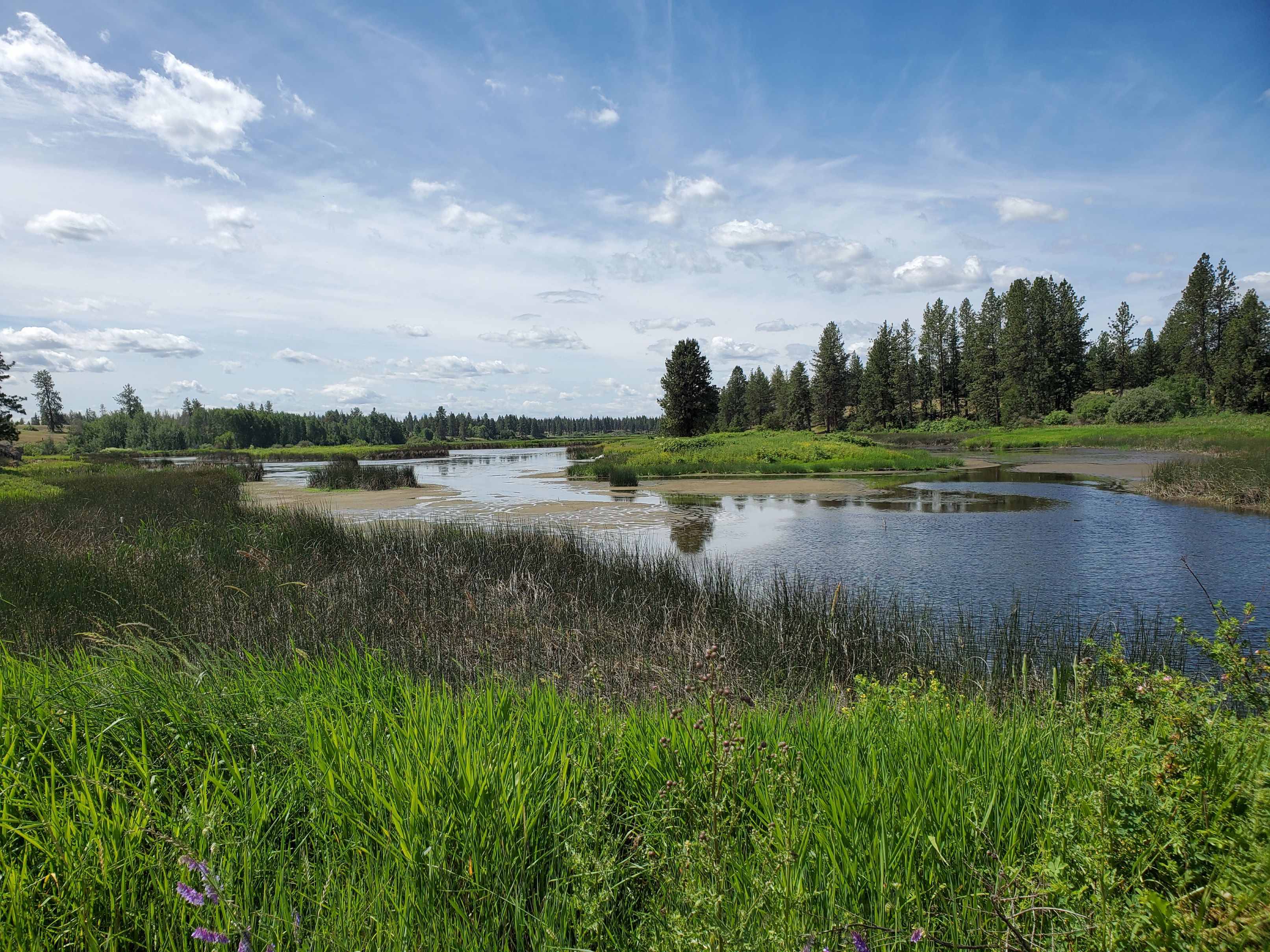
This wheelchair friendly trail can be traveled via hike, bike or drive. Photo by KristenSF.
Just an hour outside of Spokane, this wildlife refuge protects channeled scablands, dating back to the Ice Age. The trail is a great option for any way you may want to experience natural beauty, as you can hike, bike or drive your vehicle on the paved trails. Trip reporters have seen porcupine, moose and other wildlife here. This wheelchair friendly trail is worth a side trip on your next trip out to the Spokane area.
> Plan your visit to the Turnbull National Wildlife Refuge using WTA's Hiking Guide
Kamiak Butte
Location: Palouse and Blue Mountains
Length: 3.5 miles, roundtrip
Elevation gain: 900 feet
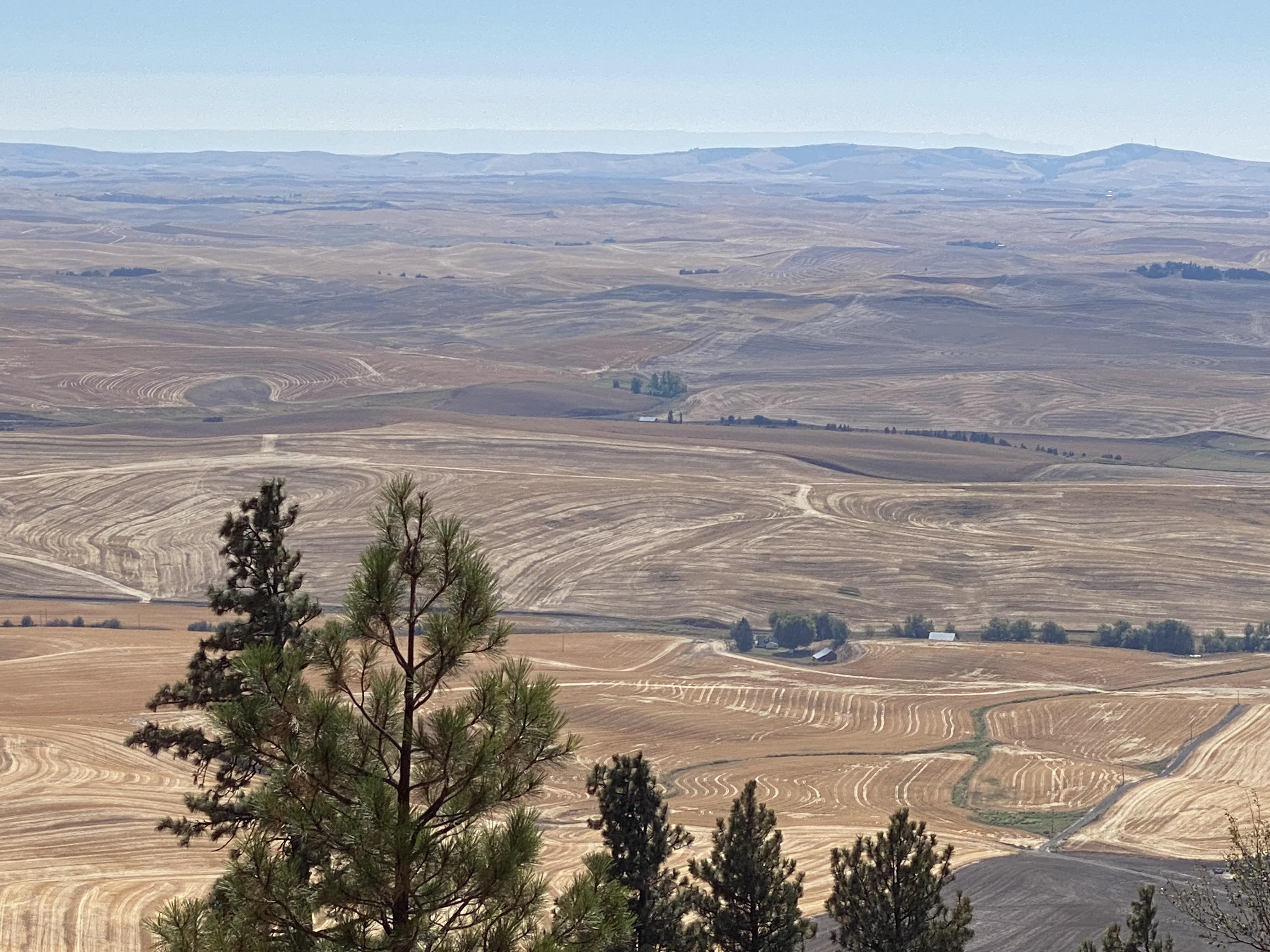
Gaze out on the mesmerizing crop designs of the Palouse. Photo by Lili S.
Part of the Palouse Scenic Byway, Kamiak Butte offers an option for a forested hike among the rolling farmland of the Palouse region. Hike this trail in multiple seasons to experience the changing landscape, from abundant wildflowers to dry fall farmland. Leashed dogs aren’t allowed on every trail here, so be sure to check signage before making your trip up the Butte.
> Plan your trip to Kamiak Butte using WTA's Hiking Guide
Crawford State Park - Gardner Cave
Location: Selkirk Range
Length: 1 mile, roundtrip
Elevation gain: 200 feet
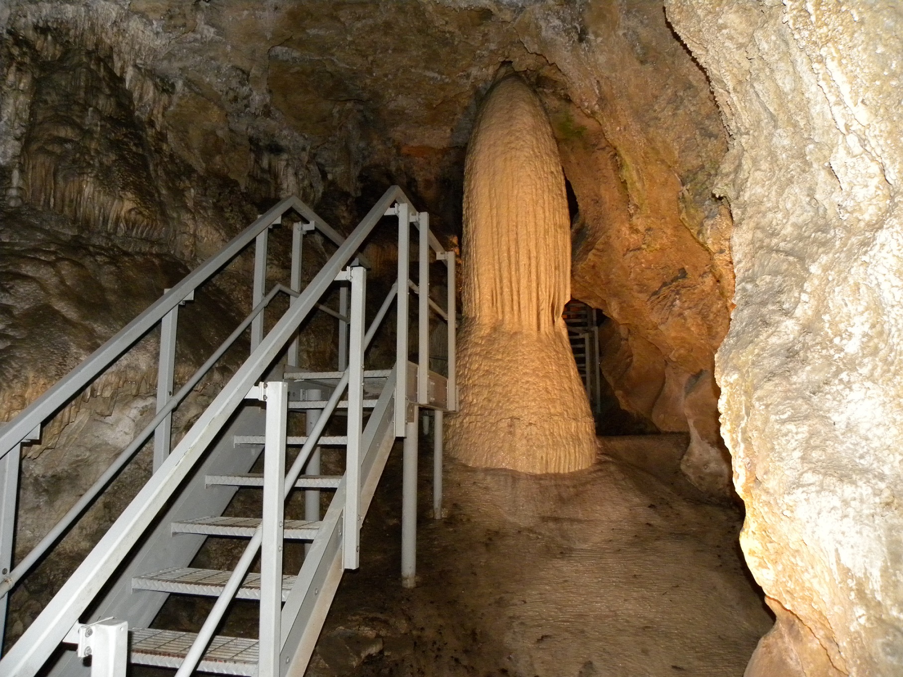
This cave hike is nearly in Canada, and will take you on a geologic exploration of the Pend Oreille region. Photo by Pribbs.
To get to this fascinating cave trail, you’ll drive north on county highway 2975 until you practically reach Canada. The drive passes along the Pend Oreille River, with plenty of mountain peaks to view. Remember, reservations to visit the cave are required, but this opportunity to view stalactites and stalagmites isn’t to be missed.
> Plan your trip to Crawford State Park - Gardner Cave using WTA's Hiking Guide
White Bluffs - North
Location: Tri-Cities
Length: 7.0 miles
Elevation gain: 500 feet
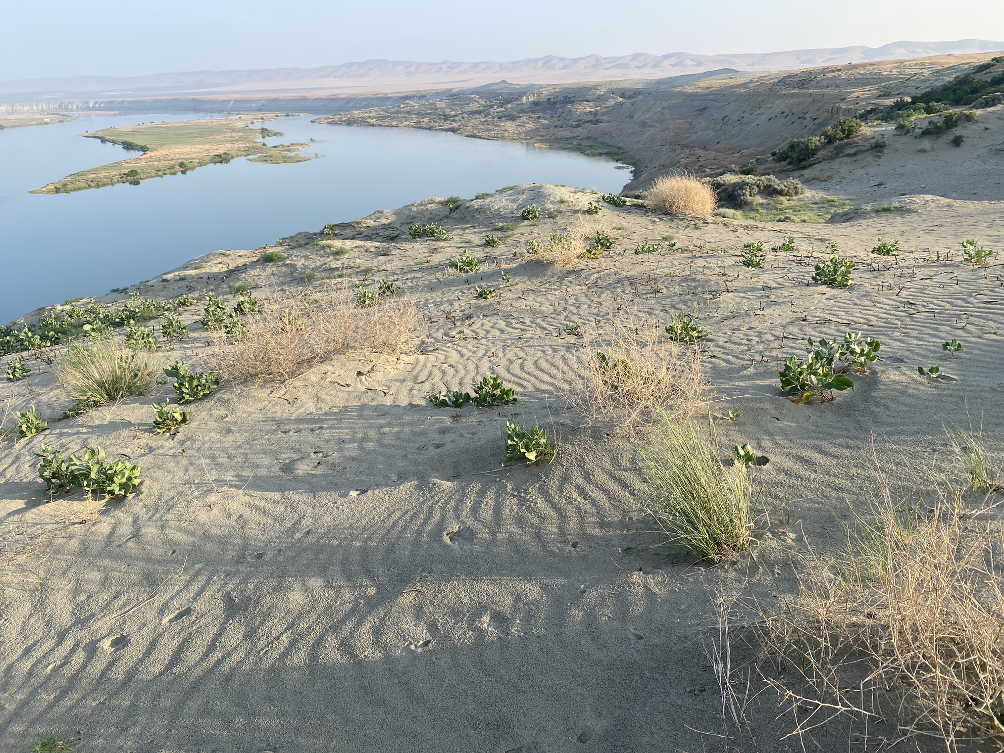
Take a hike to the White Bluffs sand dunes to catch glimpses of local wildlife. Photo by Taipan91021.
Access these otherworldly sand dunes in the Hanford Reach National Monument. Situated near the Columbia River, this trail is a birder's paradise. You'll reach the dunes about 2 miles into this hike, and once you get there, the trail gives way to dune hiking. Be sure to stay on the dunes, since the soil surrounding it is sensitive. This lesser-visited corner of Washington isn't to be missed.
> Plan your trip to White Bluffs - North using WTA's Hiking Guide


