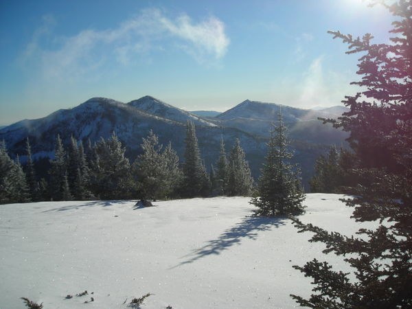
A DELIGHTFUL, CHALLENGING SNOWSHOE OR X/C SKI 1-DAY OR OVERNIGHT TREK: The trailhead to Columbia Mountain begins on the top of 5575’ Sherman Pass (highest year around pass in WA) just off of State Highway 20 (north side), 28 miles west of Kettle Falls, Washington. Detailed directions can be found in 100 Hikes in the Inland Northwest by Rich Landers. The USFS trailhead parking area is well plowed by WA State, which is why, to park here, you must have a State Sno-Park Permit ($10 one-day or $30 seasonal) www.parks.wa.gov/winter/permits.asp displayed on the lower left corner of your windshield. I could see that my permit was checked because the enforcement officer wiped away the fresh fallen snow to read it. The trail to Columbia Mountain begins as the Kettle Crest National Recreation Trail No. 13. The total length to and around Columbia Mountain is about 8 miles with an elevation gain of 1200 feet. This may be a little farther than you care to do in one day on snowshoes or skis, but you can shorten the trek to 6 miles by bypassing the loop around the entire summit. To do this, turn left at mile 2.5 at a sign that points to Columbia Mountain Summit. The sign is on a tall enough post that it’s usually not buried by snow. If the trail is obliterated by deep snow, simply continue upward on the south, southwest and southeast sides of Columbia mountain until you reach the summit at 6780 feet. There you will be rewarded by outstanding scenic vistas of the entire southern Kettle Crest Range, and reaching east and north into Idaho and British Columbia. You will also enjoy exploring the old forest service fire lookout log cabin built around 1915. I departed the trailhead at noon and snowshoed to the summit by 3 pm without working up too much of a sweat at 16F. I made camp near the summit at 6500 feet elevation, with an awesome view out the tent door overlooking 7000’ Sherman Peak and Bald Mtn. (see photo) While watching the gorgeous “warm” glow of the sunset, I noticed the temperature had dropped to 13F. My hi-low thermometer read 5F for a low that night, which could have just as easily been (-)15F, so pack your warm winter sleeping bag or better yet, insert your summer bag into your winter bag! The next morning I broke camp and completed the loop counter-clockwise around Columbia Mountain. I don’t recommend completing this loop now until mid-June because the trail is cut into the north face and is already covered by 45 degree angled snow and ice sluff, which would slide you off and down into oblivion if your sliped. This area is also prone to avalanche later in winter and early spring. Snowshoes or skis with skins are a must because the snow is already accumulating to knee deep and will be waist deep by the end of December. The trail is not machine groomed but there is a track for the first few miles made by other hardy souls who frequent this trail. When you go, be totally prepared with a good topo map and magnetic compass. A GPS is also extremely handy in addition to, but not in place of a map and compass. Be prepared for below zero weather with high wind and zero visibility in case the weather unexpectedly turns sour. Even though you are out for just the day up Columbia Mountain, be sure to pack enough to stay overnight in winter conditions . . . just in case . . . in case it’s so beautiful you don’t want to go back until tomorrow. PS There is cell phone coverage at the 6500’ elevation level looking south and east. Hike On! then ~~~
Trip Report
Kettle Crest North, Columbia Mountain Snowshoe — Tuesday, Dec. 11, 2007
 Eastern Washington > Okanogan Highlands/Kettle River Range


Comments