Trip Report
North Fork Skykomish River, Blue Lake High, Pass Creek & Dishpan Gap — Friday, Jul. 7, 2006
 Central Cascades > Stevens Pass - West

N. Fork Skykomish R #1051
Dishpan Gap
Blue Lake High Route
Peak 6562
PCT #2000
Cady Pass
Pass Creek #1053
4 trails radiate from this trailhead, offering 6 possible loop trips.
We went up #1051 to Dishpan Gap, up the Blue Lake High Route to Pt. 6562, back to Ward’s Pass along the PCT to Cady Pass, and out Pass Creek Trail #1053.
Bald Eagle Ridge (#650?) is a scenic way back (spring below Long John Mt. in late season).
CAUTION: if you plan to exit via Pass Creek Trail, you are committed to the ford, which could be dangerous at high water. Little more than knee-deep today (I'm 6'), but I had to cut an alder walking stick and it was a little weird, alone in the dark, carrying a dog. There is another ford higher up Pass Creek, but just enough to get your feet wet today.
These trails are in good shape but there are a number of big windfalls. One guy with a pulaski could do a lot of good, unclogging drains and cutting new ones. Still a lot of snow up high, obscuring the trail but not an impendiment unless you’re trying to find the trail in the dark. Most of the PCT east of Skykomish Peak is still under snow, but it’s firm, easy walking.
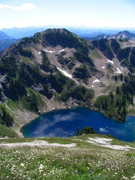
The Blue Lake High Route takes you almost to the summit of Peak 6562, higher than anything else nearby except Johnson Mtn. Three named peaks nearby (June, Skykomish, Kodak) are considerably smaller. Beckey includes many smaller peaks but makes no mention of it (1st ed. anyway). I'm calling it Johnson's Sister or maybe Mt. Woebegon, overlooked because it’s right at the map’s corner-fold where it gets rubbed off. Spectacular views of Monte Christo group, Sloan, Pugh, White Chuck, Glacier Peak, Indian Head, Poet group, and you can see Rainier, Stuart, Daniel & Hinman, Chimney Rock, all the Snoqualmie Pass stuff. 10 miles from the trailhead, with 3 or 4 ways back (Bald Eagle Ridge is nice). I get the feeling that few people go here – the summit is not trashed like most summits, so watch your feet and don’t turn over any rocks. Snow patch persists into late summer at least. Glad to see that last year’s bivvy was undetectable (we’d moved some rocks for a bed, but put them all back).


Comments