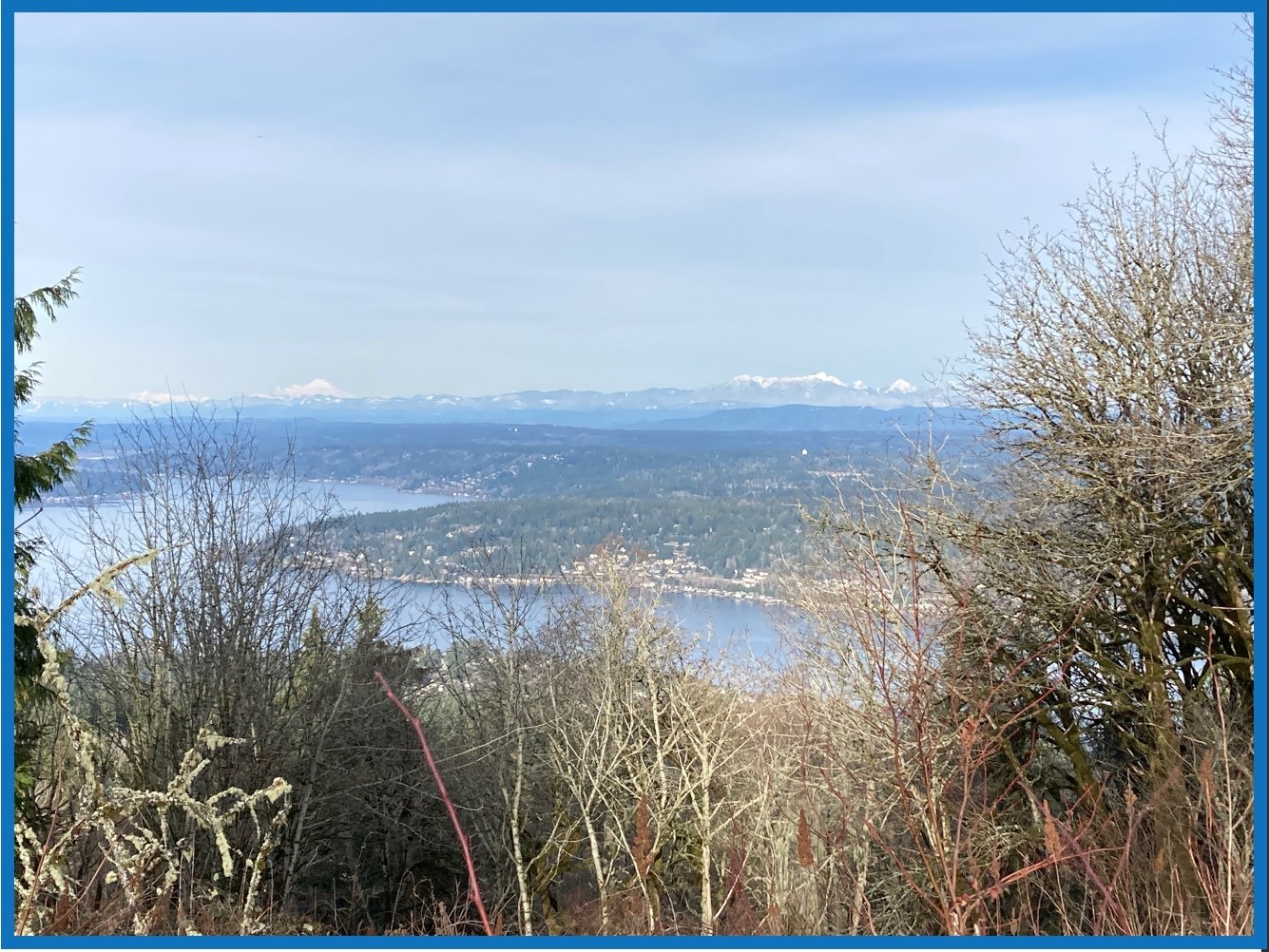
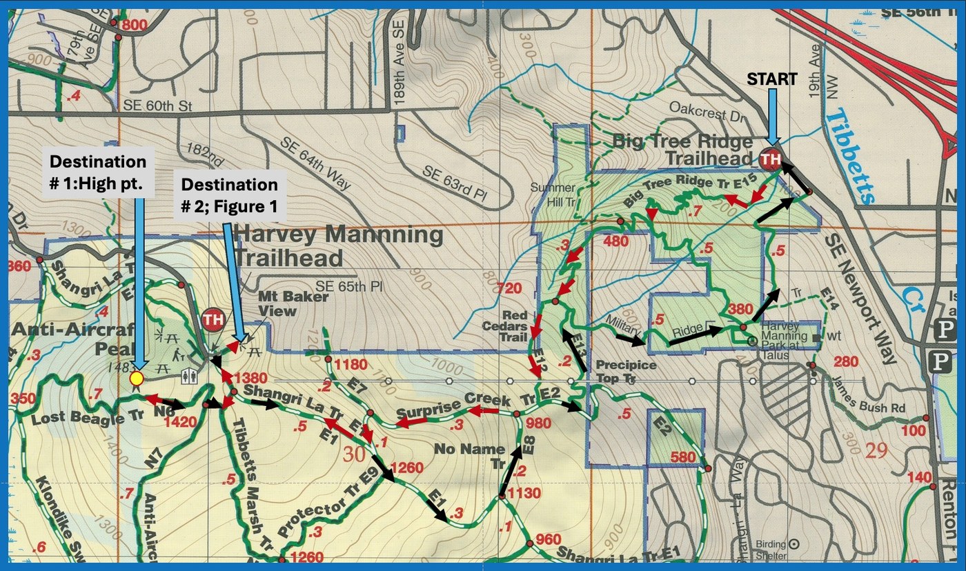
This is a series of trails harboring many surprises (Figure 2). There are big trees (but the biggest are a long ways from the trail), there is a precipice (sort of), there are red cedars (there are lots of other species), there was a lost Beagle (was it found?), Surprise Creek (the U.S.G.S. map does not show or even have contours where it might be. In contrast, the Green Trails map has found some contours for it from the U.S.G.S. map, but then puts it in the wrong place. Even the powerline right-of-way, relative to the trails, or the trails themselves, appear to be in the wrong place. Perhaps, this explains why the beagle got lost or were the owners lost?), Military Ridge (until you know the history of the summit area, this seems a strange name), and then when you are convinced that the those naming the trails have had no problem find a name up to now, but suddenly you are confronted with a "No-Name Trail!" Fortunately, the condition and the signage associated with all these trails and the numerous junctions are outstanding. King County Parks has done an excellent job and they are currently greatly improving the drainage on the Shangri La Trail.
As much as I make fun of the names and locations of these trails, they and the entire Cougar Mountain complex of trails and trailheads are an outstanding and a wonderful resource for folks located in King County. This is a great time of the year to enjoy these trails (I was hoping for much more snow). Their frozen status (thawing is beginning) and the 1/8 to 1/4 inch of snow meant dry, clean hiking shoes. There was some ice on short sections or parts of the trail, but there was always an ice free by-pass.
When I first reached the trailhead, I was surprised by how cold it was (at the same time, it was -2oF at Snoqualmie Pass) and how many cars were already in the designated parking spots (no permits required). Several cars left as I was getting ready and several other cars left when I left two hours later. Lots of turn-over. This relatively new trailhead is getting good use (https://www.wta.org/go-hiking/trip-reports/trip_report.2023-12-10.2610533860). It is in a great location.
I have described this trail systems in detail in two other reports (1: Dec. 10, 2023: https://www.wta.org/go-hiking/trip-reports/trip_report.2023-12-10.2610533860 and 2: Nov 6, 2022: https://www.wta.org/go-hiking/trip-reports/trip_report.2022-11-06.3627036611 ). I will not repeat the detail found in those earlier reports. However, I will say that this very intense cold period has resulted in some very interesting ice formations: first (seen in Figure 3) are the vertical crystals that have shoved rocks and soil upward. These formations are prevalent on the exposed parts of the trail and often, because of trail use, they collapse. You can see where parts of the trail that have been lifted and are undermined by ice crystals and are ready to collapse. Both the already collapsed sections and the sections not yet collapsed force you to be more observant. In some cases, the water crystals appear like almost transparent solids extruded through square or rectangular openings. In other cases, they appear like basalt flows (see Figure 3).
Water was flowing in the small streams including Surprise Creek. However, any obstacle encountered resulted in splash and ice formation (see Figure 4). This photograph was taken where one is on the Military Ridge trail just above the Harvey Manning Park at Talus and near where I and the trail crossed from Surprise Creek from its north- to the south-side. For the rest of the trip down, Surprise Creek is always to your left. Surprise Creek flows under SE Newport Way about 5 feet NW of where the return trail reaches the road. In other words, considerably SE of the relatively new trailhead. Back to the mysteries surrounding Surprise Creek.


Comments
scottsemans on Anti-Aircraft Peak Loop, Lost Beagle, Big Tree Ridge, Shangri La, No Name, Surprise Creek, Military Ridge, Precipice Top Trail, Red Cedars
Nice report. Two interesting points raised: 1) Frost heave. This is of particular interest to trail builders and restorers because it's the organic elements, not the mineral soil, that heaves. Organics are supposed to be removed from the trail, so these rare ground-freeze episodes make "crystal" clear the distinction, which can be hard to see when working on a trail. 2) Is it really named Surprise Creek? The "trail" is an old road and only partially converted to actual trail. It was named by early IATC explorers who were surprised to find a creek crossing it. I've always known that creek as Stagecoach Creek. After bridges on Precipice Top and Precipice Bottom trails, it joins Military Creek and the resulting creek does culvert under Newport Way on the other side of the new trailhead from where AA Creek is similarly culverted.
Posted by:
scottsemans on Jan 25, 2024 09:26 AM
Abam on Anti-Aircraft Peak Loop, Lost Beagle, Big Tree Ridge, Shangri La, No Name, Surprise Creek, Military Ridge, Precipice Top Trail, Red Cedars
Thank you for the comments as they help clarify some of my questions. Repeated the hike on Tuesday, the 23rd and, other than wet, streams full and flowing, and drainage ditches and channels full of water, there was little if any legacy of the cold period.
Posted by:
Abam on Jan 25, 2024 01:19 PM
scottsemans on Anti-Aircraft Peak Loop, Lost Beagle, Big Tree Ridge, Shangri La, No Name, Surprise Creek, Military Ridge, Precipice Top Trail, Red Cedars
You may not have gone downhill on Surprise Creek Trail at the point where Precipice Top Trail cuts in. This section crosses private parcels, so has never been actually worked as a trail. Ditches have developed on the surface creating a high outside berm, preventing water outlet, so hikers basically walk in the blowout ditches or adjacent where flat spots can still be found. Winter walks are wet feet, and the rest of the time it's dodging nettles. It has a great view out over I-90, though, and overall is no steeper than Shangri-la, so a viable looping alternative out of the Talus neighborhood.
Posted by:
scottsemans on Jan 26, 2024 10:24 AM
Abam on Anti-Aircraft Peak Loop, Lost Beagle, Big Tree Ridge, Shangri La, No Name, Surprise Creek, Military Ridge, Precipice Top Trail, Red Cedars
Thank you for the additional clarification. I had assumed that the trail shown on Figure 2's map and labeled E-13 was the Precipice Top Trail and that at the junction with the Surprise Trail (E-2), the Surprise Trail continues to the right and down in a slightly diagonal direction. At any time of the year, it looks like a mid-thigh down car wash.
Posted by:
Abam on Jan 26, 2024 01:07 PM
scottsemans on Anti-Aircraft Peak Loop, Lost Beagle, Big Tree Ridge, Shangri La, No Name, Surprise Creek, Military Ridge, Precipice Top Trail, Red Cedars
Yes, E13 is Precipice Top, nicely designed by a WTA ACL, lovely routing and buildout. Lower Surprise Creek, not so bad now as the lowest part, as it reaches Talus, was the worst & work has been done there.
Posted by:
scottsemans on Jan 26, 2024 01:18 PM