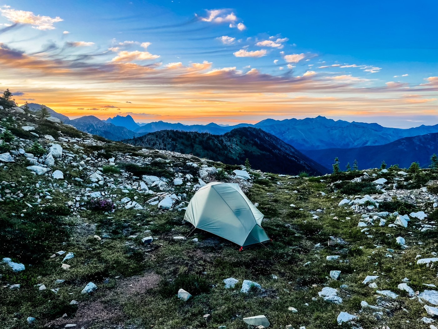
Did this loop as an overnight backpacking trip clockwise from East Bank TH. Day 1 was East Bank TH to just the other side of Devil's Dome 20.43 mi / 6690ft gain and Day 2 was Devil's Dome to East Bank TH via Jackita Ridge at 21.6mi and 3320ft gain. Big thanks to anthonyE's previous trip report with the detailed water and campsite beta - it all checks out and was wildly helpful.
TL;DR:
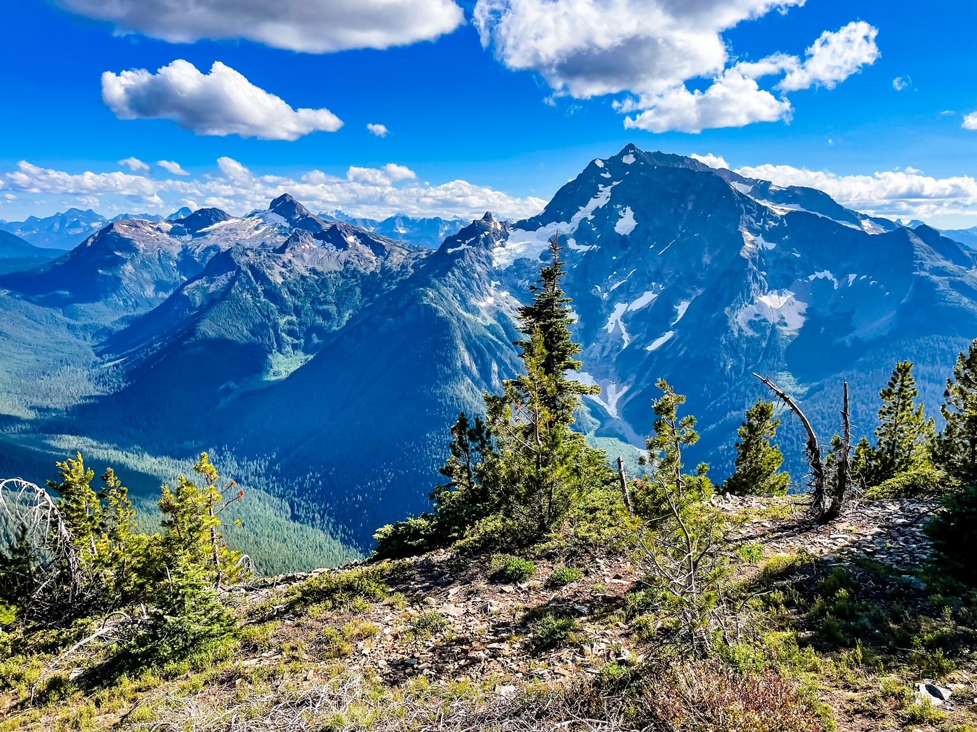
If doing this again, I would still go clockwise. Snow free (a few patches off trail if you heart so desires). The bugs weren't bad, and it felt almost like a fall trip, except when the heat of the afternoon was felt, and lack of ripe blueberries was noted, but views are splendid and plenty! There are sections of overgrowth that you've got to push your way through, lots of chest/head height growth which is more annoying than it was difficult to pass, but no loss of trail at any point*. This trail felt pretty exposed on both ridge trails, but shaded on the lower trails. There are a few longer spurts of dry sections, so depending on your water carry system, it may be prudent to fill up when you can. If you don't mind a little brush and some solid climbs, you will be highly rewarded with views and would recommend this trail to anyone looking for a nice mountain loop!
Road Conditions: Hwy 20 paved all the way, and TH is just off the road, so any car can access. Parking was not even half full when I arrived around 7:30am on Saturday morning. There is a well stocked and clean pit toilet here.
Trail Conditions:
East Bank TH: well maintained, easy to follow, well marked. You will need a permit if you plan to camp at any of these sites along the way. Roughly 12.5 miles before the junction. Not a ton of gain, plenty of water sources, quick miles and made for a nice warm up to start the trip.
Devil's Ridge Trail: in fairly good condition with sections of overgrowth and a handful of single blowdowns. There's a tree fallen on the Pasayten Wilderness boundary sign as you climb up, which honestly is a sign in itself (this feels so par for the course with Pasayten), as the trail becomes noticeably more unmaintained, but you never lose trail or have to route find at any point. There was a solid water source about 3 miles into the climb, and some smaller trickles on either side of the summit, but otherwise pretty dry, and more exposed. Really windy up at the Dome, but 360 views and honestly the breeze was a welcome treat with the heat.
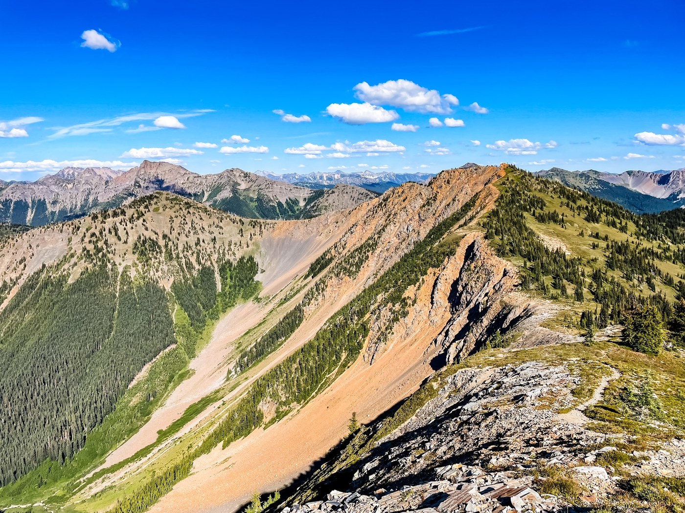
Jackita Ridge Trail: in good condition, and similar to Devil's Ridge in that there are sections of overgrowth and blowdowns, but never really bad enough to lose trail. Whoever developed this trail likes to get where they're going, and is not a fan of switchbacks. Aside from the end (beginning if going ccw), and the scree field, which is almost necessary, the trail is notably steeper grade on the ascents and descents than Devil's Ridge. I was glad to be going up the scree field and to have poles as it's quite loose, but the views are varied as you wind your way around, over, and down the mountains. The water sources were more notably stagnant in the lower meadows, but there are some really nice flows in the woods including a couple little waterfalls. I hit the final descent in the heat of the day, and despite being in the shade, you can really feel the heat trapped in that valley, so be mindful and stay hydrated!
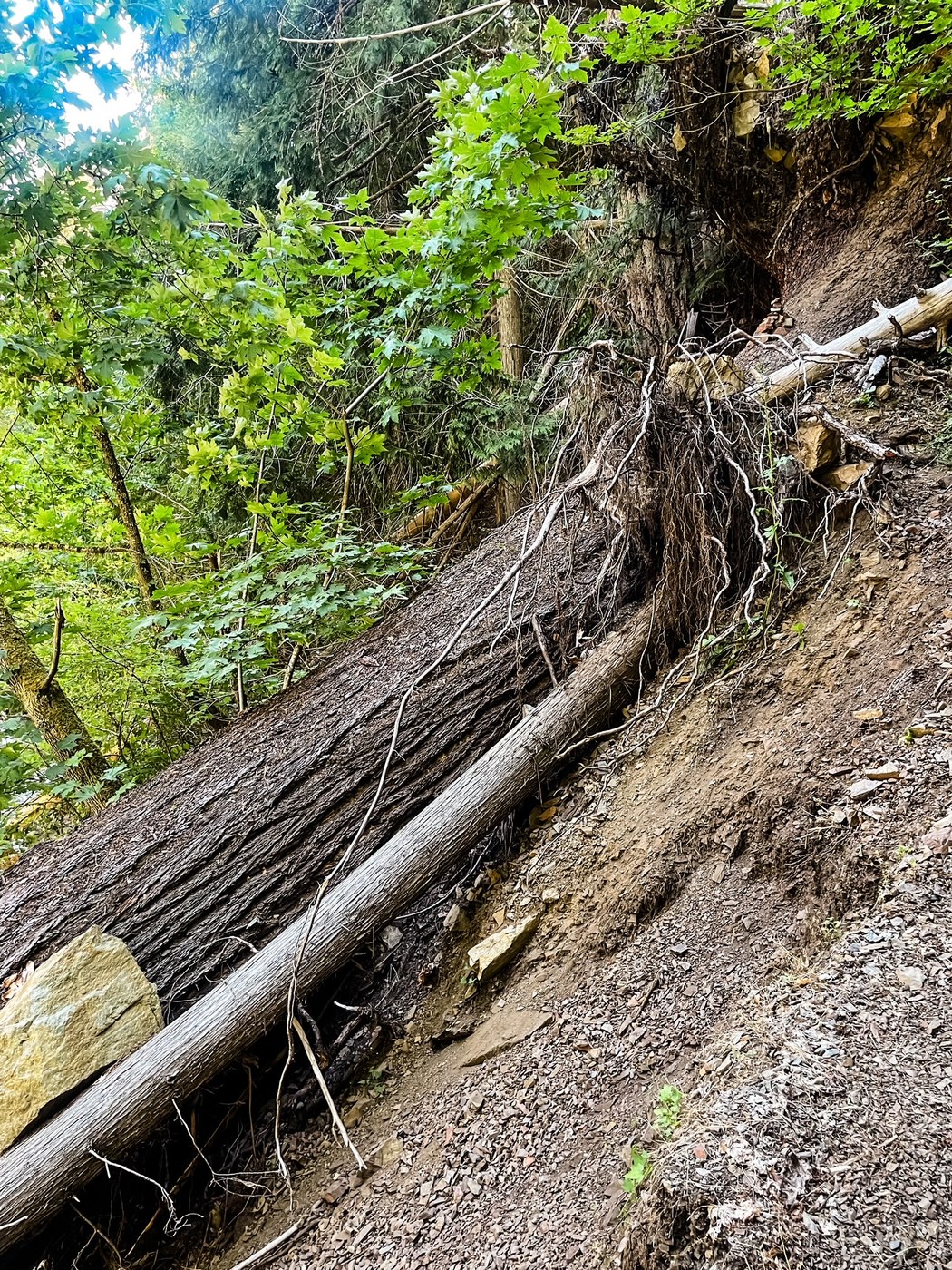
Ruby Creek Trail: quite possibly the longest 3 miles of my life, the trail is fine, similar to others with some overgrowth but mostly shaded and runs along the creek. I think this trail only stays "maintained" by the foot traffic, but seems otherwise like the forgotten trail. *REALLY large blowdown and loss of trail to landslide (see pic 4). I almost considered going down and just walking in the creek to get around, but you can go up and around which is what I ended up doing, but the tread is very loose and unstable. You won't slide to your death, but maybe scrape yourself up a bit if you lost your footing. I do think it's a bit more interesting of a trail than East Bank with some fun features, and seeing/hearing the creek flowing, but at the end of the trip it feels like a slog, and the heat was really trapped in the valley, so despite the shade and cooling from the river, it got pretty toasty and felt I was overheating.
Pro tip: bring a dry change of clothes and keep in your car, and dip into the creek just on the other side of the bridge, and you've only got a quarter mile hike to the TH. I hiked it in my camp sandals, so totally doable. Or if from Canyon Creek TH, just ford the river and then take a dip in! It felt so refreshing to cool off and put on dry clean clothes for the drive back home. 10/10 would recommend.
Animals/Bugs: I did not find the bugs too bad especially on the lower trails, but I also camped near Devil's Dome which was notably cooler and breezier than the rest of the trail. There were bugs around, enough that you'd hear a high pitch buzz pass by your ear to remind you they're there, but as a self-proclaimed mosquito magnet, I was able to enjoy dinner with a view without much trouble. Jackita Ridge felt buggier in general (warmer and more stagnant water), but staying on the move I didn't encounter much trouble, but perhaps camping along here would be more bothersome. Surprisingly no animal sightings aside from your classic chipmunks, squirrels, and birds. I expected to see at least 1 bear, as the terrain seems like bear heaven, but maybe in the fall when the berries are ripe they will be more abundant. I did see a little Marmot on Jakita and a little snake slither off the side of the trail on East Bank TH.
Water sources: Fairly reliable for the most part. There are a few longer stretches as mentioned above, but I didn't ever find myself low on supply. I did carry an extra L up to camp, knowing it would be dry, but collected earlier than I could have. Some of the water sources on Jackita are more stagnant as mentioned, which is not a problem, but I prefer a little flow and trickle when I can get it. If you're the same, just keep on trekking and know you'll hit a more flowing source in a mile or two.
Other: I was able to pluck a few ripe thimble berries on East Bank Trail! You can see the baby blueberries starting to grow, so will be ripe for the picking come fall. I only passed a handful of people on each trail, and had no one else camping nearby, so plenty of solitude and quiet. I suspect pushing bigger miles perhaps makes that more likely, as I did see people setting up camp at various spots. If you see a blow down that's not easily stepped over or walk under, I found most had an alternate boot path, or newly established trail that went around it.
Happy Trails!


Comments
anthonyE on Devil's Dome Loop, East Bank Ross Lake, Devil's Ridge, Jackita Ridge, Ruby Creek, Jack Mountain
Thx for the mention! Happy the report came in handy.
Posted by:
anthonyE on Jul 25, 2023 07:56 AM
Walkin' Fool on Devil's Dome Loop, East Bank Ross Lake, Devil's Ridge, Jackita Ridge, Ruby Creek, Jack Mountain
Great report, thanks! I just did the loop and wanted to add that at the big blowdown along Ruby Creek, on the west side of the blowdown (I was going up that side as I went CCW from East Bank TH; you would have been descending it), I put my hand where I shouldn't have and got stung pretty good on the wrist. I was concerned I'd get swarmed because you can't really move fast going up/down that section, but luckily there were just two of the buggers. Not sure if there was a nest, but just something for others to be aware of.
Posted by:
Walkin' Fool on Jul 31, 2023 01:23 PM
jndupuy on Devil's Dome Loop, East Bank Ross Lake, Devil's Ridge, Jackita Ridge, Ruby Creek, Jack Mountain
Oh wow! I didn't see any nest or have any issues with that, but can totally see where they would be in that area. Thanks for adding that note, and hope people are able to get around it without much trouble, or keep an eye out for things that may have taken advantage of the uprooted tree.
Posted by:
jndupuy on Aug 01, 2023 01:06 PM