After a cold and snowy Saturday night and rain in the Sunday morning forecast, we decided on an afternoon hike to hopefully be out in better weather as the day went on. There were some dark clouds on the drive up to Anacortes, but we also saw some blue sky starting to open up to the North. We arrived at the trailhead shortly after 1 PM and there were only a few other cars in the parking lot.
We started up the trail and immediately noticed it was not as muddy as it could have been. The ground was frozen in a lot of places which made it easy to avoid stepping in puddles of water or thick mud. When we reached the first junction we took a left on Trail 320 in order to hike the loop clockwise. This made it so that we could end the hike with the best views from Mt. Erie and Sugarloaf. This part of the trail was very peaceful with ferns covering the forest floor and wind whistling through the treetops overhead. It was a very windy day but for most of the hike the trees protected us from the wind.
There are many different paths to reach the first summit, Little Round Top, some more direct than others. It is helpful to hike with a map of the Anacortes Community Forest Lands since there are many junctions to navigate in this section of the trail. We chose to explore Trail 306 on the way to Little Round Top because the map indicated there was a viewpoint along this trail. The viewpoint was mostly obscured by trees, but we caught some glimpses of the San Juan's to the Northwest. At this point of the day there was plenty of blue sky above us now, especially looking North.
We continued on and eventually arrived at Little Round Top. There are no views here, it is just a small clearing on a rounded high point. There was a dusting of snow and someone had used branches to arrange some kind of symbol on the ground. The sun shining through made the trees in the clearing particularly colorful, so we stopped to take a few photos before continuing on to the next summit. It didn't take long to get from Little Round Top to Sugar Cube since the trails between them were rarely steep and the two high points are close in elevation. There were two blowdowns that we had to pass but there was plenty of room to go around them. Sugar Cube was also forested and had no views but was not as obvious of a summit as the clearing on Little Round Top. It was mostly just a stretch of trail that meandered along a high point before the trail descended towards Whistle Lake.
To make the hike longer you can stop by Whistle Lake after descending from Sugar Cube, but we decided to take a right on Trail 21 and head towards Mt. Erie. Eventually we took a left on Trail 207 and hiked through a beautiful ravine covered in ferns. There was a small bridge over a creek lined with intricate ice formations on either side of the bridge. As we ascended out of the ravine the climb to Mt. Erie began. The trail was quite steep in places and there were several more patches of snow on parts of the trail. As we got closer to the top there were some slippery boulders that we had to climb over that were partly covered in ice. Mount Erie is at a low enough elevation that the traces of snow probably won't stick around long, but the ice was quite thick in places and could remain throughout the week.
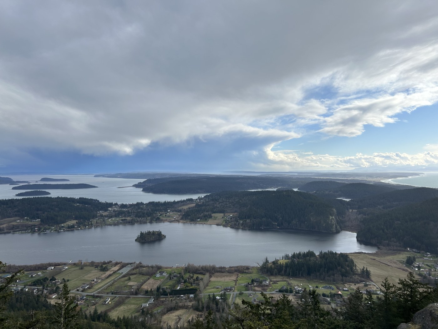
When we got to the top of Mt. Erie we walked across the parking lot towards the main viewpoint facing South. There was no snow at the top of Mt. Erie but there was slightly more wind than on the trail. We walked down to the rocky viewpoint to have a quick snack and take some photos. The islands, water, and sky were magnificent, and it was clear enough to see part of the Olympics in the distance.
Once we started to get cold, we turned back to descend towards Sugarloaf. We were careful climbing down over the icy boulders but other than that the way down was not very slippery. We did see some small ponds that had frozen over, but most of the trail was dry and sturdy. The trail up to Sugarloaf was steep in some places but we used this to warm up after cooling off on the descent from Mt. Erie. The views from Sugarloaf were spectacular. The San Juan Islands sprawled out towards the horizon and the wind swept across the Salish Sea below. We didn't stay long at the top of Sugarloaf since the strong wind was coming from the North and made this viewpoint very cold. We did stop for a short break to take pictures and admire the views, but we would've stayed longer if it hadn't been so windy and cold. Sugarloaf might have my favorite view on this hike with the sea churning between islands as far as the eye can see.
Heading down from Sugarloaf there was one more viewpoint offering views to the North that we stopped at before heading back to the car. The last stretch of trail includes a steep descent, but other than that it was easy to get back down. It took us just under three and a half hours to complete the hike. We were very happy to turn on the heat once we got back in the car. Despite the cold temperatures and strong winds, it was a beautiful day, and we dressed warm enough to never be too cold throughout the hike. It was a great day spent outdoors exploring more of the Anacortes Community Forest Lands.


Comments