Between storms and during the Seahawks game would be a good time to retreat to one of many favorite hikes. Drove to the Harvey Manning Trailhead with very little traffic. As I approached the NW corner of the Cougar Mountain Regional Wildland Park, I could see a clear, low-elevation demarcation above which all was white. So much better than smoke!
The restrooms were moved in 2021 to the ‘upper’ parking area as that area served the outdoor learning activities associated with this park. All are porta-potties; all are frequently serviced.
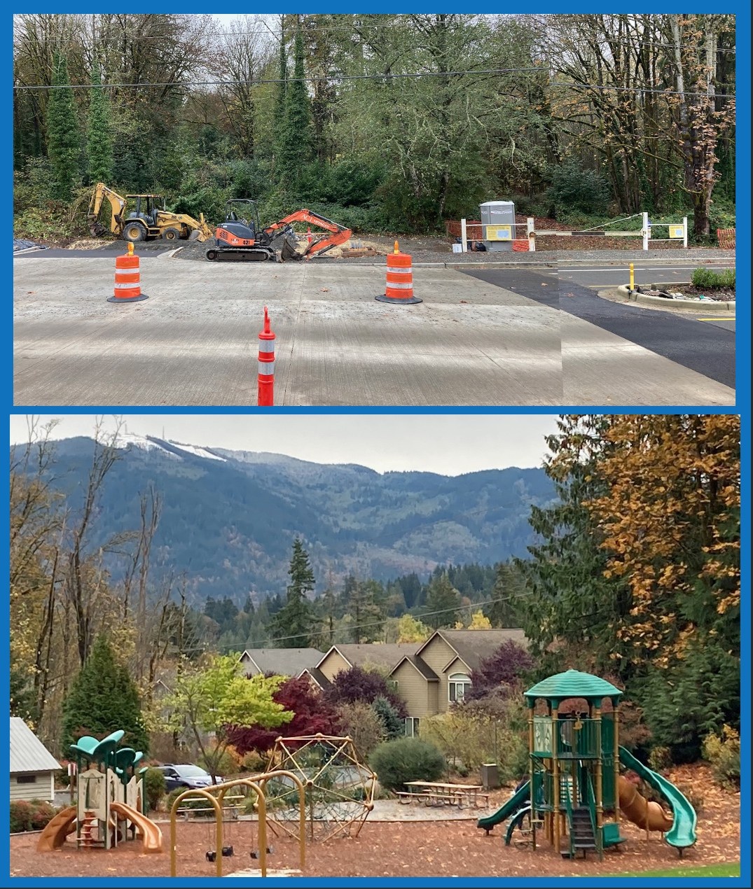
My route (Figure 1C) would start by walking up the road to the ‘summit’ of Anti-Aircraft (1,486 ft). The road was covered with debris, mostly leaves, small branches, moss, and lichens, from the recent storms. Took the Lost Beagle Trail to the Shangri La Trail, encountered three boisterous runners going in the opposite direction, two older women walking their dogs, and then no one else all the way down this trail, across on the No Name Trail to its junction with the Surprise Creek Trail where there was single hiker. Took what was labeled the Military Ridge Trail to a series of junctions near a playground – sports field on the north end of the Talus Complex (Figure 2 top). There were several trail junctions at this point, one heads northwest and has a sign (Figure 1A) indicating that it was mapped and described by Yean Kim from Boy Scout Troop 336 for an Eagle Scout project (see below). A couple hundred feet later, there is a sign (Figure 1B) indicating that one is in a Natural Resource Preservation Areas of the City of Issaquah and a junction. I took the trail to the left and reached Newport Way NW shortly. The right is perhaps the Precipice Bottom Trail. The last 100 feet of the trail that headed left, and which followed an old logging road, was the most challenging part of the entire hike – two very slippery large, old bigleaf maple stems and then almost a class 3 scramble over three large rocks (class 2 when dry). These obstacles have been present for at least 4 years when I first discovered these other trails.
The down-hill part of the hike ended and the up began with a walk-up Newport Way to the Big Tree Ridge Trail trailhead. This area has been closed since just before the pandemic with construction on Newport Way and then the promise of a formal trailhead with parking appeared on signage as the street construction was ending. The signage said (and is still present) that this new trailhead would be open in the fall of 2021. As bottom part of Figure 2 illustrates, the construction has just begun. Perhaps by the fall of 2023. The return and up-hill hike involved the Big Tree Ridge Trail, the Red Cedars Trail, the Surprise Creek Trail, and the Shangri La Trail to the Harvey Manning Trail Head. I called home, got in the car, turned on the radio: the Seahawks had just scored, and it was SH 31, Cardinals 21, which turned out to be the final score.
There were more downed trees versus people encountered on this hike 14 to 11 (and three well behaved dogs). Most of the downed logs were red alder and had been dead before they were blown over; there was one living black cottonwood and a living red alder and Douglas-fir. The last two were on the lower half of the Big Tree Ridge Trail and had been freshly cut with a chain saw. All were easily crossed, except for the two large, very slippery logs. No wildlife seen, birds heard, weather very cool with increasing cloud cover over the Cascades. A nice walk.
Eagle Scout Kim has a tour script and an audio recording associated with the Scan Me Icon: (1) A three-page, single space document that orients one to the area, its trails, and its natural history. All his points are well documented with some 22 urls. (2) There is an audio recording. Both can be found here: https://drive.google.com/drive/mobile/folders/1vpGBWMUFlFIEQsobpFJGnNSEsM0o-Ukc?usp=sharing__;!!K-Hz7m0Vt54!gJLW1MGp9JhW2AG-j-YlmC1WnAa0GZL_MLZxKOIdd_ooLSD-xmJU1qBsXXcbeB7D5iXXE6WtYeRU_Bre_mjfGU3l$ . His trail signage is excellent (Figure 1A).


Comments
Hiking Persona #4 on Lost Beagle, Shangri La, No Name, Surprise Creek, Military Ridge, Precipice Top Trail, Red Cedars
That is quite the hike and report! Have you tried reporting trail issues using See Click Fix on your phone? I've had good luck with the County responding at least on this mountain to trees being down. I reported four on Sunday and they are already cleared.
Posted by:
Hiking Persona #4 on Nov 09, 2022 09:02 AM
Reporting Trail conditions
No, I have not. Thank you for this recommendation.
Posted by:
Abam on Nov 09, 2022 09:10 AM