

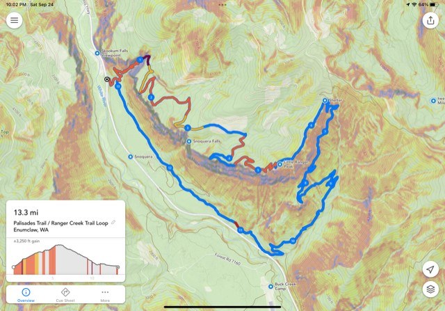
There would be fabulous views on a clear day above the Palisades cliffs. Unfortunately, this day was overcast with a touch of light drizzle. We could only see the other side of the valley, and further up the valley (most of the time). The cool weather did make the uphill hiking more pleasant than on a hot summer day. At the last viewpoint, 2 of us decided to continue with the loop on the Ranger Creek trail for a total of about 14 miles.
Shortly after the last viewpoint we entered the burn area with acres of damp fireweed and some new douglas-fir seedlings popping up. Thank goodness for quick dry pant legs. The (Norse Peak) burn area is mostly along a ridge line with some steep drop-offs on the right side. Probably not a good place for overactive children or unleashed dogs. There were numerous downed trees even though there were just as many cut earlier this year. So they are still falling and it would be best to always be aware and avoid on a windy day.
We saw a couple elk prints on the trail and some scat (maybe bear). No other hikers, or cars at the trailhead.
We thought of using 2 cars to avoid the 3 mile hike back to the Palisades trailhead but I was not clear where the Ranger Creek trailhead is located. A real trail is a short walk NW of the Buck Creek road/NF7160 that you should use. There is also a cheater trail directly opposite Buck Creek road. Take an extra minute to use the real one please.

Comments