

I did a three day trip, taking the Pass Creek trail up to the PCT, then north and backdown the North Fork Skykomish trail to make a nice loop. Here are some particulars.
Road Conditions to the North Fork Skykomish river trailhead: Beckler River road (FS65) up and over Jacks pass was fine. The last 4-5 miles along FS63 were also ok with the exception of a few large potholes and navigation over a previously washed out bridge that was recently repaired and looks to have had another washout, that has been temporarily repaired to allow some vehicle traffic. I would be somewhat reluctant to take an average low clearance sedan over this; however I did see a Ford Fusion parked at the TH when I arrived, so try at your discretion.
Bugs: The usual nuisance for the summer with the mosquitos being quite bad at the TH, the first mile or two of the North Fork Skykomish river trail and up on the PCT. When the breeze was blowing you were fine; when it stopped, it was quite bad if you did not have repellent on or weren’t covered up.
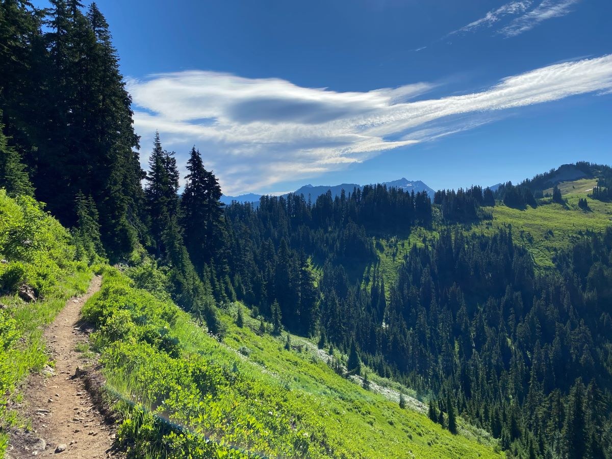
Trail Conditions: Pass creek trail was in good shape from the bottom to the top. Fording the two streams at the beginning were not bad with the water being only ankle deep at mid-morning. The trail also had no blowdowns or other obstacles to navigate. Once on the PCT, it lived up to its normal good conditions. Many thru-hikers on this section, both northbound and southbound. I camped at Lake SallyAnn which was snow free and had quite a few campspots to choose from. The general camping area around the lake was also in better condition than I had expected.
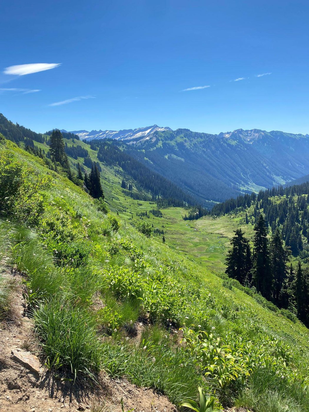
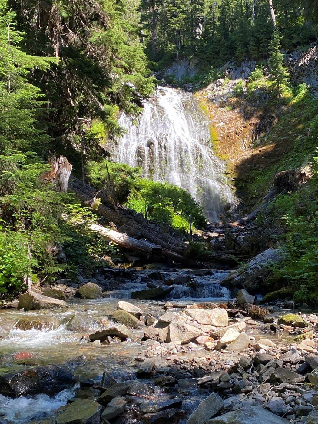
Day two took me up to Dishpan gap to stash my pack and continue on for a quick trek north to the top of Kodak peak. There is a boot trail going up the east spine of the peak that starts where the PCT makes a loop around its east end. The snow is mostly melted out which made the trek up straightforward with the top providing wonderful views of Glacier Peak and all around. This section of the PCT that I was on is beautiful from Cady Pass to Dishpan gap. After returning to pick up my pack, I traveled down the North Fork Skykomish river trail to camp at the confluence of two rivers (about 4 miles down trail). This trail in general had a fair amount of debris on it as this trail probably doesn’t see much use. A crew has been on it recently with many blowdowns removed and some brush trimmed down in the heaviest places. Very thankful for the hardwork with all of the recent tree's to remove. It is a beautiful trail with varied terrain types throughout its length. The only downside is the rather steep decent that occurs in the first few miles leading down from the PCT. One thing not to miss is the waterfalls that is near the camp where two rivers meet which is where I spent night two. One river is to the left of the camp when approaching from the PCT (south side), while the other is to the right. If you walk over to the southern stream and look upstream, there is a beautiful and rather large waterfall. I imagine it will lesson somewhat as summer wears on.
All in all, a great little loop that takes in one of the nice sections of the PCT.
Comments