
I've had my eye on the Cady Creek-PCT-Little Wenatchee loop for some time, and it's the middle of July, so what could possibly go wrong? I did a solo backpack trip intending to spend one night at Lake Sally Ann, and the next night at Meander Meadows. I ended up doing only one night at Sally, and headed down the "short cut" of the Cady Ridge Trail. Here's my first WTA trip report! (And thank you to all the countless trip reporters that I've relied on over the years...it's about time I pitched in!)
I started off down the Cady Creek Trail, and after the first easy section, I encountered several enormous blow downs I had to navigate my way around, but not too much trouble. I came across a couple of snowfields which covered up the trail briefly, an omen of what was to come. Then a creek tributary took over the trail, so I had to bushwhack over mossy logs and swamp ground to get through that section. At some point, you'll see a three-rock cairn after this muddy mess--bear to your left to get back on the trail.
You'll also have to ford across a very strong current stream, but not a long ford. Water was almost up to my knees (I'm 5' 9"). Bring your water shoes. It's doable if you're used to this sort of thing. I'm not. Brrrr!
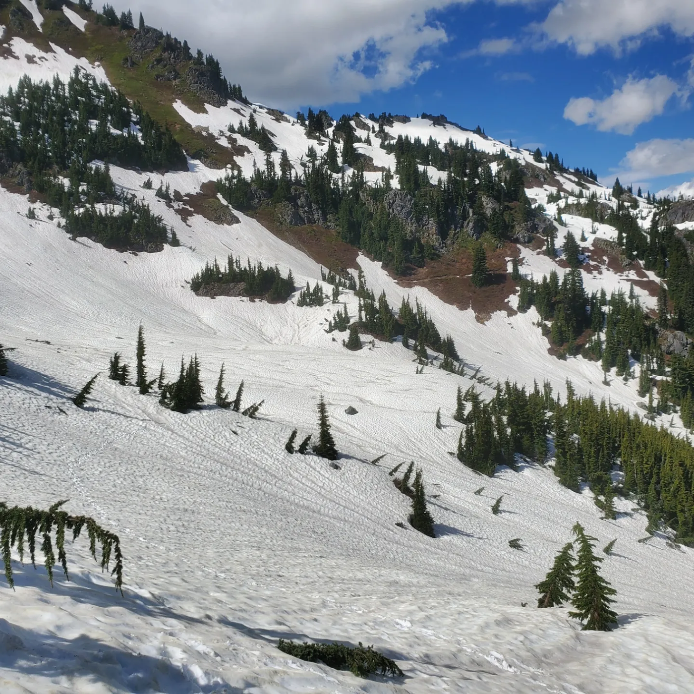
I went up the PCT heading north toward Sally Ann. Eventually the snow appeared and the trail pretty much vanished. I cannot emphasize enough that you must carry GPS to navigate yourself through this. A compass is helpful, too (for you Gaia devotees, you know what I mean...Gaia loves bouncing your position around, and doesn't pinpoint you exactly). As I gained the ridge, I was despairing about if I should turn around. By sheer happenstance, a group of hardy Canadians were through hiking the PCT in the opposite direction. So, I was able to navigate my way to Sally Ann with their snow tracks! (Of course, confirming my position with Gaia). This group was the only people I saw the whole trip.
I got to Sally Anne, and it's almost completely frozen and snowed in. Fortunately, there is a flat, dry piece of ground right above the lake, with room for about two tents. Whew! You can get water from Sally Ann, but be careful not to fall in her ice sheet. The night was restful, views were spectacular, and I played John Denver on my portable Buckshot speaker.
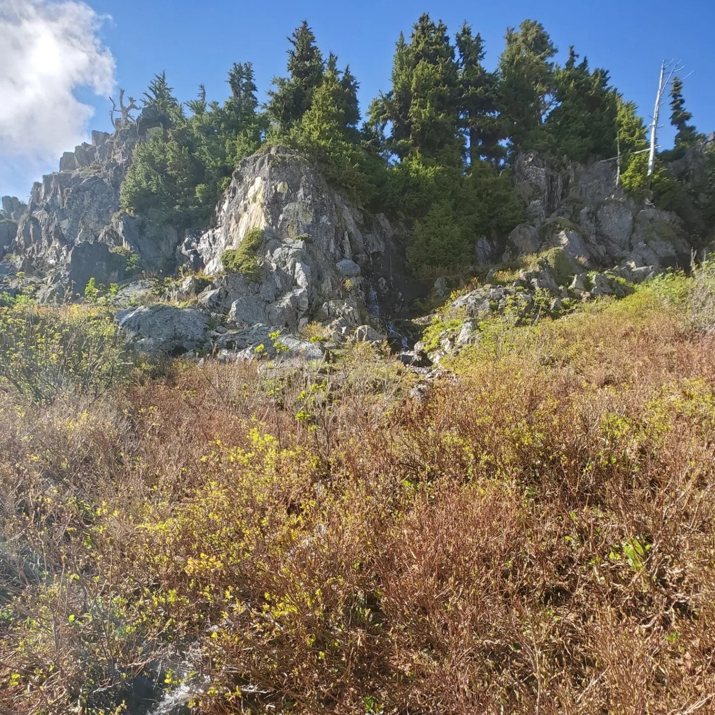
Since I was by myself, and I knew it would be just more snowy misery on the way to Meander Meadows, I decided to cut the trip short one day and head back to the trailhead via the Cady Ridge Trail. I got my fair share of snowy misery anyway, and there were no Canadian snow tracks to guide me. The first section wasn't too bad, I just had to be very careful navigating myself through endless snow traverses. Then a godawful bushwhack and slippery snow section followed. At one point, I slipped and slid down about 40 feet, catching a tree to arrest myself before I fell off the mountain. Ironically, that fall actually got me back on the "trail", so maybe it was the Mountain Goddess smacking some sense into me. I was rattled, to be sure. But nothing for it, I got back up, and bushwhacked my way until I finally reached the Cady Ridge. Here, I could see some footprints. Evidently, people hiked up to Cady Ridge, and then sensibly turned around. From there, there was more slippery snow to slog through, but at least the navigation wasn't too bad as the trail played peek-a-boo. Then finally the Cady Ridge Trail dried up, and I started the very steep descent down.
First day: 9.5 miles to Sally Ann via Cady Creek-PCT. Second day: 7.5 miles from Sally Ann to Little Wenatchee Trailhead via Cady Ridge Trail.
Road: Pretty crummy, bring your AWD high clearance forest road buster. Low clearance cars might be able to pull it off, but they will be punished.
Required: GPS, trekking poles, sunglasses for the snow glare
Recommended: Microspikes (gives you decent traction on that icy, slushy early summer snow), compass, gators, ice axe (I didn't bring an axe, but there are some steep angle snow traverses where some may feel more comfortable with an axe. But don't even try to attempt this without at least trekking poles unless you're Spider-Man!)
I hope you're aren't dissuaded by my trip report. It's an absolutely gorgeous hike. I would just say don't do it alone, and be ready to snow navigate. And as of now, there is dry ground camping at Sally Ann. Go for it!

Comments