

(The track starting to the SW that begins to follow the trail on GAIA is the route we took up to Hart Pass. The track leaving Hart Lake going to the NW is the actual Hart Pass way trail. As you can see, the actual trail is nowhere near where it is represented on GAIA. Let me know if you have any questions about this trail; I'll gladly help you out!)
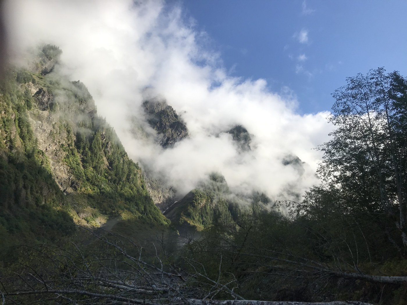
For us, Hart Lake and Lacrosse basin are the prettiest areas of the park. We've been there via the Skokomish a couple of times, so since my wife had never been to enchanted valley, I figured we'd go that way. Trip started great, but naturally the rain kicked in...We ain't punks though, so we kept going! Saw a beautiful elk herd of around 50 animals near Pyrites creek on day 2, but no bears in the valley. Thankfully the rain let up, and on day three we headed up the O'Neill pass trail with our sights on Hart Lake. Along O'Neill pass trail, there were portions of overgrown trail and a few large blowdowns to deal with; nothing too terrible. To save time and pounding of the feet, we decided to take Hart Pass way trail (this saves 6-7 miles or so, and probably 1000' feet of climbing). Right around White creek, we spoke with Ranger Patrick, and he informed us that Hart Pass way trail is wrong on the GAIA; the trail is further east of where it shows up on the GAIA. I cannot emphasize this enough: when you enter the meadow left from the main trail, stay to the left of the large stand of trees! (Keep looking left right after you pass the dried creek bed and you will see a boot path. If you went too far, you'll see two cairns. Turn left here). You will progress up a dried creek bed that shows up blue on the GAIA, and will pick up the trail just to the right of the dried creek. My wife and I put up some cairns to assist (the trail is obscured by saplings around this area). Unfortunately, we continued west, looking for the trail illustrated on GAIA, and wound up stuck climbing a NASTY draw, eventually ending up 200' above Hart Pass. This was easily the scariest climbing I've ever done, and I was very worried about us taking a serious fall. We had gotten to the point where it was too dangerous to descend, so we decided to keep progressing. Thankfully, neither of us got hurt. It was very foggy as well, complicating any hope of visualizing the route. We made it to Hart lake at 2100, exhausted, with bruised egos and a thankfulness that we survived (We contemplated activating our fast find for help on 2 occasions). There were a couple bears wandering around the lake that evening according to another camper; we saw one up on the slope near Hart Pass the next day on our way out. In order to compare routes and save time and figure our what had happened the day prior, we took Hart Pass way trail back to O'Neill pass. The trail was fairly easy to follow, though I lost it briefly in the woods just after crossing the dry creek bed. Once you get through the woods portion after coming down from the pass and into the meadow, you basically follow the creek down into the meadow and continue to O'Neill pass trail. Hart pass way trail will save you some time, and it's really not that difficult, just be careful. Please don't make the mistake I did and try to follow the GAIA; it could get you hurt!


Comments
SpruceMoose on Enchanted Valley via East Fork Quinault River, LaCrosse Basin
Great report! Thanks for reiterating the dangers of thinking that GPS is gospel. I've seen many trip reports on WTA from folks who dumped their GPS data as if it was truth; elevation gains much higher than actual, distances very distorted and lengthened...many misleading reports that would be dangerous for others to use.
Posted by:
SpruceMoose on Sep 24, 2019 08:20 AM
ScarletGypsy on Enchanted Valley via East Fork Quinault River, LaCrosse Basin
Really appreciate the warning! Do you think there's good areas for hammock camping on this trail? or have any recommendations for places to hammock camp here or nearby?
Posted by:
ScarletGypsy on Sep 26, 2019 08:32 PM
ViewfinderPCT on Enchanted Valley via East Fork Quinault River, LaCrosse Basin
Thanks for the report! I don't know if you will see this, but I am planning a trip to the same area in late July and hoping to take the same route to Hart Lake. I am wondering if you could give any more tips or information on finding the safer route?
Posted by:
ViewfinderPCT on Jun 28, 2021 12:33 PM