

I did a solo trip on the Devils Dome loop. I had it at about 43 miles with over 10,000 feet of elevation gain. I ended up doing it clockwise because the Devils Creek camp area was already booked for my planned second night, but available on the first night. I think this direction was probably harder as most of the climbing was concentrated in a single (middle) day, and the approaches to many of these climbs was over more loose/unstable tread than their respective descents.
Day 1 – East Bank Trail: 12.5 miles, ~1000 feet elevation gain/loss. Started at the East Bank trailhead because of the reported outage of the Canyon Creek bridge. Drop down from the trailhead to a pleasant walk in the woods. Most of the East Bank trail is on a wide, stable tread that meanders through the woods well away from the lake. There were no particular obstacles on the trail, although there was one section where the trail had a minor collapse through an area supported by a retaining wall (see picture). This was still easily passable, but might present an issue for stock. I didn’t have my first view of the lake until over 7 miles in, although the last 3 miles or so run along a ledge overlooking the lake. The Devils Creek hiker camp has 3 sites each with room for 3-4 tents. There is a small stream for water adjacent to the stock camp. Access to the lake was another ½ mile to the Devils Junction boater camp. Water level is very low, so the (brand new) dock at the boater camp is well above the lake. There are a few other hiker camps along the way to Devils Creek, and boater camps, but the boater camps are all closed.
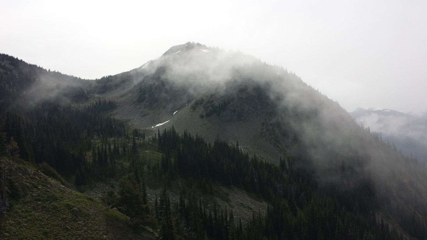
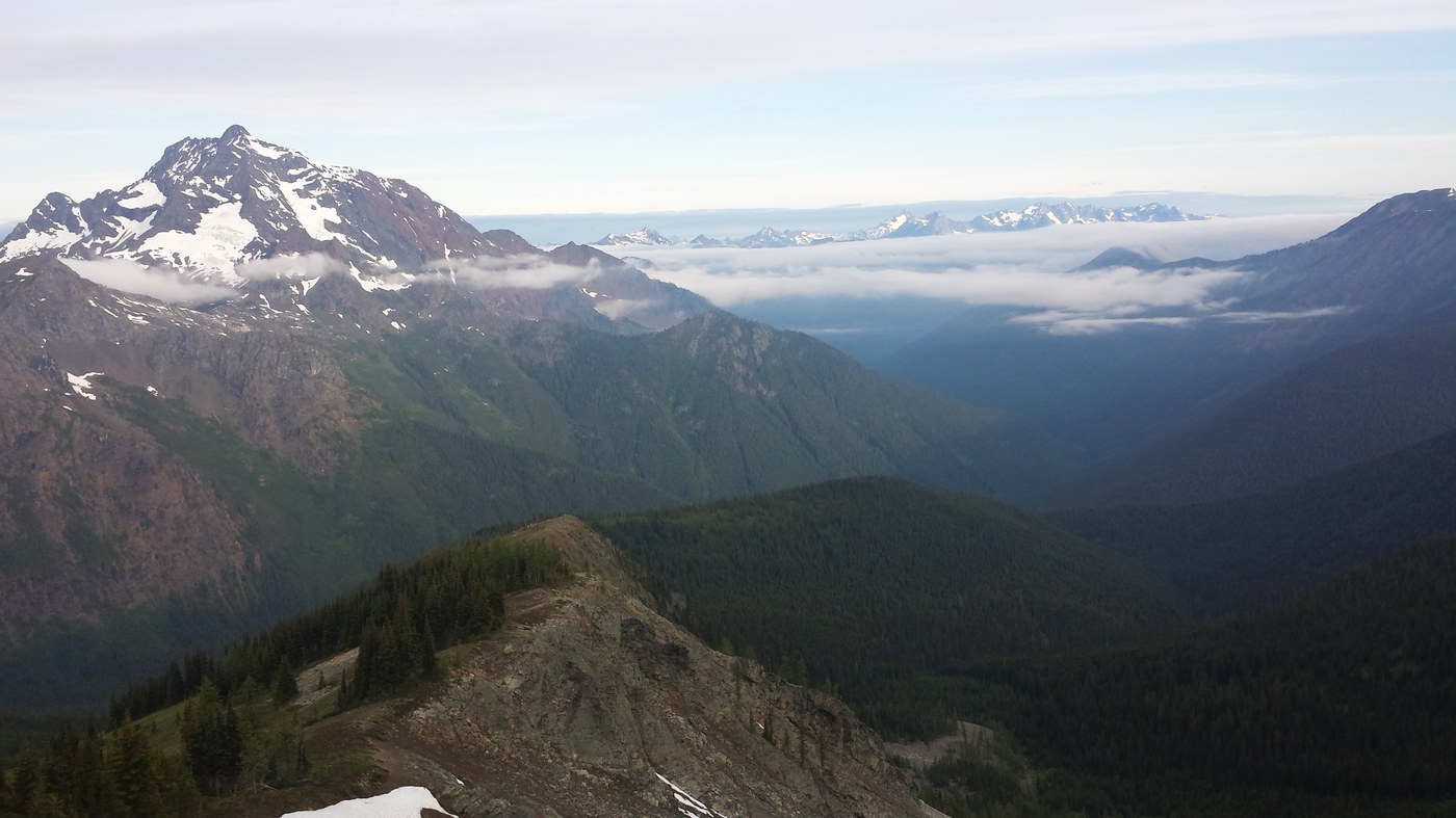
Day 2 – Devils Dome Trail: 16.5 miles, ~7500 feet of climb. The climbing starts immediately out of camp and continues at a steady grade for about 4 miles, then kicks up a bit steeper for the next mile and a half. There were not obstacles on the trail for the first 4 miles, then a few downed trees for the steeper section. After about 5 ½ miles from the Devils Creek campground, you level off a bit and reach an area with a few camps sites, but no apparent water source. Less than ¼ mile after that is a side trail (may be difficult to spot) to the Dry Creek shelter which, reportedly, has water, but I did not investigate. Then you begin a gradual ascent to Devils Dome. There is a nice campsite along a small creek in the bowl below the dome. After this campsite, the climb steepens, and the footing becomes mostly loose rock and uneven tread. The final climb to the dome top took longer than I expected because of the loose rock, the steeper grade, and the surplus of opportunities to stop and take pictures. There is small campsite on top of the dome where someone has built a rock wall presumedly as a wind break. There is no water.
After the dome, there is a gradual descent on mostly stable tread and then little elevation change until Devils Pass. There were not any obstacles on the trail until about ½ mile before Devils Pass. There as no snow on the trail. There was a small campsite at Devils Pass, but, again, no apparent water source. From Devils Pass, continue for another 2 ½ miles on the Jackita Ridge trail, with little elevation change, until you approach the North Fork of Devils Creek. To get across the creek, you first lose, and then gain back 1000 feet of elevation all within about 1 ½ miles. There are few camp sites before crossing the creek that have access to water. After crossing the creek, the trail climbs steeply, and the few additional sites shown on the (latest) Green Trails map are well above the creek and did not have any apparent water sources. The next site with water is about 2/3 mile after finishing the climb and is situated between 2 small creeks. It has room for 1 or 2 tents. I was grateful that it was unoccupied when I got there.
Day 3 – Jackita Ridge to Ruby Creek: 15 miles, ~2000 feet of climb. The trail starts climbing immediately out of camp, again, and rolls along four about a mile before it starts to zig-zag up a scree field to a saddle along Jackita Ridge at 6800 feet. It then descends gradually to Devils Park in the midst of broad basin/meadow area. I didn’t take the time to explore, but Devils Park appeared to have, at least, 4-5 established camp sites with room for multiple tents each. After Devils part, the trail loses about 800 feet of elevation over the next two miles and then rolls between 5000 and 5200 feet for another 2 miles to the intersection with the Crater Lake trail. After the Crater Lake trail, Jackita Ridge loses 3200 feet over 4 miles of relentless switchbacks with stable though sometimes overgrown tread. There were a number of downed trees on the section, but nothing that required much of an extra effort to get over or around.
At the bottom, the trail intersects with the Ruby Creek trail. Although the Canyon Creek bridge is out, you can get across the creek, without getting your feet wet. A downed tree makes it possible to get to the remains of the bridge and finish the crossing. I, nonetheless, continued along Ruby Creek.
I understand the Ruby Creek trail is no longer maintained, and it is clearly in need of some love. It apparently does not see a lot of traffic, but it was generally easy to follow and only had a few obstacles along the way. The noise of the creek competed with the noise of Highway 20 while the trail rolled along for the next 3+ miles until finally delivering you to an intact bridge across the creek at the intersection with the East Bank trail.

Comments